Tag Archives | tornado

May 14, 2010 No Trees, Texas Tornado and Supercell

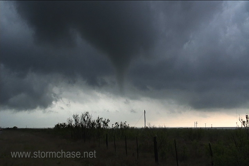
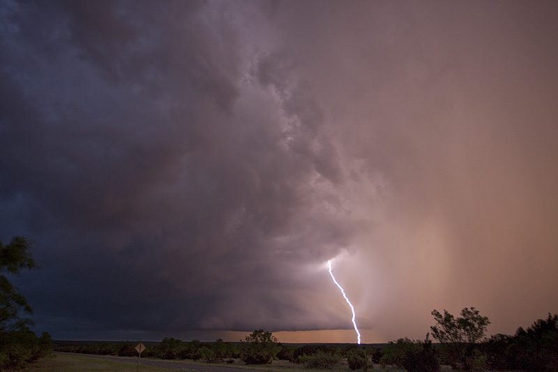
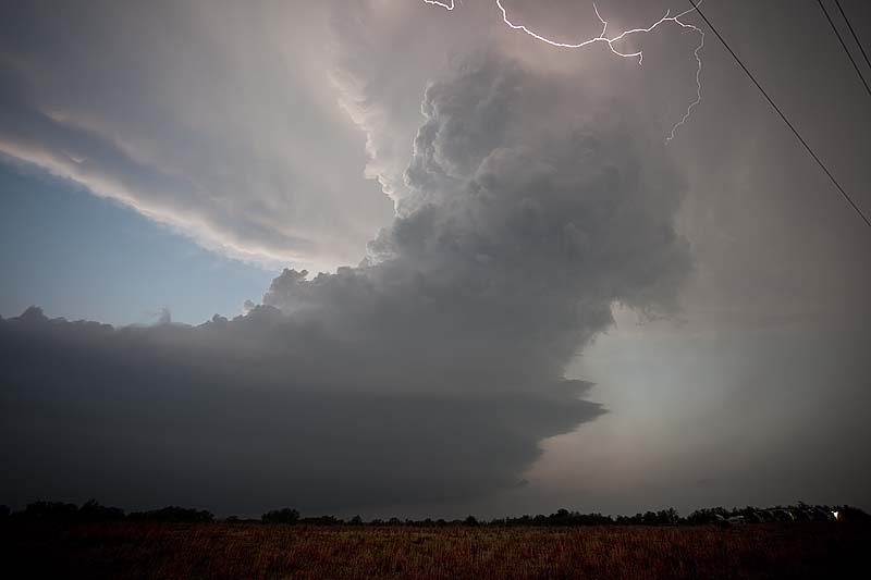
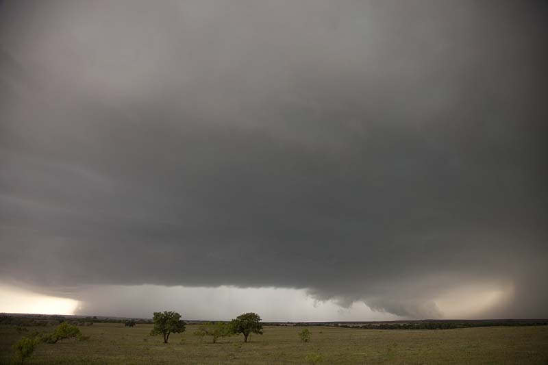
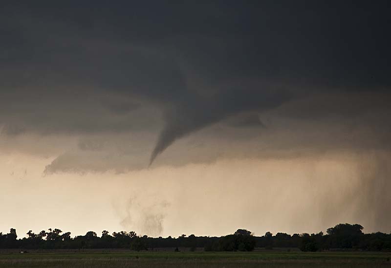
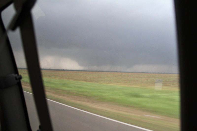
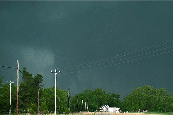
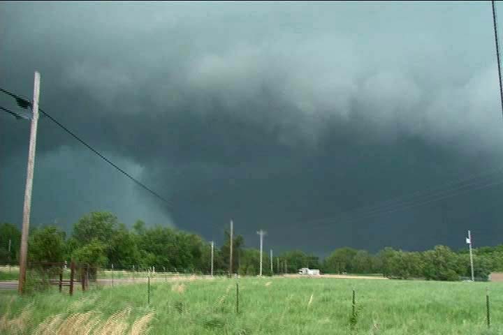
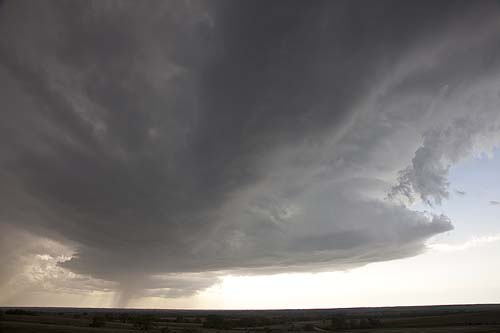
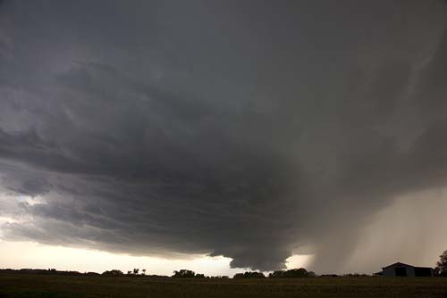
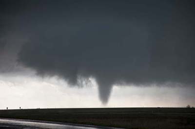
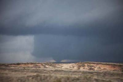
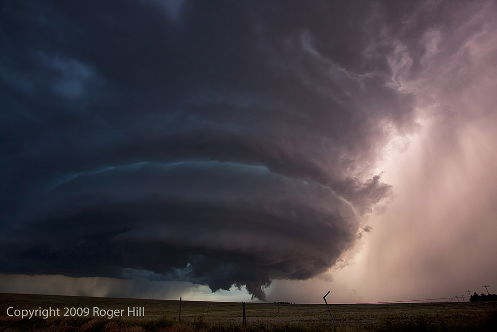
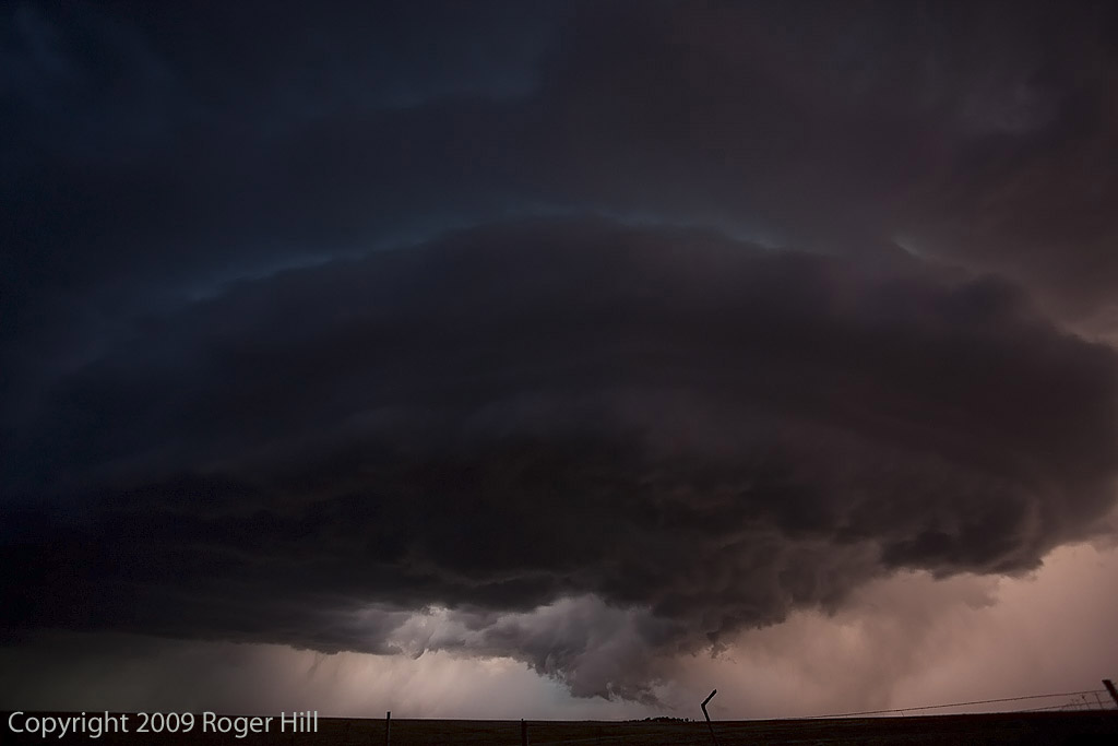
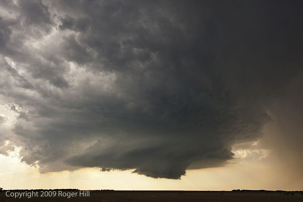
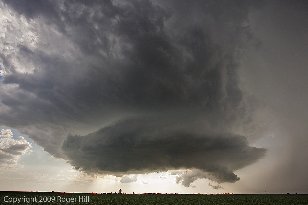
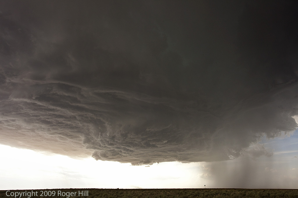
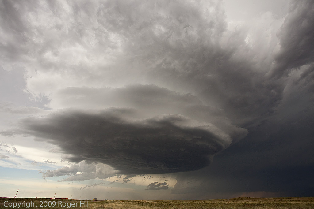
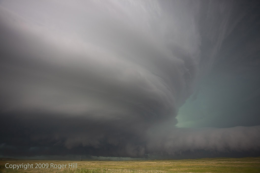
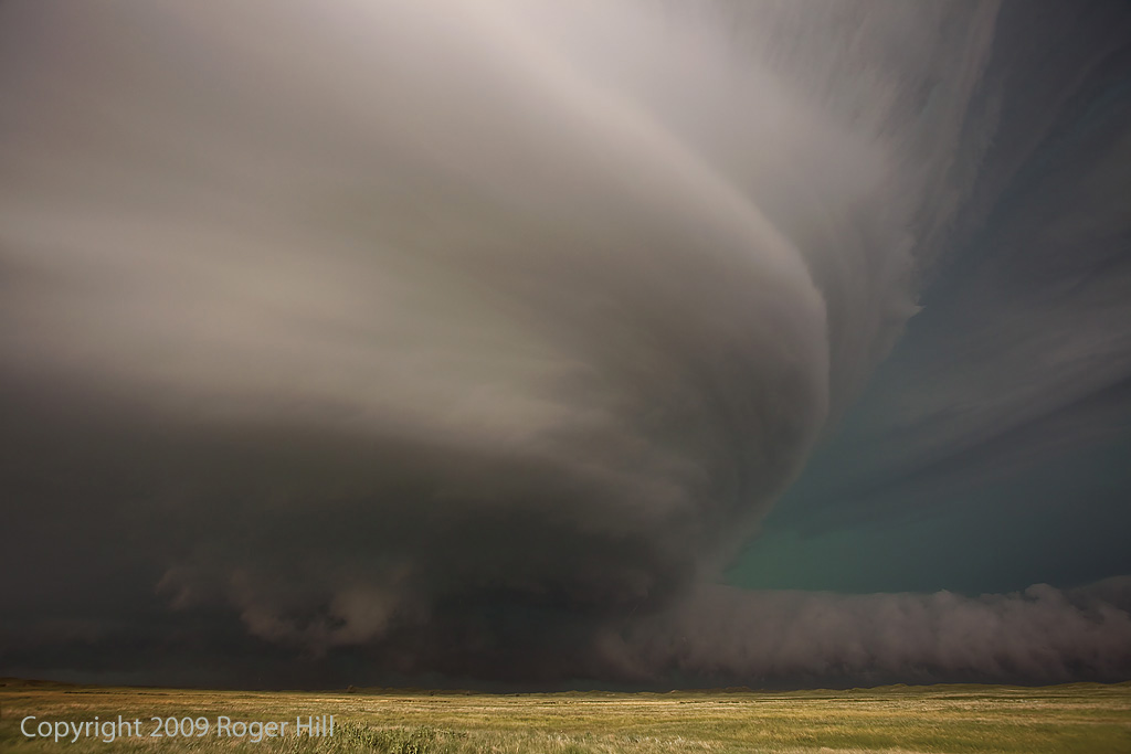
Had an interesting day this day as we targeted a boundary in southwest Texas from Odessa towards Carlsbad. By the time we arrived early afternoon, storms were already firing. A couple became quickly tornadic as they encountered the boundary. We were 5 minutes late to witness a nice cone as we got stuck in the core behind some semis. We did witness a brief tornado near No Trees, Texas, as well as an oil tank explosion from a CG strike. The storm became very electrified and had beautiful structure and colors.

Here is a Youtube video from this day:

May 11 and 12, 2010 Supercells and Brief Tornado

May 11th and 12th promised to be decent days. Decent moisture and instability were present, along with good shear. However a fairly stout cap was in place on the 11th, which was much weaker on the 12th. We intercepted a briefly tornadic supercell south of Woodward, OK on the 11th and then a monster HP beast near Clinton, OK on the 12th. The 11th’s storm was a wet LPish type supercell with pretty structure and a weak tornado not far from Strong City. The 12th’s supercell produced a tornado east of Clinton that we weren’t able to see, however the HP’s structure was quite nice.

May 10, 2010 Northern Oklahoma Tornado Outbreak

May 10th had huge potential with SPC issuing a High Risk. A strong deep trough would kick out a wave through the southern plains that would create strong moisture advection, increasing instability and strong deep layer shear. We chased one particular storm that formed well southwest of Cherokee, Oklahoma. It developed from a high based supercell that moved off the dryline into deeper moisture, lowering its base and becoming a beast. We intercepted it close to there and followed it toward Wakita where it produced numerous tornadoes. Later that afternoon we would catch another supercell near Ponca City that produced a slender elephant trunk tornado near Pawuska, OK. Being on the wrong side of the van as we raced east to escape a closing tornado west of Medford, I could not shoot any decent video, but here is a cool video that also contains two clips from Ruth McAvinia that shows some crazy behavior from a couple of chasers. Some of these pictures are from my guests Dr Ken Fitzgerald and Ruth McAvinia.

April 30, 2010 Ozark County, Missouri Tornadoes

April 30th took me to southwest Missouri for what ended up being a High Risk day from SPC. All the ingredients were coming together for a tornado outbreak in Missouri and Arkansas. We targeted a pinch point in the boundary that occurred near Muskogee, Oklahoma. Storms kept firing in that location and then raced north into colder rain cooled air in southwest Missouri. Finally, one storm was able to right turn and not race into the colder air. This storm produced several confirmed tornadoes in northwest Arkansas and southwest Missouri as it pulled the boundary into it. We intercepted two of those tornadoes. If you have never chased in the Ozarks before, it is a very difficult task. With storm motion at 50 MPH, we were on curvy, winding, hilly roads that you could not drive over about 40 mph safely on. Thus as the storm passed us we could never catch it again. Below are a few pics and also a video I shot. Still it was an exciting successful chase!

April 29, 2010 Washington, Kansas Tornadic Supercell

April 29th took us to central/northern Kansas to play a boundary. Moisture was not optimal that day, but lift and shear were great. A supercell formed southwest of Cuba, Kansas and looked pretty respectable. It had a decent non-rotating wall cloud for a long time. Finally as it moved north of Washington, a new lowering started spinning rapidly, eventually putting down a brief tornado as it came directly overhead blasting us with strong WARM RFD winds. The wall cloud passed directly overhead giving us a moment of intensity hoping it would not drop a tornado until it passed us. It was on the ground off and on for about 3 minutes before dissipating.

Check out this video time lapse:

April 22, 2010 Texas Panhandle Tornadoes

April 22nd was a day that had high hopes. A very deep trough moving in the southwestern states created strong southwest flow aloft with good diffluence. A dryline set up over the central Texas panhandle. By late afternoon storms exploded along the dryline just south of Clarendon, Texas and moved north. As they approached the interstate 40 corridor, they produced several tornadoes. I broke the 2010 season in with a bang, catching 5 tornadoes from two supercells.

July 31, 2009 Kansas Tornadic Supercell

What a pleasant surprise this day was! I was hoping for a couple of high based supercells in western Kansas and certainly got much more than I hoped for! Several supercells developed from southwest Nebraska southward along a boundary in western Kansas. Caryn and I intercepted a tornadic storm just south of Gove that produced hail almost golfball sized as well as at least 2, possibly 3 tornadoes.

July 20, 2009 Kansas Beautiful Supercell

July 20th had decent promise for severe storms. An old boundary lay northwest to southeast across Kansas, with increasing shear and lift with an approaching wave. Severe storms formed along the boundary, with a storm I intercepted in central Kansas near Great Bend. The storm of the day was in southwest Nebraska, but this storm as well was tornado warned. Check out this new time lapse video:

July 18, 2009 Texas Panhandle Nicely Structured Supercell

July 18th was another day of good northwest flow, albeit the moisture and instability were a bit less than the 17th. We captured a beautiful LP/low end Classic supercell in the Texas panhandle north of Dalhart and stayed with it till it died south of I-40 in eastern New Mexico. Crazy chasing down here in July when you should be up north! But, this was a beautiful storm that also produced TONS of hail. Check out the time lapse and hail video below.

July 13, 2009 Valentine, Nebraska Amazing Supercell

July 13th was one of those days you don’t soon forget. A supercell formed near Rapid City, SD and tracked all the way southeast of Valentine, NE by late evening. It was a storm to behold! Beautiful structure, likely a couple tornadoes buried in rain and hail to baseball size was the story of this day. It was tornado warned for over 6 hours!