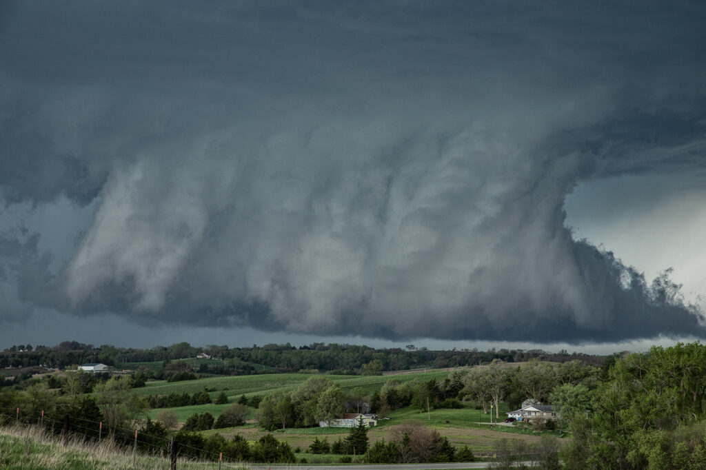
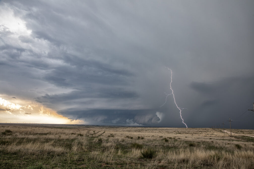
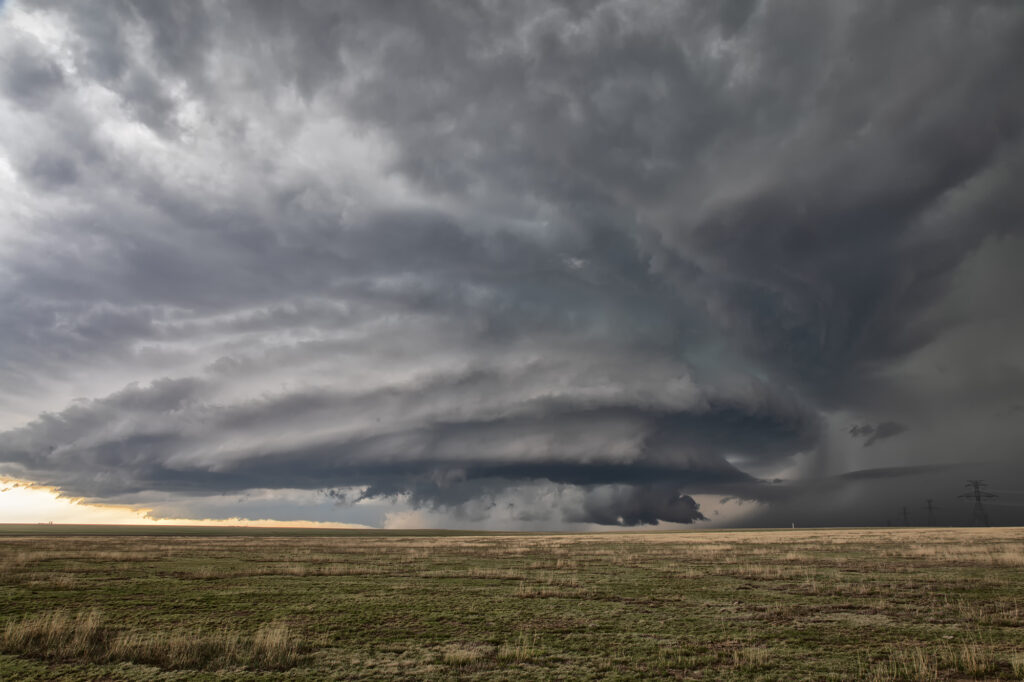
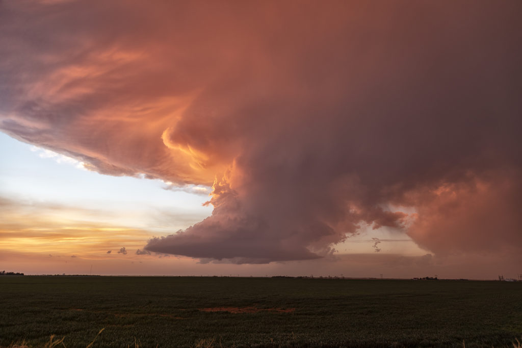
May 29th brought the last tour day of the Prime Time Mini-tour and Mother Nature brought some nice storms for the ride back to Denver. Started the day in Lubbock, TX with a plan to chase around the Springfield, CO area. Moisture started to mix out in that area, but a nice cumulus field started to build just west of Lamar as a weak La Junta low was forming. We headed for that area and watched from just south of Highway 50 as cells developed between Caddoa and Lubers. As the cells consolidated, lightning became more frequent and we got some nice lightning photos. The southernmost cell then became severe warned and we headed towards the east side of Wiley to stay in front of the strengthening southern storm. After a short time, we had to reposition to the east again along county road 196 and then south to Highway 50. During this time, the cell just to the north of our storm became tornado warned (radar indicated). Unable to get closer to the northern cell, we were able to watch that supercell and the southern LP supercell from our position. As both supercells began turning hard right over and just to the east of Lamar, we took dirt roads to get to a great vantage point looking over open land and observing both cells. The northern supercell was once again was radar indicated tornado warned, but no tornado was observed nor reported. The storms were nearly stationary at this point, moving southeast very slowly which allowed us lots of time to watch and admire. As darkness set in, we decided to start our 4 hour drive back to Denver. Working our way around the south side of the storm, we were treated to an incredible view of the structure of the southern LP cell, causing us to stop and take more pictures. A great day was had by all, super way to end the 4 day tour!


May 20th Akron, Colorado Tornado Warned Supercell
May 20th took us to eastern Colorado for what appeared to be a decent set up on paper. High based storms formed before moisture could work its way west, however they did not last. By later in the afternoon a storm developed rapidly southwest of Akron as a cluster of cumulus deepened. The storm hit the better air and became severe. Structure improved, and soon a lowering developed with RFD dirt wrapping around it. A merry go round ensued. The developing rotation could not tighten enough to produce a tornado, but it was fun watching it try. Lightning became intense so we had to vacate our position and move east and south. Eventually the storm became quite messy and we chose to leave it since we had to be in Iowa the next day on a far better set up (see the next chase account!!!). Enjoy the pics!

April 30th Red Oak, Iowa Tornado Warned Supercell
April 30th provided a fast moving, but strong upper level system across the central states. Moisture was sparse, but racing north of southerly low let jet winds. We knew it would be close to get enough good moisture to allow cloud bases to be low enough to produce tornadoes in Iowa. By mid afternoon clusters of storms for in southeast Nebraska. One such storm intensified as it moved into southwest Iowa. It became severe as it moved further east and eventually became tornado warned. On radar it looked like a classic tornadic supercell, but in real life, it’s base was just a tad too high to produce tornadoes. It was a prolific hailer and had nice structure. At one point it had a very large wall cloud that had the look. However, it could never maintain tightened rotation, only broad slow motion. A pretty storm, but just couldn’t produce any tornadoes. A fun day nonetheless!
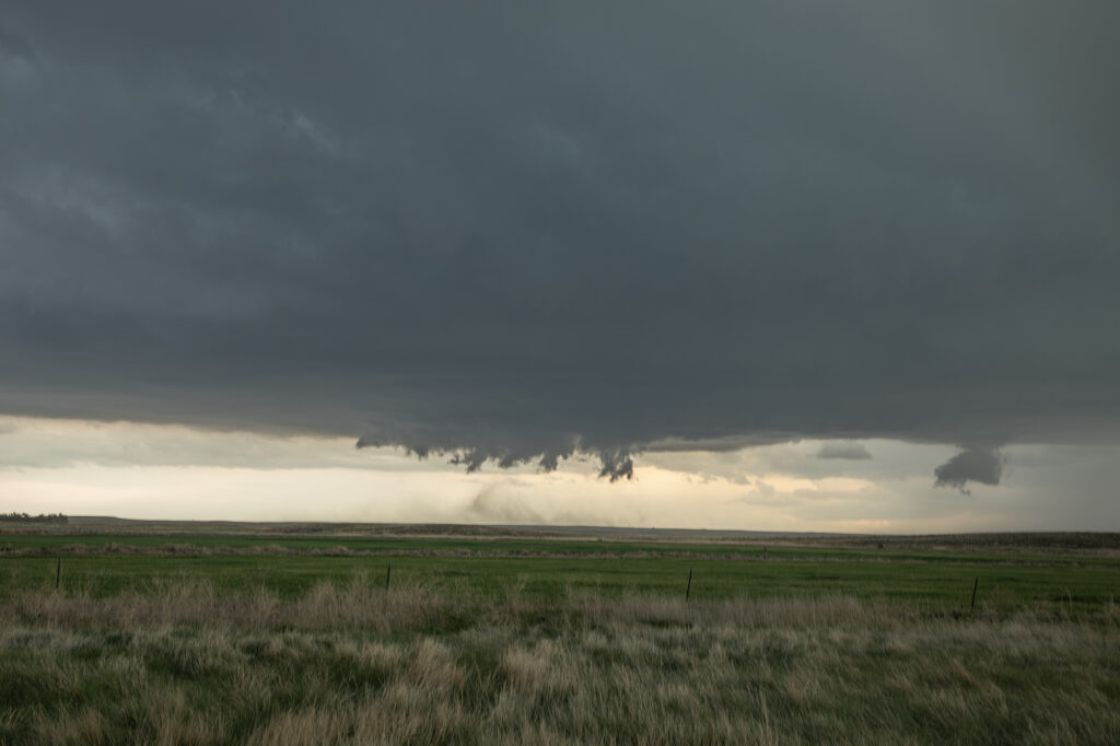
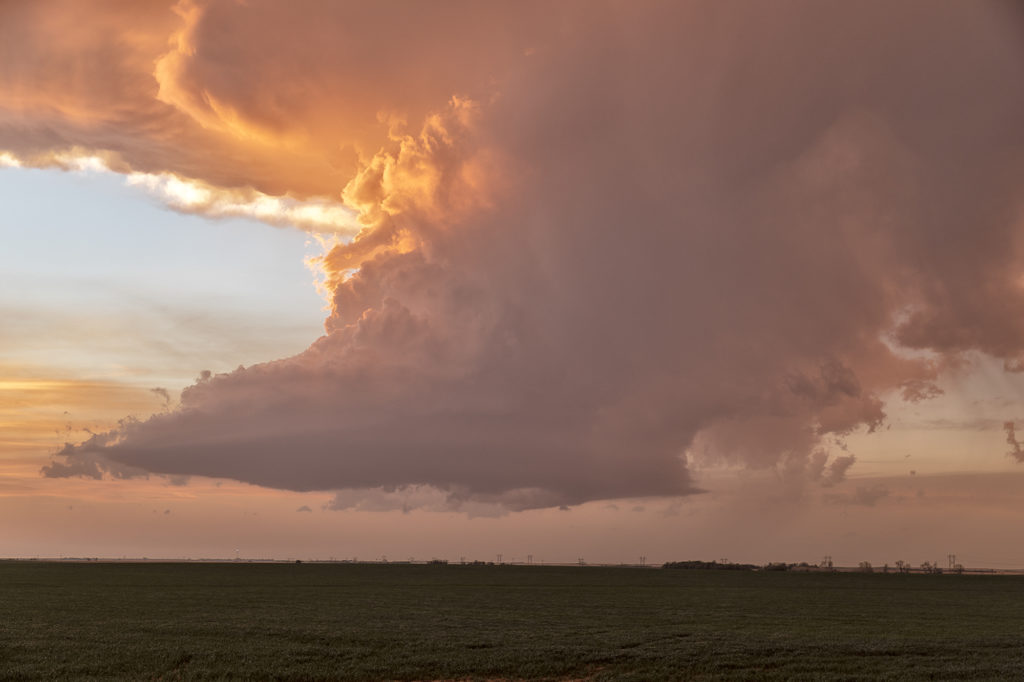
July 20th Southeast Colorado Tornado Warned Supercell
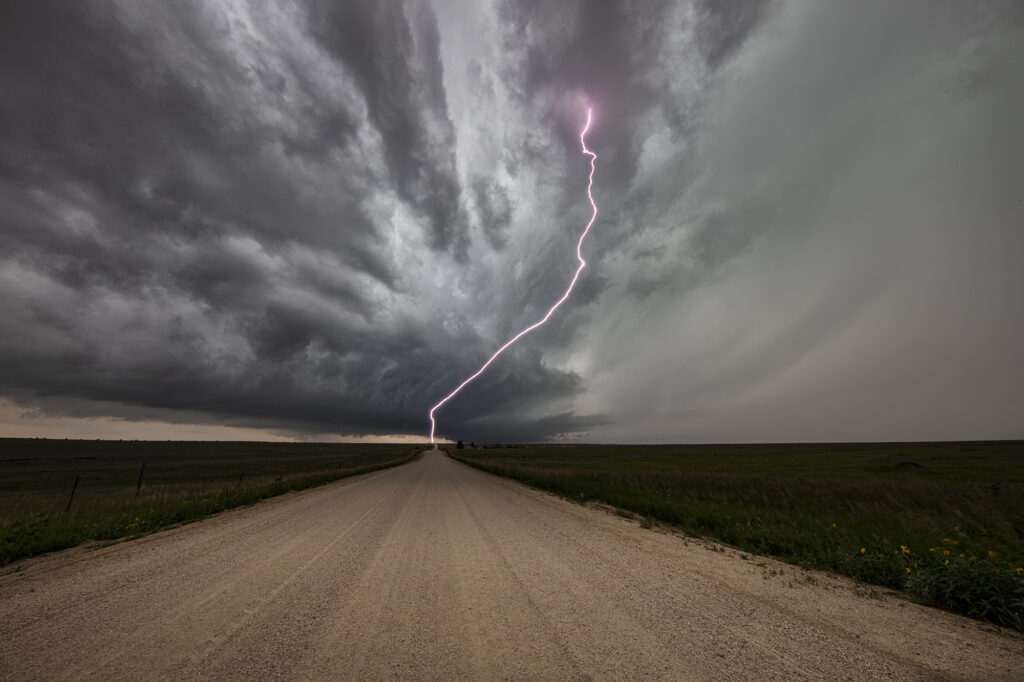
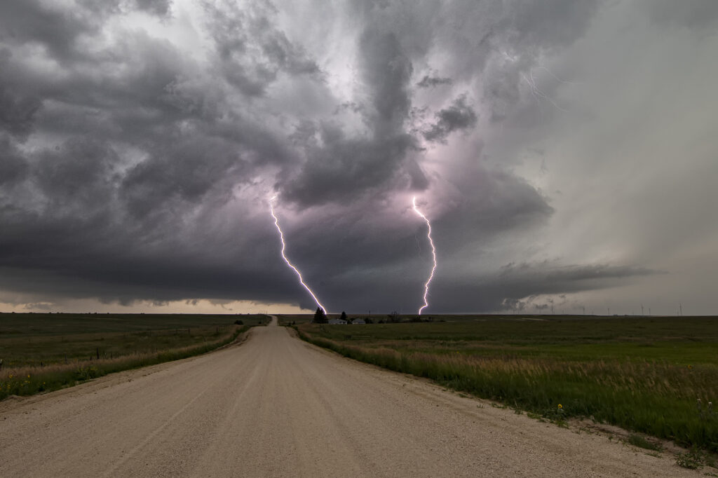
July 20th featured good shear, excellent moisture and instability, and the Palmer Divide to produce storms with upslope flow. Mid afternoon a supercell formed near Simla, Colorado and turn to the south. As it did, it was rotating very strongly and may have produced a couple of broad, weak tornadoes. The lightning was absolutely insane with the supercell and the hail was quite large, up to softball sized! As the storm moved south, it was interfered with by another supercell and the southern storm became the dominant supercell. It moved southeast and eventually collided with northeast moving storm near LaJunta. Over the next 45 minutes it struggled to maintain any intensity until it finally pushed through all the left moving storms. It became tornado warned near Las Animas and had quite strong rear flank winds along with very large hail. We ended up letting it go as we needed to be back in Denver that evening. A great local chase for our tour group and one of the prettier supercells and lightning shows on the season! Enjoy the pics!!!
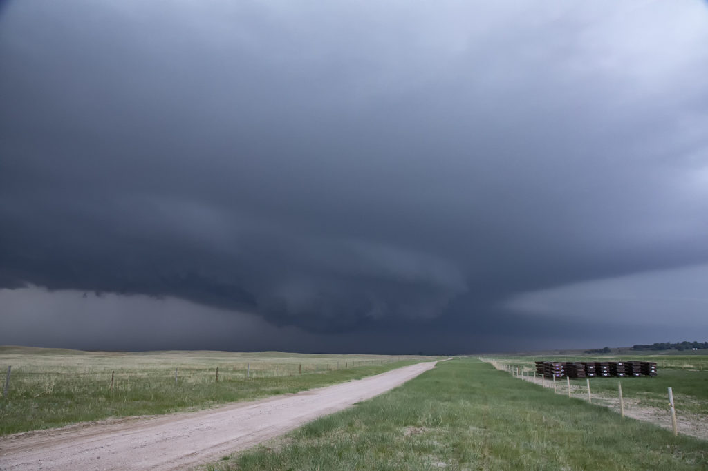
June 11th Raton Mesa, CO Tornado Warned Supercell
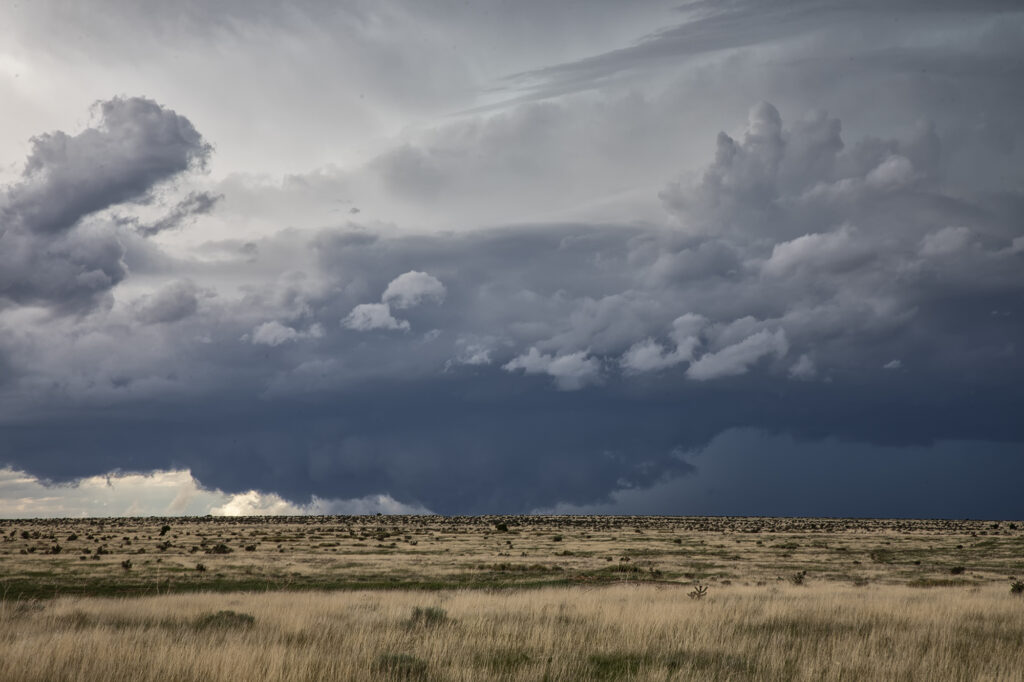
May 11th had a lot going for it. Good upslope flow into the Raton Mesa, decent moisture and instability and great wind shear would set the stage for supercells this day. Storms formed early afternoon and became tornado warned. We blasted west from the Oklahoma panhandle into the mesa in time to watch a supercell get very interesting. Couldn’t confirm any tornadic activity, but it certainly looked like it had potential. This storm also produced baseball sized hail and high winds. It was a treat to photograph and watch spin across the mesa into the Oklahoma/Texas panhandle. Fun day for all the guests who witnessed this beauty! Enjoy the pics!
May 19th Texas Panhandle Tornado Warned Supercell
May 18th featured a short wave trough moving into the Texas panhandle. It also had a dryline extending along I-27 south and north of Amarillo. Storms started forming mid afternoon along the dryline. Although they couldn’s sustain themselves and eventually died off, they did produce some severe weather. Late afternoon a cluster of storms formed northwest of Amarillo. Due to weaker wind shear, we hoped something would emerge from the cluster due to storm interactions. It certainly did! A supercell emerged west of Chunky, TX and drifted slowly east. It tried to produce a tornado a few times, and was tornado warned. It could never keep a rotation couplet tight enough to produce one. The storm produced baseball sized hail and had very pretty structure. Whenever you get that stack of plates look, you know it is a special storm! Moving very slowly east, it kept it’s intensity for several hours before finally decaying mid evening. A great day and a fun chase! Enjoy the pics!
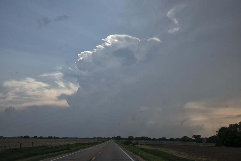
May 4th Crowell, Texas Tornado Warned Supercell
May 4th was a strange day. A decent threat of severe storms and low end tornado potential existed. High based storms formed off the caprock by mid afternoon and moved east. Bases never lowered. Another couple of storms, eventually supercells, formed along a boundary a bit further east southwest of Crowell, TX. Within a few minutes a lowering formed and exhibited some rotation. As the storm moved east, a line of storms formed in front of it, thus limiting the quality of inflow air into the supercell. It caused it to slowly weaken over time. The storm produced baseball sized hail, high winds and was tornado warned for a couple of hours. It showed a fantastic hook echo on radar, but it just couldn’t sustain with cold inflow from storms ahead of it.
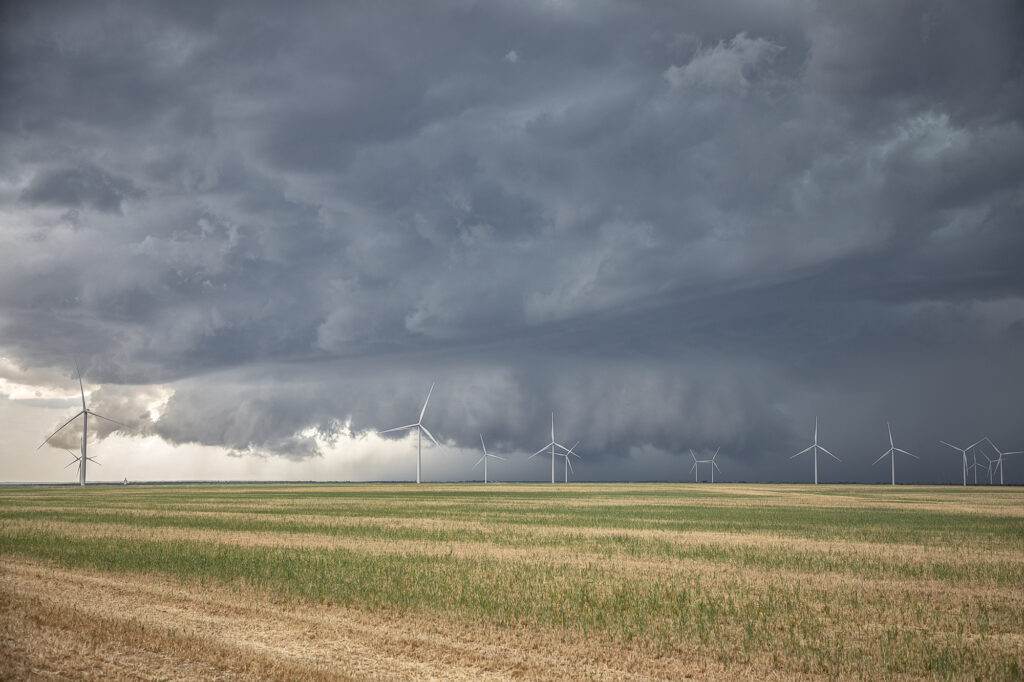
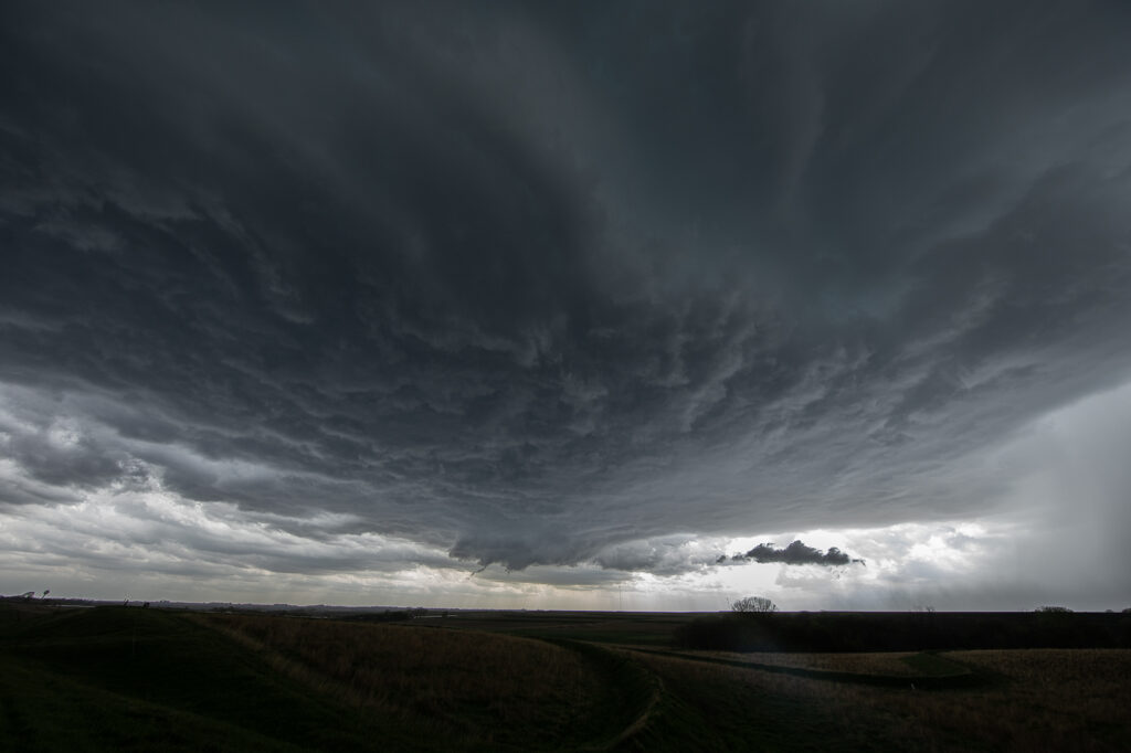
May 29th Central Nebraska Tornado Warned Supercell
May 29th was the classic “day before the big day” type set up. Moisture and instability were rapidly increasing along a lifting warm front in Nebraska, and shear was quite strong. Models showed late afternoon and early evening supercells forming north of Broken Bow and that is exactly what occurred. It took awhile from the main supercell to root along the boundary and get organized, but once it did, it became a formidable storm! Eventually it became tornado warned as it moved to the northeast and stayed warned for a few hours. Due to storm motion and poor roads, it became virtually impossible to stay with it. Near O’Neill we had to let it go and head to Sioux Falls, SD for the night. The storm had good structure, and it had a well defined rotating wall cloud. It just couldn’t tighten enough to get a tornado to form. Enjoy the pics!
April 21st Southwest Kansas Tornado Warned Supercell
Tour 1, Close Encounters started off the tour season with a bang! On arrival day, we blasted to southwest Kansas near Coldwater and caught a pretty LP supercell spinning like crazy! It became tornado warned early evening and tried to produce a funnel. It did not produce any tornadoes. The prettiest thing about this storm were the sunset colors lightning up the underside of the anvil and mammatus clouds. A great start to the official 2022 tour season! Enjoy the pics!
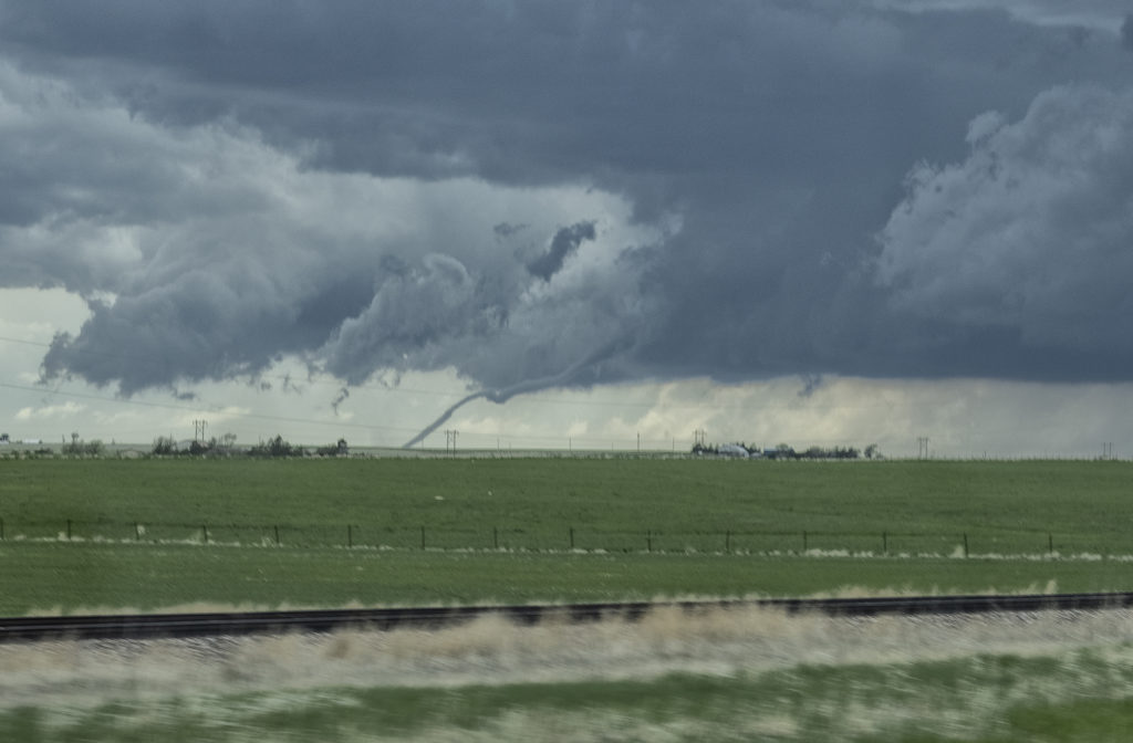
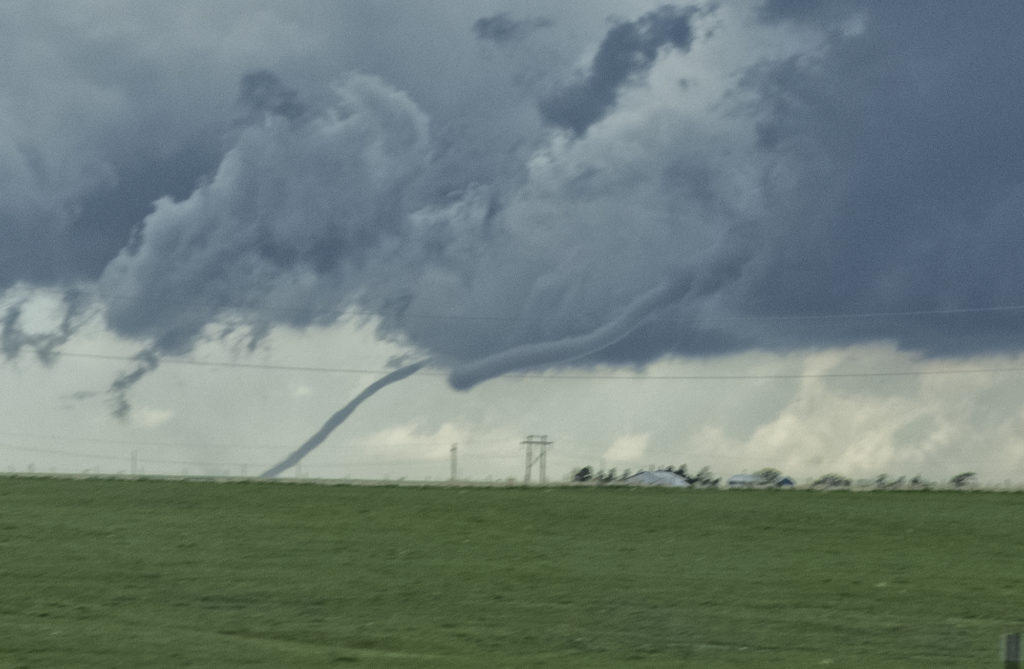
May 22nd Colorado Tornadic Supercells
May 22nd had great potential in Colorado. Good upslope flow and moisture, as well as great instability and wind shear would set the stage for intense tornadic storms! One storm formed early in the afternoon and produced a fast tornado west of Akron. A second supercell formed south of Limon and produced several tornadoes. We were able to intercept the first supercell and tornado west of Akron, but tried to blast down towards Limon later and couldn’t get there in time for the second storm. Still we caught a pretty tornado and then the end of the second tornadic supercell. A fun day, very hectic and exciting!! Enjoy the pics!!!!