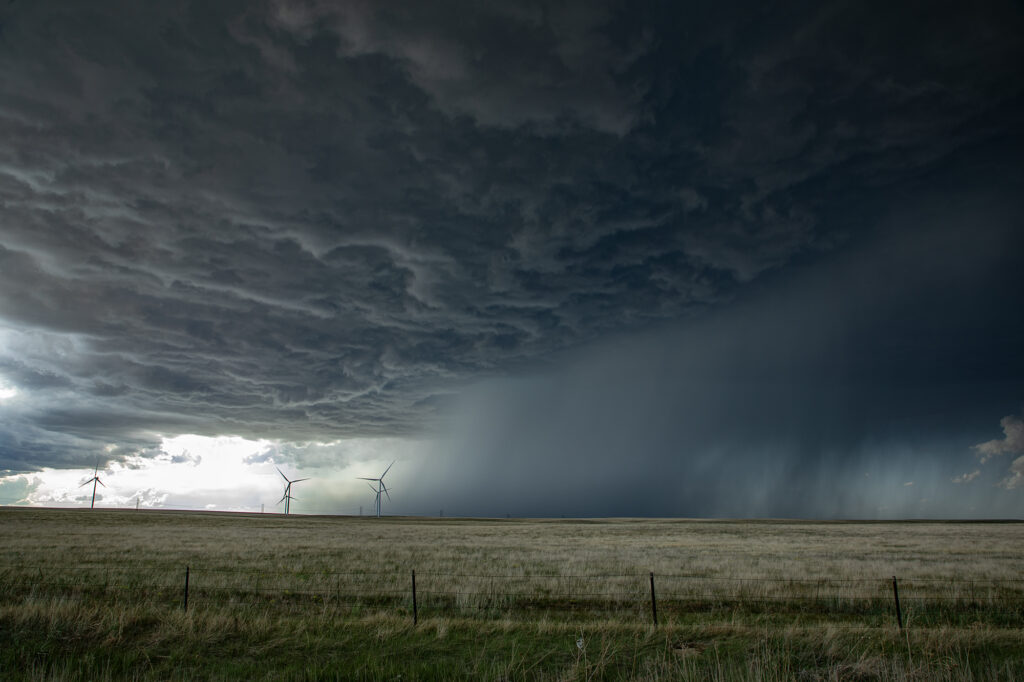
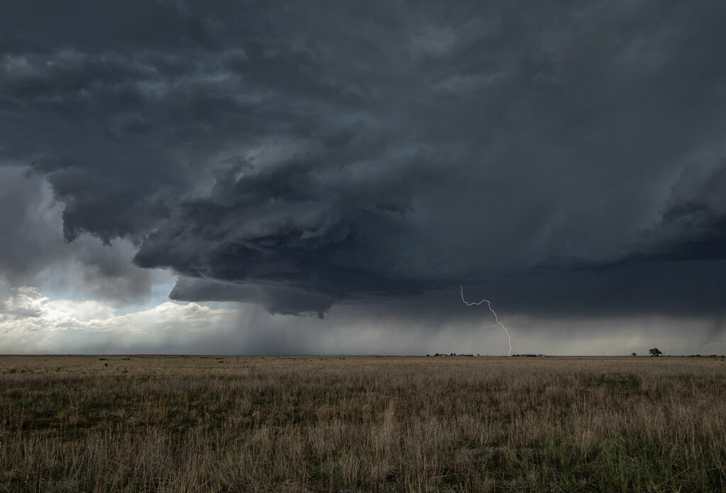
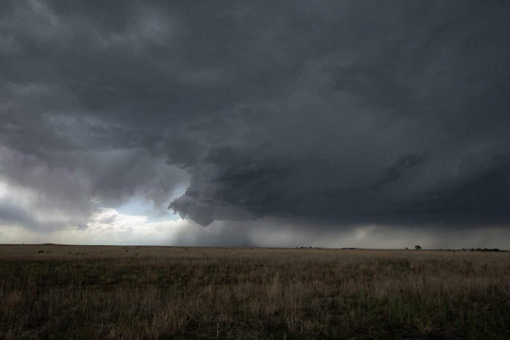
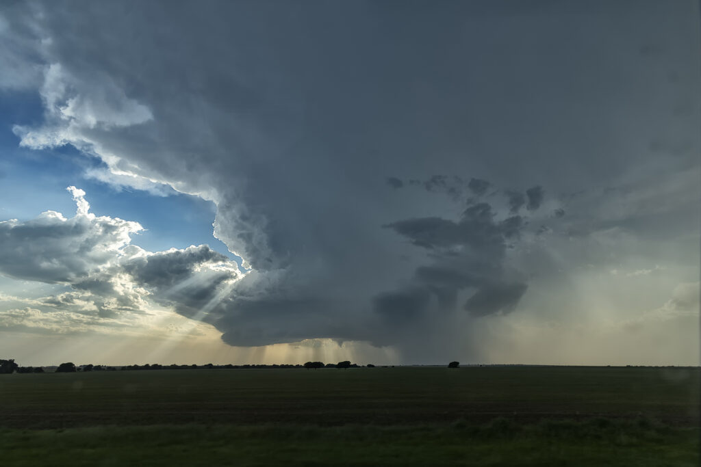
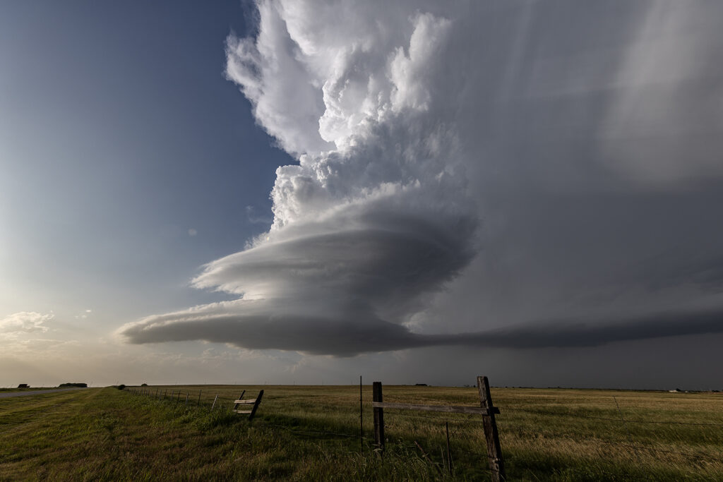
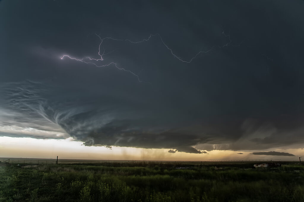
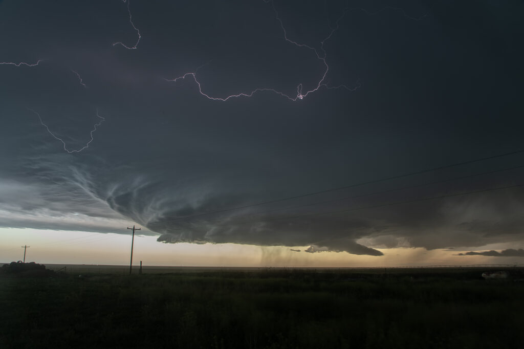
Upslope flow on the north side of an outflow boundary into the Palmer Divide set the stage for an intense supercell to form. It was tornado warned several times and came as close as it possibly could to producing a tornado without doing it! The structure was amazing, and as it anchored west of Simla, it spun hard. A massive bowl formed with a merry go round under it spinning wildly! However, this is a year where there seems to be a lot of close calls without storms actually producing a tornado! Someone called in a multivortex tornado, which is absolutely false. There was never a touch down and we were very close to the action the entire time. As it moved east of Limon, CO, the structure was just gorgeous. When it approached the Kansas border it became outflow dominant and steadily weakened. It has been a long time since I saw a storm’s low level mesocyclone spin that hard and NOT produce a tornado!
June 1, 2026 Last Chance, CO Tornado Warned Supercell
June 1st took us just east of our house in Colorado. A supercell formed near Denver and slowed moved, developed east and eventually became tornado warned near Bennett. Hail to baseball size occurred. A couple other supercells formed further east along a boundary just north of Last Chance and also became tornado warned. Due to the high based nature of the storms, there wasn’t a great threat of a tornado occurring. However, the structure was pretty and the lightning quite nice. They also produced hail to tennisball size and the moved east towards Akron, CO. Fun day, pretty storms!!!
May 16, 2026 Goodland, Kansas Tornado Warned Supercell
A triple point surface low over northwest Kansas would provide the convergence needed to fire off supercell thunderstorms this day. One storm formed northwest of Goodland and meandered east/southeast becoming a prolific hailstorm. Lack of real quality moisture would prevent tornadoes from occurring, however, as a left split from a storm over Rush county raced north, it collided with our storm and caused it to spin. A tornado warning was issued and a wall cloud formed, also spinning. Due to the higher based nature of the storm, it did not produce a tornado. As it moved east, more storms formed as a complex eventually developed that had winds up to 90mph in it! We raced east to get ahead and were treated to a sunset beast that also tried to become tornadic. An awesome day, great storms and lightning, as well as a tornado warning. Enjoy the pics!!!
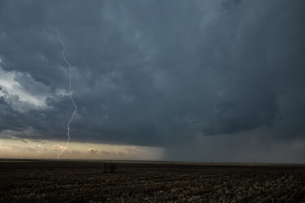
May 8, 2026 Chattanooga, OK Tornado Warned Supercell
Good shear, but limited moisture would be the problem this day. Storms formed along a cold front in central Oklahoma by mid afternoon, but were high based. We were watching a cluster of towers west of Lawton and hoped something would form from them. Later in the afternoon, they did just that. A supercell emerged and produced baseball sized hail. Early evening it became tornado warned. It produced a couple of funnels but was moving into capped air and weakened. The setting sun made for a cool image as the updraft evaporated.
May 1st Westway, Texas Tornado Warned Supercell
May 1st set up was far from ideal. Limited moisture was present moving into the upslope play of northeast New Mexico. Shear was great, as was lift. However, limited moisture also meant limited instability. Despite all that, severe storms formed south near Logan, NM as moved east. The tail end storm latched onto the old frontal boundary draped across the region and started spinning hard. As the storm crossed the Texas border, it became tornado warned. The structure was amazing! As it churned southeast along the boundary, it produced hail tennisball sized and had numerous lowering over time. Headin into the Hereford area, the hail became intense so we chose to push ahead and northeast of it and get out of its way. For a day that wasn’t advertised, a bit of panhandle magic certainly became the story of the day! Enjoy the pics!
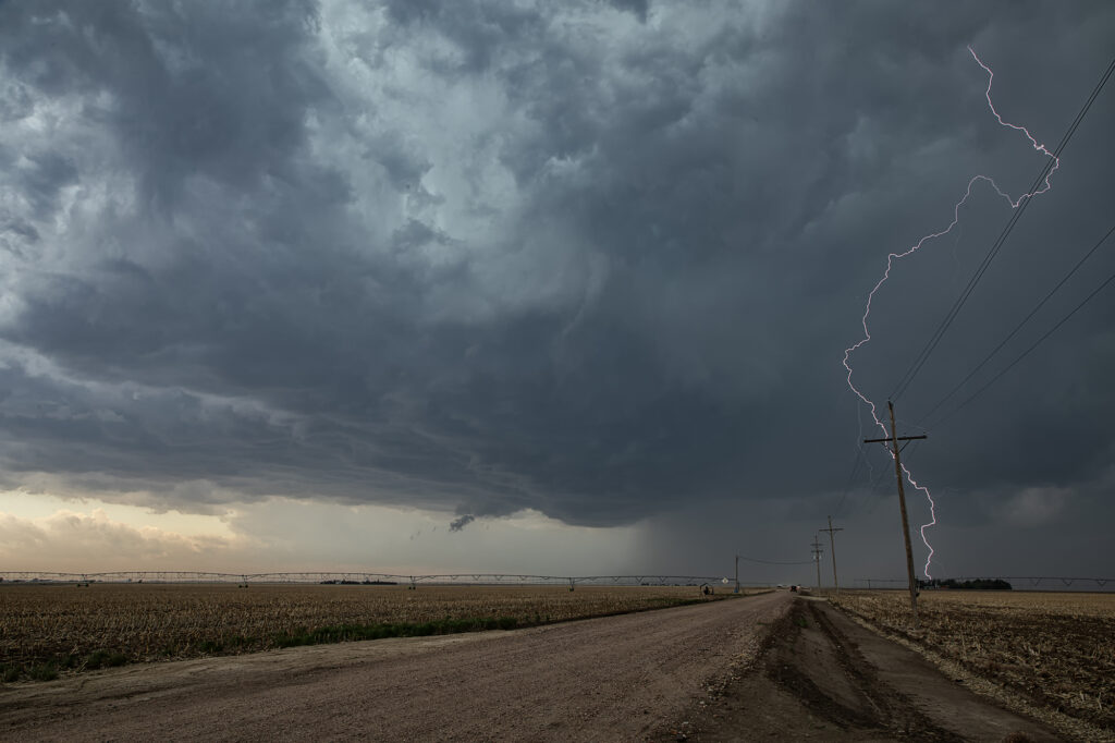
June 27th Amidon, North Dakota Tornado Warned Supercell
June 27th had a lot going for it. An approaching shortwave trough, an outflow boundary along with a dryline, as well as decent moisture with dewpoints in the 60s and moderate CAPE around 2500 j/kg would set the stage for severe weather in Montana, North Dakota and South Dakota. We originally targeted the area around Buffalo, South Dakota, but as moisture mixed out, we knew we’d have to venture a bit further north into southwest North Dakota. A supercell formed near Beach and became tornado warned. An hour later another supercell formed northwest of Amidon and also became tornado warned. We pushed north to get in position to watch it and as we did a couple of weak funnels formed under it and were reported to the NWS. The storm was anchored along a boundary and slowly back built. Numerous times there were rotating lowerings under the southwest portion of the updraft, as golfball sized hail fell from the vault region. Eventually the cell turned southeast and moved off the boundary. However, it moved into more stable air and slowly weakened but not before becoming tornado warned one last time! We stayed with it over beautiful canola fields and stopped for some photography. A fun day, and some amazing scenery!!!


June 23rd Neptune, Saskatchewan Tornado Warned Supercell
June 23rd was the first day of Photo Tour #2. Models showed a triple point low over southern Saskatchewan, with a cold front/dry line extending south into northern Montana. We had a LONG was to go starting from Denver, with close to a 10-12 hour drive! So, we departed at sunrise and blasted north. We arrived in Wolf Point, Montana late afternoon as cumulus towers formed west toward Glasgow. Storms were already severe and tornado warned in Canada, with Environment Canada issuing a PDS (Particularly Dangerous Situation) tornado watch for parts of Saskatchewan. Knowing we still would have another 2-3 hour drive to make it up there, we decided to see what the Montana developing storms would do. SPC issued an MD for Montana talking about a couple supercells forming. We hedged our bets for Montana. Soon it became clear that was the wrong choice as storms formed as left moving supercells, so we crossed the border into Saskatchewan north of Plentywood, MT and blasted north towards the tornado warned supercell. We got within about 10 miles of it as the sun was setting so we stopped for photography. Structure was gorgeous and so were the pale blue and orange colors of the storms! We stayed with it the best we could and at one point a very dark, large “v” shaped lowering occurred although we could not tell whether it was a wall cloud or broad cone shaped funnel due to the distance we were from the storm. Having to get back to our border crossing, which closed at midnight, we waved goodbye and back tracked to get back into the US. A 1060 mile day that resulted in a stunning supercell near Neptune, Saskatchewan was well worth the drive! Enjoy the pics!


June 12th Central Minnesota Tornado Warned Supercell
June 12th featured awesome shear, but a dearth of low level moisture. Dewpoints in the 50s to low 60s wouldn’t be enough to get intense tornadic storms to form. Most storms were higher based and quickly became outflow dominant. We positioned ourselves near Wadena, MN and chased a storm that formed southwest of there straight down I-94 towards the Twin Cities. The storm spun hard, but had a tendency to be linear and quite gusty. Another cell formed along a boundary just to the east and acquired supercell characteristics. It developed a lowering that someone report a tornado from. From our vantage point, I had a hard time believing that report. Another over zealous chaser in action! We stayed with our storm and near St Cloud, it became tornado warned. At one point it had a lowering that looked like a broad funnel forming, however, that’s as far as it went. Soon the gust front hit us and we called it a day. A bit of a frustrating day in which there was some decent potential for nice supercells and even a couple of tornadoes, but to no avail.

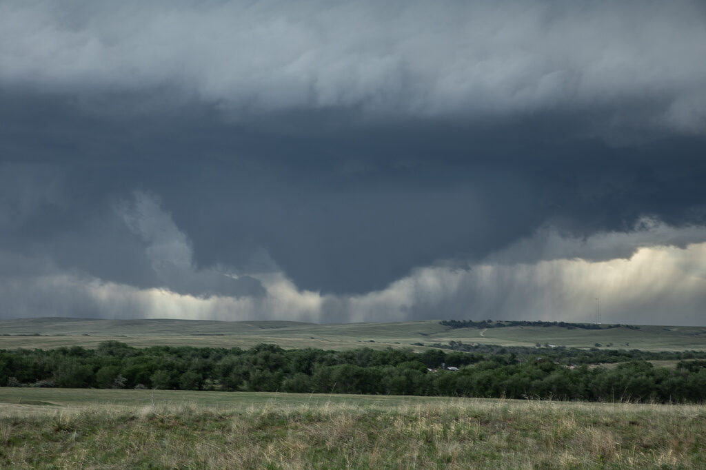
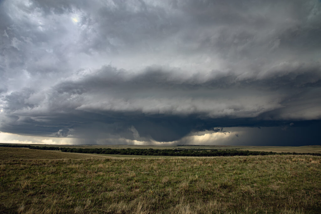
June 7th Ansley, Nebraska Tornado Warned Supercell
June 7th featured good moisture and instability, as well as moderate shear. A boundary lay across central Nebraska and would be the focus for several supercells The storm we chose to chase formed early afternoon near Thedford, and intensified as it moved southeast. By the time it got close to Broken Bow, it was well structured, producing baseball sized hail and a possible tornado. We followed it through town and southeast as the structure truly became insane! As it approached Ansley, it became tornado warned, but did not produce I feel low level shear from cloud base down was insufficient to produce tornadoes. Nonetheless, the structure was quite nice as it moved all the way to I-80 by mid evening. Enjoy the pics!!!


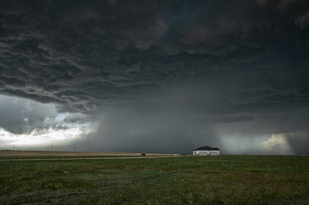
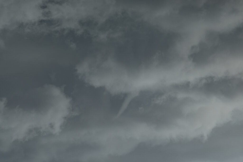
May 31st Eastern Colorado Supercell
May 31st featured a short wave trough moving across Colorado, with limited moisture, but strong shear. Most models developed storms off the Palmer Divide, intensifying as they moved east/southeast. That is exactly what happened. A storm started spinning and became tornado warned west of Cedar Point, but never showed strong enough rotation to produce a tornado. Another storm formed to the south of it and ended up being the storm of the day. As it steadily intensified, a severe thunderstorm warning was issued for it. As it approached Limon a DESTRUCTIVE STORM warning was issued for hail baseball sized. We encountered hail about golfball size as we had to punch the core and get ahead of it south of Hugo. About 10 miles south of town, structure became quite nice and a lowering formed with slow rotation. I thought for a bit that it might produce a tornado, but to no avail. It never could balance its updraft and downdraft well. With the sun getting low in the sky and having to be back in Denver soon, we waived goodbye one last time and headed home. A fun day and close to Denver made it an even better treat! Enjoy the pics!