Tag Archives | June

June 12th Wyoming and Nebraska Tornadic Supercells

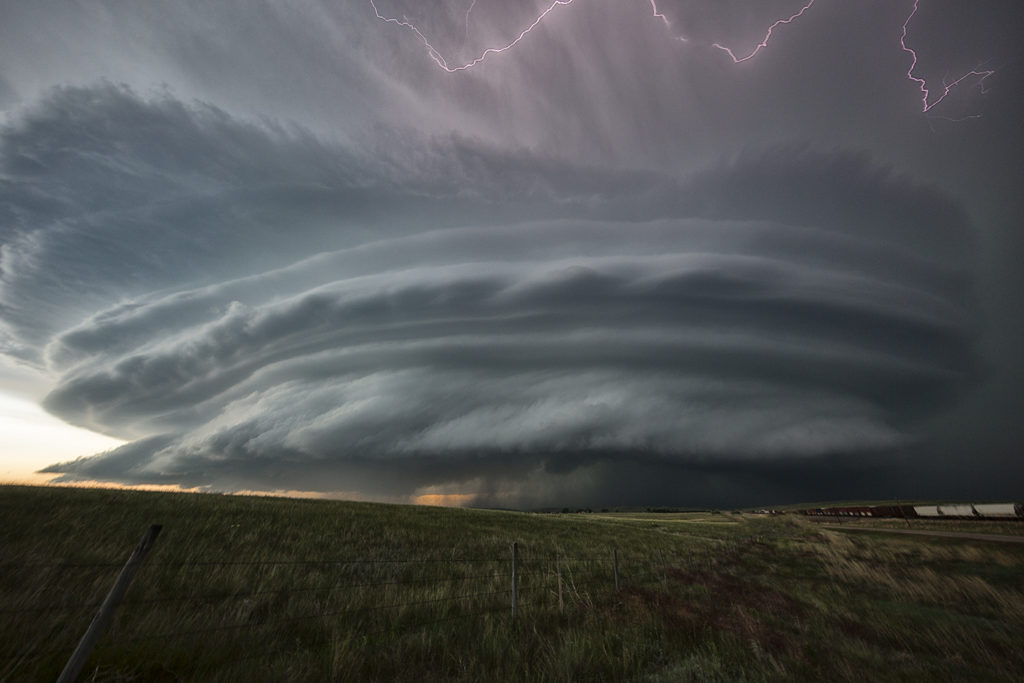
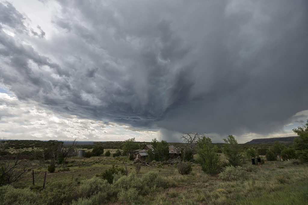
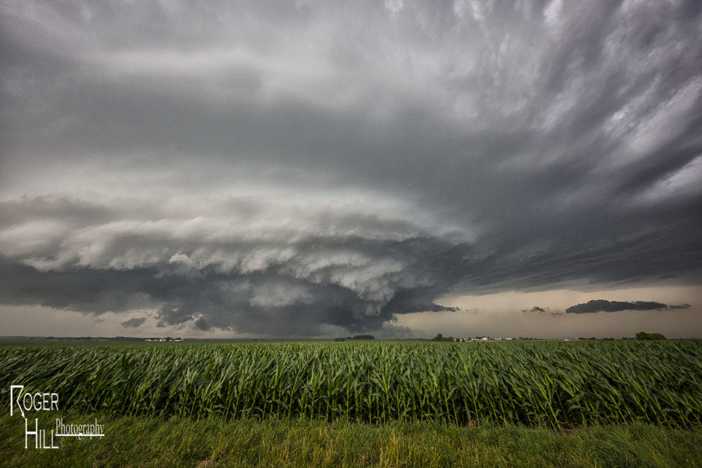
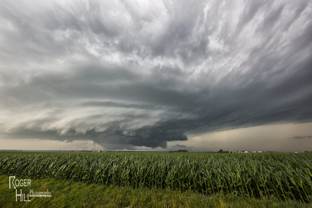
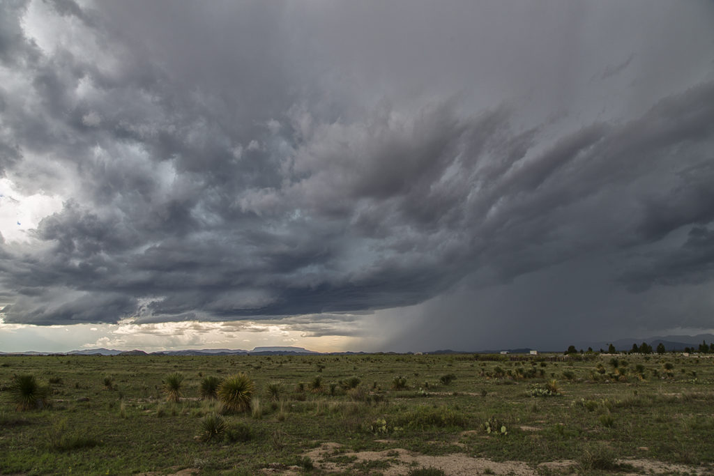
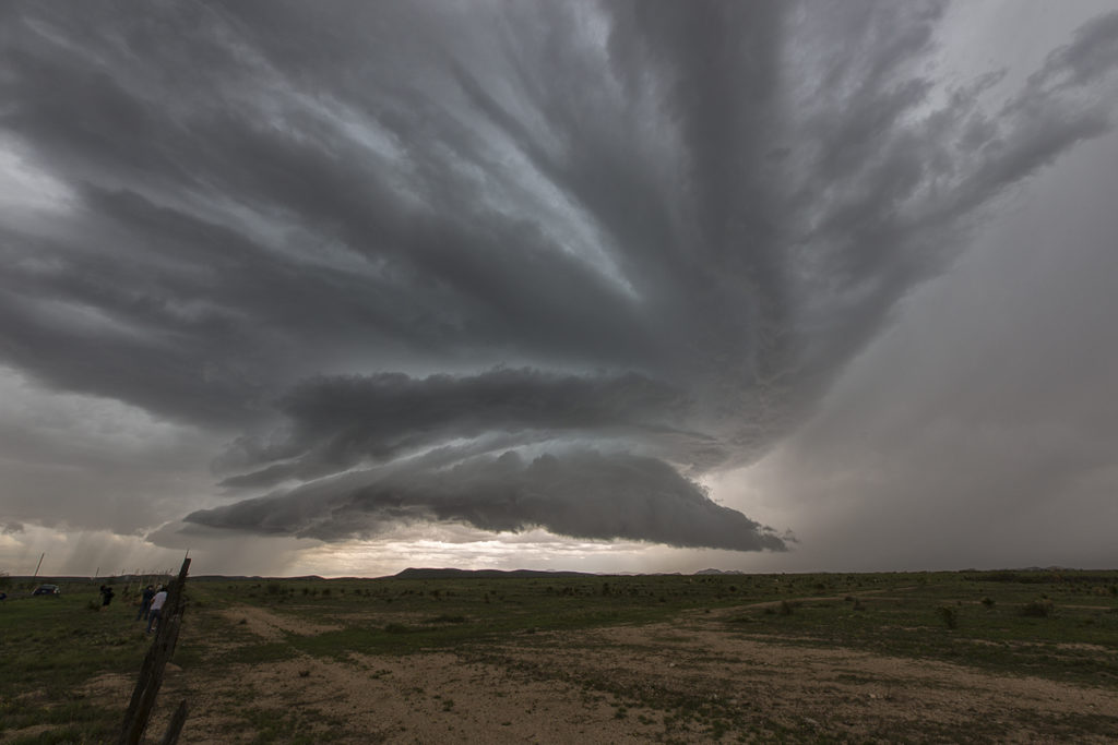
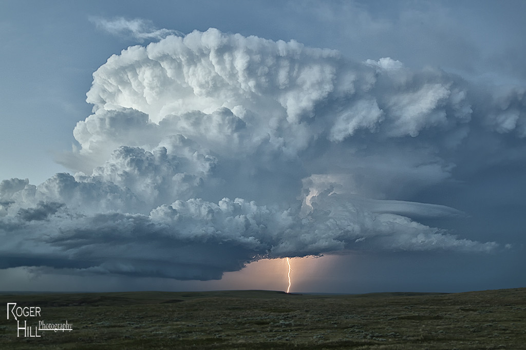
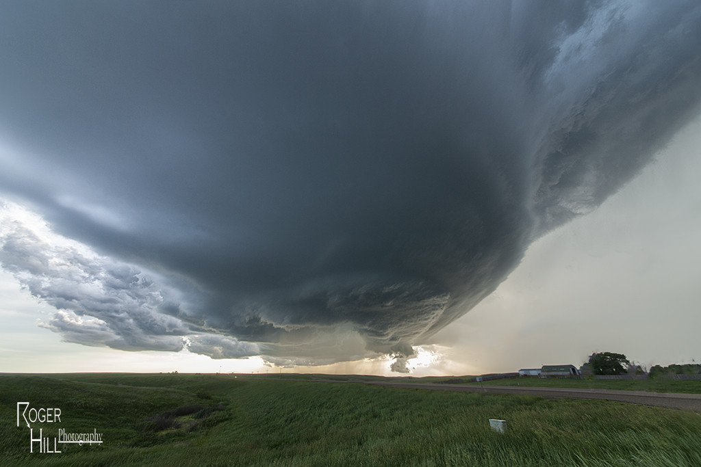
June 12th had the potential to be a record breaking event for eastern Wyoming, as well as the Nebraska panhandle. At the end of the day numerous tornadoes formed across the landscape!  Very high moisture, extreme CAPE, very strong wind shear and upslope into the Laramie Range would cause several supercells to form.  We chased the first supercell of the day, which produced a couple of tornadoes near Lingle, Wyoming.  This storm was tornado warned for many hours as it moved northeast across eastern Wyoming and western Nebraska.

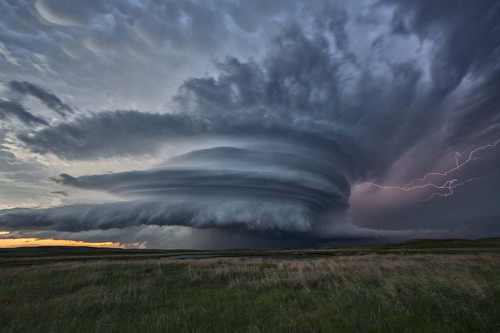
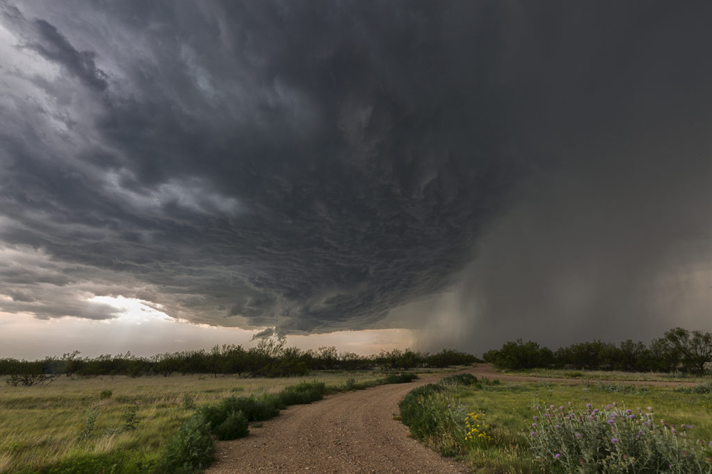
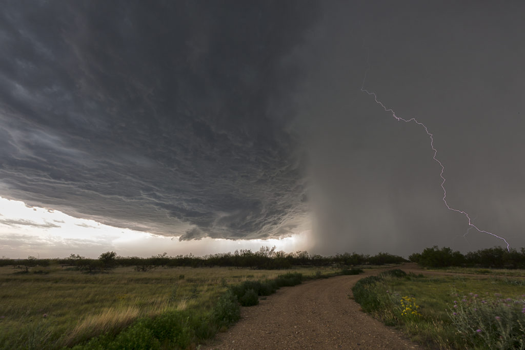
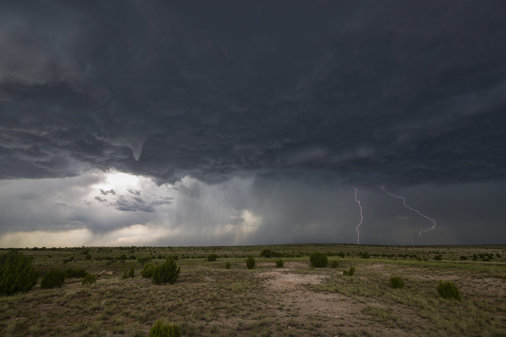
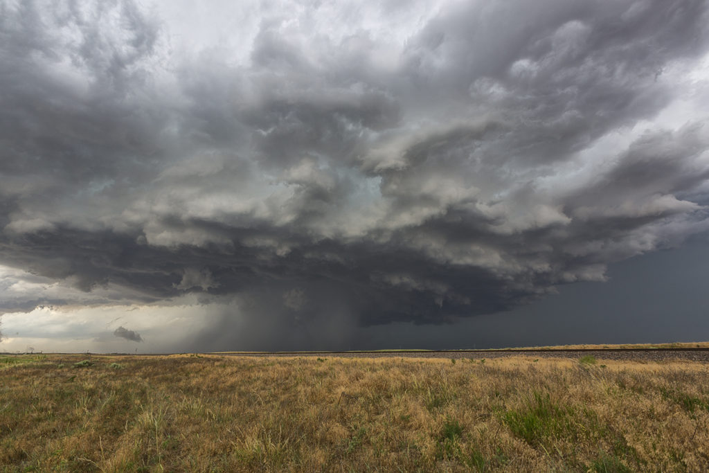
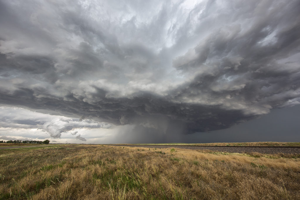
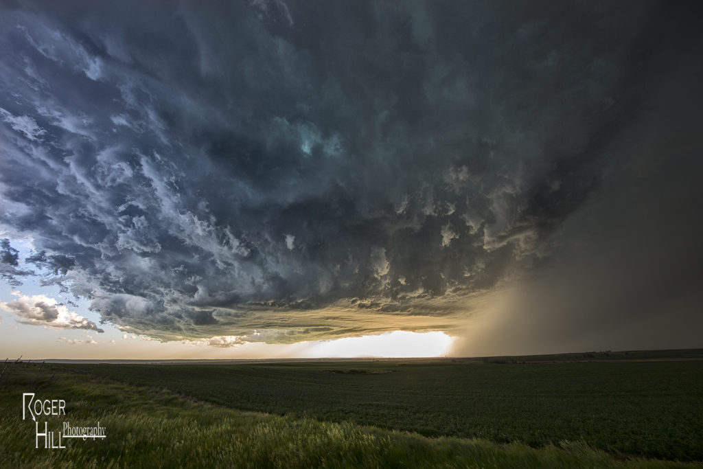
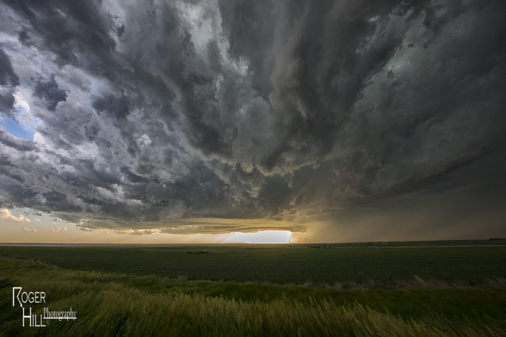
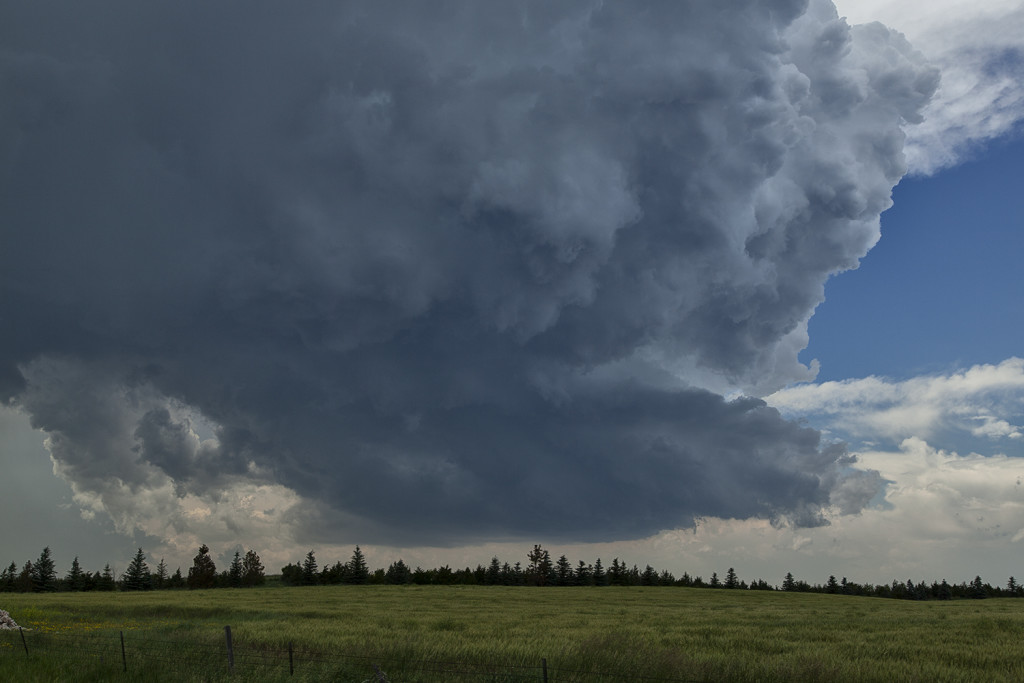
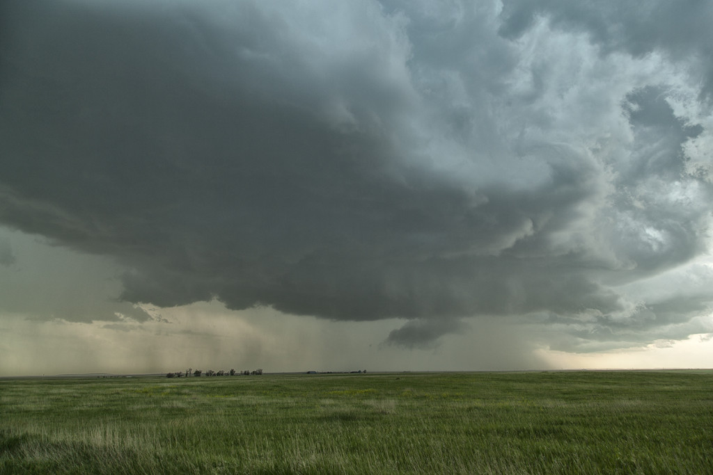
Later we would drop south towards Scottsbluff, Nebraska and catch a tornadic storm that came out of Colorado (See the next chase account from SLT co-owner Caryn Hill!!!!!). We witnessed 3 tornadoes from this storm. Later in it’s life cycle, it would become one of the most photogenic supercells of 2017 as it rolled across the Nebraska Sand Hills headed for southern South Dakota where it dissipated after midnight.   For an event to be this strong, this far west, it was almost unprecedented.  SPC even had a Moderate Risk for eastern Wyoming, only the second one in history!  They were also forecasting strong tornadoes, which did occur.  Hail and lightning in these monster supercells were incredible as well! Enjoy the photos!!!!


June 8th Texas Panhandle Supercell

June 8th on paper didn’t look that great. Limited moisture would be the biggest factor in getting tornadic storms. However, decent shear, CAPE, and a sharp dryline would provide the necessary ingredients to sustain severe storms.  By mid afternoon a couple of storms formed on the dryline near Dumas. They quickly went severe due to very steep lapse rates which enhanced hail size. It took awhile for the tail end storm to take over the show, but it did, and it gave us quite the view from our position. The storm spun hard and produced copious amounts of hail to baseball size. It also produced a couple of funnels that never had the appearance of touching down. For several hours the supercell persisted while slowly drifting south. Well south of Amarillo it eventually dissipated in the night sky after a gorgeous sunset. It was a treat to watch this storm for hours!


June 7th New Mexico Supercell

June 7th didn’t have a lot going for it. Limited moisture, instability and shear would cause Tour 6 to head for higher terrain. We arrived near Las Vegas, New Mexico as a supercell came off the mountains, headed for flatter lands.  This storm looked nice, albeit high based, and produced a lot of hail, lightning and wind. We followed it to Vaughn, New Mexico where it weakened and eventually dissipated. For a very marginal day, we had good results and a very nice supercell!

June 27th Southwest Nebraska/Northeast Colorado Tornado Warned Supercells

The first day of the Reunion tour provided a decent high plains set up. Upslope flow into western Nebraska would push 60 dewpoints along a boundary as moderate westerly mid level winds would help generate enough wind shear for supercells. Two such storms formed along the northwest/southeast oriented boundary and would produce giant hail to softball size. Both supercells were tornado warned with the second storm producing a confirmed tornado near Eckley, Colorado. Structure was decent as well. We came back through the area the next day to find thousands of acres of cropland shredded to the ground, mostly corn. Sometimes hailstorms can produce more significant damage than a tornado can. This was the case with these storms.

June 22nd Western Illinois Tornadic Supercell

We made a long hard dash from North Dakota to Illinois on June 22nd for what appeared to be a setup that had high tornado potential. Extreme instability, upper 70s dewpoints, strong wind shear and a warm frontal boundary would set the stage for a pretty decent tornado event. By late afternoon we arrived near Moline as storms finally got going along the boundary. Several supercells evolved along the warm front and several became tornadic. We intercepted two supercells that produced tornadoes, albeit weak tornadoes. Surprisingly there was only one tornado rated EF2 this day, which occurred well after dark. We chased along and north of I-80 from east of Moline to north of Peru, Illinois. Too many cell interactions made for a sloppy event, although the first tornadic supercell we intercepted near Hooppole had very pretty structure. I was sure this storm would drop a significant tornado. It produced a weak tornado that skipped along the ground for a couple minutes. As it continued east, it produced another tornado, a short lived multiple vortex tornado northwest of Peru. Later another supercell we saw in the dark produced the EF2 southeast of us. We couldn’t stay up with it. A long day, but a rewarding day for the tour!

June 21st Northeast Montana Tornado Warned Supercell

June 21st was the first day we had decent shear, instability and some moisture to work with. A dryline and old outflow boundary set up in northeast Montana and would be the focus for supercells late afternoon. We drove to Bainville, Montana and waited at this cute little gas station/restaurant for storms to form and intensify. We were torn between cells near Glascow or further southeast near the Belfield, North Dakota area. We ended up choosing the northeast Montana storms. After a few cycles, a supercell emerged near Wolf Point as we drifted west towards Brockton to intercept it. Although it was a bit higher based, the structure was nice. As the supercell moved east, it became tornado warned near Culbertson. Near Fairview, a report of a tornado occurred, but we couldn’t see anything under the base. Not sure what the locals were looking at as with lcls at 800MB, it was pretty obvious the tornado threat was fairly limited. It stayed tornado warned all the way to Watford City, North Dakota where it was feeding on outflow air from storms to the east, and weakened quickly. Fun chase day, good storm, lots of lightning, hail and wind. Northeast Montana is a very pretty area to chase in!


June 1st Marathon, Texas Supercell Thunderstorm

June 1st continued the streak of limited moisture and shear for the US. We decided to chase the Davis mountains in southwest Texas and were treated to a pretty storm with very large hail to tennisball size.  Two supercells emerged from the mountains with one storm in particular becoming a prolific hail producer. It tracked from near Marathon eastward to Sanderson where it dropped its largest stones of the day, measured 2.5″ in diameter.  Later on, the storm gusted out and outflow kicked up a cluster of new cells on the Mexico border that were producing an incredible amount of lightning strikes. Pretty indeed, and a great way to finish the day!

June 25th Chugwater, Wyoming Tornado

June 25th looked like a mess on paper. Lots of moisture, good CAPE, good lift, but little shear would be the story this day. We headed up towards Kimball, Nebraska for the initial convention developing, only to be taken west towards Chugwater as numerous storms formed. Splitting and left moving storms were the norm, with a few showing rotation on the northern side of the cells. As we approached Chugwater from the east, a rope tornado formed and planted itself on the ground for about 3-4 minutes.  It was something we really weren’t expecting but were pleasantly surprised to see! It was our 7th tornado on Tour 8 this year!


June 22nd Aurora Borealis

Although earthly weather was quiet on June 22nd, a CME that hit the earth that day sparked an amazing aurora display that night. We were in the Spearfish, SD area as darkness fell and the skies lit up in green and purple pillars as the intensifying aurora became visible. We spent a couple hours at night photographing this incredible event!  Much fun for all the guests who ventured out with us at night to witness space weather at it’s finest!

June 21st South Dakota Tornado Outbreak

June 21st was a day that had great potential. Very good shear, moisture and instability were in place across the high plains into the western Dakotas. An approaching shortwave trough would provide the necessary lift to spark intense supercells in southeastern Montana.  One particular supercell formed near Baker, Montana and cycled several times as it entered northwest South Dakota.  This storm would be responsible for a half dozen tornadoes we witnessed across northern South Dakota.  The first tornado occurred as the storm really ramped up near Ralph, South Dakota. It would cycle several times and keep producing tornadoes all the way to near Eagle Butte where it dissipated late evening. The structure was some of the best of the season and several tornadoes were quite photogenic! Tour 8 scored big with this gorgeous beast!