Tag Archives | June

June 17th East Central Wyoming Tornado Warned Supercell

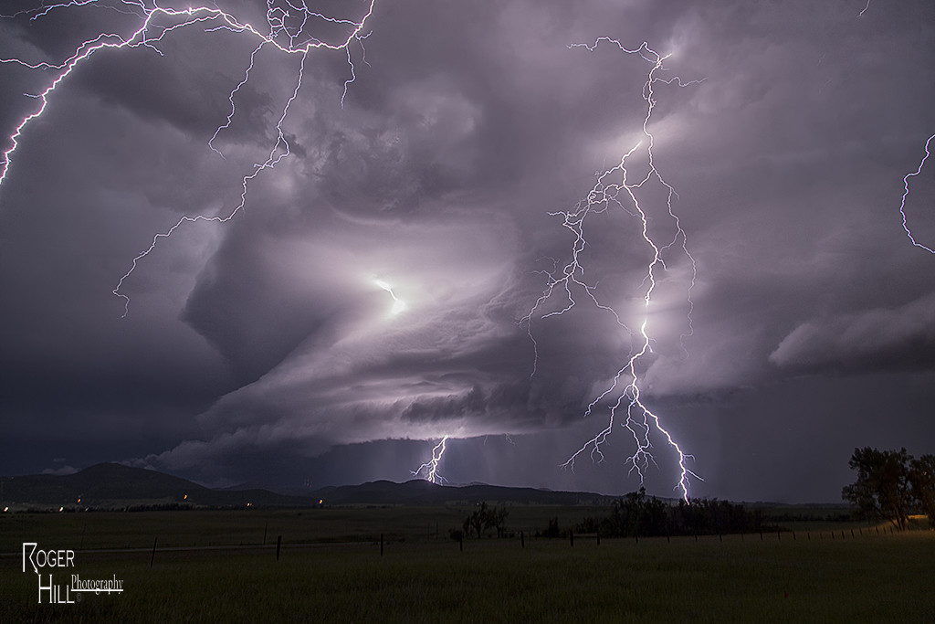
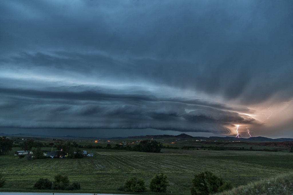
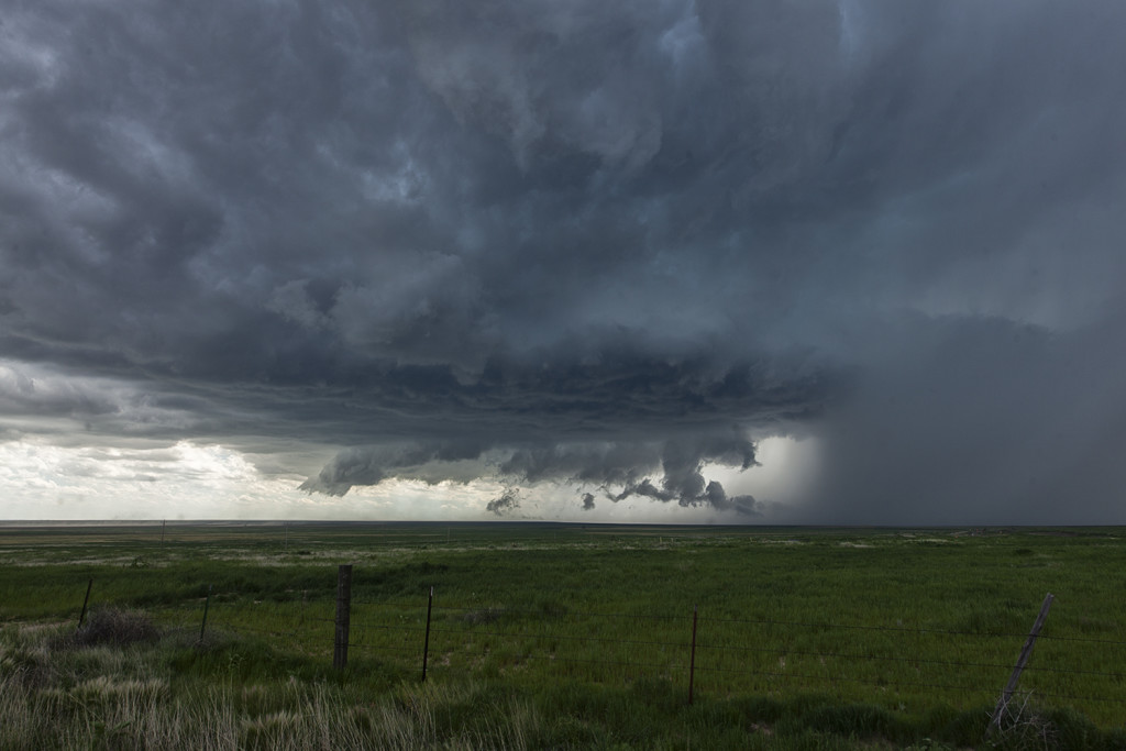
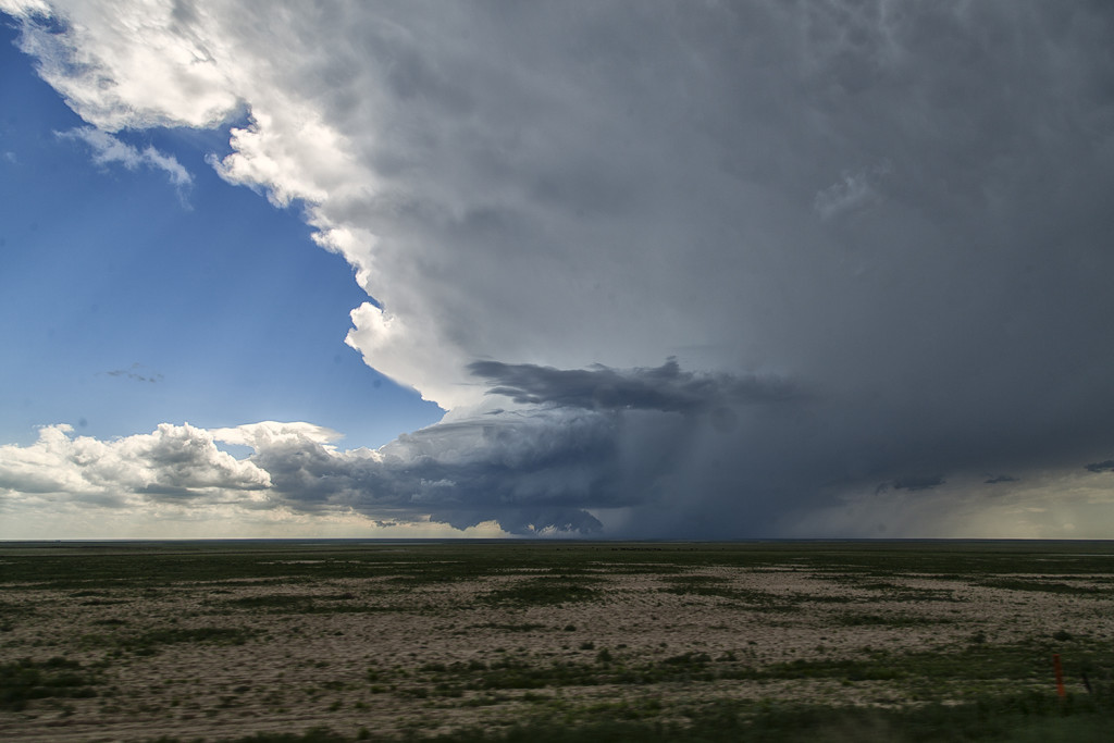
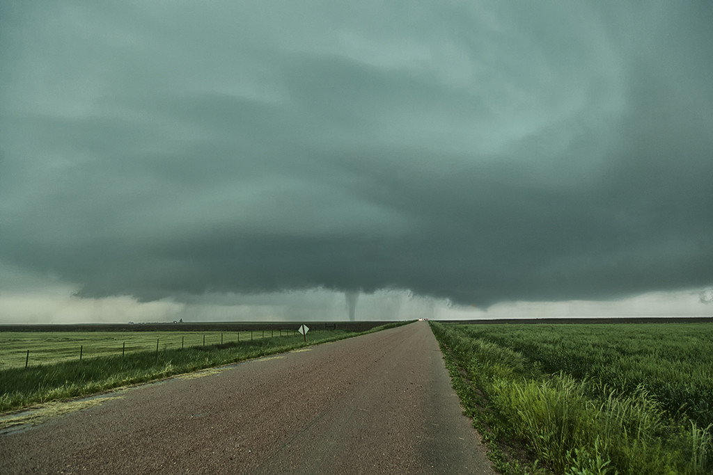
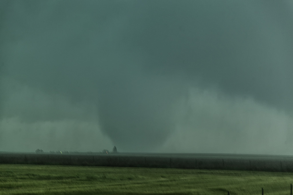
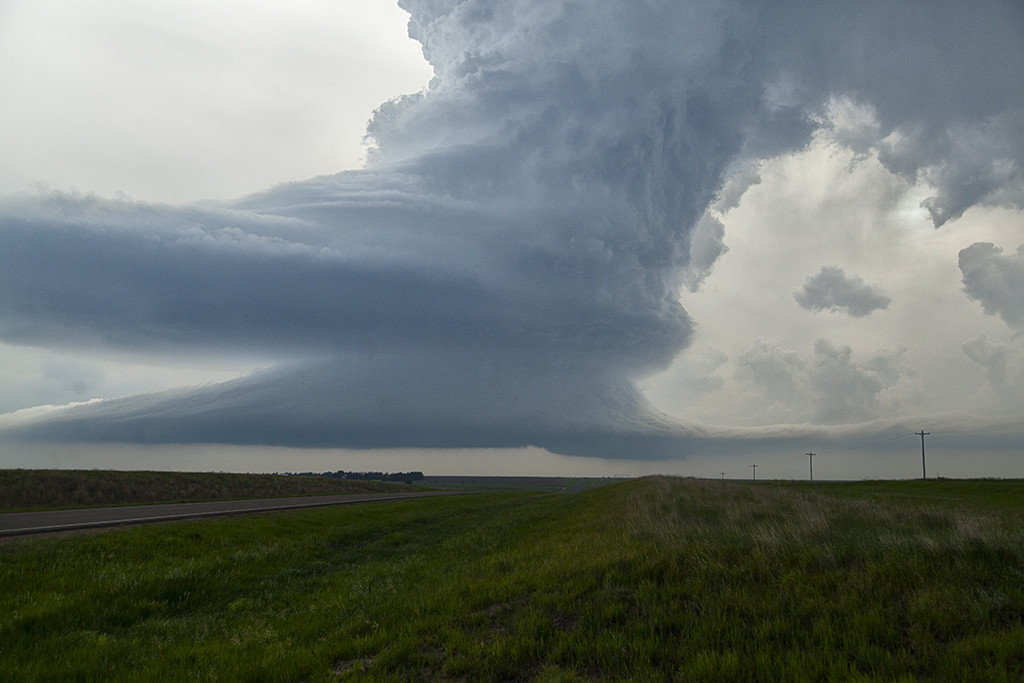
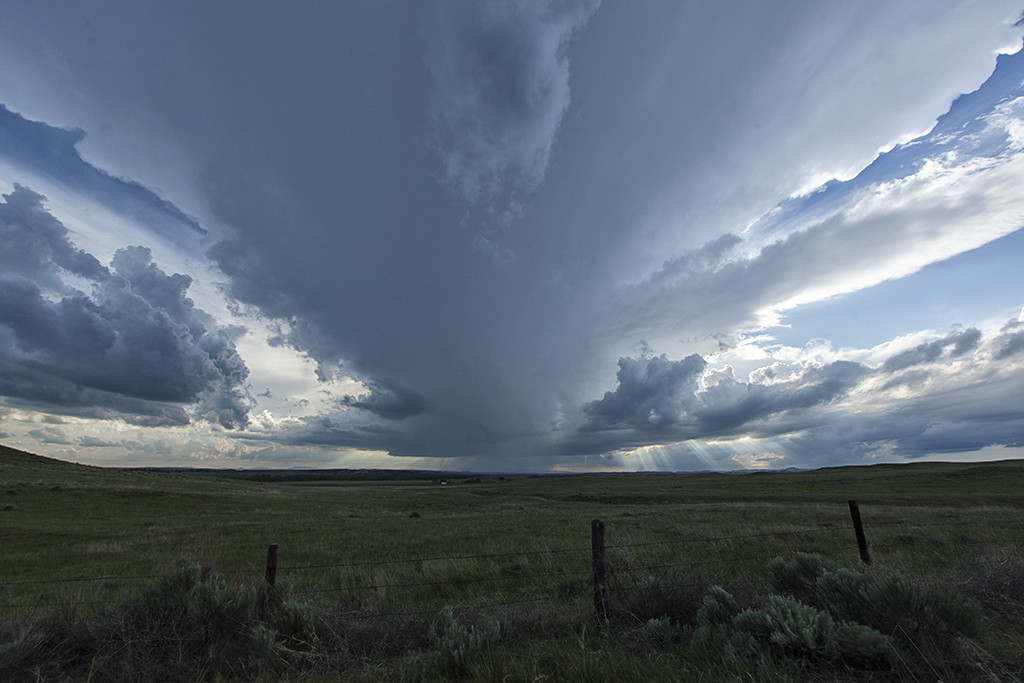
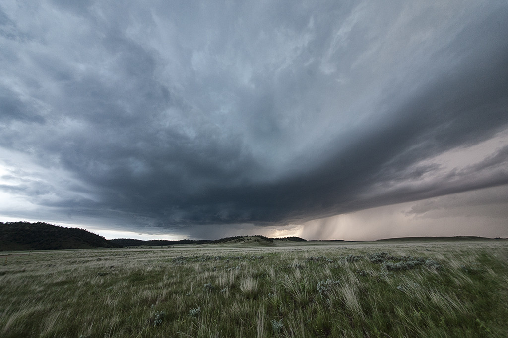
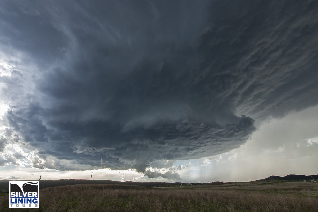
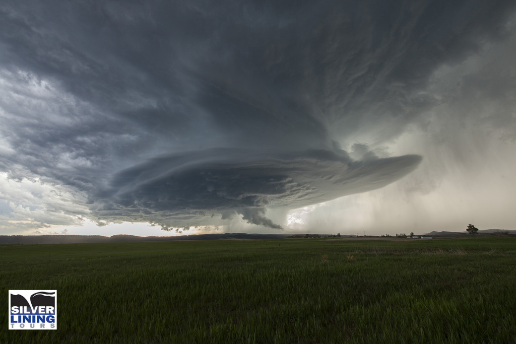
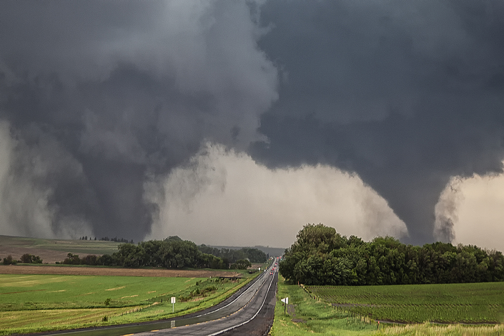
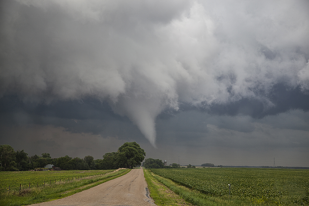
June 17th had a short wave trough moving across the northern high plains. Decent moisture and instability was in place to fuel significant storms. However a capping inversion kept storms from forming until late in the day. A storm complex moved out of Montana into eastern Wyoming, and it was this complex that developed significant rotation as a storm in front of the line became absorbed into it and caused it to rotate rapidly. A tornado warning was issued for the western Black Hills as the storm approached Beaulah and into the Spearfish area. The structure as dusk was quite nice and the lightning was amazing! One of the best lightning displays all season so far!


June 11th Southeast Colorado Supercell

June 11th had issues, but still produced some nice storms. Marginal moisture, but decent shear overlaid eastern Colorado. By mid afternoon storms formed along a boundary that stretched across east central and southeast Colorado.  One particular supercell tracked along the boundary from north of LaJunta to far southeast Colorado. It struggled to stay on the moist side of the boundary occasionally, but managed to be quite a prolific hail producer. Never a real threat to produce a tornado, it did however manage to produce several short lived funnels. By early evening a cluster of storms formed south of Lamar. A tail end storm became a powerful supercell and was tornado warned for a couple hours. Visually it was stunning with constant rotation under the updraft. Two tornado reports came in, however they were not validated.  As the supercell tracked into southwest Kansas, it became an outflow dominant storm and produced significant winds.

June 5th Eastern Colorado Tornadoes

June 5th kept us close to home. A warm front draped over east central Colorado would become the focus for intense supercell storm development by late afternoon. It provided a differential heating boundary where storms erupted on the south side of it and interacted with the strong low level shear on the boundary. We sat between Anton and Cope and watched as a strongly tornadic supercell anchored at that point and produced multiple tornadoes. All in all we counted 4 confirmed tornadoes. The storm was a tad messy, and thus photos from the day clearly show the rain/hail as we took each shot. A couple of the tornadoes appeared to be strong, but fortunately only destroyed a barn in the wide open eastern Colorado plains. Tour 5 and Photo Tour #2 enjoyed the event as both were in great position to watch the entire tornadic cycle of the supercell.

June 4th Kansas Tornado Warned Supercells

June 4th had high potential. When Tour 5 and Photo Tour #2 awoke in the morning we felt we had to get into northern Kansas. A very volatile environment was present with 70 dew points, 5000 CAPE, strong shear and lift along an outflow boundary. There ended up being a few very beautiful supercell storms form in northwest and north central Kansas by early evening. Their structure was top notch, lightning superb and hail huge. Both tours enjoyed the long opportunity to photograph, video and just watch the storms as they spun across northern and central Kansas.

June 3rd Wyoming Supercell

June 3rd was a day we felt had decent severe weather and tornado potential. High CAPE, great shear and good lift along the higher terrain of the Laramie Range we felt would result in a few tornadic supercells. Unfortunately nature had other plans. Nothing of significance formed until just before dark and even then what happened is still up for debate. The storm spun nicely, and just as darkness hit several blocks and columns of scud clouds formed under the updraft, of which some folks called tornadoes. I am a pretty firm believer there were no tornadoes from this storm, but was certainly suspicious! Still, Tour 5 and the Photo Tour #2 had a great time with it!

June 1st South Dakota Supercell

For Tour #5 and Photo Tour #2, June 1st took us to the Black Hills area of South Dakota. Good upslope flow coupled with high CAPE values, would produce a very nice supercell storm that anchored itself to the east side of the Black Hills. This storm spun nicely, even tried to produce a tornado, but didn’t quite have enough low level shear to become tornadic. It did,, however, produce tons of very large and damaging hail to baseball size south of Sturgis. The storm persisted for several hours before decreasing in intensity just before dark. Both tours had a very nice treat on this day, and along with great structure, the storm produced some incredible lightning!

June 16, 2014 Northeast Nebraska Tornado Outbreak

First, our heart felt sympathy goes out to those who suffered losses on this day. When we awoke on the morning of June 16th, I had butterflies in my stomach. I knew there would be potential for strong to violent tornadoes in Nebraska. Unfortunately those fears were realized as at least a half dozen strong or violent tornadoes would ravage the area east of Norfolk. The town of Pilger would be particularly hardest hit. We spent a good chunk of the day around Columbus analyzing data and watching things unfold.  With a temp of 83 and a dewpoint of 78, stiff east winds buffeted the area along a warm front. Conditions were ripe for powerful supercells and tornadoes. Mid afternoon storms formed along and north of the warm front. They moved into colder air and weakened. We knew it wouldn’t be long before storms would form along the warm front and ride it eastward with extreme shear. Southeast of Norfolk the first tornado formed and tracked near Stanton. Another tail end cell developed and produced the rest of the tornados this day with twin EF4 tornadoes destroying Pilger and other locations northeast of there. We watched from the back side of the tornadoes, about 1-2 miles east of us as the event unfolded. An event we’ll never forget! Tornadoes of every shape, size and strength occurred. The last time twin violent tornadoes occurred so close together was nearly 50 years ago! Amazing, and devastating to say the least!