Tag Archives | Colorado

May 24th Eastern Colorado Tornadic Supercell

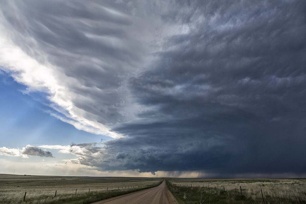
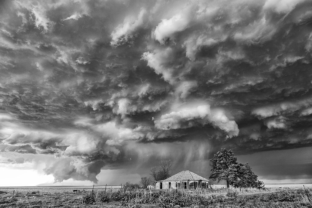
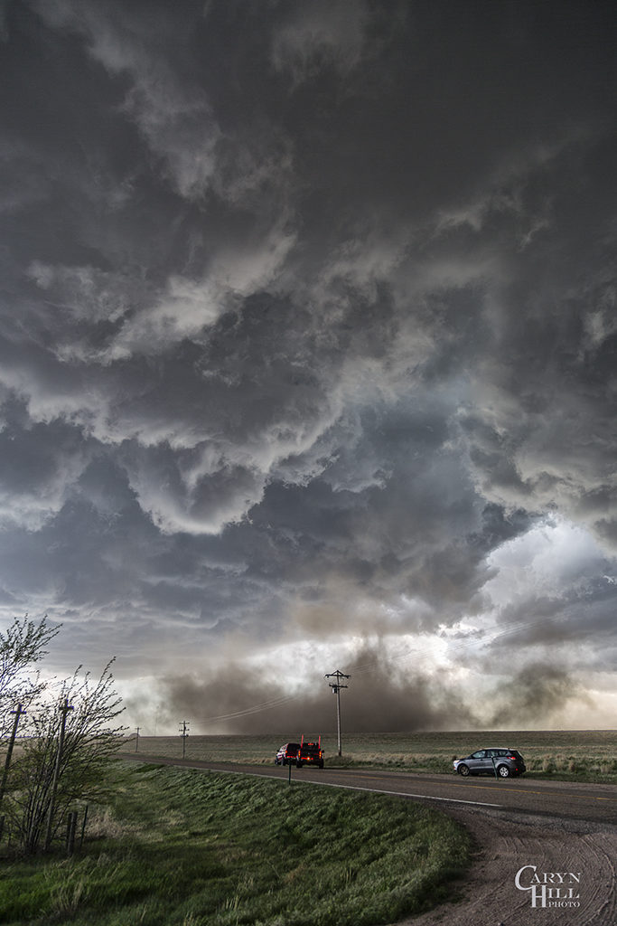
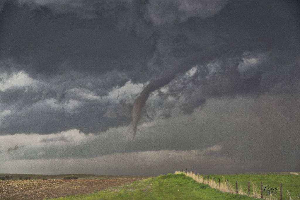
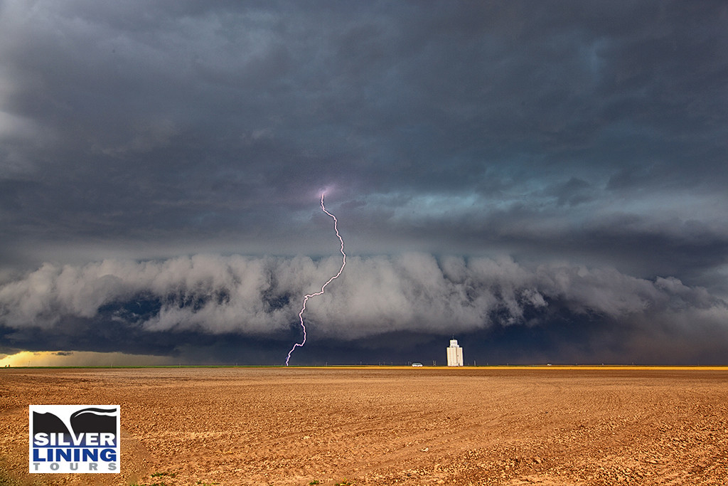
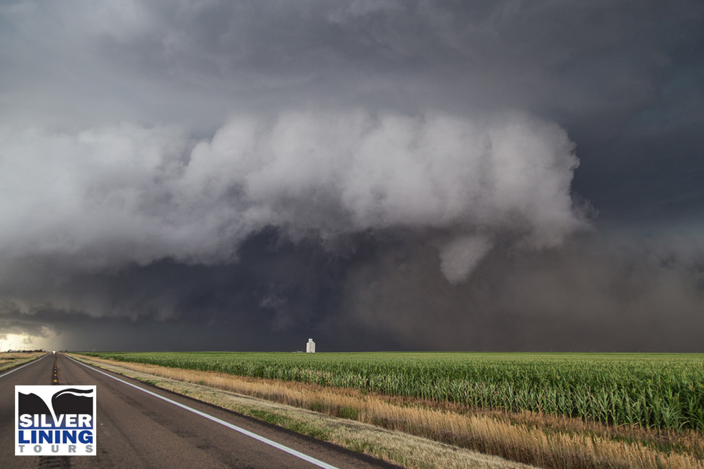
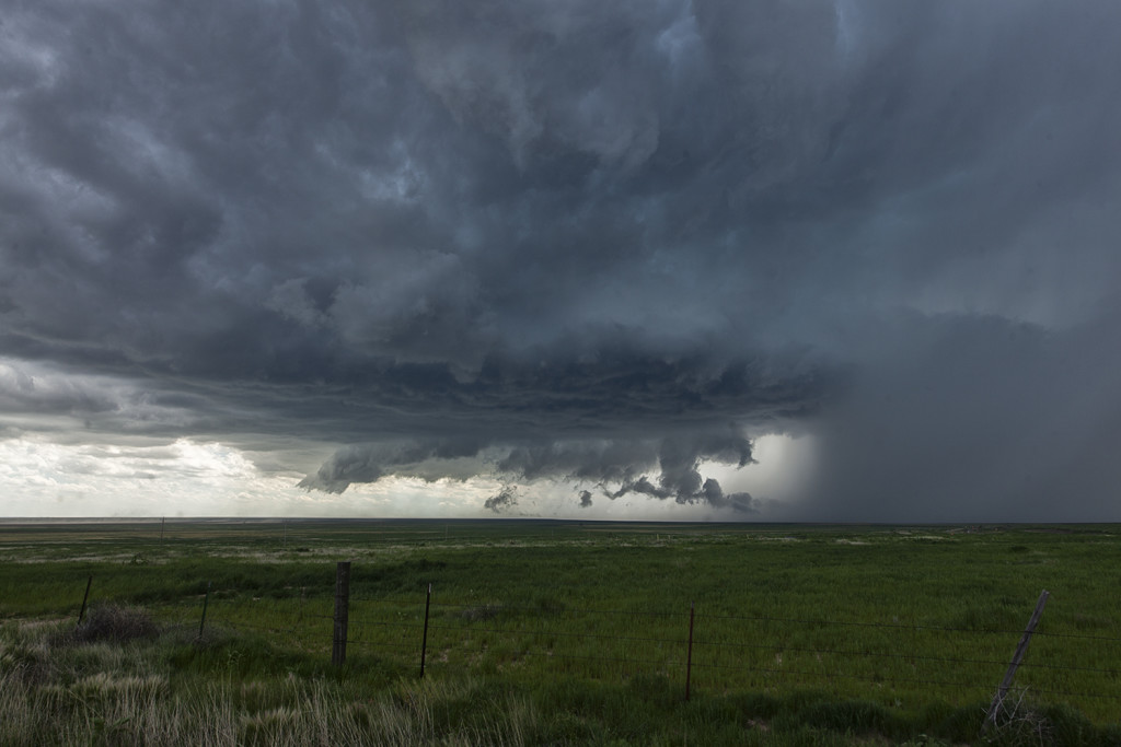
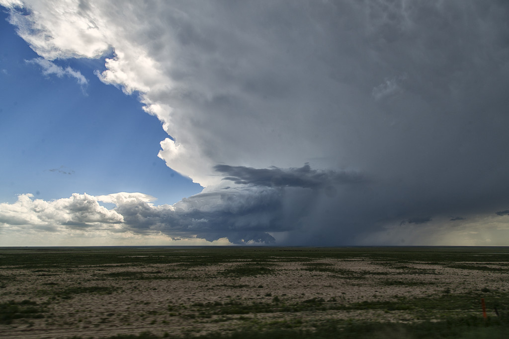
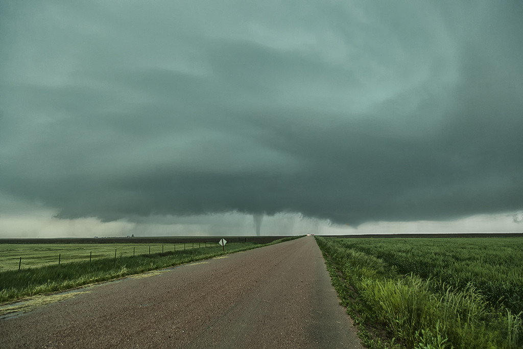
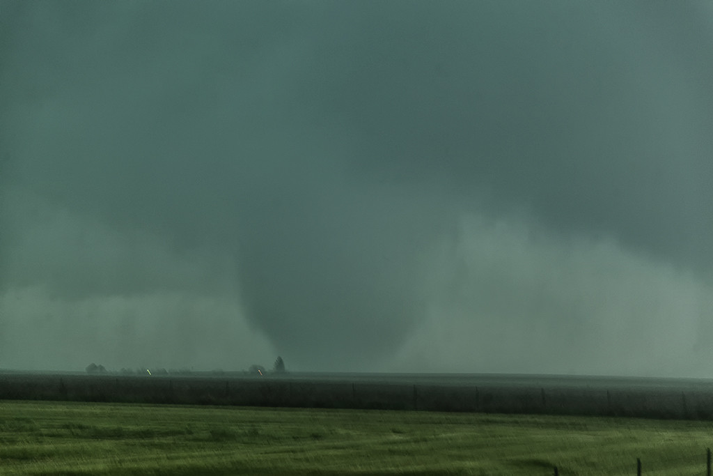
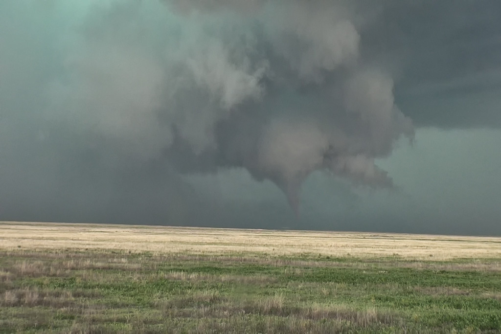
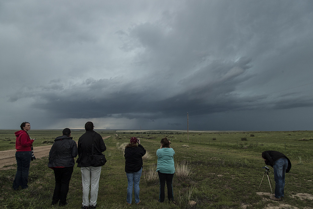
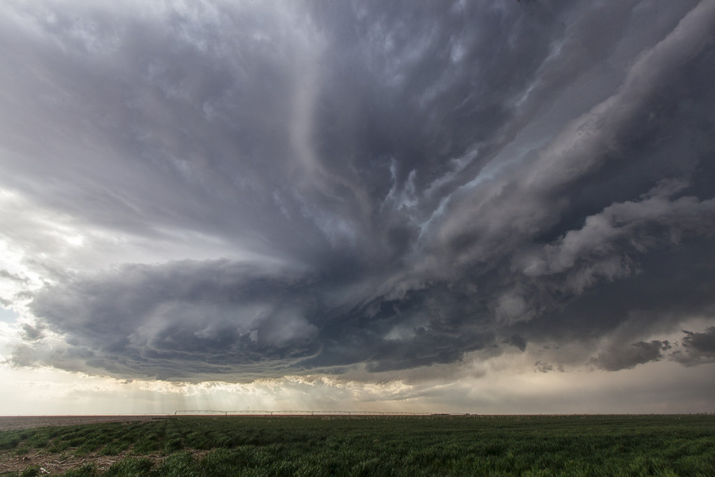
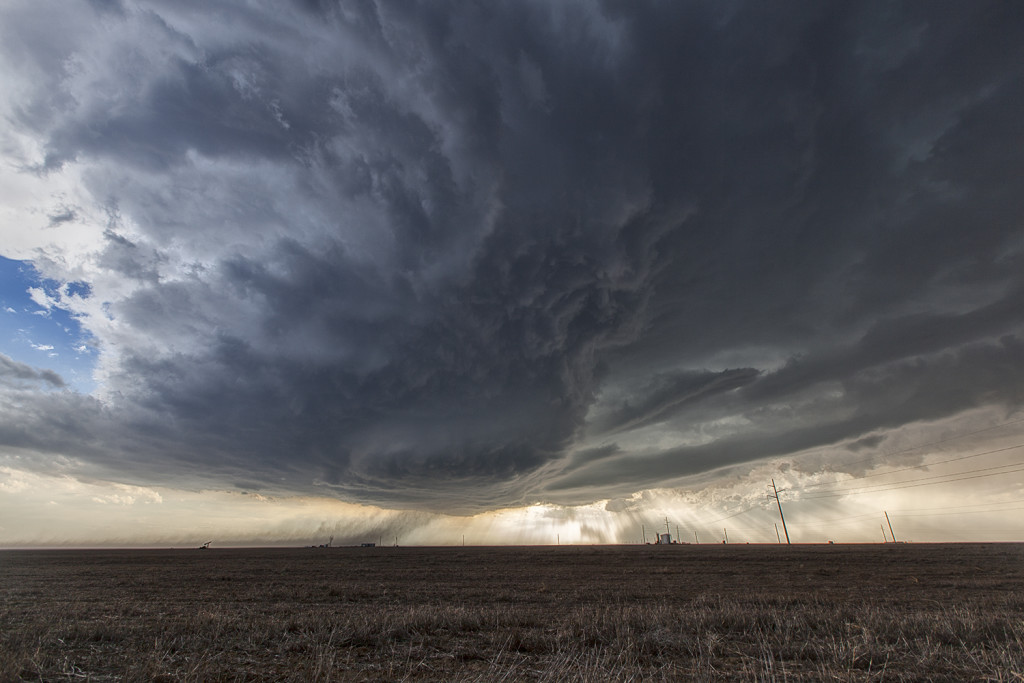
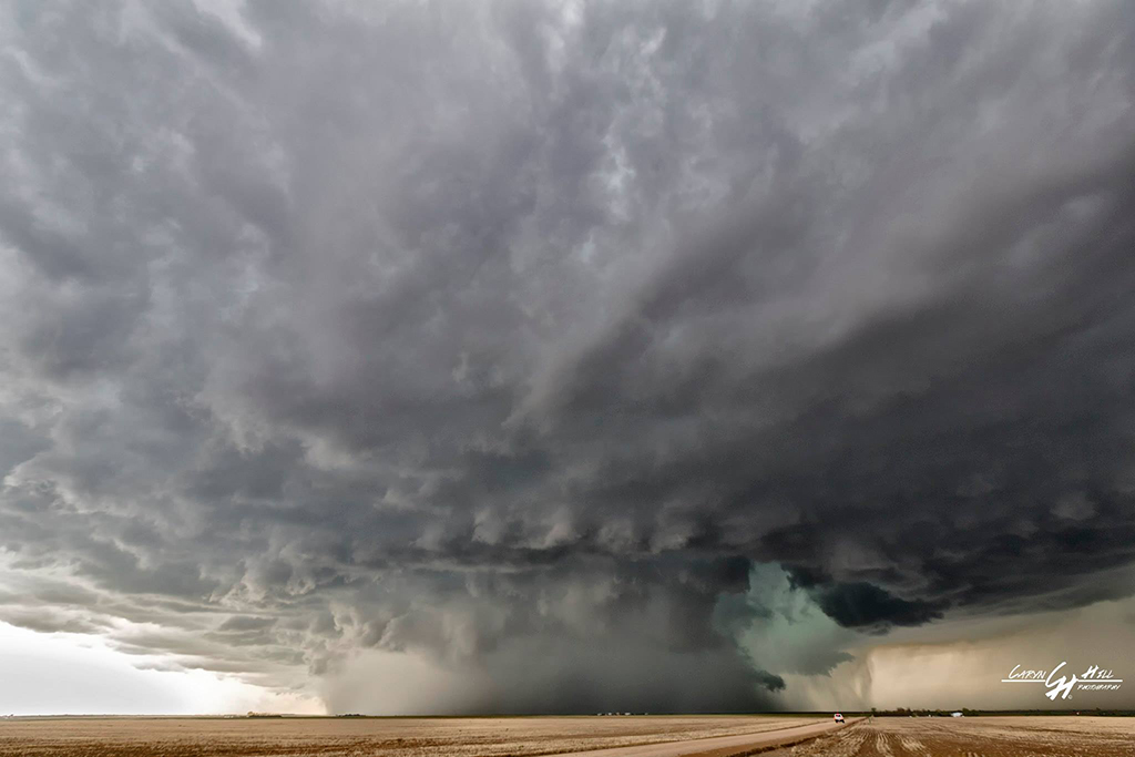
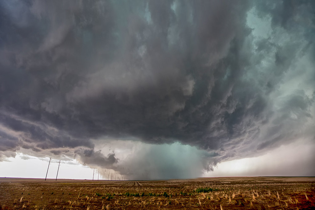
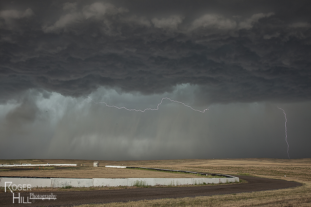
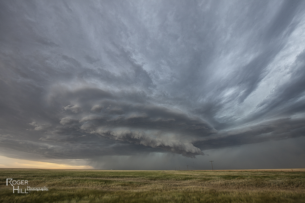
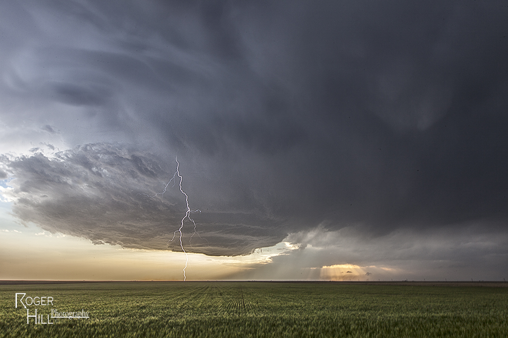
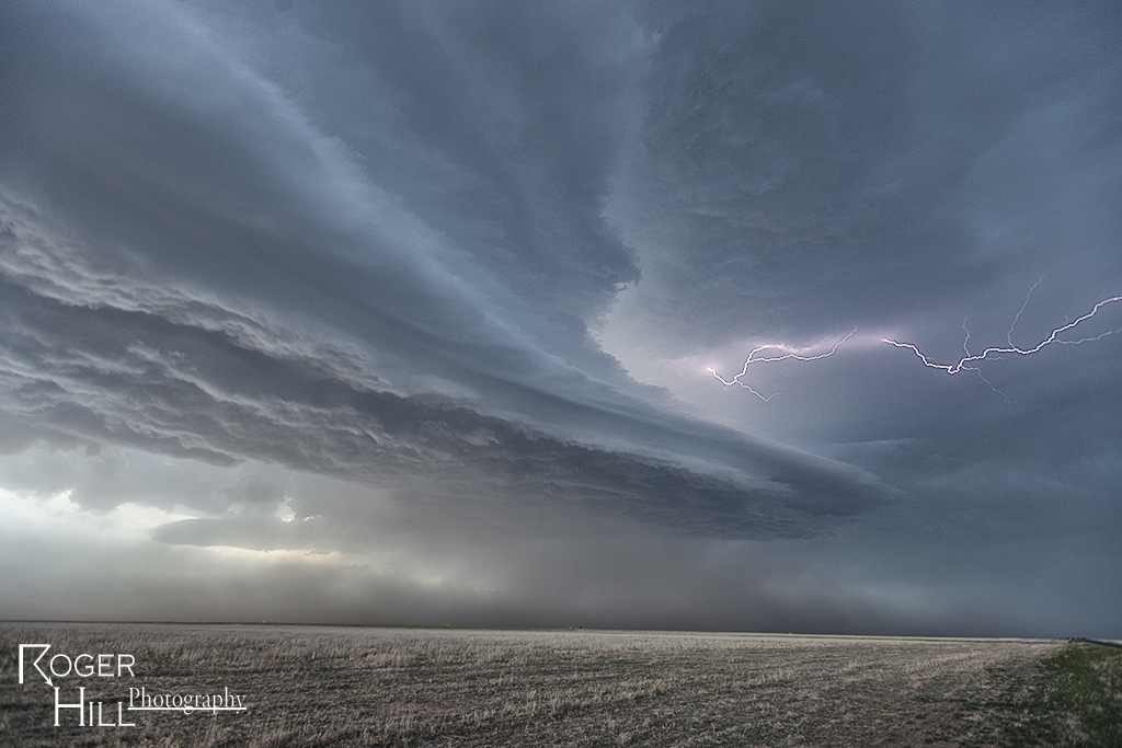
May 24th was a day that had huge potential. Unfortunately there were two pretty clear targets. Play the upslope in eastern Colorado for what would certainly be a pretty tornadic supercell, or play southwest Kansas with high instability along an outflow boundary. Fortunately we had two tours going at that time, Tour #4 and also Photo Tour #1. After considerable discussion Photo Tour #1 headed for Colorado while Tour #4 headed for southwest Kansas. Both tours scored big this day!  Upon arrival in Colorado Photo Tour #1 intercepted an intensifying supercell east of Denver. This storm would become a formidable supercell that would cycle multiple times and produce a half dozen tornadoes.  As this storm approached an area south of Ft Morgan it began it’s tornadic phase as it intercepted better moisture and instability and the storm’s base came down. the Photo Tour, true to its name, found numerous beautiful places to photograph this supercell and it’s tornadoes all the way out towards the Kansas border. It kept producing tornadoes off and on the rest of the day and into the evening. Nothing wilder than night time tornadoes. Finally as it moved into northwestern Kansas, the Photo Tour dropped off it and headed to their night destination.


May 7th Wray, Colorado Tornadoes

On May 7th we had high hopes for something big to happen. It certainly did not disappoint! Numerous storms formed early afternoon along and south of a warm front draped over eastern Colorado. Upslope flow was deep, while shear, instability and moisture were quite good as well. Too many storm interactions early in the afternoon caused messy modes, with several tail end supercell type storms to form and be the ones that produced the most severe weather. A cluster of cells near Ft Morgan early in the afternoon would produce tornadoes along the warm front, but we decided to target more southern tail end storms that were receiving the best feed of air.

Late afternoon, our on call tour led by Caryn Hill would intercept a supercell south of Wray that would produce a pretty elephant trunk shaped tornado. It would die off fairly quickly before the main show would start. A mixture of supercell and nonsupercell tornadoes would form, nearly a half dozen in all. The final tornado is one that has been well publicized, a beautiful whitish tornado as seen in the pics below, with a reddish debris cloud nearly to cloud base!  Remember SLT will get you there!

July 19th Western Kansas Severe Storm

July 19th took us to southeast Colorado and southwestern Kansas. Although the set up wasn’t stellar by any means, there was enough shear, instability and moisture to support severe storms, including supercells. Mid afternoon south of Seibert, CO a supercell formed and tracked southeast. It eventually merged into a line of storms with embedded supercell structures as they marched all the way to Garden City, Kansas. Near the town of Tribune, Kansas on cell in the line spun pretty strongly and produced 80 mph winds, baseball hail and even a funnel cloud. This was a nice way to wrap up the Great North Tornado Hunt tour as the guests got to see a little bit of everything on this tour!


June 11th Southeast Colorado Supercell

June 11th had issues, but still produced some nice storms. Marginal moisture, but decent shear overlaid eastern Colorado. By mid afternoon storms formed along a boundary that stretched across east central and southeast Colorado.  One particular supercell tracked along the boundary from north of LaJunta to far southeast Colorado. It struggled to stay on the moist side of the boundary occasionally, but managed to be quite a prolific hail producer. Never a real threat to produce a tornado, it did however manage to produce several short lived funnels. By early evening a cluster of storms formed south of Lamar. A tail end storm became a powerful supercell and was tornado warned for a couple hours. Visually it was stunning with constant rotation under the updraft. Two tornado reports came in, however they were not validated.  As the supercell tracked into southwest Kansas, it became an outflow dominant storm and produced significant winds.

June 5th Eastern Colorado Tornadoes

June 5th kept us close to home. A warm front draped over east central Colorado would become the focus for intense supercell storm development by late afternoon. It provided a differential heating boundary where storms erupted on the south side of it and interacted with the strong low level shear on the boundary. We sat between Anton and Cope and watched as a strongly tornadic supercell anchored at that point and produced multiple tornadoes. All in all we counted 4 confirmed tornadoes. The storm was a tad messy, and thus photos from the day clearly show the rain/hail as we took each shot. A couple of the tornadoes appeared to be strong, but fortunately only destroyed a barn in the wide open eastern Colorado plains. Tour 5 and Photo Tour #2 enjoyed the event as both were in great position to watch the entire tornadic cycle of the supercell.

May 23rd Southeast Colorado Supercell and Tornado

High CAPE, good shear and lift along a boundary would provide the focus for severe storm development on May 23rd. We arrived south of Lamar early afternoon as storms formed quickly, and became severe. An anchored supercell southwest of Lamar did everything it could to be the storm of the day (which is was). Constant new cell development on its flank resulted in the storm mode being messy. By mid afternoon, though, it managed to pull off the anchored spot and move northeast. The storm had incredible structure, HUGE hail and finally produced a weak tornado. Structure was the main thing this day and it certainly did not disappoint!

April 11th Southwest Kansas Tornado Warned Supercell

We got to chase close to home on April 11th, with storms developing in southeast Colorado off the Raton Mesa. As they moved east into southwest Kansas, deeper moisture and increasing instability resulted in an intense supercell forming which produced baseball sized hail and had incredible inflow winds. It came close to producing a tornado as well before diminishing after dark.


May 21, 2014 – Denver, Colorado Tornadic Supercell

The second of two super days in eastern Colorado! May 21st had much better moisture and shear than the day before did, while the Storm Prediction Center issued a tornado watch and warned of potential strong tornadoes in the area. We started the day home, a rarity for us, and didn’t have to go far. By early afternoon a cluster of storms formed over Denver, with the easternmost storm intercepting the best parcel of air and becoming a significant supercell. Just to the east of DIA, we sat looking down the notch of this beast as it spun wildly. It produced a couple funnels and what we are sure was a partially rain wrapped tornado that was only visible from the northeast looking southwest. Several other chasers saw what we did and there was a period of a few minutes where multiple vortices were spinning on the ground! We stayed with the storm as it cycled and moved eastward into more stable air. It slowly weakened at that point, never being what it was initially. A fun chase day, close to home and the tour was able to stay in the same HAIL BEATEN hotel that night. Piles of hail a couple feet deep were all around!


June 23rd Northeast Colorado Tornado Warned Supercell

June 23rd featured decent shear, but again, low dewpoints. High based storms developed east of Denver and intensified, becoming severe, as they moved east into better moisture. One storm exhibited supercellular features and even became tornado warned, producing a decent funnel. structure was reasonably pretty and with the fresh wheat fields, was a nice treat.

June 4th Southeast Colorado Supercell

I wasn’t expecting much this day due to poor moisture and not ideal shear. However, the upslope flow into the higher terrain of southeast Colorado and the western Oklahoma panhandle proved again to be sufficient for storm generation. One very pretty lpish supercell formed north of Boise City, OK/south of Campo, CO and gave us a very nice show. Pretty hard chasing with the passing of our good friend Tim Samaras, his son Paul and Carl Young. Very cool in the 3rd photo where the setting sun cast THREE light beams over us. Some is watching from above.