Tag Archives | 2007

July 3rd, 2007 Kit Carson County, Colorado Tornadofest

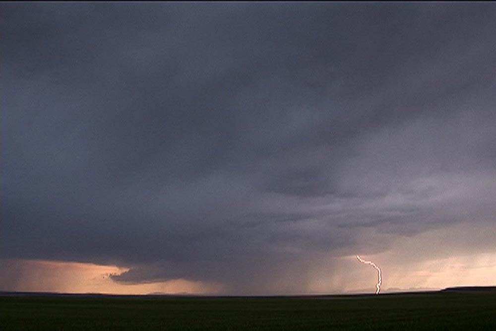
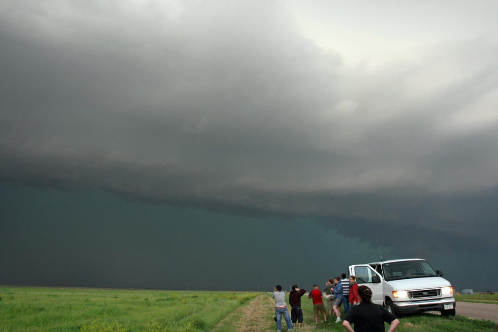
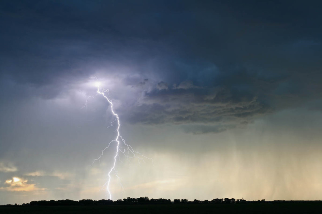
Started the day contemplating a chase, but didn’t know for sure if I would. By late morning, strong and rock hard towers were developing south of my house . Just finishing our tours, I was tired, and was headed into town to take care of some mailings. But, seeing the convection south of me, I couldn’t resist. I blasted down I-70 headed for Limon around noon. Shortly after I got on 70, NWS PUB issued a tornado warning for the area southwest of Limon, CO in northeast El Paso county. Radar was pretty clear to see the boundary with various areas of interest along it. However before I even arrived in Limon, the developing cells dissipated.

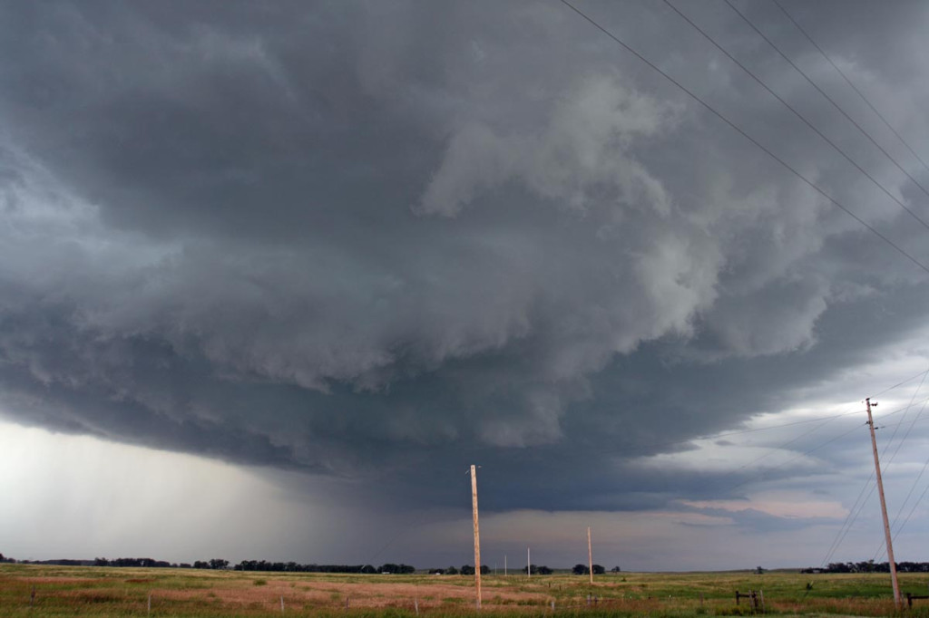
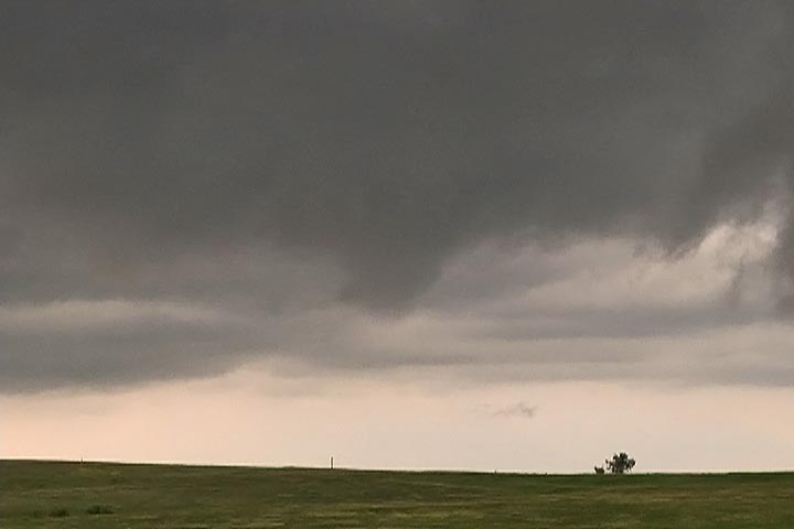
I decided to go to the Post Office and mail my packages while I was there, and when I came out around 1:30 PM MDT I noticed a rather large area of towering cumulus off to my northeast, northwest of Flagler. More rapidly growing cumulus were developing along the boundary, which was as clear as day. What bothered me was my 91/44 ob at Limon, but noticed much better moisture farther northeast. So, off I went! I headed east bound of I-70 and watched as the towers developed into two young thunderstorms.

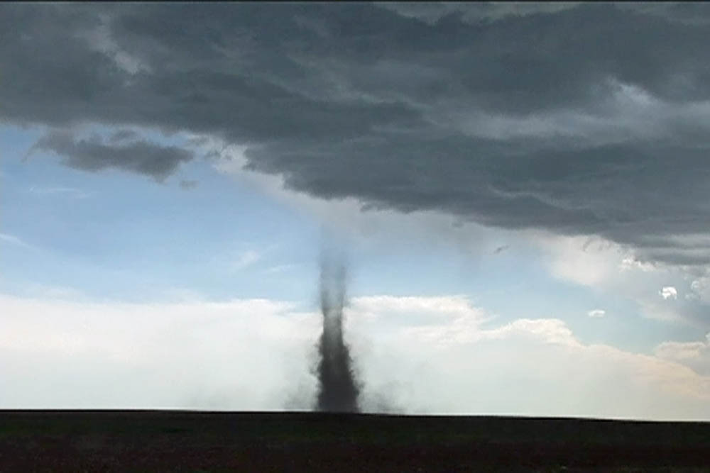
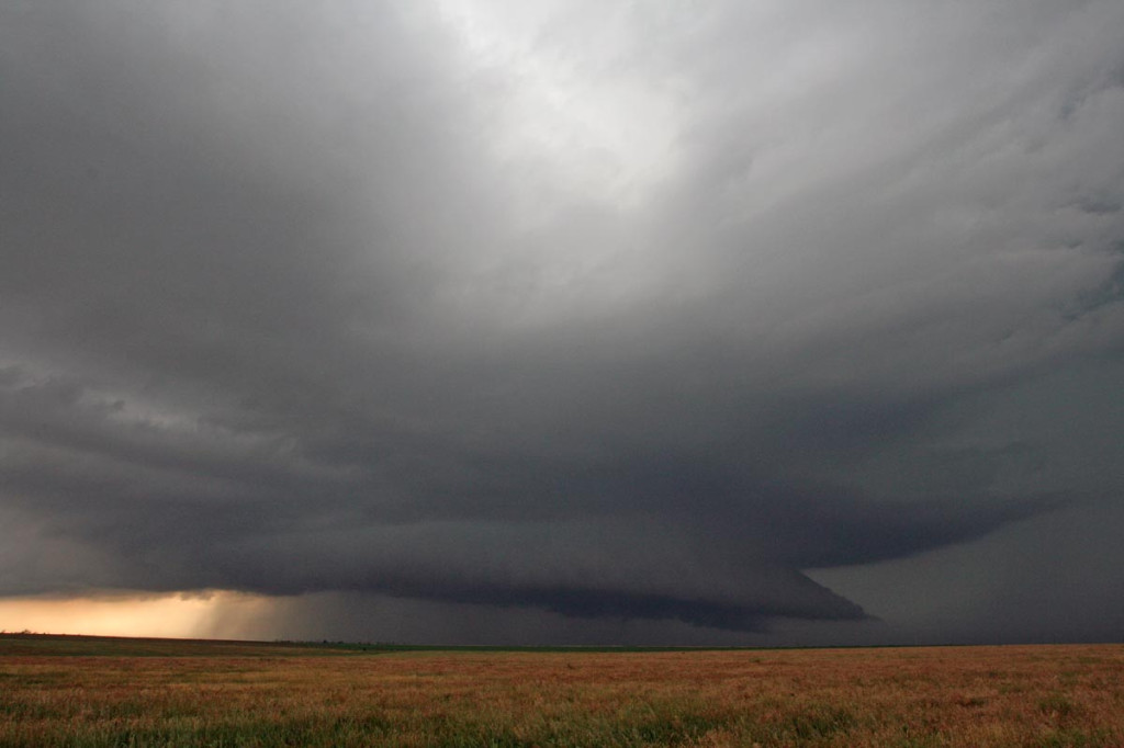
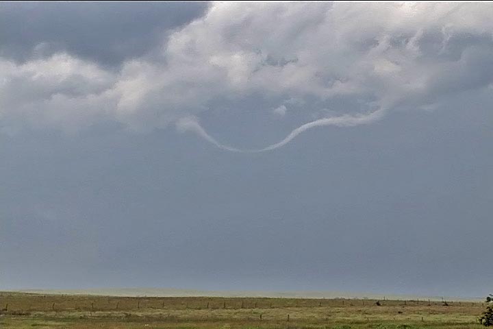
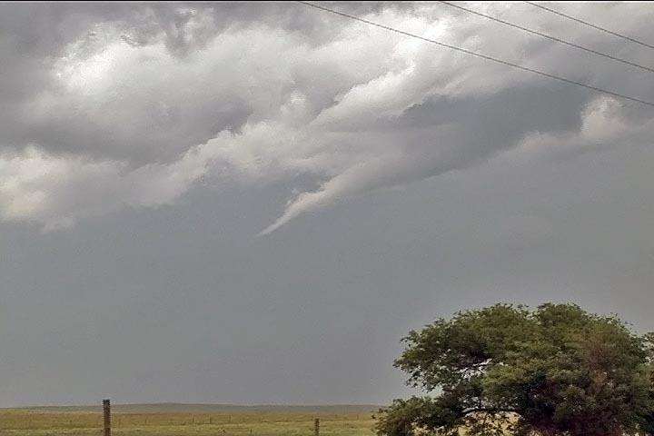
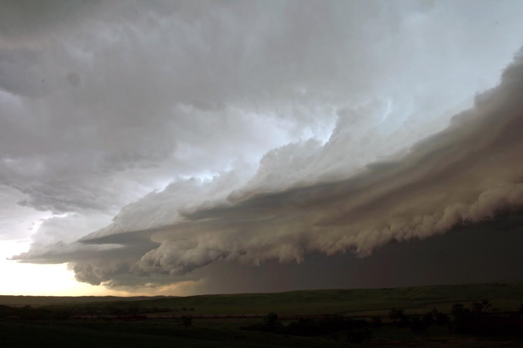
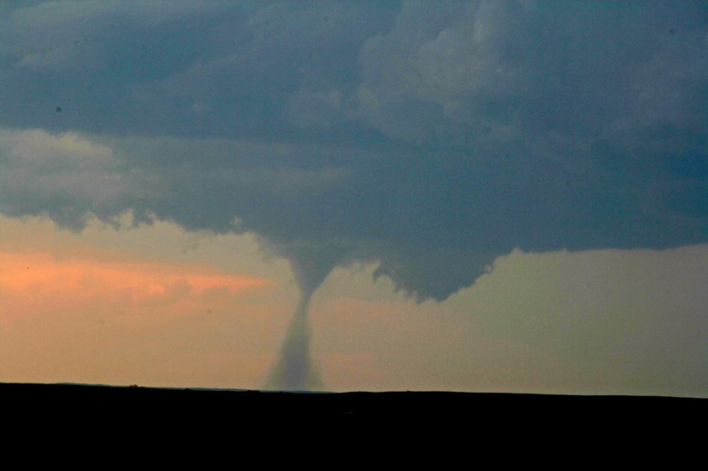
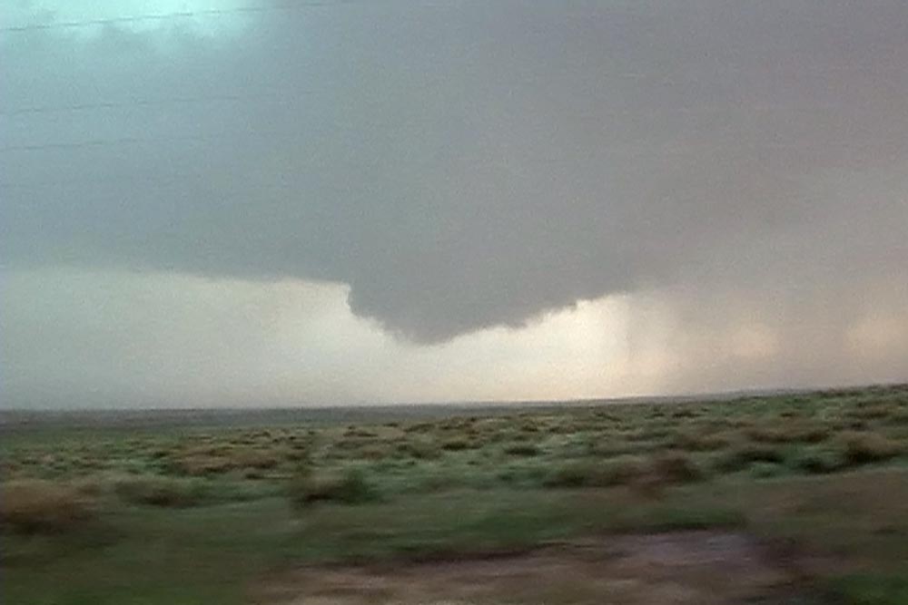
About 10 miles west of Flager, and about 5 miles north of I-70, a small tornado developed. This tornado quickly became visible to cloud base with a fairly transparent tube of dirt. It lasted only 4 minutes from 3:14 -3:18 PM MDT. The young thunderstorm farthest west developed a flared base, cork screwed updraft and even a clear slot, so I pushed east to get on it. At 3:21 PM, another debris cloud formed and by 3: 26 PM was completely to could base where a small funnel appeared. By 3:29 PM, the tornado had a rather large pear shaped debris cloud and was simply gorgeous to watch. At 3:31, the next tornado formed just west of it under a new tower. It persisted for 4 minutes before dissipating. Meanwhile the original tornado was continuing to strengthen. At 3:34 PM, a long slender grey funnel appeared just east of the clear slot and at 3:36 PM it touched down. At 3:38 PM two tornadoes criss crossed each other and made for a wild photo op!!! At 3:41 pm the one tornado lifted, while the supercell tornado continued. At 3:45 another tornado formed west of the supercell tornado, and another tornado formed southeast. Quite a wild shot with 3 on the ground at the same time! The farthest west tornado diminished and lifted at 3:49, while the supercell tornado persisted until 3:51. The farther east tornado lifted at 3:53.

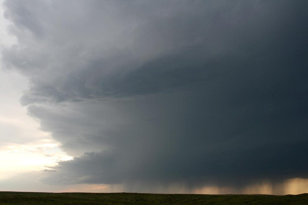
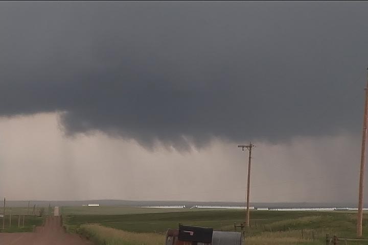
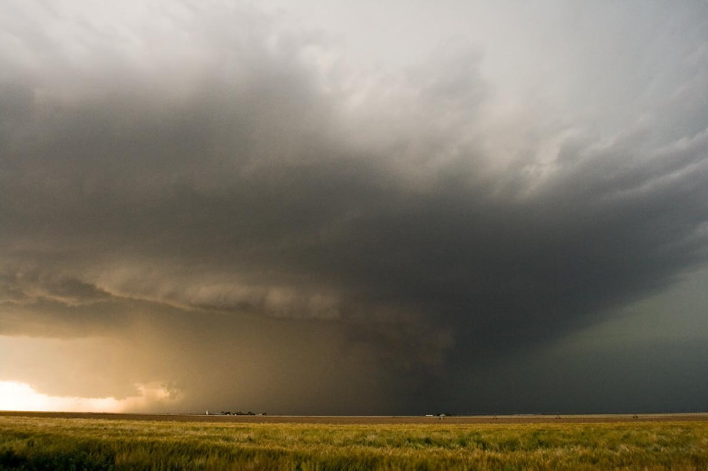
Now is when the real fun begins! At 3:57 PM, I was near the junction of Kit Carson County Roads AA and 13, northwest of Siebert. A debris swirl formed about 100 yards to my north. Thinking it wasn’t much of anything, I pulled over and got out of my van to watch. As I turned around, a coal black debris swirl formed about 300 yards to my south! I grabbed my cameras and them up. By 4:03 PM, the southern tornado became VERY strong with debris to cloud base and was the most photogenic nonsupercell tornado I have ever photographed! At 4:07 I turned around to grab another lens and saw a HUGE tornado just to my north. I couldn’t believe my eyes! This was only about 200 yards away. It had a 300 yard debris cloud with a fat grey funnel directly overhead and extended from a very pronounced clear slot on the east side of a beautiful circular updraft! The wind speeds at the surface were QUITE strong around it as you could see multiple vortices rotating in it and inflow jets streaming into it. Gorgeous site! Meanwhile at 4:13 PM the tornado to my south diminished and lifted. I decided to head north on CR 13 and see how close I could get safely to the large tornado. I came within literally 50 yards of the debris cloud and stopped, filming every precious moment. The noise was horrendous!!!!!!! I saw pieces of tin flying around the base, along with fence posts and barbed wire. Soon, a telephone pole snapped off. I could see what looked like a couple dead animals in the field it had just crossed. This tornado moved northeast, then north and finally northwest, just missing the county sheriff’s farmhouse, while his horses totally panicked trying to escape. At 4:22 PM, it dissipated, while yet another tornado formed to its west under a new tower. This fairly thin and snaking tornado lasted from 4:29 – 4:34 before giving in to developing cores.

As I headed south on 59 to Seibert hail to quarter size starting falling on me.

What a crazy day!

June 28th/29th, 2007 Montana and Alberta Supercells

June 28 and 29 took us to the far northlands of Montana and southern Alberta. June 28th’s storms developed near Glacier National Park and moved north near Conrad, MT. These storms were quite electrified and produced nickel sized hail.

On June 29th, we decided to head across the border to Canada and play supercells developing off the higher terrain west of Milk River and move northeast. We intercepted the prettiest supercell I have ever witnessed in Canada! It pummeled the border crossing with golfball to tennis ball sized hail and damaged many vehicles.

June 27th, 2007 Wyoming Beauty

June 27th did not hold great promise for severe weather. However, the threat for strong storms was enough to get us north from Denver to north central Wyoming, south of Buffalo. Several storms developed, a couple marginally severe, and gave us a pretty scenic view interacting with the mountains and plains.

June 21st, 2007 South Dakota and Nebraska Supercells

It is a rare occasion that you get woken up at 6 AM with a TORNADO WARNED supercell out your window! June 21st was one of those days! A cluster of supercells developed overnight and moved southeast across south central South Dakota. We intercepted one near Kimball, SD that produced 4.25 diameter hail! Later that day, an old boundary would provide the lift and convergence to develop the best storm of the day, that also produced hail to 3.5″ in diameter!

June 19th, 2007 Kansas HP Supercell

After spending the night in Hays, Kansas, June 19th’s catch was an easy one. We were on the first cell of the day, a beautiful tornado warned classic supercell near Hill City. A second supercell developed to its south and became the show of the day. It right turned and built southward all the way south of Dodge City. However the original supercell produced a tornado that we did not see, since we had blasted south in front of the new supercell. I do not regret missing this tornado. You almost had to be in the wrong place to see it! This was one of the largest HP storms of the year.

June 13th, 2007 Ashland, Kansas Tornadic Supercell

June 13th ended up being a better chase day than I thought it would be. We started in Valentine, Nebraska after our South Dakota chase the day before and had to blast south quickly to get into position for this day. A boundary, decent shear, decent moisture and instability would set the stage for what we thought would be landspouts this day. Instead, we got a northwest moving supercell that produced baseball sized hail and a brief tornado near Ashland, Kansas.

June 12th, 2007 South Dakota Supercells

June 12th was the worst of nightmares weatherwise. Great shear was all the was present this day, as too many overnight thunderstorms would not allow much instability to form. Storms formed along a boundary, with no cap, and became outflow dominated quickly. Too many storms would form from Nebraska, northward through North Dakota. Despite several tornado watch boxes, no decent tornadoes developed this day. The images here were taken within 50 miles of Murdo, SD.

June 6th, 2007 South Dakota Badlands Tornadic Supercell

June 6th had all the ingredients for significant severe storms, including tornadoes. Good shear, a strong wave, good instability and respectable moisture would set the stage for supercell storms. SPC issued a MODERATE RISK and associated tornado watch box for western South Dakota. By 1 PM we had arrived in Wall and stopped for lunch. A couple of small towers were going up south of us. After 45 minutes of our lunch break, a supercell rapidly developed south of town. As we gathered the clients and headed out, it didn’t take long for a tornado to form. This tornado, although not terribly strong, stayed on the ground for 25 minutes. We could never get any closer than 15 miles from it. Later, the storm turned into a monster HP supercell before lining out.

June 1st, 2007 Colorado High Based Severe Storms

June 1st didn’t have tremendous promise as a short wave moved across Colorado where there was extremely limited surface moisture. By late afternoon a few high based storms developed west of Sterling and provided a beautiful lightning show and rainbow.

May 31st, 2007 Oklahoma Panhandle Tornadic Supercell

May 31st wasn’t a day I was really expecting too much. Moderate westerly flow aloft, coupled with fair moisture and decent instability would set the stage for supercells, producing hail, wind and tornado or two. We started in southeast Colorado where storms formed on the north side of the Raton Mesa, then propagated into the Oklahoma panhandle and became nice supercells. One storm in particular, featured here, produced at least 2 low contrast tornadoes and a couple of spinups under the shear line, and hail to baseball size.