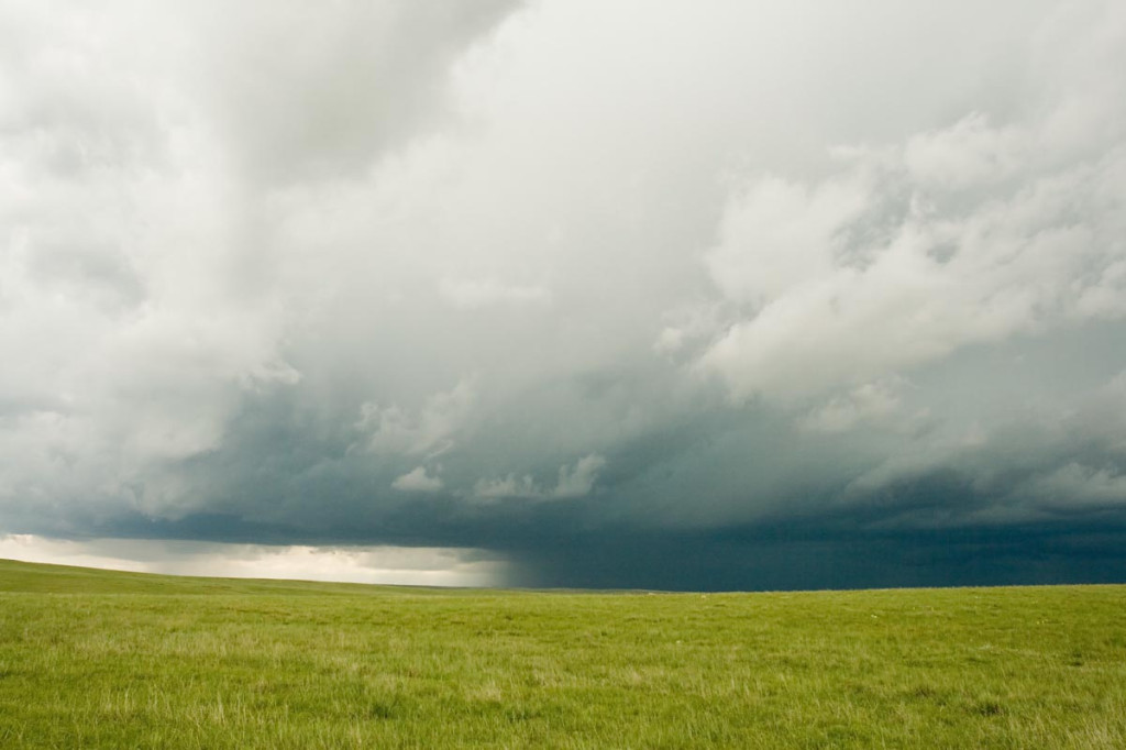
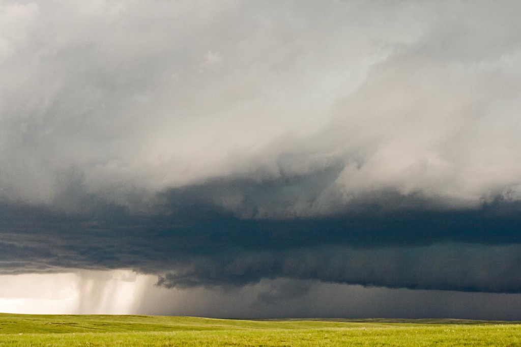
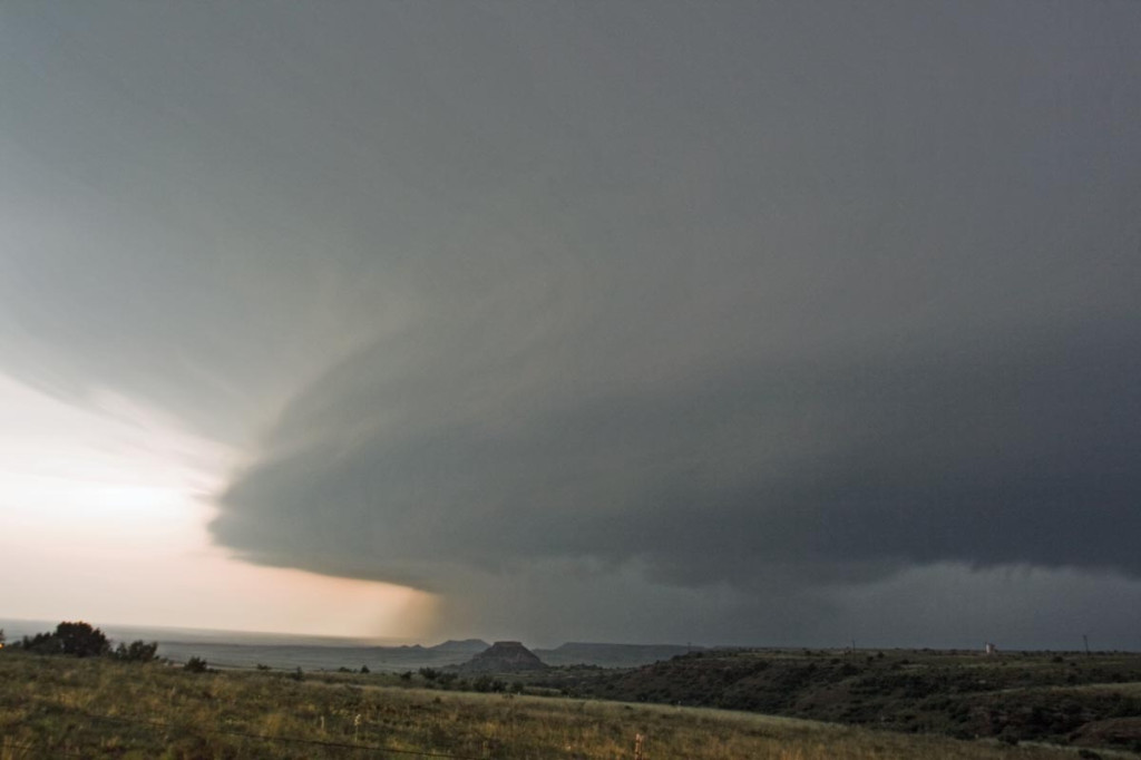
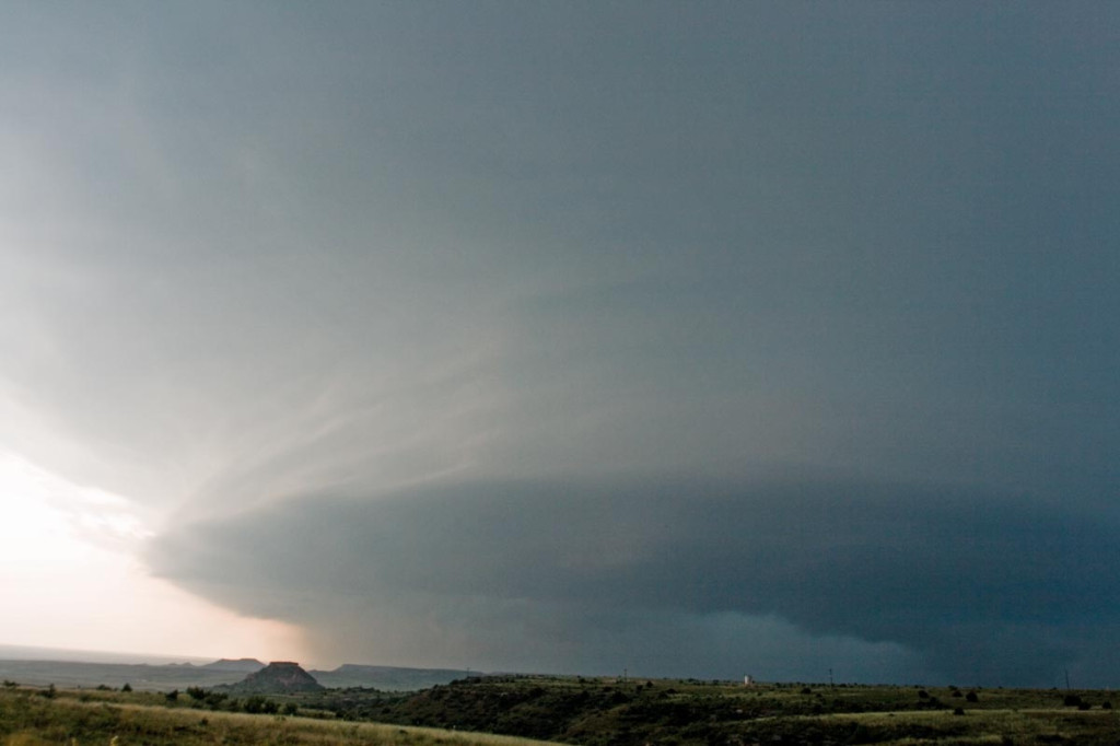
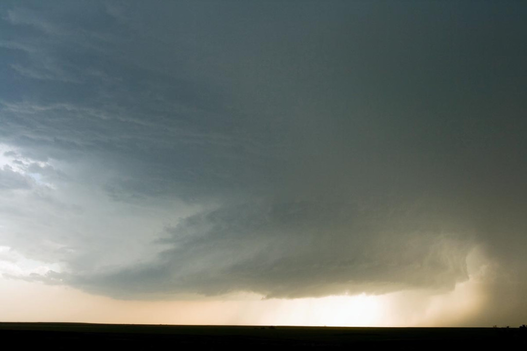
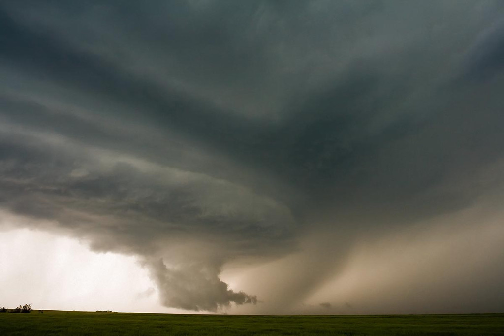
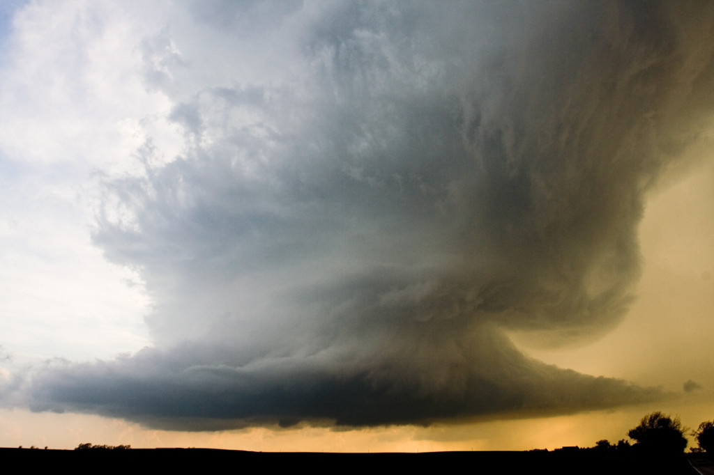
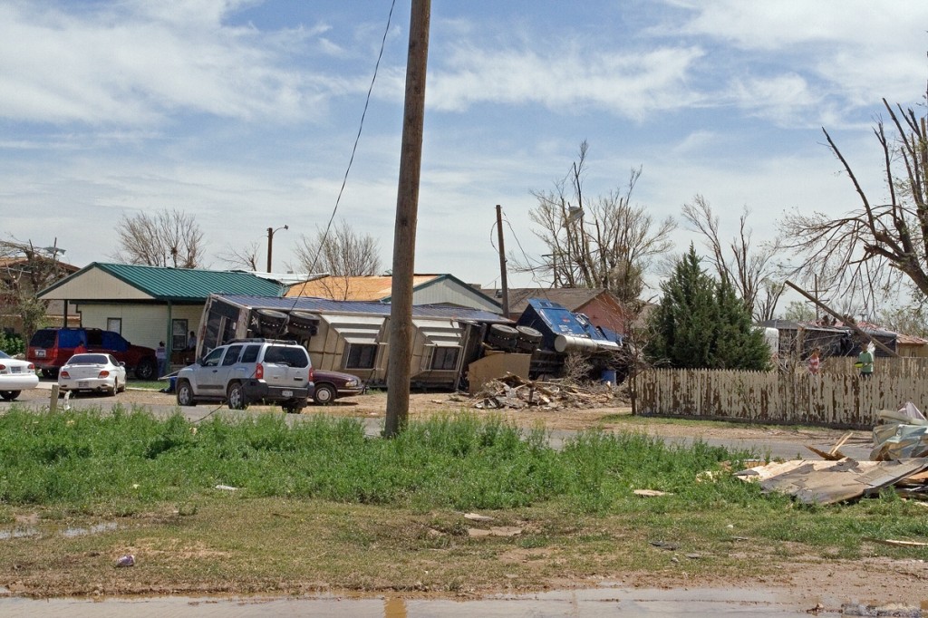
May 30th included a tornado watch for all of eastern Colorado. An old outflow boundary/cold front lay from the Palmer Divide northeastward to the triborder area. Strong low level shear and ample mid level flow, coupled with decent moisture and instability would set the stage for supercell storms in Colorado. As is often the case in the high plains of Colorado, storms become HP rather quickly and produce intense amounts and sizes of hail. This storm would be no different. Despite the continuance of many tornado warnings, this storm never really had the chance to produce due to its extreme outflow dominance. Check out the photos below.
May 23rd, 2007 Texas Panhandle Supercells and Tornado
May 23rd looked like a classic Texas panhandle day, with the exception of fairly weak flow at anvil level, which proved to be fatal for viewable tornadoes. SPC put out a PDS tornado watch box by mid-afternoon and things looked pretty interesting. Rapidly developing supercells formed by 4 PM and became quite a messy situation as too many storms formed. It was virtually impossible to get a glimpse of any tornado for a long period of time as they wrapped with rain quickly.
May 22nd, 2007 Hill City, Kansas Tornadic Supercells
May 22nd brought us to north central Kansas to play along the dryline. By mid afternoon it became apparent that north central Kansas would become the focal point for strong instability, good convergence, good shear and fair moisture. Enough to generate a few supercells, one of which became tornadic. We had great positioning for them all, and at one point in time we had 3 in our view at once. Quite a sight! The photo above, was from the tornadic storm just southwest of Hill City. This storm produced two tornadoes, both of which were fairly brief in nature, less than 5 minutes each.
May 5th, 2007 Kansas Tornadofest
May 5th was a High Risk day from the SPC. Everything seemed to be coming together for a significant tornado outbreak. We decided to target storms in southwest Kansas east of Dodge City. A strong dry punch, intense wind shear and strong instability would set the stage for tornadic supercells. Storms struggled till early evening with the strong shear ripping apart about any storm that tried forming. Finally a supercell developed near Pratt that became tornado warned. It produced a weak tornado and many funnel clouds. About an hour later, several supercells developed and produced numerous tornadoes. We were able to intercept 6 more tornadoes, including a few that were strong.
April 24, 2007 Nickerson, KS Tornadic Supercell
April 24th was a day that held great promise. SPC had a large MODERATE RISK all across the central and southern plains. I decided to play the area along the dryline/warm front intersection in central Kansas. We waited and waited and waited for things to finally get going. Every updraft that went up suffered from entrainment issues and finally the tail end updraft near Nickerson went crazy. This storm developed beautiful structure and produced at least a half dozen weak tornadoes.
April 21, 2007 Texas Panhandle Tornadofest
Not much can be said about April 21st that hasn’t already been said. Decent moisture, great lift, great shear and a strong dryline would spell trouble for the Texas panhandle region. By mid afternoon, many cells tried to form on the dryline and just couldn’t get surface based. Finally about 4 PM storms started to become surface based and it did not take long for them to become tornadic. We intercepted a tornadic storm not far from Dumas and a second one near dark southeast of Dumas.
April 20, 2007 Moorefield, Nebraska Tornadic Supercell
Since April 20th was my birthday and there was a respectable chance for severe storms, Caryn and I headed out on i-76 towards Imperial, Nebraska to play the strong upslope flow with good shear, but marginal moisture. Dewpoints were expected to increase as the evening progressed, but what we ended up with was much more than I had planned on! A couple of LPish type storms developed around 6 PM and then just before dark, a tornadic beast emerged from the tail end of the complex and produced several tornadoes that caused considerable damage between Moorefield and Gothenburg.
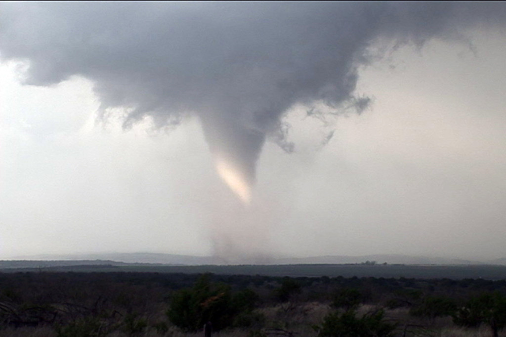
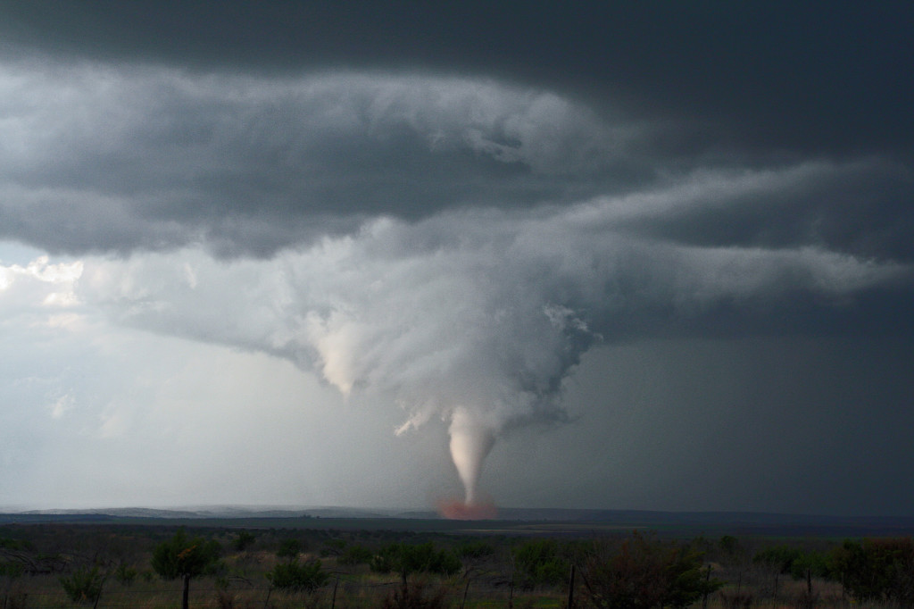
March 28th, 2007 Texas Panhandle Tornado Outbreak
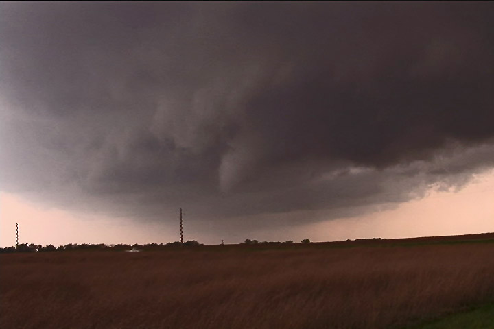
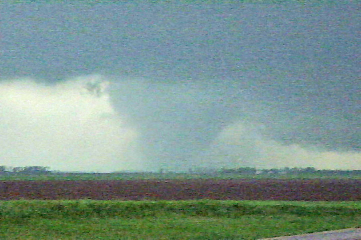
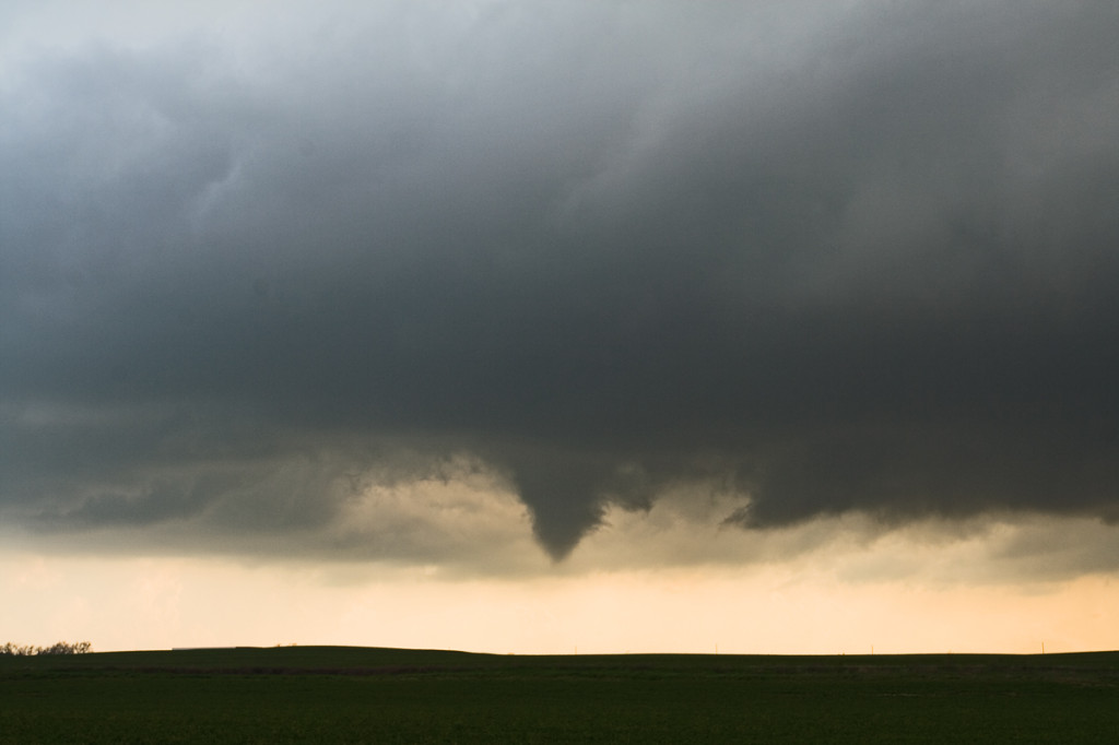
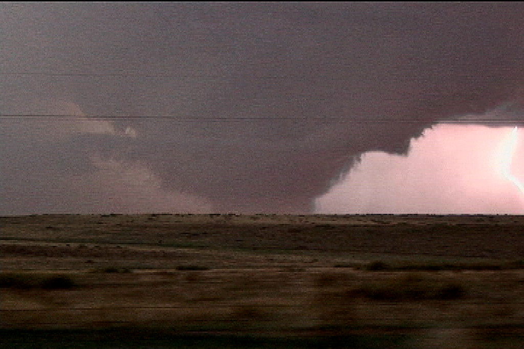
March 28th was a day many storm chasers will never forget. An unusually strong and deep system was crossing the Rocky Mountains with intense lift, deep moisture, incredible shear and good instability headed towards the southern and central high plains. This would set the stage for what would become one of the most prolific tornado days in the high plains ever recorded in March. All in all I caught 8 tornadoes this day with 3 being quite photogenic and quite strong. A total of 65 tornado reports were submitted to SPC. Two different supercells spawned killer tornadoes. I have many still photos and a few video captures of the tornadoes we intercepted below. The first two tornadoes we could not get photos of as they were too far off near Silverton, Texas. We were on a hard intercept course for that supercell and couldn’t get there in time to get good photos. Both tornadoes were slender elephant trunk shaped tornadoes. Then a 3rd tornado formed, a multivortex tornado, northeast of Silverton and that is where my first video capture was taken. After that supercell moved northeast, the developing tail in storm became quite a dominating monster. We caught 3 or possibly 4 tornadoes from that storm. Finally, as that cell moved northeast towards Miami, Texas, we could see a lightning lit very large wedge tornado to our distant north. This final tornado derailed a train and did some minor damage.
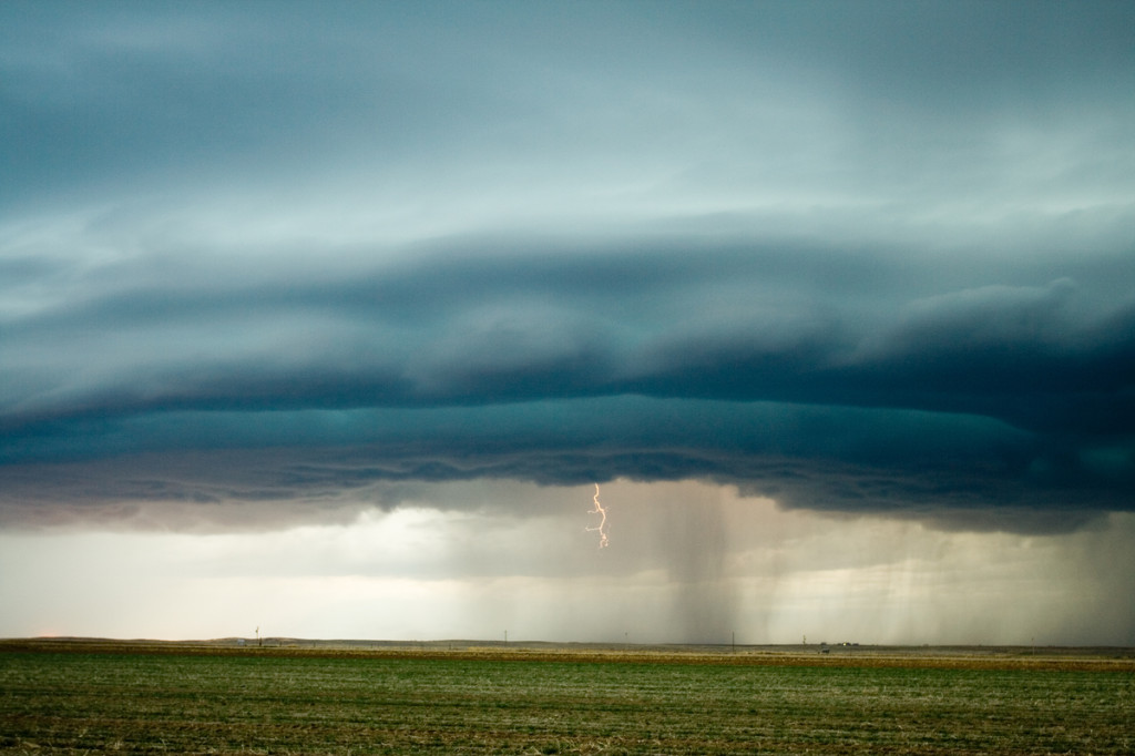
March 23rd/24th, 2007 Eastern Colorado and Southwest Nebraska Storms
A strong closed low was to be the culprit for sever weather across Colorado and Nebraska on March 23rd and 24th. the most intense storms and tornadic supercells developed over eastern New Mexico, while Colorado just didn’t have enough deep moisture to get intense storms to form. Marginal supercell structures formed and were quite photogenic. On the 24th, poor lapse rates and marginal moisture would spell doom for what appeared on paper to be a decent set up. A couple of tornado occurred in northeast Colorado on Saturday, with a possible brief tornado near Hayes Center, Nebraska.
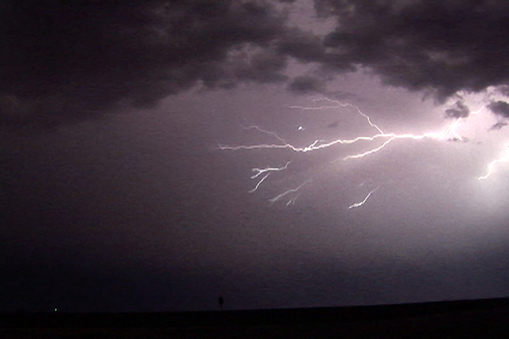
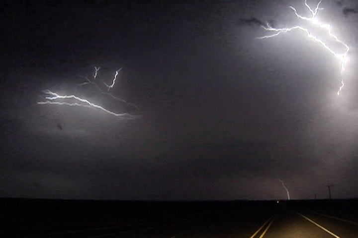
March 10th, 2007 Claude, Texas Hail and Anvil Crawlers
March 10 appeared to be a marginal day for severe weather across the Texas panhandle. With nothing else to do, I decided to head south from Denver to see what would form. Limited moisture was the main problem, but very cold air aloft and decent wind shear would help to produce several high based supercells this day. Many of them produced hail quarter size, with up to ping pong ball sized reported with the storm featured here. Near dark as the cells merged into a southeast moving MCS, the anvil crawler show began.