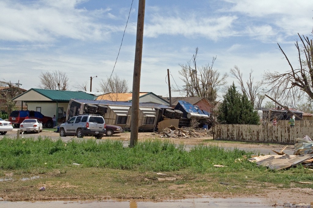
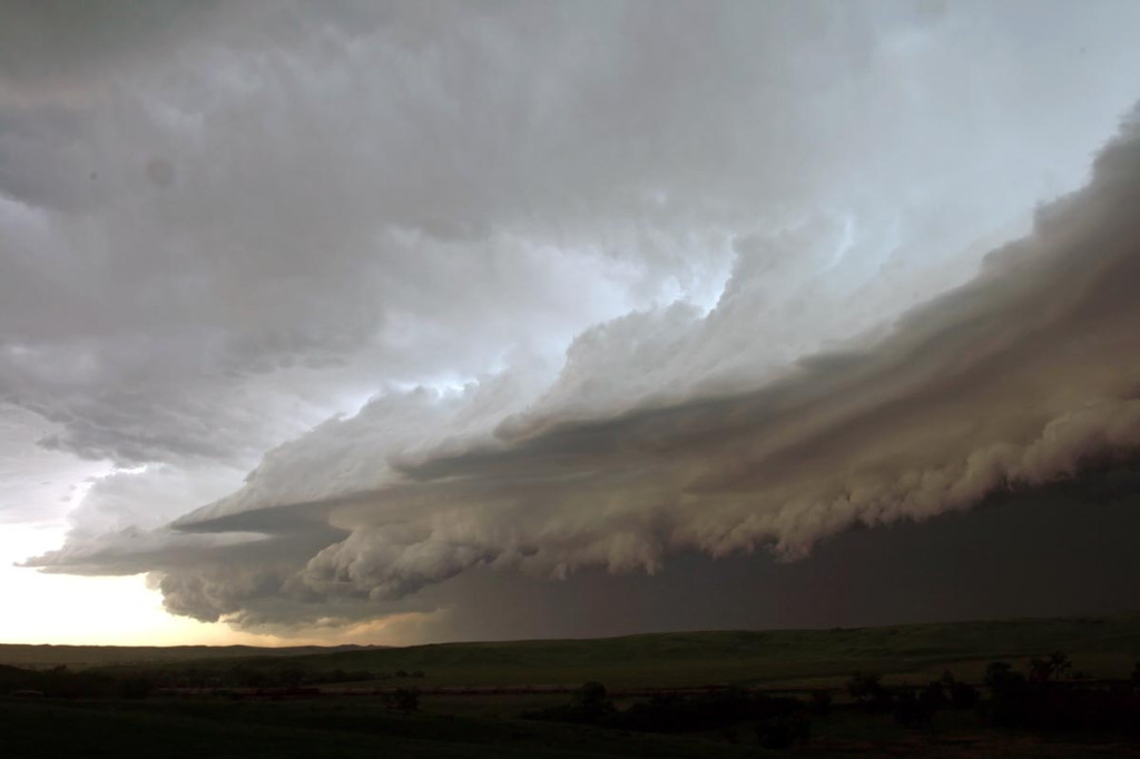
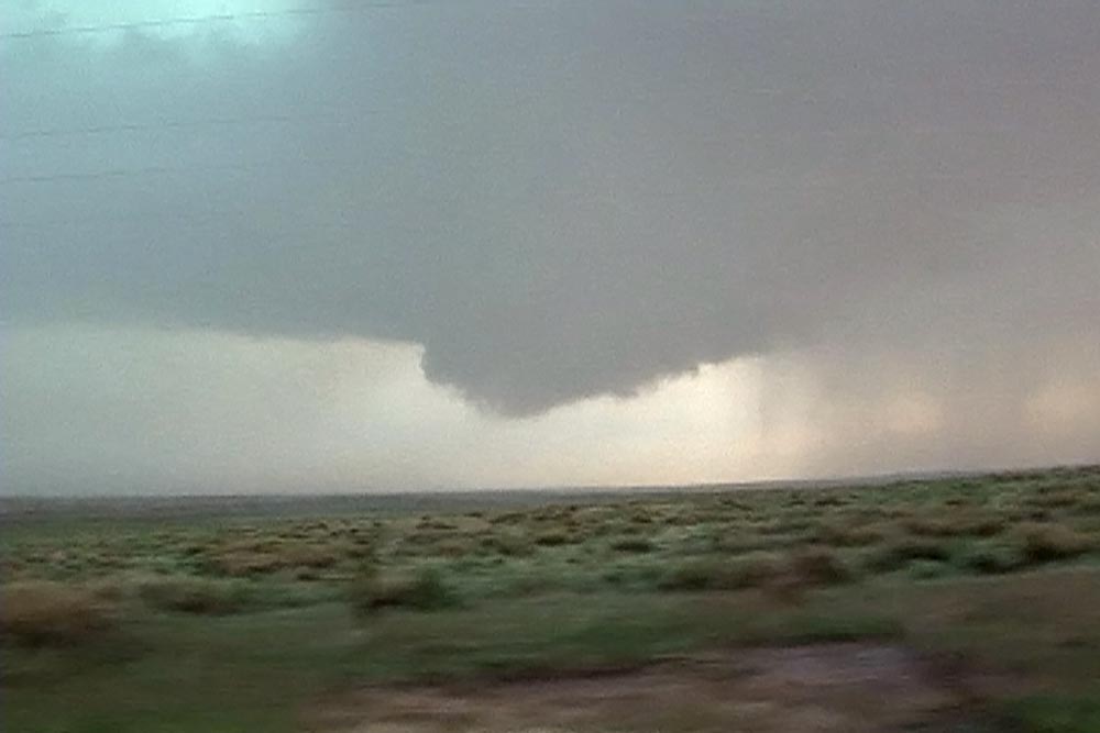
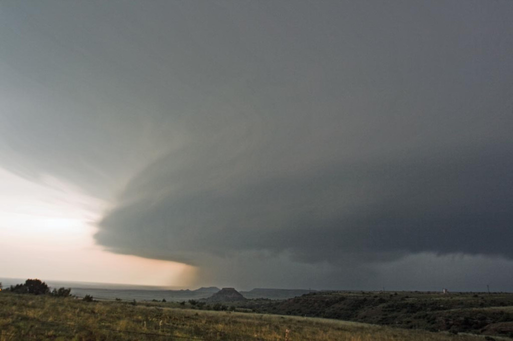
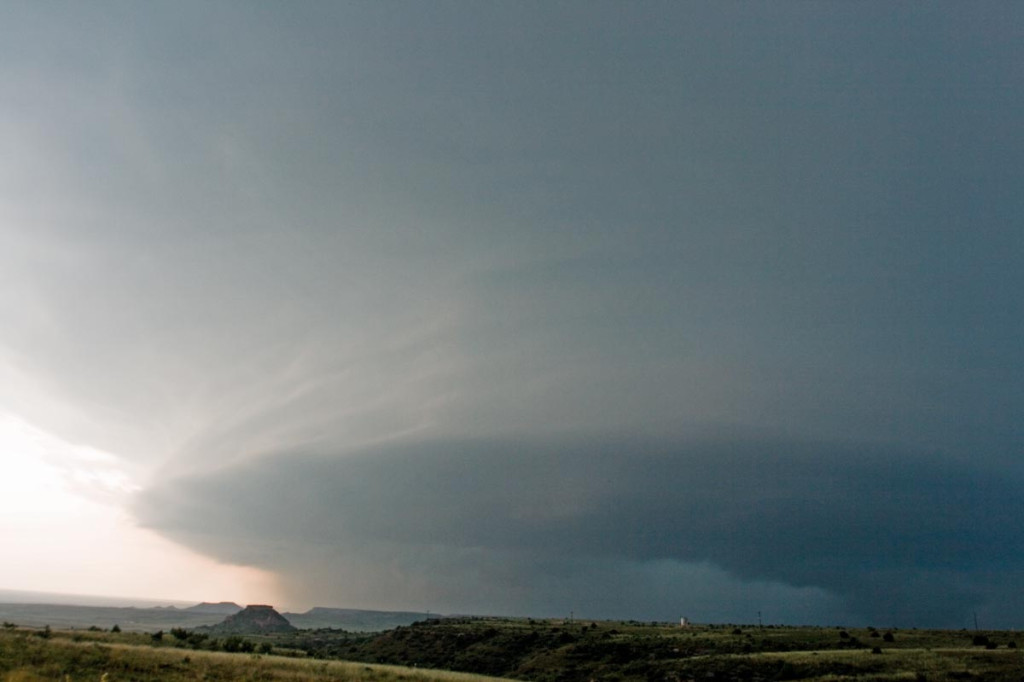
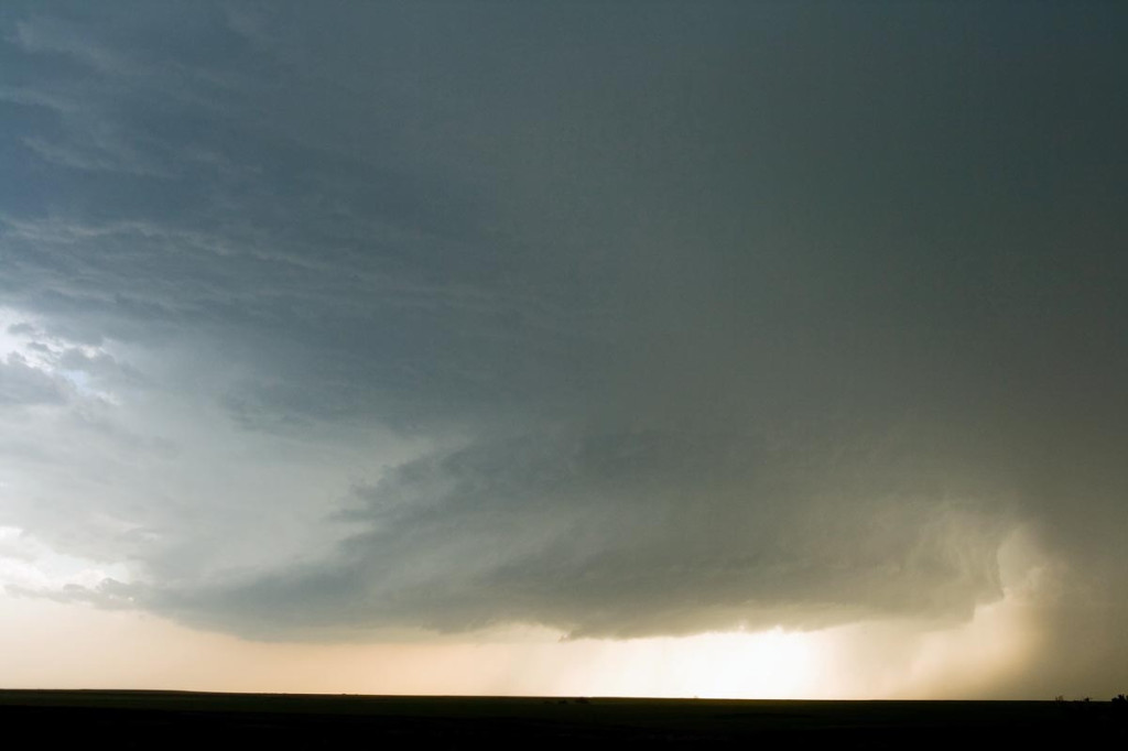
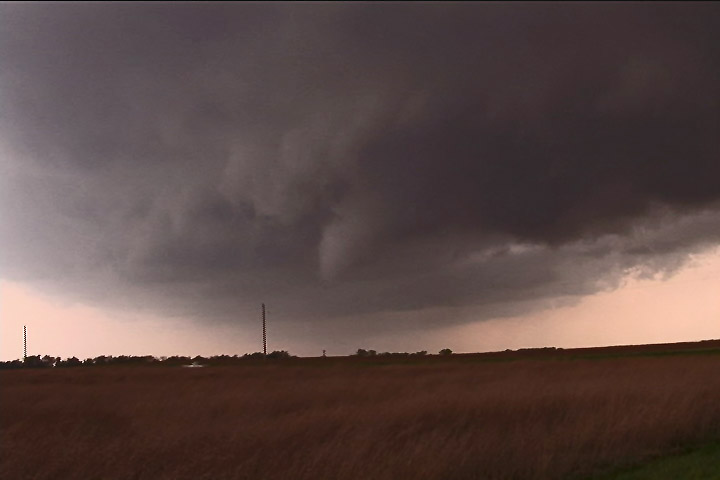
June 12th was the worst of nightmares weatherwise. Great shear was all the was present this day, as too many overnight thunderstorms would not allow much instability to form. Storms formed along a boundary, with no cap, and became outflow dominated quickly. Too many storms would form from Nebraska, northward through North Dakota. Despite several tornado watch boxes, no decent tornadoes developed this day. The images here were taken within 50 miles of Murdo, SD.
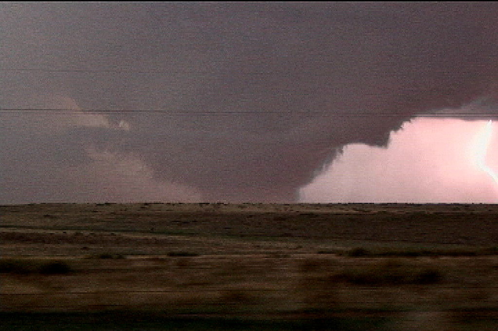
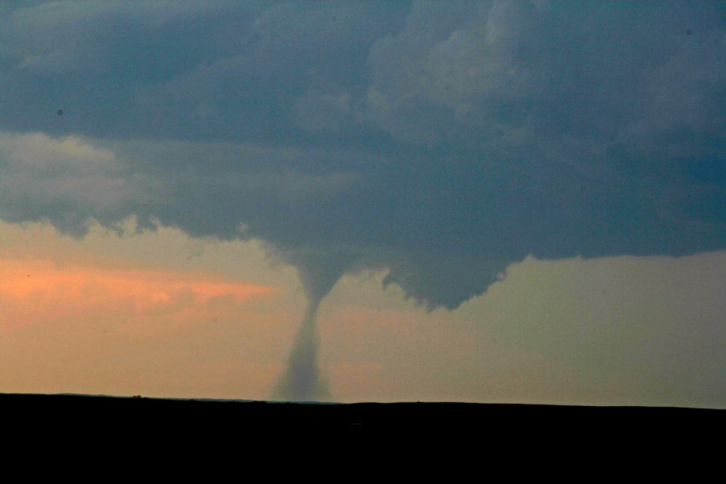
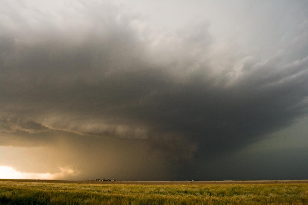
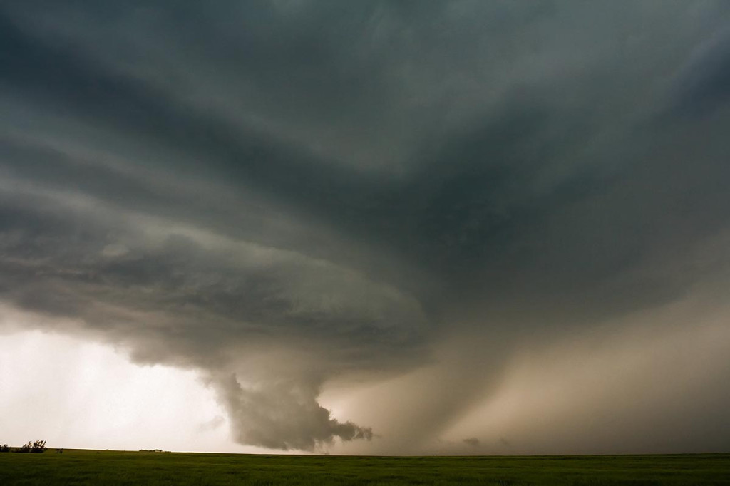
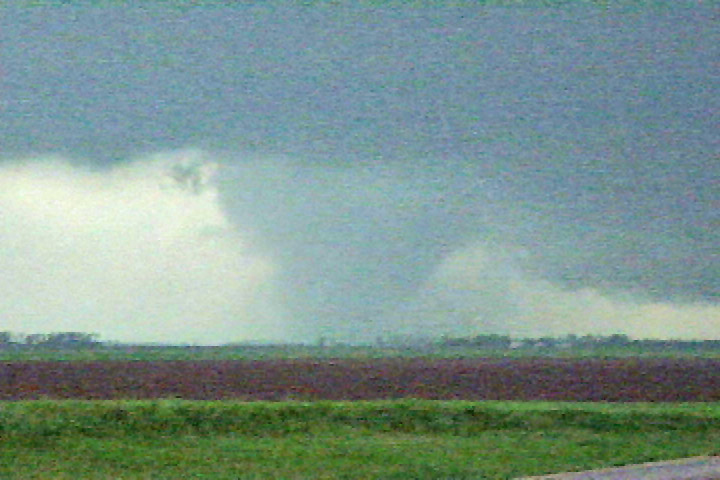
June 6th, 2007 South Dakota Badlands Tornadic Supercell
June 6th had all the ingredients for significant severe storms, including tornadoes. Good shear, a strong wave, good instability and respectable moisture would set the stage for supercell storms. SPC issued a MODERATE RISK and associated tornado watch box for western South Dakota. By 1 PM we had arrived in Wall and stopped for lunch. A couple of small towers were going up south of us. After 45 minutes of our lunch break, a supercell rapidly developed south of town. As we gathered the clients and headed out, it didn’t take long for a tornado to form. This tornado, although not terribly strong, stayed on the ground for 25 minutes. We could never get any closer than 15 miles from it. Later, the storm turned into a monster HP supercell before lining out.
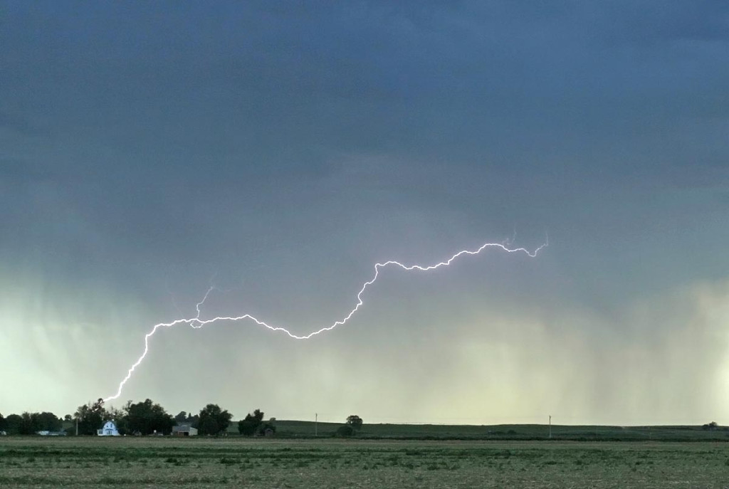
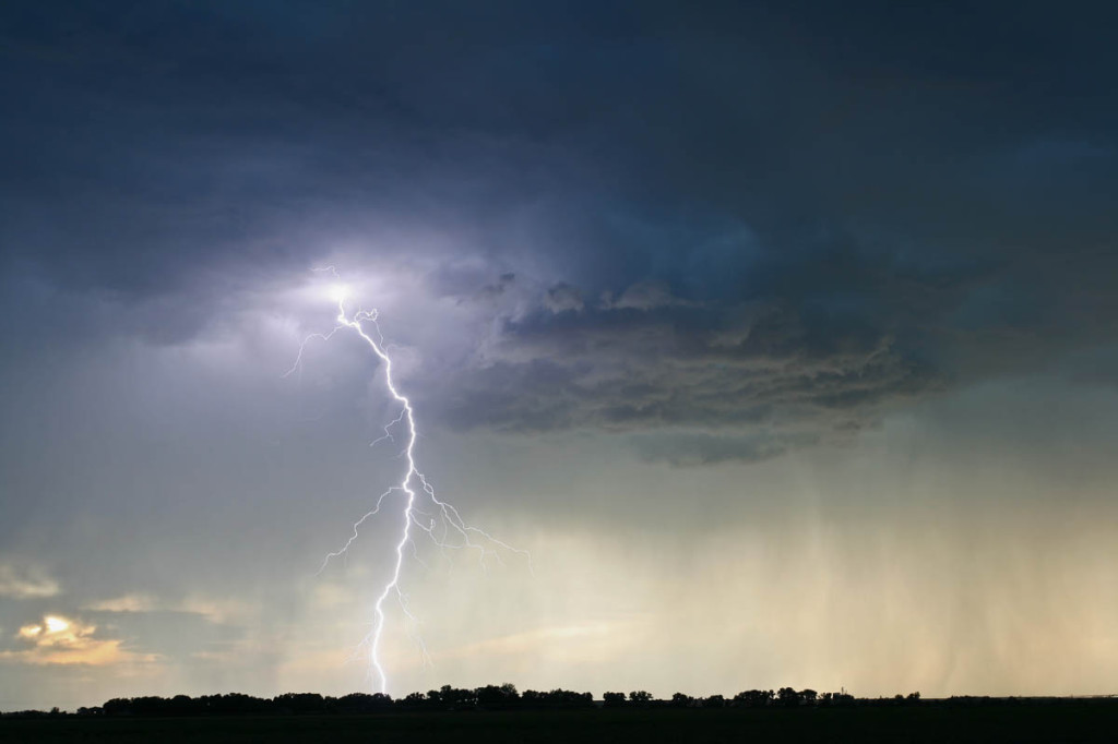
June 1st, 2007 Colorado High Based Severe Storms
June 1st didn’t have tremendous promise as a short wave moved across Colorado where there was extremely limited surface moisture. By late afternoon a few high based storms developed west of Sterling and provided a beautiful lightning show and rainbow.
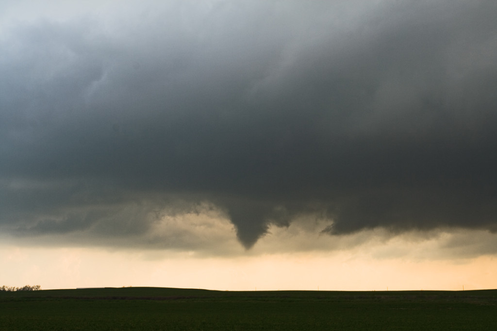
May 31st, 2007 Oklahoma Panhandle Tornadic Supercell
May 31st wasn’t a day I was really expecting too much. Moderate westerly flow aloft, coupled with fair moisture and decent instability would set the stage for supercells, producing hail, wind and tornado or two. We started in southeast Colorado where storms formed on the north side of the Raton Mesa, then propagated into the Oklahoma panhandle and became nice supercells. One storm in particular, featured here, produced at least 2 low contrast tornadoes and a couple of spinups under the shear line, and hail to baseball size.
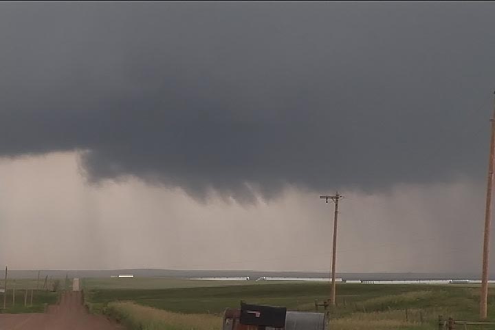
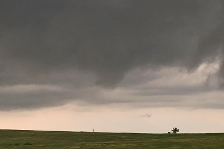
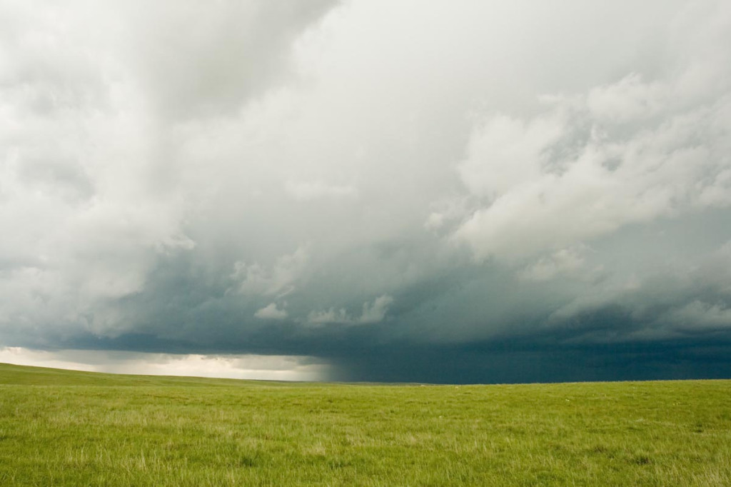
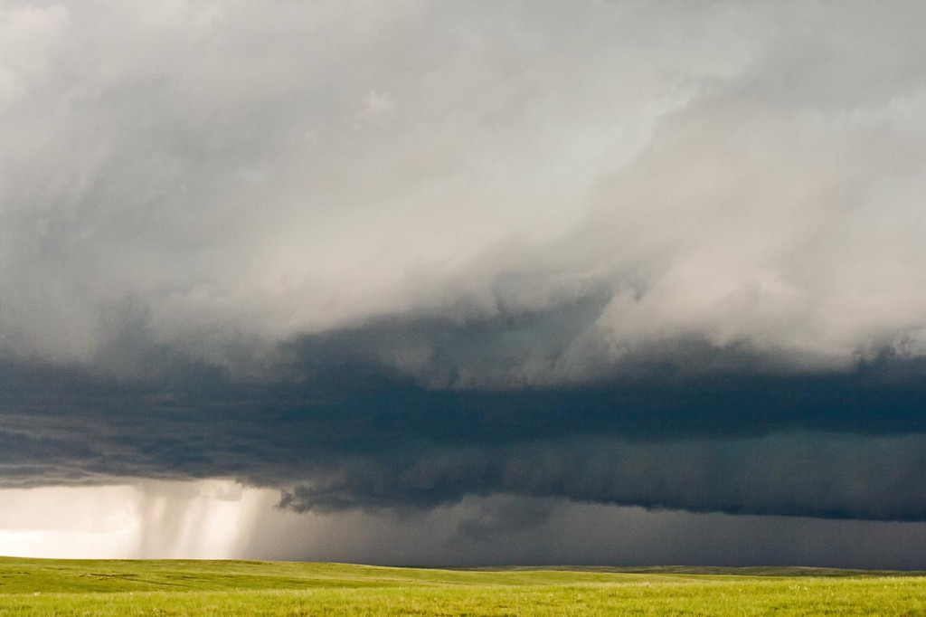
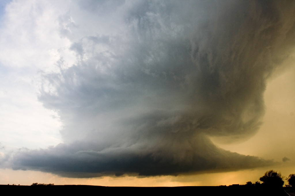
May 30th, 2007 Colorado HP Hailstorm
May 30th included a tornado watch for all of eastern Colorado. An old outflow boundary/cold front lay from the Palmer Divide northeastward to the triborder area. Strong low level shear and ample mid level flow, coupled with decent moisture and instability would set the stage for supercell storms in Colorado. As is often the case in the high plains of Colorado, storms become HP rather quickly and produce intense amounts and sizes of hail. This storm would be no different. Despite the continuance of many tornado warnings, this storm never really had the chance to produce due to its extreme outflow dominance. Check out the photos below.
May 23rd, 2007 Texas Panhandle Supercells and Tornado
May 23rd looked like a classic Texas panhandle day, with the exception of fairly weak flow at anvil level, which proved to be fatal for viewable tornadoes. SPC put out a PDS tornado watch box by mid-afternoon and things looked pretty interesting. Rapidly developing supercells formed by 4 PM and became quite a messy situation as too many storms formed. It was virtually impossible to get a glimpse of any tornado for a long period of time as they wrapped with rain quickly.
May 22nd, 2007 Hill City, Kansas Tornadic Supercells
May 22nd brought us to north central Kansas to play along the dryline. By mid afternoon it became apparent that north central Kansas would become the focal point for strong instability, good convergence, good shear and fair moisture. Enough to generate a few supercells, one of which became tornadic. We had great positioning for them all, and at one point in time we had 3 in our view at once. Quite a sight! The photo above, was from the tornadic storm just southwest of Hill City. This storm produced two tornadoes, both of which were fairly brief in nature, less than 5 minutes each.
May 5th, 2007 Kansas Tornadofest
May 5th was a High Risk day from the SPC. Everything seemed to be coming together for a significant tornado outbreak. We decided to target storms in southwest Kansas east of Dodge City. A strong dry punch, intense wind shear and strong instability would set the stage for tornadic supercells. Storms struggled till early evening with the strong shear ripping apart about any storm that tried forming. Finally a supercell developed near Pratt that became tornado warned. It produced a weak tornado and many funnel clouds. About an hour later, several supercells developed and produced numerous tornadoes. We were able to intercept 6 more tornadoes, including a few that were strong.
April 24, 2007 Nickerson, KS Tornadic Supercell
April 24th was a day that held great promise. SPC had a large MODERATE RISK all across the central and southern plains. I decided to play the area along the dryline/warm front intersection in central Kansas. We waited and waited and waited for things to finally get going. Every updraft that went up suffered from entrainment issues and finally the tail end updraft near Nickerson went crazy. This storm developed beautiful structure and produced at least a half dozen weak tornadoes.
April 21, 2007 Texas Panhandle Tornadofest
Not much can be said about April 21st that hasn’t already been said. Decent moisture, great lift, great shear and a strong dryline would spell trouble for the Texas panhandle region. By mid afternoon, many cells tried to form on the dryline and just couldn’t get surface based. Finally about 4 PM storms started to become surface based and it did not take long for them to become tornadic. We intercepted a tornadic storm not far from Dumas and a second one near dark southeast of Dumas.