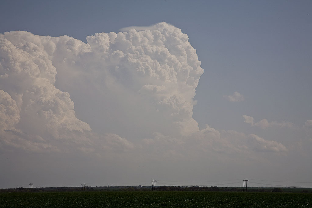
April 26th featured a diving shortwave from the northern Rockies, and meager moisture return behind a departing storm in the eastern US. Shear was respectable, but with limited moisture, we new there wouldn’t be much of a tornado threat. However, the thought of high based supercells producing hail and good lighting was enough to get us east of Lubbock, Texas. A nicely structured storm formed and tracked southeast for several hours, producing hail to 2″ in diameter, decent structure and tons of awesome lightning.
April 24th, 2008 Northwest Kansas Supercells and Tornado
April 24th was going to be a touch and go day. Strong shear, but sparse moisture would be forecast in Kansas, while much better moisture, but a strong cap would occur in Oklahoma. Hence the ages old question, where to chase. I finally decided that north would be best where a weaker cap would certainly result in initiation, even with meager dewpoints in the mid 50s. We arrived in Colby as two high based supercells developed. We would stay with these storms throughout the evening as one storm would become dominant. It even produced a nighttime tornado that shows up clearly at a high ISO. After we left it, it produced a 1/3 to 1/2 mile wide tornado near Beloit after midnight. We awoke the next morning in Kearney, Nebraska to snow.
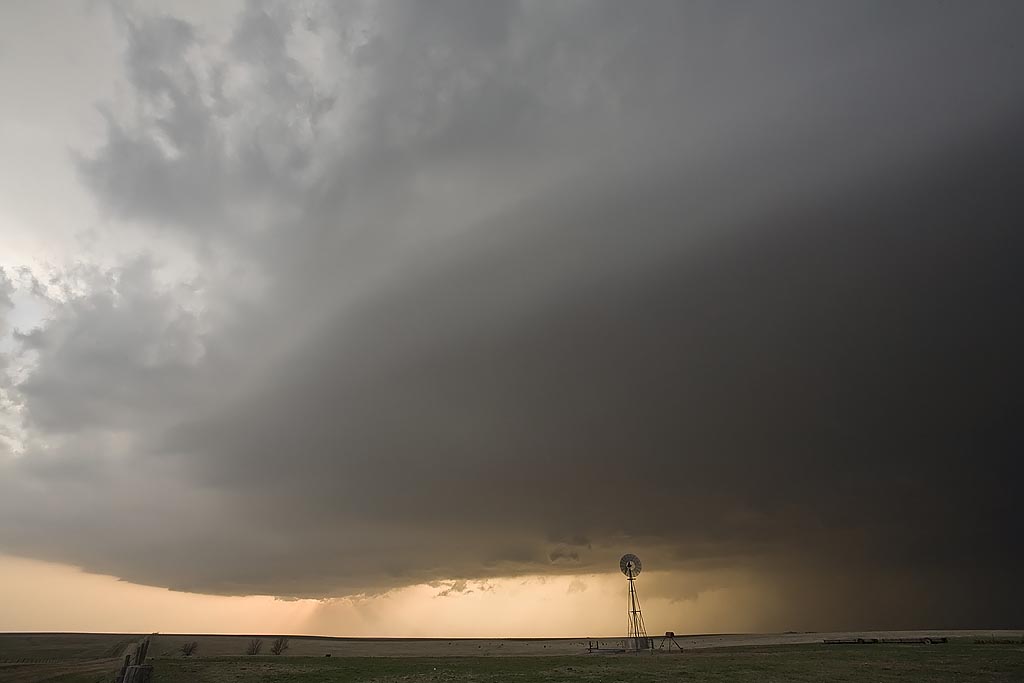
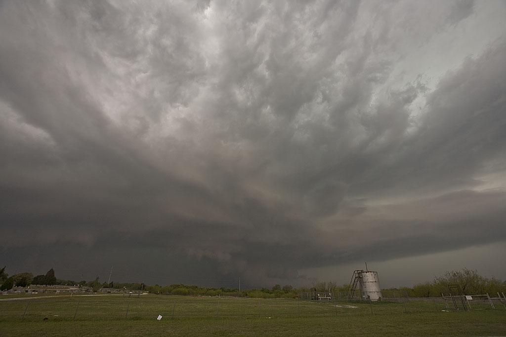
April 23rd, 2008 West Texas Supercells and Tornado
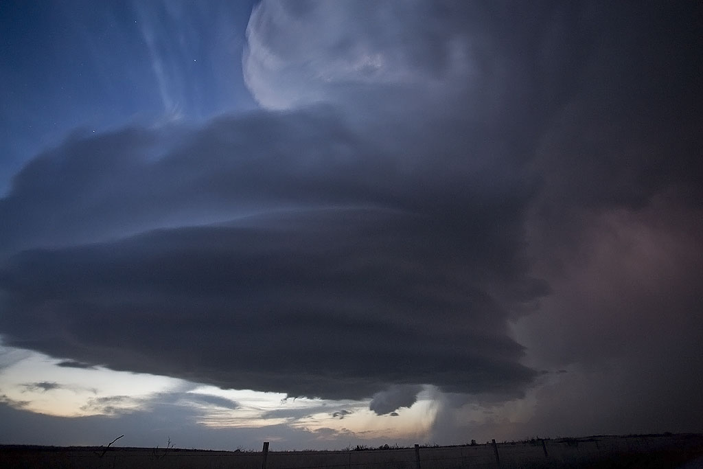
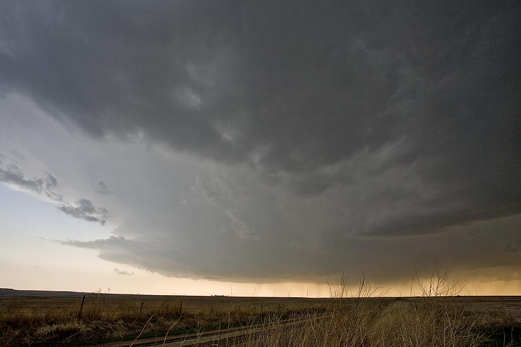
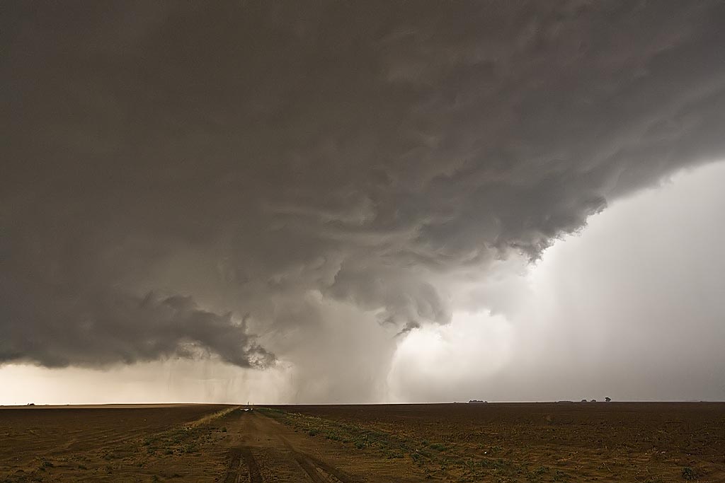
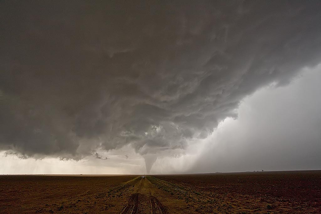
April 23rd looked like a significant severe weather day. It did not disappoint. My target was along the outflow boundary and dryline intersection, which I forecast to be near Lamesa, Texas. We headed out from Wichita Falls, where we spent the night before, around 8 AM. We encountered several storms, some severe, on our drive. We finally made it there just as a storm went up, but just north of the boundary. Finally by mid afternoon, the storm, propagating south, pulled the boundary into it.
Even though it still had that cold look to it, it was able to produce a 10 minute long tornado near Patricia, Texas, that was quite photogenic. We had inflow winds near 50 MPH, but cool, feeding the storm. An hour later the storm died as it moved east into more stable air. Thus we stayed put at the triple point, as another gorgeous supercell developed. It did all it could to produce a tornado, but just could not focus long enough to do it. It did, however, it produced baseball sized hail northwest of Big Springs, Texas and had gorgeous structure!
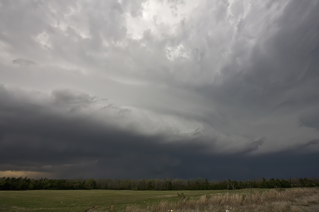
April 17th, 2008 North Texas HP Supercells
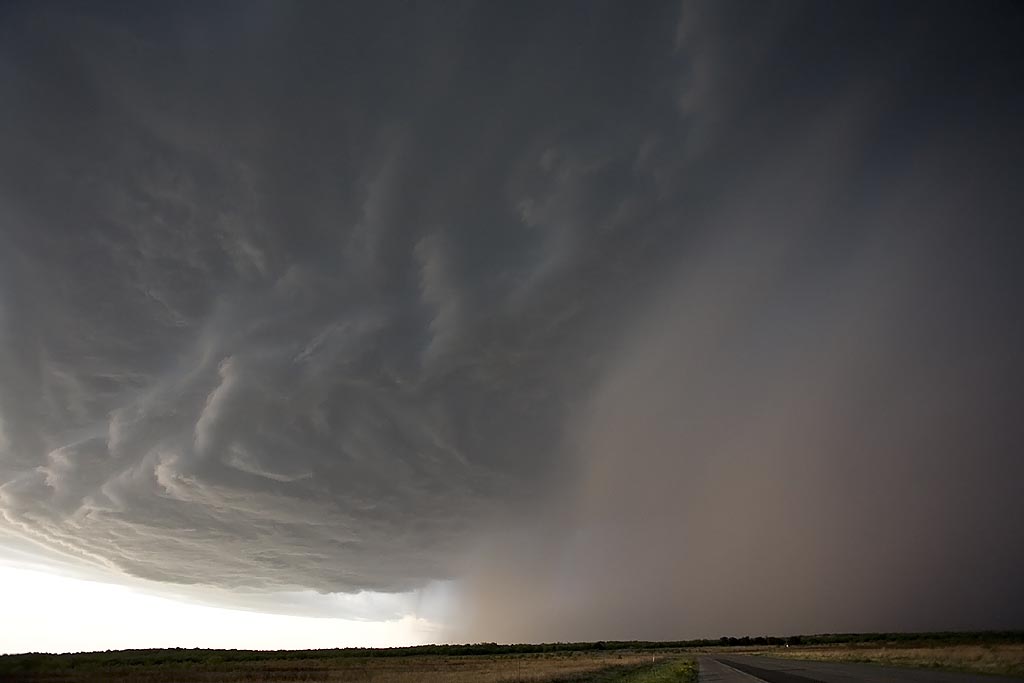
April 17th didn’t hold high promise to me. Storms seemed they would form and become undercut by the advancing front. One such storm did just that, developing west of Throckmorton, TX as the front surged south of it. However, it managed to get decent air and right turn, pulling the frontal boundary into the updraft. This storm had rapid rotation in the notch as scud and a tail cloud formed, streaming in from the east, as the rear flank core surged around the updraft. There “could” have been something buried in the rain and baseball sized hail, but we weren’t punching the core to find out. The second storm had tornado warnings west of Fort Worth, TX, and by the time we got to it, it also became quite HP, eventually lining out as numerous storms formed, merging into a line.
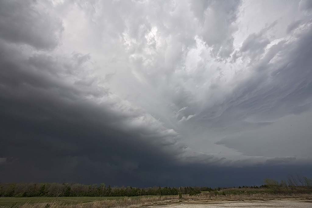
April 1st, 2008 Southeast Oklahoma Supercells
April 1st looked like a decent day for tornadic supercells in southeast Oklahoma. By the end of the day, it would greatly disappoint a lot of storm chasers. Storms had problems with entrainment and undercutting all day long. We were able to get on two tornado warned cells near I-35 not far from Madill and points east. The storm pictured above, rode an outflow boundary and did all it could to produce, but in the end just couldn’t do it due to outflow problems.
April 7th, 2008 Northern Texas Supercellfest
April 7th was a decent looking day with a strong dryline/warm front intersection over western Oklahoma and north Texas. We arrived mid afternoon as a tornadic supercell developed west of Wichita Falls. SPC issued a PDS tornado watch and upgraded to Moderate Risk. We witnessed a brief tornado in the occluded mesocyclone, and then had great photo ops for two other lpish supercells. We also encountered tennisball to baseball sized hail with all three storms. Check out the photos below.