
April 13th Southern Minnesota Tornadoes
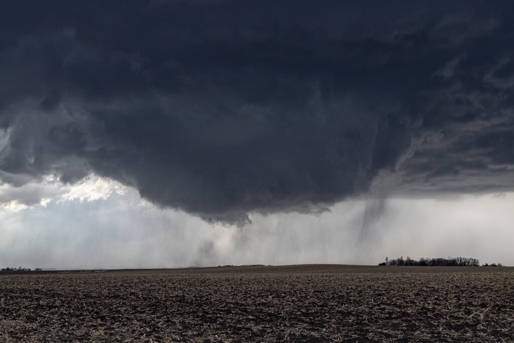
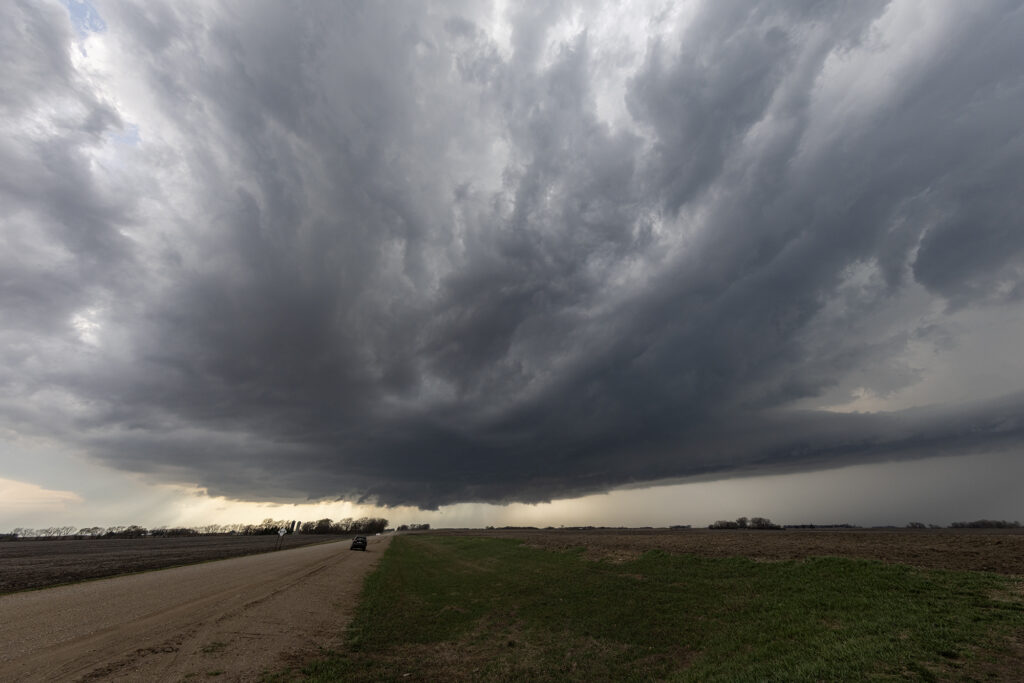
April 13th took our on call tour north to a volatile set up along a warm front/triple point over southern Minnesota. Mid afternoon we arrived near Fairmont, MN as the atmosphere became extremely unstable. Several storms developed along the warm front, then crossed it into colder air. These were not tornadic, but produced big hail. Soon, our storm formed west of Truman, MN and anchored on the warm front. You knew that the show was about to begin as it ramped up quickly and grew to over 50,000 feet. A tornado warning we issued as the storm spun had and approached our location. We drifted east with it and a huge bowl shaped lowering formed, and quickly dropped a pretty cone tornado. It stayed on the ground several minutes before lifting. Another elephant trunk shaped tornado formed east of town and was also on the ground for several minutes. It was quite pretty! After it dissipated, a third truncated cone shaped tornado formed and was on the ground for about 5 minutes before lifting. We stayed with the supercell past Minnesota Lake where it continued to be tornado warned, but it did not produce anymore tornadoes. Numerous cell mergers would disrupt the low level mesocyclone until it soon died off. An incredible day with a pretty supercell and 3 tornadoes we were only a mile away from! Enjoy the pics!
No comments yet.