Tough day! Two clear choices were in play. Chase the Cheyenne Ridge, which can (and did!) produce magical results. Or chase the eastern side of the Palmer Divide where dewpoints 5-7 degrees higher were forecast to pool along a boundary. I had a feeling the Cheyenne Ridge would get interesting, but also the latter target would also produce. Higher dews/instability usually result in better results. We caught a stunning structured supercell near Kit Carson. However the Cheyenne Ridge produced one supercell that dropped a few tornadoes. Our storm also produced a tornado, but had far superior storm structure. We chased it down towards Eads where it slowly started to weaken. Having the appearance of a spiraling barber pole, the structure was the best of 2025! We were a bit too far east (after chasing another storm) to get a good shot of the tornado, but a highly contrasted image clearly shows it. No regrets with a storm this pretty! Enjoy the pics!

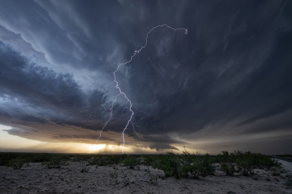
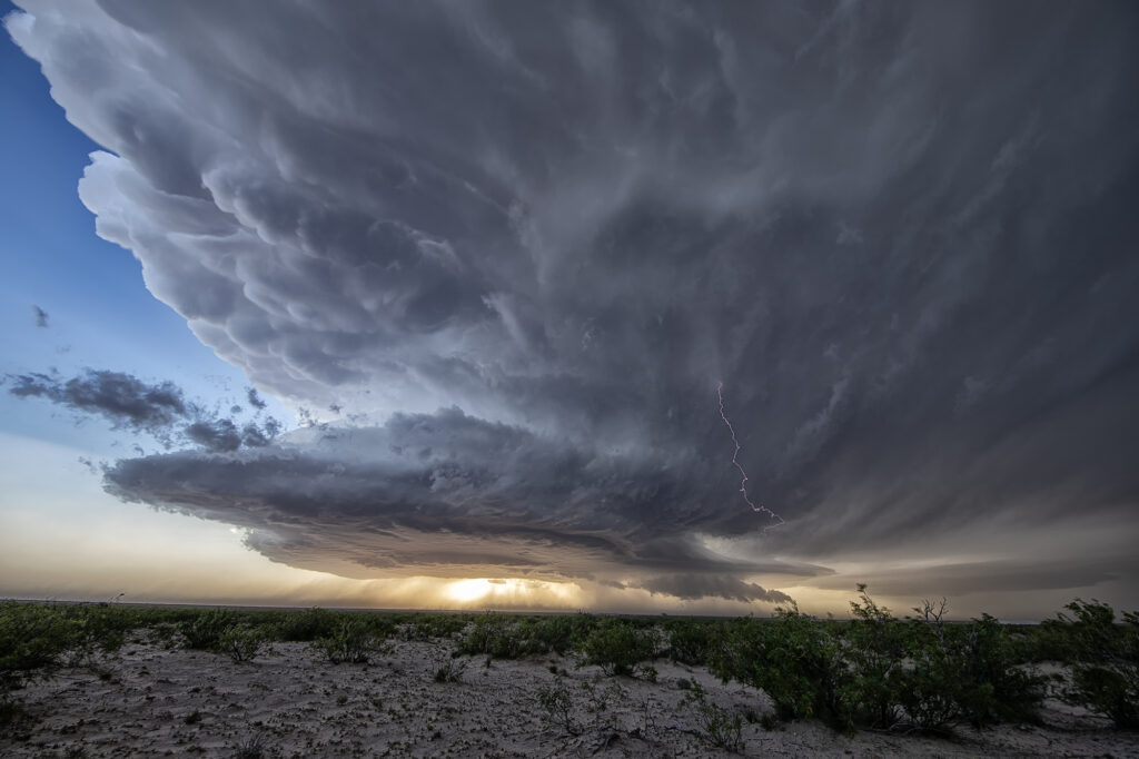
May 4th Orla, Texas Gorgeous Supercell
May 4th brought a new trough into the southwest US. Moisture was still limited from the previous trough that pushed a front into the gulf. It usually takes 4 days minimum to get moisture back after that occurs, and this was the 4th day. A stout dryline was evident in southwest Texas off the Guadalupe mountains and storms formed along it. Due to lower moisture quality, the storms initially were higher based. Shear steadily increased and a beautiful supercell emerged from a cluster of cells southeast of Carlsbad. As the storm moved east, it encountered better moisture and instability and continued to intensify. Although never a threat to become tornadic, the structure was quite pretty! Right at sunset it became very electrified producing numerous cg strikes each minute. Finally, we left it at dark and headed to our hotel to get ready for the next day. We hope you enjoy the pics!
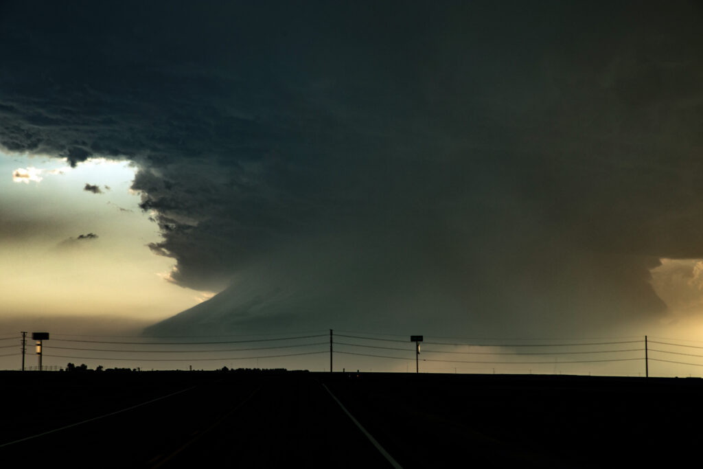
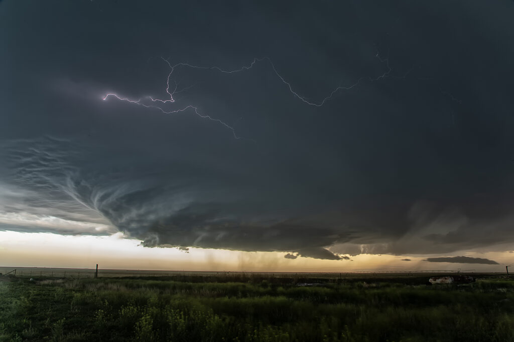
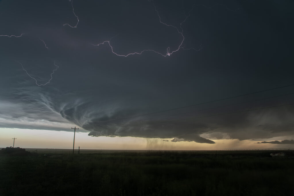
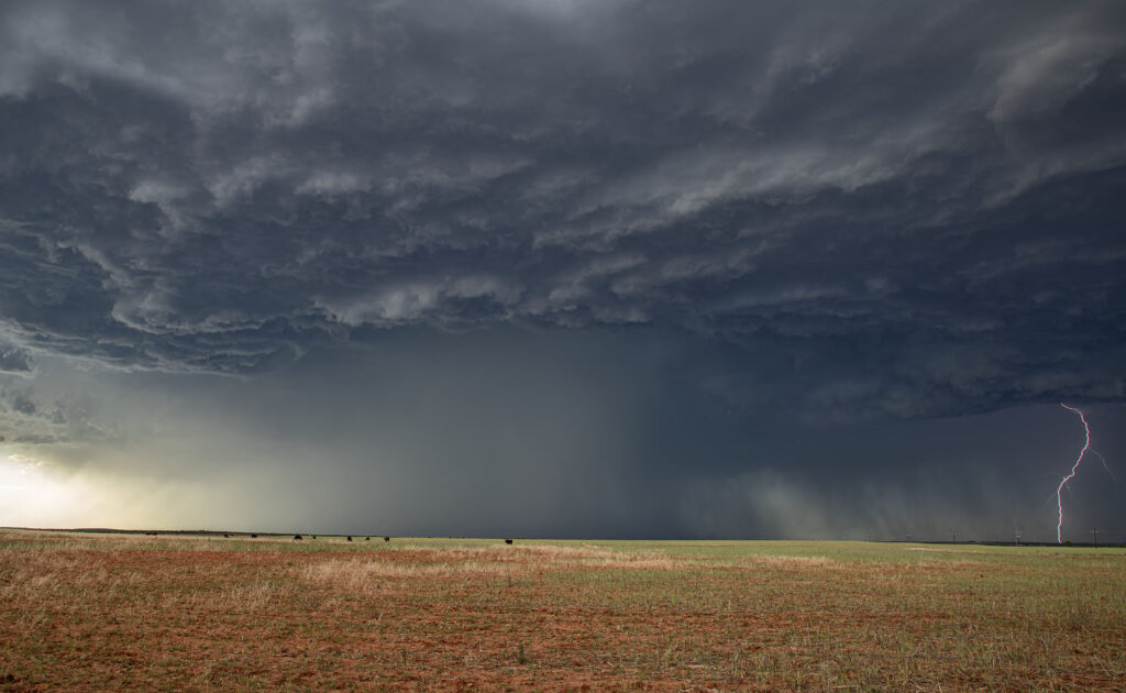
May 1st Westway, Texas Tornado Warned Supercell
May 1st set up was far from ideal. Limited moisture was present moving into the upslope play of northeast New Mexico. Shear was great, as was lift. However, limited moisture also meant limited instability. Despite all that, severe storms formed south near Logan, NM as moved east. The tail end storm latched onto the old frontal boundary draped across the region and started spinning hard. As the storm crossed the Texas border, it became tornado warned. The structure was amazing! As it churned southeast along the boundary, it produced hail tennisball sized and had numerous lowering over time. Headin into the Hereford area, the hail became intense so we chose to push ahead and northeast of it and get out of its way. For a day that wasn’t advertised, a bit of panhandle magic certainly became the story of the day! Enjoy the pics!
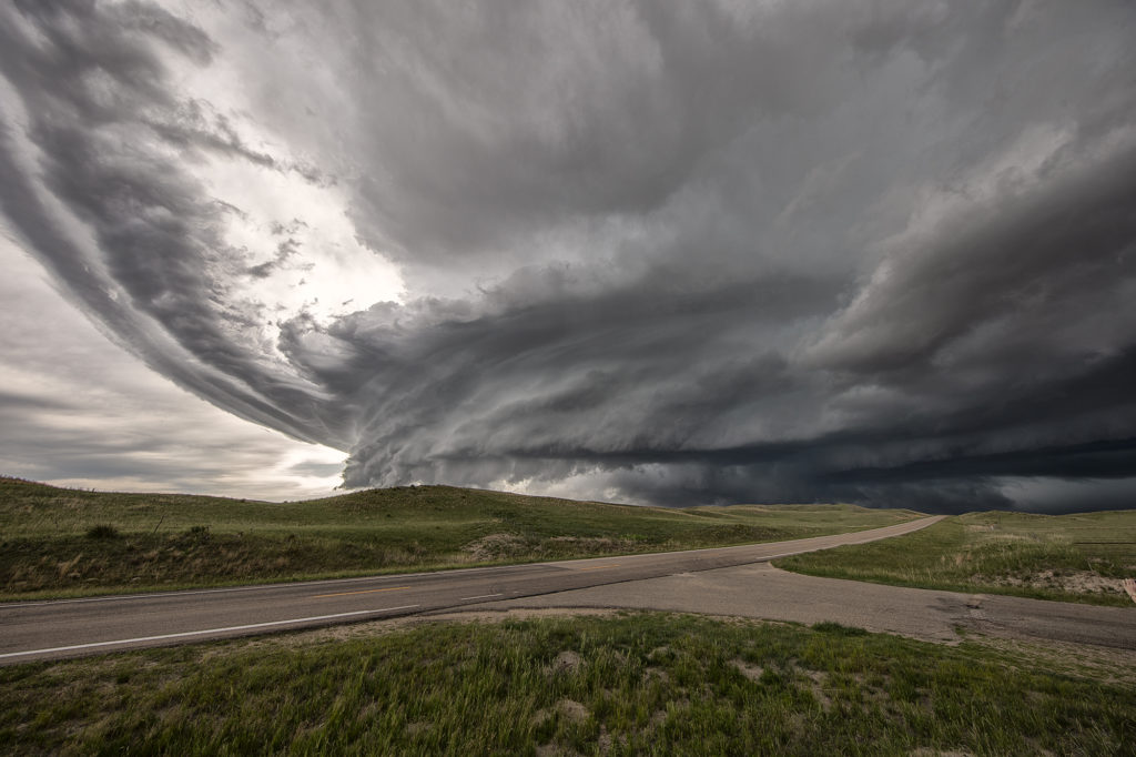
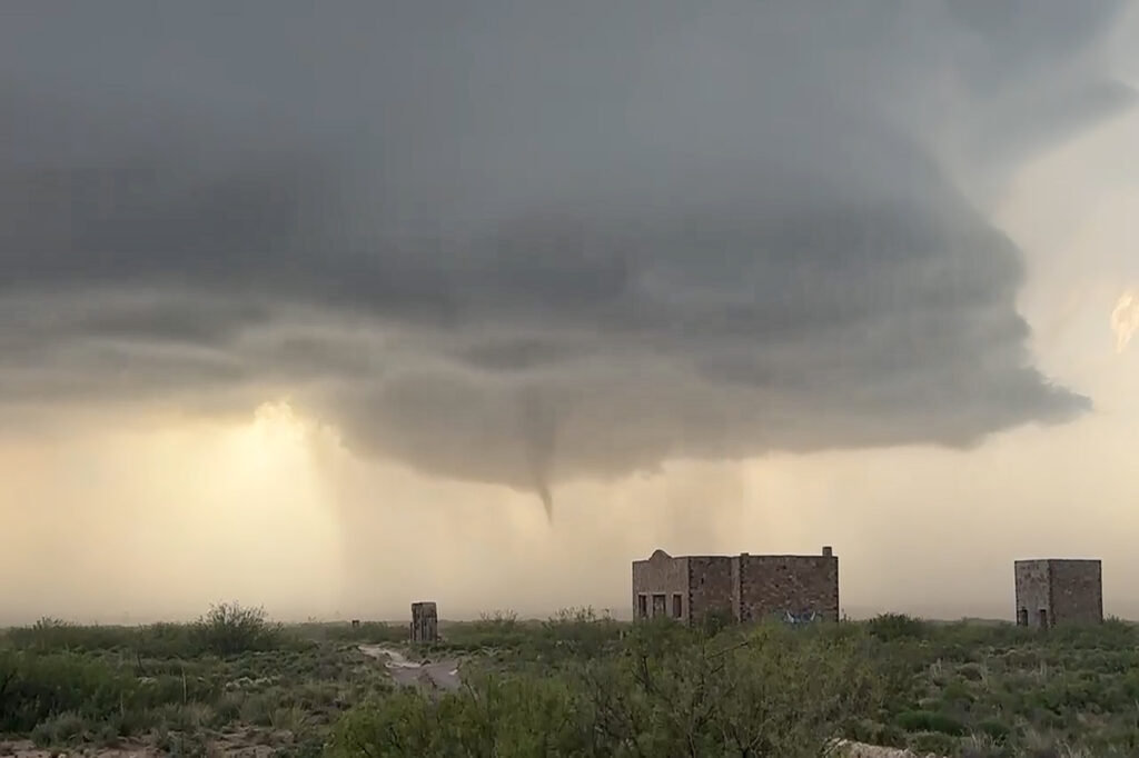
April 26th Roswell, New Mexico Tornadic Supercell
April 26th featured an upslope/dryline play in eastern New Mexico. Storms formed along and north of an outflow boundary. We intercepted the triple point storm that developed just northeast of town and kept back building at the triple point until it got so strong it moved southeast along the boundary. It didn’t take long in the highly sheared environment for it to start rotating strongly. Inflow winds of 50 mph fed the storm. There was so much dirt being sucked into the updraft at times, you could see the dirt cloud rise into the updraft base. Eventually the low levels started rotating as a very obvious mesocyclone formed. A clear slot wrapped around the meso and a long snaking elephant trunk shaped funnel, then tornado descended from cloud base. Dirt partially obscured it from time to time and it dissipated after about 5 minutes. The storm was a prolific hailer as ell we 3-4 inch stones reported. We stay with it until dark when it weakened. A fun day and a major powerful supercell was incredible to experience from birth to death. Enjoy the pics!
June 16th McCook, Nebraska Gorgeous Supercell
June 16th brought us to southwest Nebraska near McCook. A triple point focused potential storm development in the area with extreme heat (temps over 100) along the dryline with dewpoints near 70 along the warm front. Many updrafts tried to form in the area near the triple point, with one updraft succeeding in sustaining itself at the triple point. The storm sat and spun for several hours. The structure was quite pretty and periodically the storm produced copious amounts of lightning. Although never a real threat to produce tornadoes due to higher cloud bases, a couple of wall clouds formed and one bowl spun for several minutes. The storm persisted towards sunset then slowly weakened as it drifted slowly northward. An exceptional day based on how model portrayed the set up. Enjoy the pics!


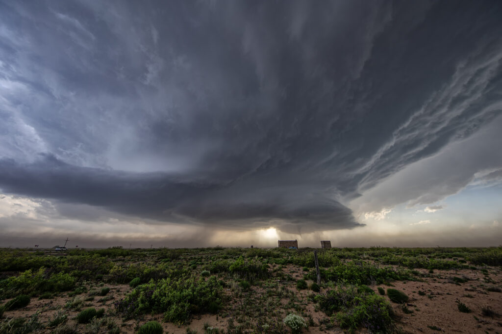
April 23rd Sweetwater, Texas High Based Supercell
April 23rd promised some decent severe weather opportunities. However due to lack of good moisture, storms were high based. We intercepted one storm northwest of Sweetwater and stayed with it all the way south of Abilene where it gusted out. Structure was pretty and the hail up to golfball sized. It was also a pretty decent lightning producer. As it reached maturity and started weakening an haboob developed spewing red dirt all over. Winds were gusting over 70mph. All in all a decent day for the ingredients available to produce intense storms. Enjoy the pics!

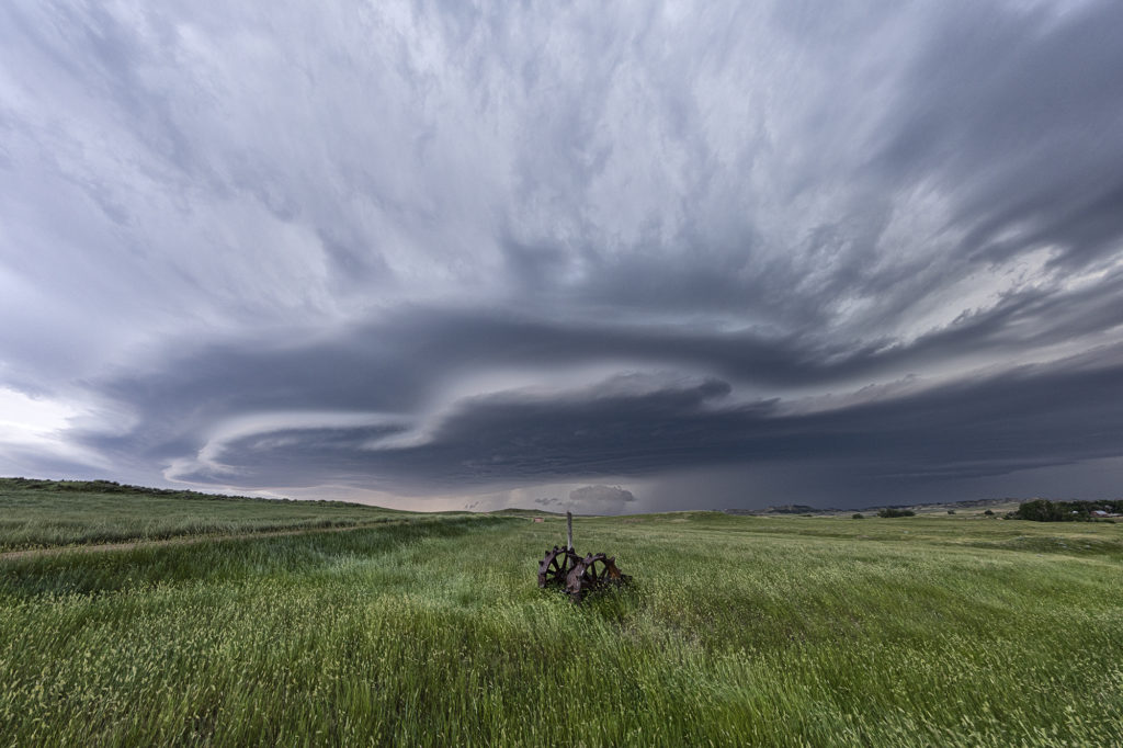
July 10th Southeast Montana Supercells
Southeast Montana was the target this day for what appeared to be a decent chance of high based supercells. Great shear was in place, but limited moisture and instability would temper the threat of significant severe weather. Nonetheless, storms formed off the Big Horn mountains and moved east and intensified. Hail the size of half dollars and winds to 70mph occurred from these supercells. Structure was typical for high based storms and one can wonder only what if there would have been better moisture and instability. It was still a fun day and we at least had severe storms.
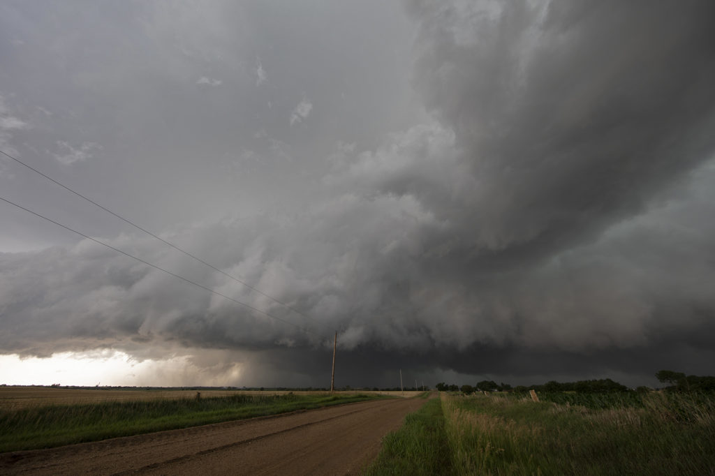
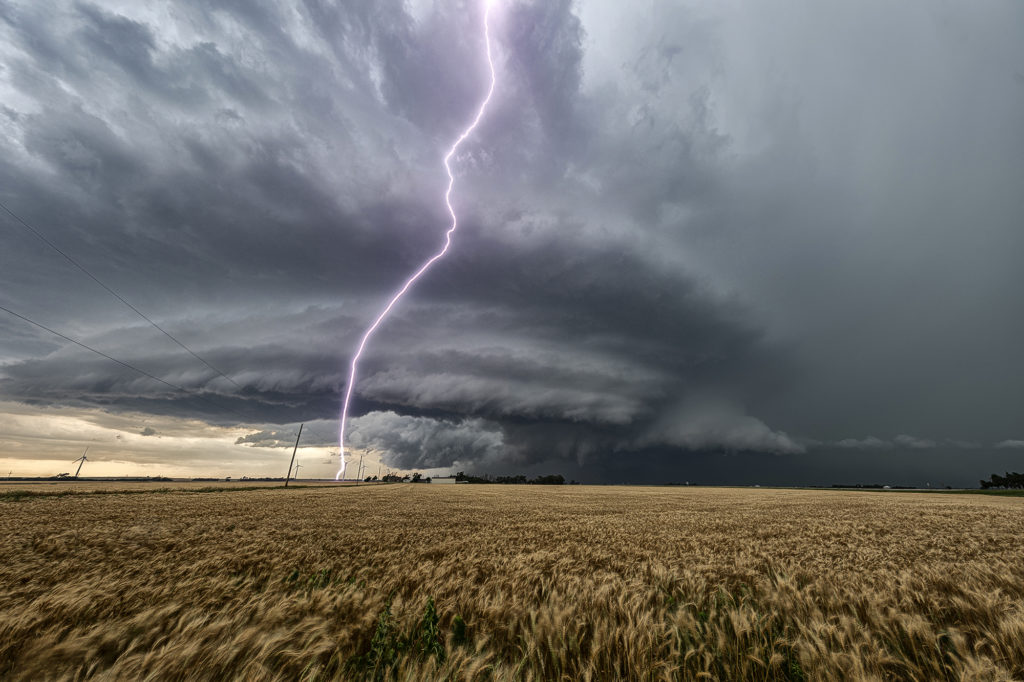
June 23rd Central Kansas Cyclic Tornadic Supercell
The ingredients for severe storms on June 23rd were there. We only needed a focusing mechanism to get a storm to form on and ride along the boundary. It certainly did! An outflow boundary from previous night’s thunderstorms lay across the I-70 corridor in central Kansas. Storms formed along it and continuously crossed northward into the colder, more stable air. As they did, they weakened and moved off to the northeast. Finally, a storm formed along the boundary at the intersection of the dryline and anchored along it. It started spinning wildly as we sat just a mile east of the updraft and watched low stratocumulus race westward into the updraft twisting and turning along the way. At that point it was just a matter of time before a tornado would form. During the next 3 hours at least 6 tornadoes occurred, although most were brief, dissipating within a couple minutes. We first had a slender slanted tornado that touched down near Wilson Lake. It didn’t last more than a minute. Next another tornado, a slender elephant trunk touched down just west of Dorrance. Little did we know, but another larger tornado was not visible from our position, so we moved east to get in front of the supercell updraft. The structure was insane! While we drove that 3 miles east, the larger tornado came out of the rain and near the interstate. One of our long time guests, Cathy Murphy snapped a shot of it out the rear window. (Thanks Cathy for letting us use your image!) We continued to move east as the storm also moved east, spinning like crazy the whole time. Another white tornado from our view formed near a cluster of wind turbines and was confirmed a brief touchdown. Eventually we ended up just west of Salina as the final tornado formed and also briefly touched down just before the storm died. A heck of a day! Great structure and a few tornadoes to boot! Enjoy the pics! A Youtube video will be releases shortly from this day! Check out our channel!
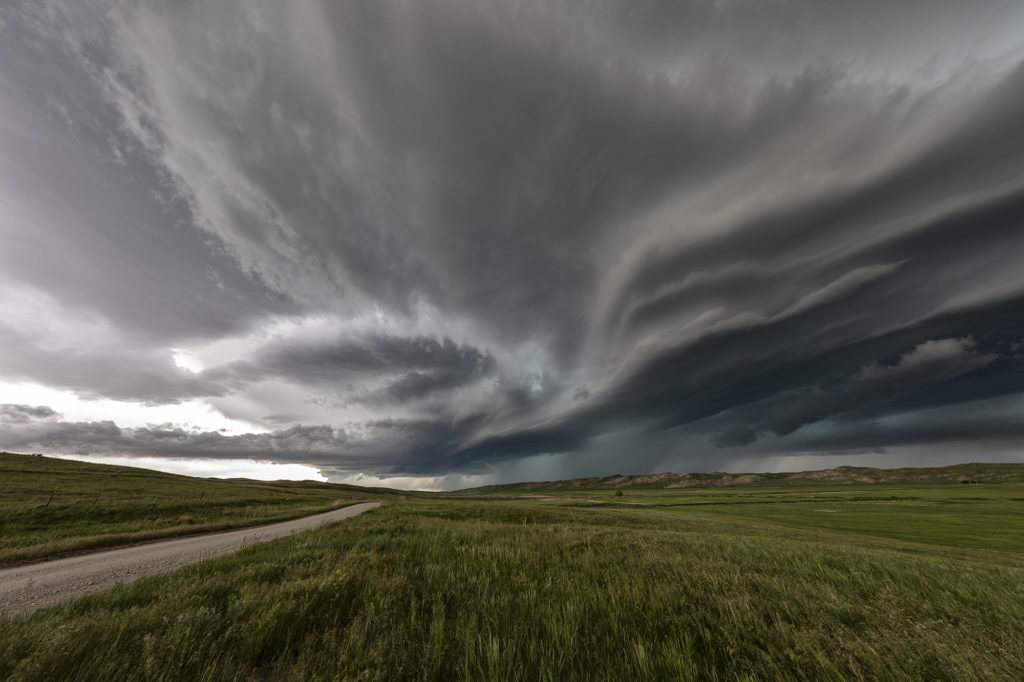
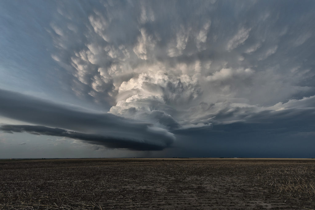
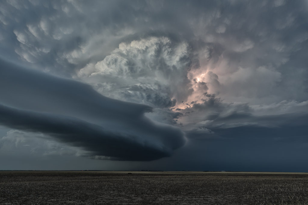
June 9th Southwest Nebraska Gorgeous Supercell!
June 9th had one target for us, southwest Nebraska. An existing boundary would be the focal point for storm development that afternoon. Numerous storms formed, several becoming severe, however only one would survive and be the storm of the day. This supercell formed south of North Platte, NE and turned hard right, spinning like a top all the way to Oberlin, KS. The structure was top notch. When it first got its act together, it did have a slowly rotating wall cloud. We thought for a minute it might try to become tornadic, but the wall cloud eventually disappeared. As the storm moved south, it had the appearance of a mothership, and as it moved into Kansas as a low precipitation supercell, the structure at sunset was just stunning! A great day for the tours and an amazing way to end the evening! Enjoy the pics!
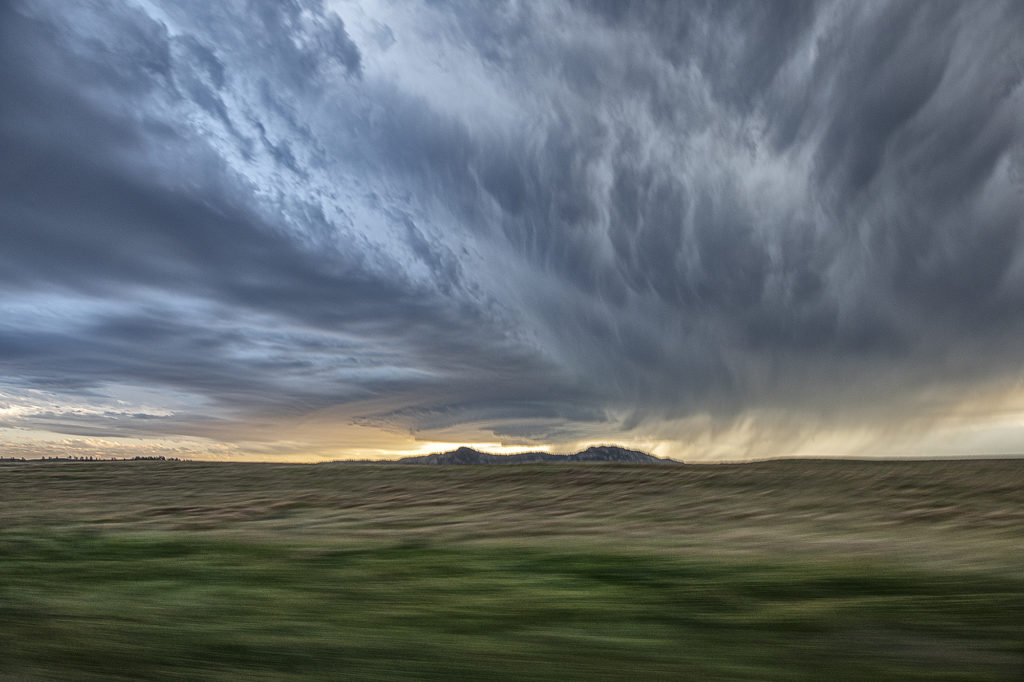
June 6th Western Nebraska Supercells
Sometimes you get a set up where shear is really strong, but moisture is a bit lacking. June 6th was one of those days where if only the moisture and resulting instability were a bit stronger that a significant severe weather event would occur. It looked like storms would form off the Black Hills and ride a frontal boundary to the southeast. By mid afternoon, a supercell formed northwest of Thedford, Nebraska and became severe. As it moved east it weakened while others formed further northwest. A storm did form off the hills and trek southeast into northwest Nebraska and became a formidable supercell. The structure was nice and the colors of the storm were superb! Having it in the sand hills is always a challenge to chase due to lack of roads. We were able to stay with it all the way past Stapleton before it eventually weakened to the southeast. A fun chase, pretty structure and beautiful landscapes! Enjoy the pics!