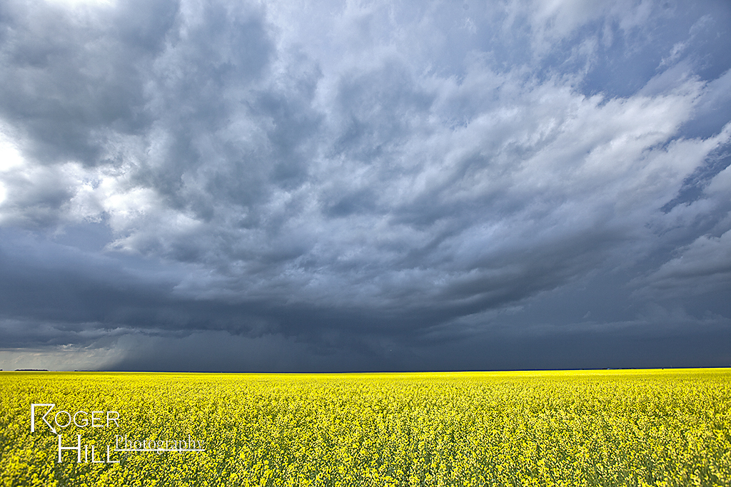
We stayed in Canada for this specific day. Everything looked like a decent tornado event could unfold. Great shear, moisture and instability were in place for a fantastic event. Only issue, a weak cap. This would allow too many storms to form too quickly, which would mitigate the tornado threat. However, we did witness a very nice supercell that likely did produce a tornado that we just couldn’t confirm south of Regina.
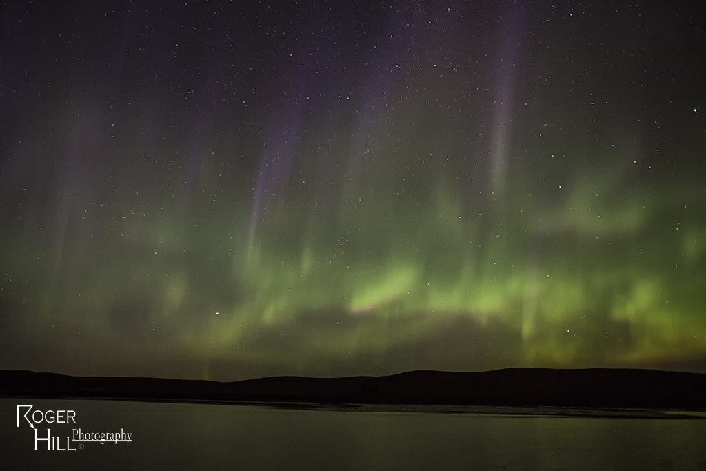
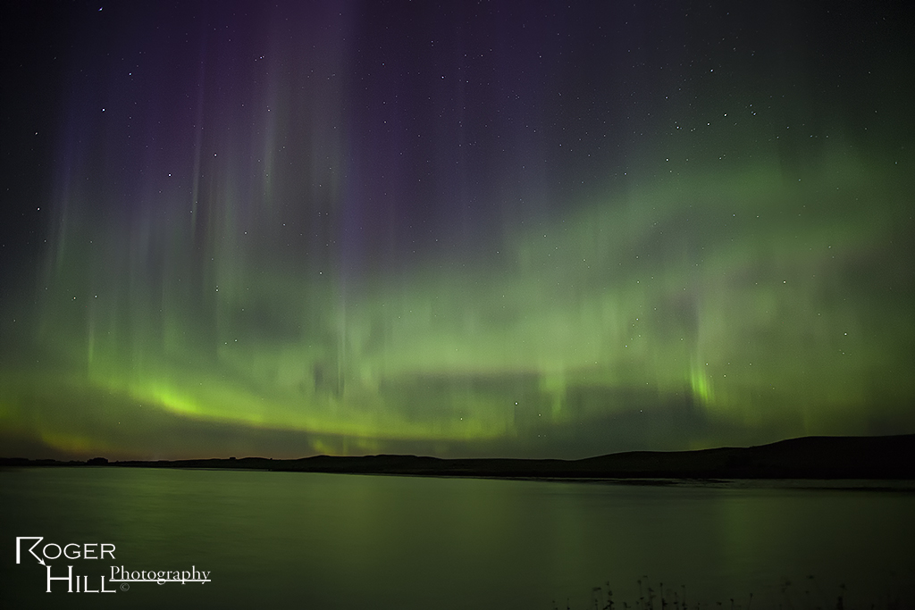
July 14th Southey, Saskatchewan, Canada Aurora Show
What a treat! One thing I love about chasing in Canada is the possibility of the Aurora making an appearance. This night it certainly did!
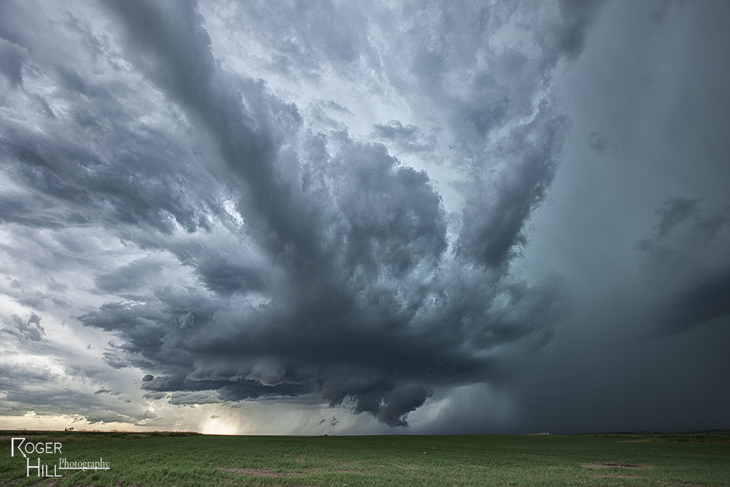
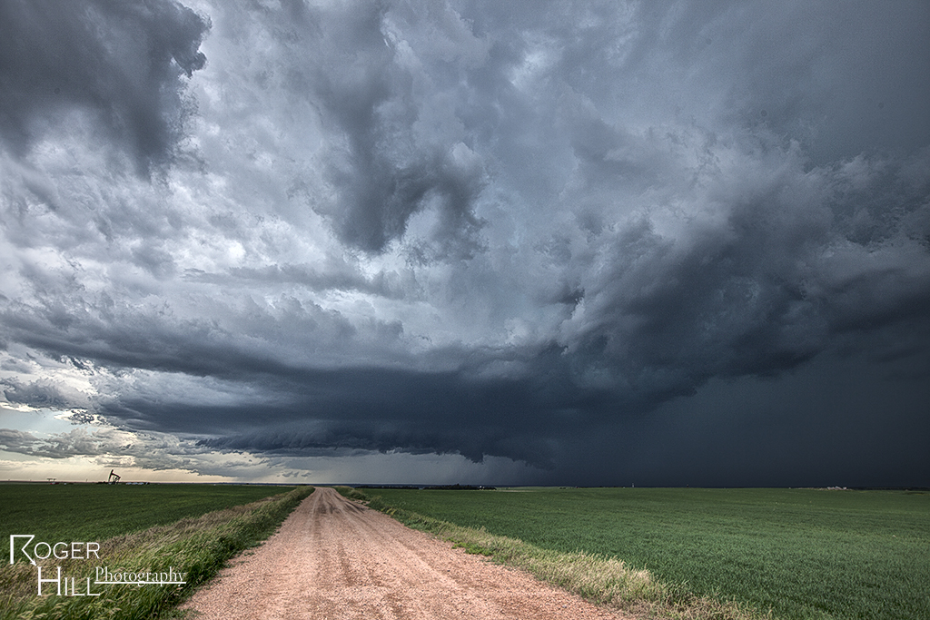
July 13th Western North Dakota Supercell
I was torn between playing further northwest or playing the dryline in western North Dakota this day. Decent shear, moisture and instability was available for any cell that could sustain itself under the capping inversion. This cell was the best of them. It came QUITE close to producing a tornado south off Williston, ND. Structure was quite pretty, and the oil fields were evident in the photos! Crazy how much oil exploration is going on up there.
July 12th Southeast North Dakota Tornado Warned Supercell
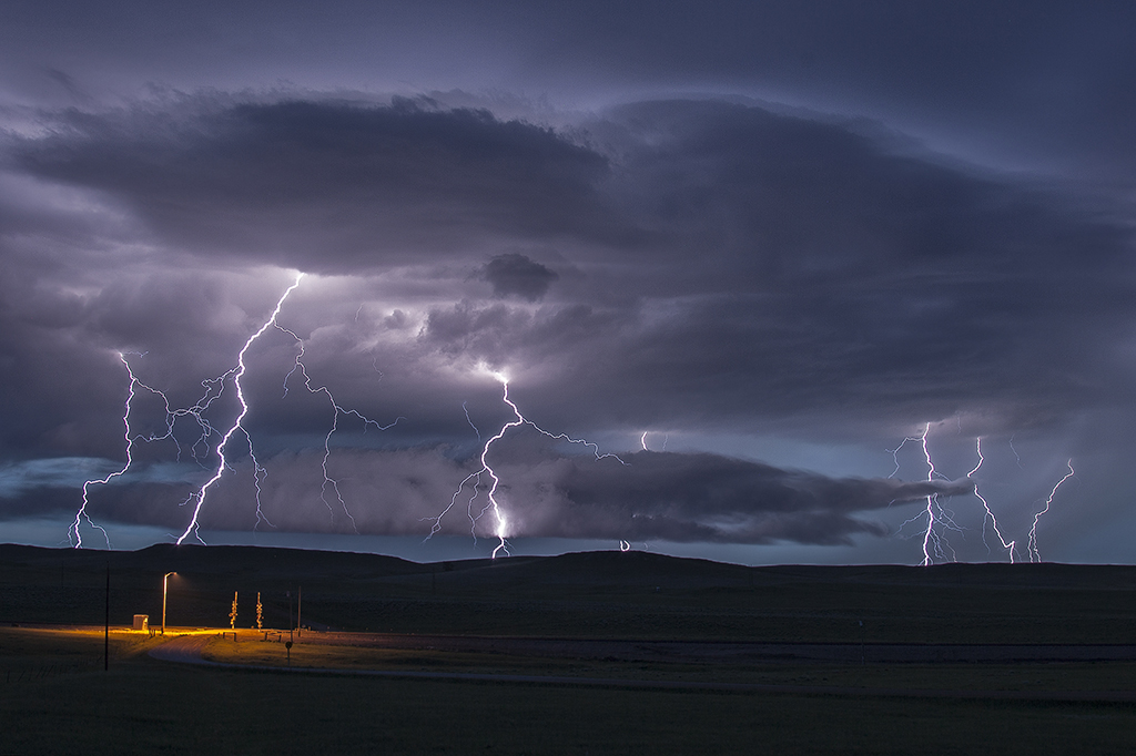
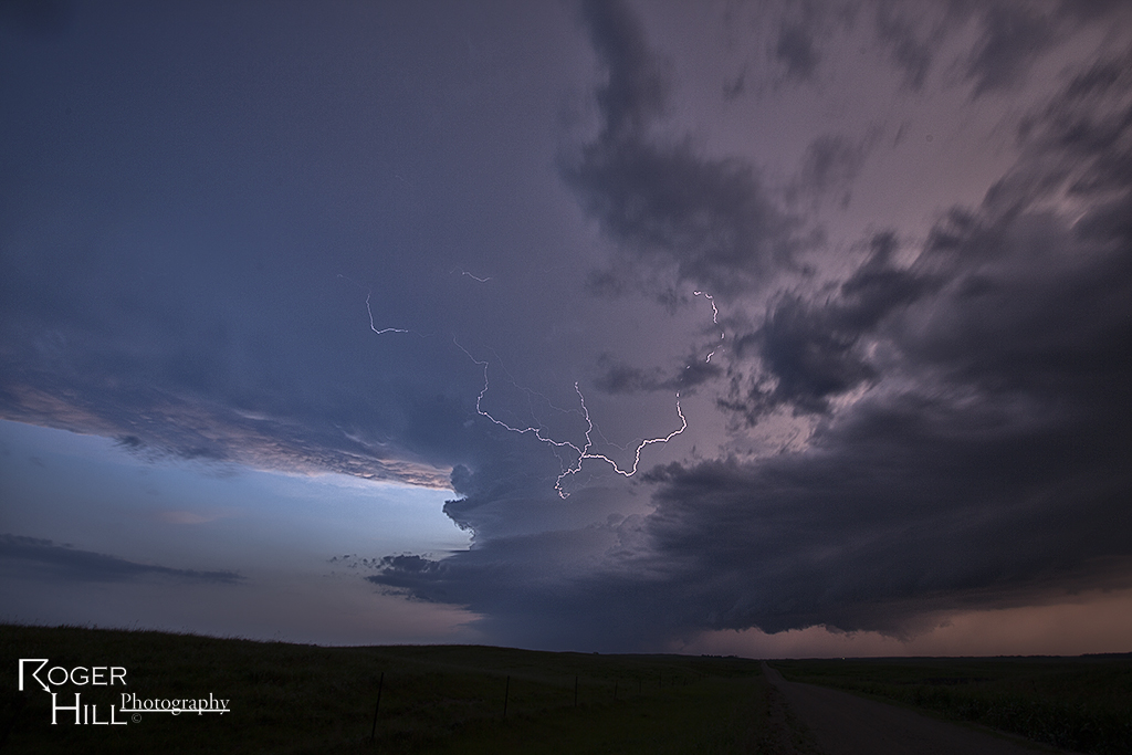
What a finish to a day that looked pretty doomed. Cloud cover all day kept good insulation from occurring and thus reducing instability. Just south of the North Dakota border, skies were clearer, but shear was weaker. Nonetheless, a supercell, nearly tornadic, formed near Cayuga, North Dakota and became a very nice storm! It was quite electrified and also produced copious amounts of large hail. We watched it form from a towering cu all the way through its decaying stage. What a treat!
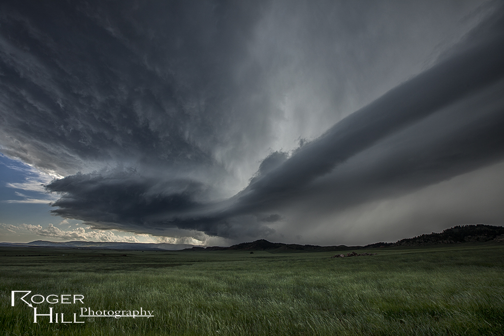
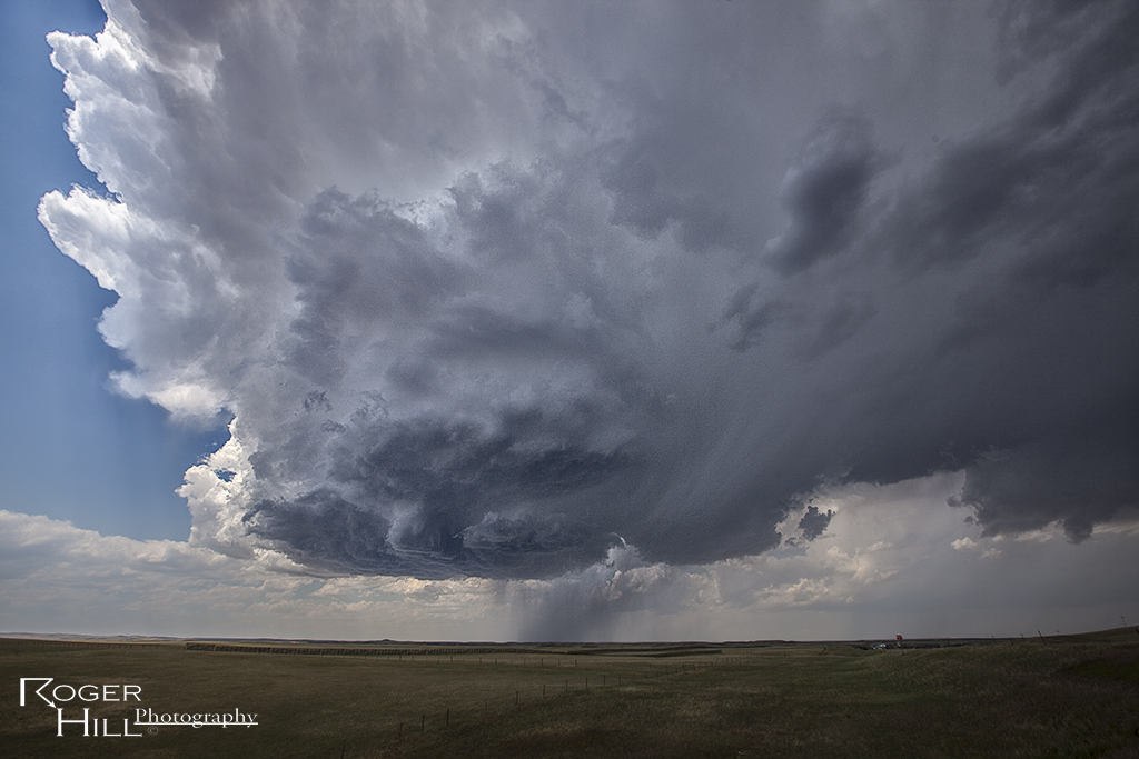
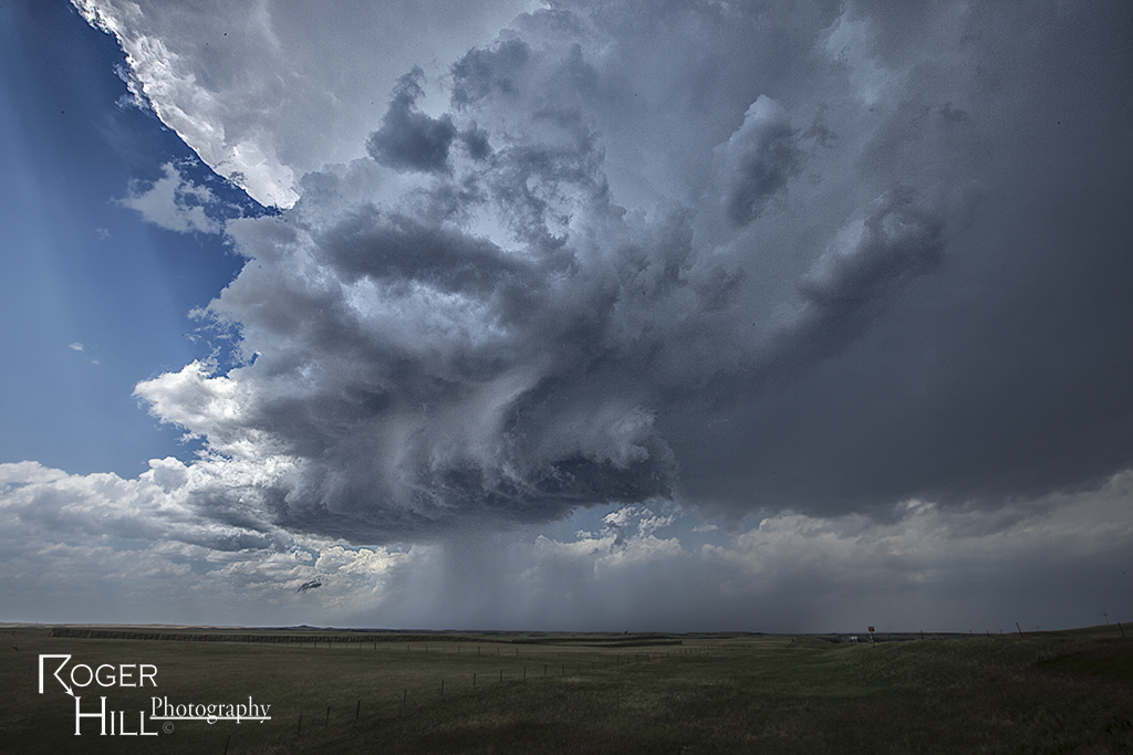
July 10th Wyoming Supercell
We intercepted a severe warned supercell in southeast Wyoming this day. Decent ingredients were in place to get storms to form in the upslope flow north of Cheyenne. This storm became a wet lp supercell and had pretty decent structure for its 3 hour lifetime.
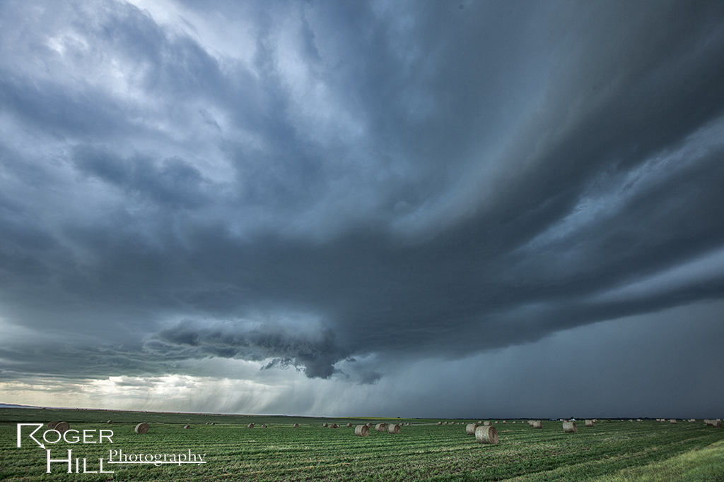
July 9th Central Nebraska Tornado and Supercell
July 9th appeared to be a marginal set up. Shear wasn’t very good, and moisture was fairly lacking. However, moisture pooled along a boundary and winds on the north side of the boundary were easterly, giving a bit of enhanced low level shear. By mid afternoon, several storms developed, with one cell north of Cozad becoming a monster supercell very quickly. The rapid development stretched low level vorticity very fast and a nonsupercell type tornado formed. It persisted for about 5-7 minutes before dissipating. Please excuse the poor quality of the tornado shots as they were taken out the windshield while moving. Other cells become photogenic (and severe) as we chased till mid evening.
July 7th Lightning Flats, Wyoming Tornado Warned Supercell
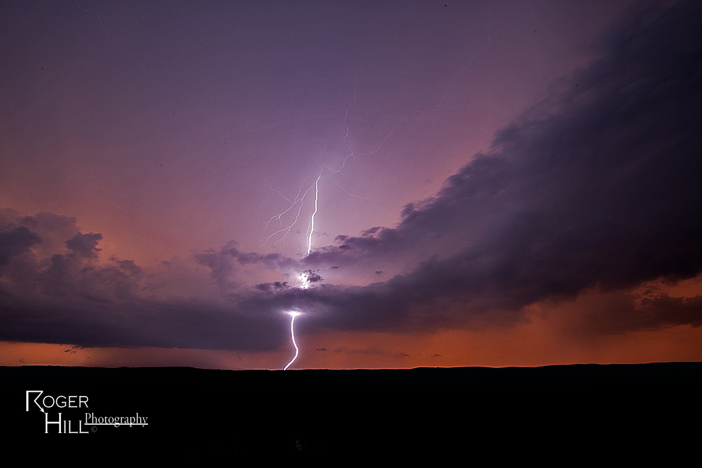
I love chasing in July in the northern plains. It is very scenic and very few people around. July 7th had plenty of moisture, decent instability, good shear and a dryline for convergence. By mid afternoon, a storm formed northwest of Alzada, Montana, and right turned along the boundary all the way to Sundance, Wyoming where it eventually gusted out. It produced a really nice funnel halfway to the ground, as well as nice structure. Near dark, another cell formed southwest of Moorcroft, Wyoming and was an electrified beast! Love those storms that produce cgs every 5-7 seconds!