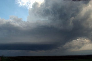
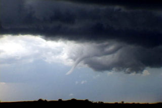
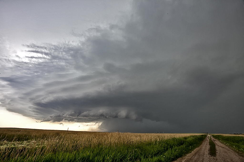
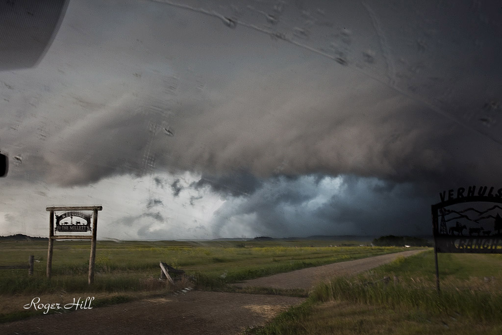
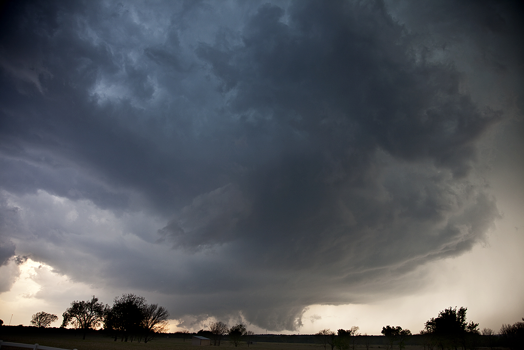
July 18th would be my last chase day for the month. We started the day in Bismark, ND. By early afternoon a boundary would set up over northern South Dakota. A tornadic supercell formed along this boundary southwest of Reva and anchored itself there for about an hour. We quickly went west and south on the Enchanted Highway and caught up to it in time to watch a substantial tornado. This supercell was fairly HP, but gave us a nice show with a moderately visible cone tornado. As it roped out, a new core on the south side of the supercell, pushed the tornado east as it became pretty visible. Most of the duration of the 12-14 minute tornado, it was poorly contrasted. Fortunately it occurred in a area that has little to no population. This storm was also highly electrified with numerous very close and intense CGs occurring.
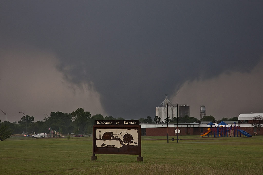
May 24th, 2011 Canton, OK Violent Tornado
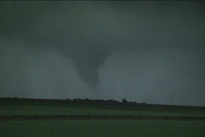
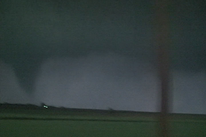
May 24th certainly lived up to its High Risk billing. Supercells exploded along the dryline in western Oklahoma and quickly became violent. Numerous EF3 – EF4 tornadoes occurred with various supercells. We intercepted the Canton storm, which produced 3 tornadoes we could verify. Then we dropped south to Oklahoma City and intercepted two more storms that produced tornadoes as well. My heart goes out to all those who suffered personal losses this day. If you haven’t gotten involved or donated to the local Red Cross/or other agencies, please do so!
May 23rd, 2011 Homestead, OK Tornado
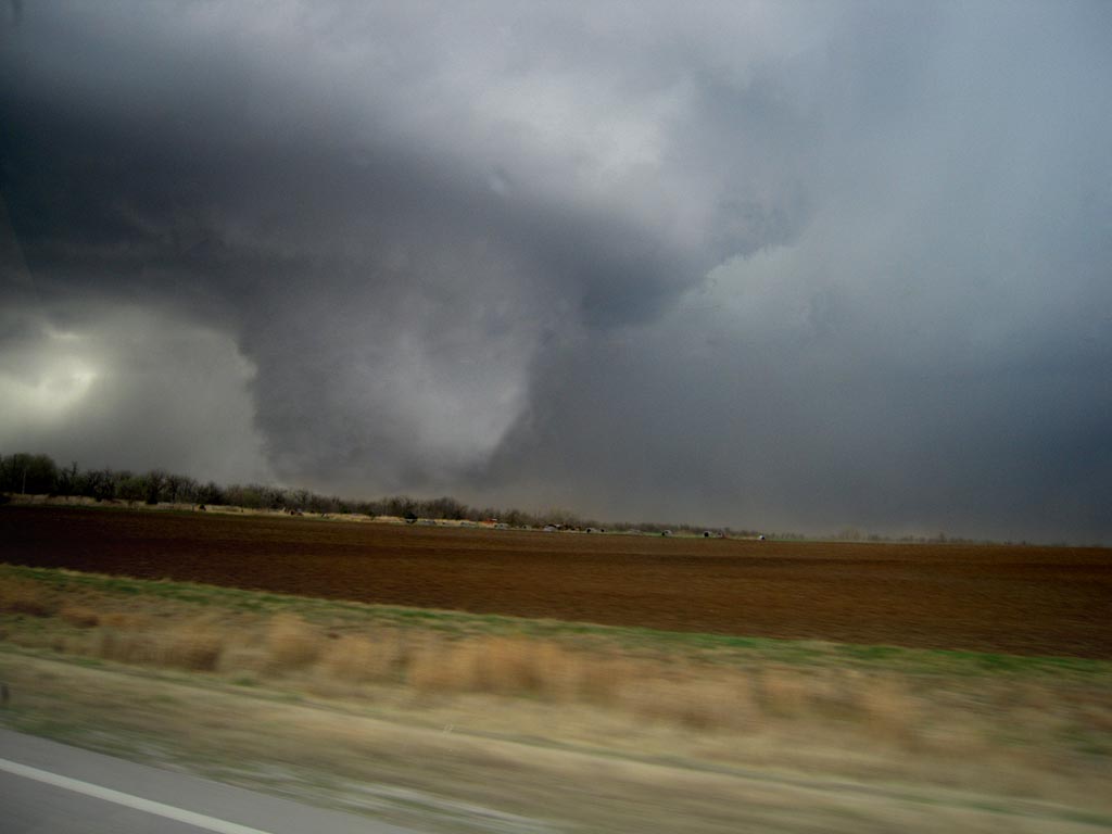
Things looked decent this day. However, due to high cloud bases, the tornado threat never really materialized. We went west from Enid, OK to play the dryline and encountered a nearly stationary supercell, albeit high based. This cell eventually dropped a slender truncated elephant trunk shaped tornado that was on the ground maybe 3-4 minutes. We later dropped south to another supercell that spun like crazy, and then abruptly died. Very wierd day, but at least we did catch a tornado. Thanks Rich Hamel for your use of your tight shot of the tornado. I had the wrong lens on my camera.
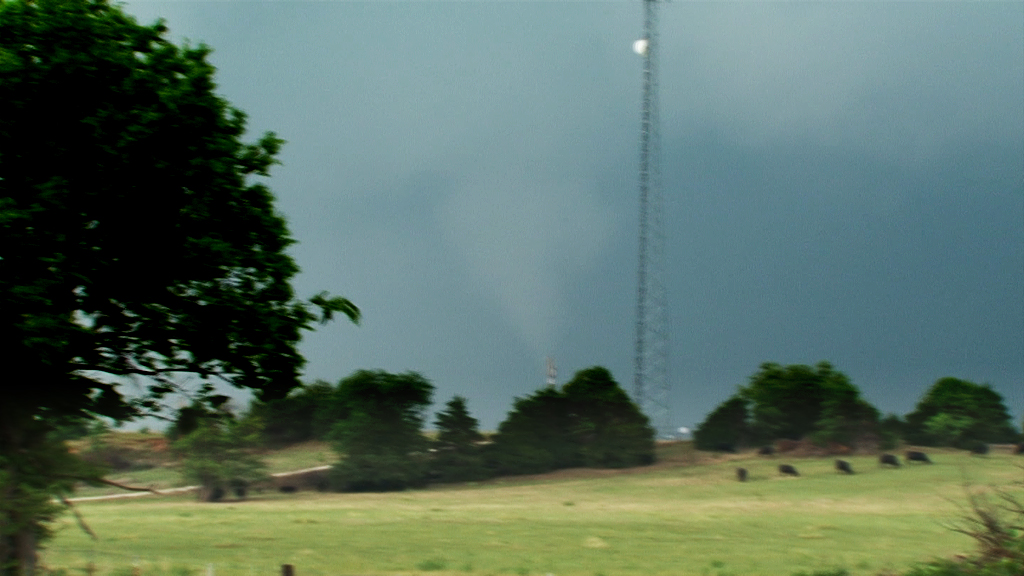
April 14, 2011 Oklahoma Tornadic Supercells
Caryn and I took a group to Oklahoma for what appeared to be a significant tornado event. Even though we did see a tornado near Burbank, OK, it did not live up to the hype that had been built up this day. A weakness in the low level shear would result in lots of supercells that were rotating, but very few that actually did produce a tornado. We witnessed a tornado during the afternoon near Burbank as a supercell spun wildly and dropped the elephant trunk shaped tornado in the photos below less than a quarter mile from us. A fun day, but not as wild as anticipated. We were saddened to learn of the 2 fatalities in southeast Oklahoma from a strong tornado that did occur near Tushka.
July 14, 2010 Northfield, Minnesota Tornadoes
Had high expectations this day as all parameters pointed to a significant tornado outbreak. I just had a gut feeling it would line out quickly and that you would have to be in position to intercept any discreet supercells before they lined out. That is what happened. I took the Canadian Prairie tour to Faribault, MN for lunch and watched as surface based storms broke the cap. We blasted up I-35 and approached highway 19. We quickly noticed an amazingly rapid development in the mesocyclone of this supercell and it took a matter of moments and it dropped a nice truncated cone tornado that crossed I-35 and flipped a couple vehicles as the white debris cloud moved into a field next to the interstate. This tornado skipped along the countryside for a couple miles and lifted.
Quickly, another tornado, a slender truncated elephant trunk shaped tornado touched down and rotated around the outer periphery of the mesocyclone. It stayed in contact for only a few minutes before lifting. The rotation in the mesocyclone was still quite intense. Another long snaking elephant trunk tornado touched down with full condensation to the ground and looked very nice. Unfortunately it did a bit of damage, as shown below. All this occurred not far from Northfield, MN. Then the cells lined out and the show was over on a day that was hyped to be a big tornado outbreak.
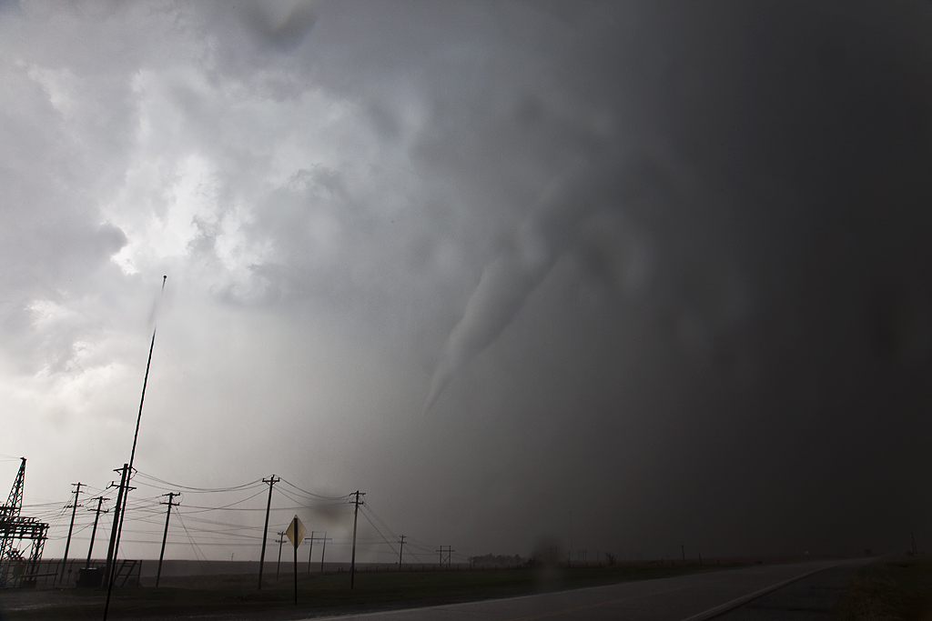
May 23, 2010 Northwest Kansas Nighttime Tornado
Not much to show here as the only shots I got were in the dark of the slender cone. There was another tornado just after this, a tapered elephant trunk that the NWS in Goodland could see from their office. The shots here are all video stills.
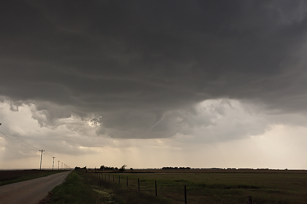
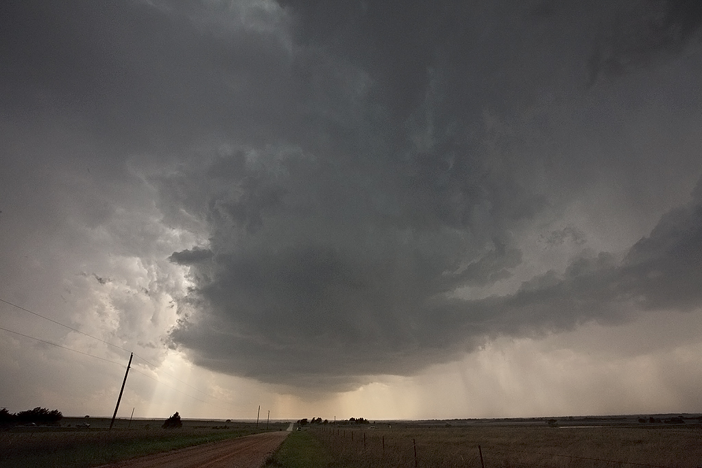
March 23, 2009 Arkansas City, KS Tornadoes
March 23rd was a day full of strong dynamics but limited moisture/instability. My plan was to head to the I-35 corridor south of Wichita and play where the best moisture/instability intersected the dryline. We caught a nice supercell, albeit high based near Kingman, KS which was severe, produced tons of hail and had a respectable wall cloud. However, the best storm of the day would form south of Enid, Ok and move into the Arkansas City, Kansas area by late afternoon and produce two fairly weak tornadoes. The structure of the storm was by far better than I had anticipated. Later, we dropped into the Oklahoma City area to play the tail end storms for lightning. We weren’t disappointed.
June 9th, 2005 North Central Kansas Tornadofest
June 9 had that feel to it. Everything was coming into place for a significant tornado outbreak. A triple point was situated over northwest Kansas, slowly drifting east. Very unstable, moist air was streaming in from the south, and with an approaching short wave trough, it was only a matter of time before rapid severe thunderstorm development would occur. I sat north of I-70, southwest of Hill City and watched the storm of the year develop from a small cumulus tower and become a prolific tornado producing monster.
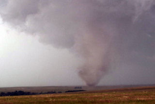
June 6th, 2005 Ekalaka, Montana Tornadic Supercell
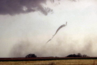
What an interesting day this turned out to be. We started in Gillette, WY, blasted to Ekalaka, MT and sat north of town and waited, and waited and waited 🙂 Finally a high based little LP updraft developed, as usual, and was severe warned. The interesting thing with this is it was feeding on 72/56 air. It moved north and weakened. Then another storm RAPIDLY developed and intensified, southwest of town. This storm became a BEAUTIFUL striated stack of plates supercell, and quickly developed a nice wall cloud. Condensation streamed in from the northeast and soon a lowering was observed almost to the ground. Rotation developed and a funnel formed AWAY from the wall cloud. It extended a third of the way to the ground and dissipated.
Then a second funnel formed without being connected to the base, then developed a debris cloud and connected to the base!! Bizarre tornado! It stayed on the ground maybe 2 minutes and dissipated too. A third funnel formed and became a gorgeous elephant trunk tornado with INTENSE rotation and cascading motion in the cloud base. This also lasted 2-3 minutes. It also was rotating around the outer edge of the meso. A fourth funnel formed, a truncated cone, and became tornadic too with a debris cloud. This one lasted at least 5-6 minutes before dissipating. Eventually the lowering wrapped in rain, and then the rain curtains parted revealing a long slender funnel halfway to the ground!! What a surprise! I was NOT expecting this type of a supercell today at all!!
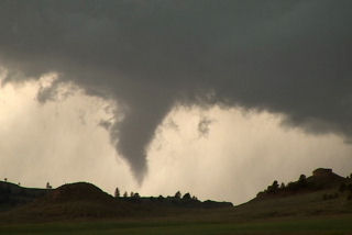
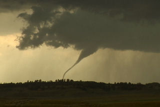
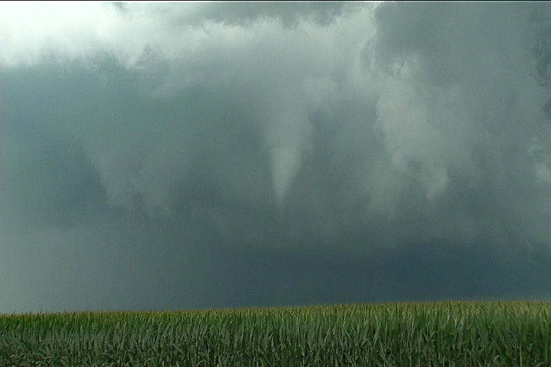
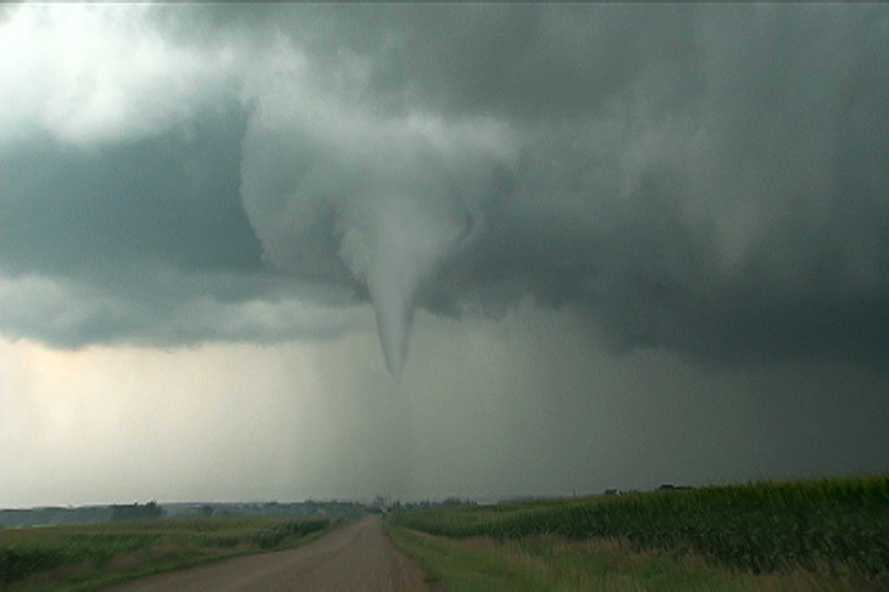
June 6th, 2004 Max, North Dakota Tornadic Supercell
This was a tough one for me. We left Denver early this AM with a target of Dickenson, ND. After almost 800 miles, we arrived to see 3 high based storms get their act together. Strong moisture return ahead of a short wave trough would provide lift to get these storms going. In spite of only upper 50s dewpoints, these 3 storms turned into supercells, with the southern storm, near Max, ND our target. We arrived as the storm was a beautiful saucer base with clear slot. A couple of funnels formed and extended close to the ground. Close enough I would consider this tornadic.