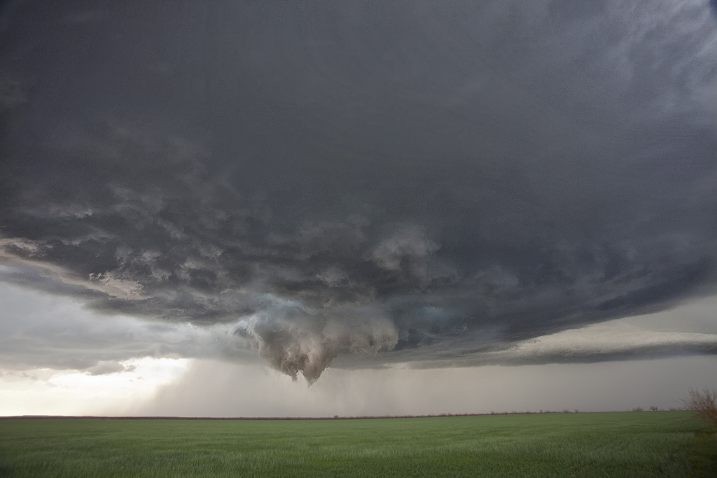
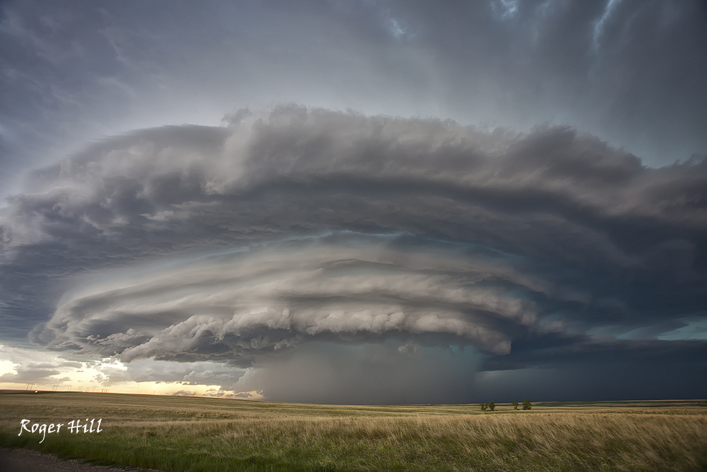
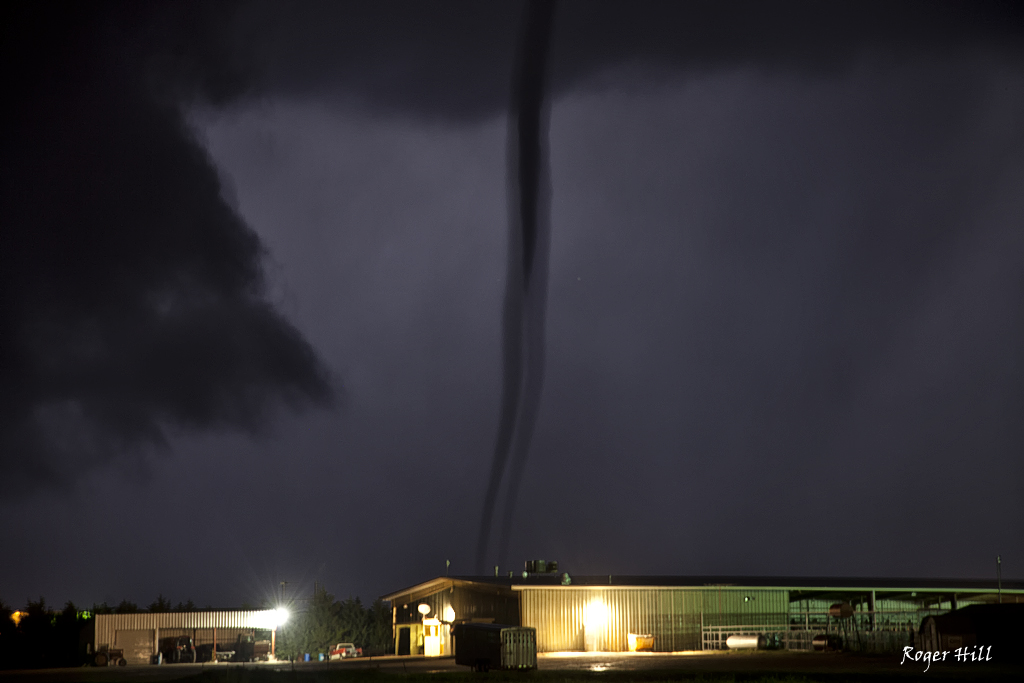
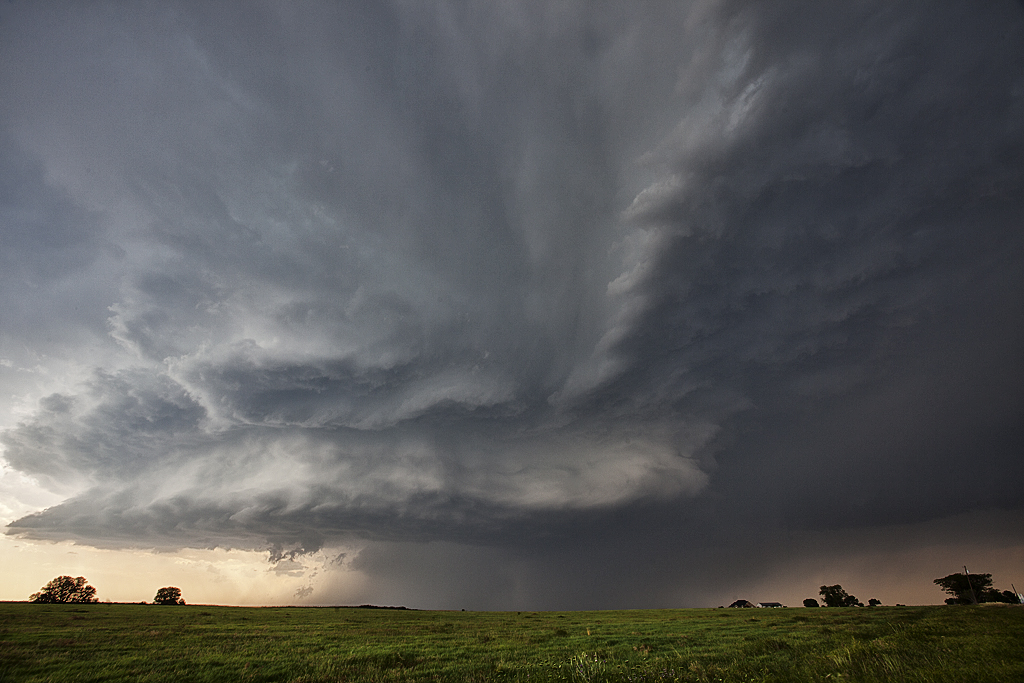
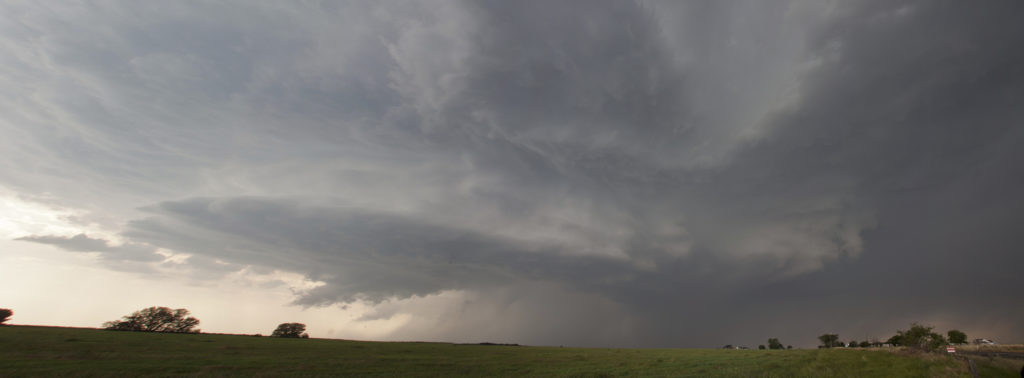
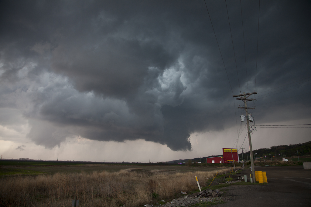
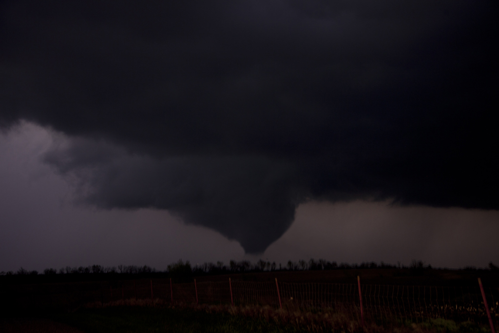
What a day June 5th turned out to be! We were anticipating intense supercells to form and they indeed did. A strongly worded tornado watch was issued for central and northern Montana by mid afternoon, with shear, instability and moisture giving the potential for strong tornadoes. Several storms formed off the higher terrain south Great Falls. As they moved north, cool and stable air banked against the mountains would cause these cells to weaken. Another cluster of storms formed in the Judith Basin area and congealed into one monster supercell. This storm had insane structure and produced about a 12 minute elephant trunk/cone tornado. It produced another tornado northeast of Ft Benson we couldn’t catch up to due to poor road options. We also got pelted with near baseball sized hail in the notch of this beast as it raced northward. Another gorgeous storm!
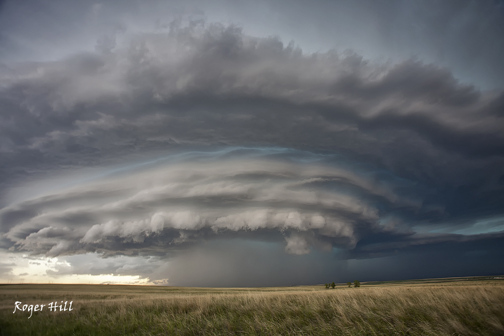
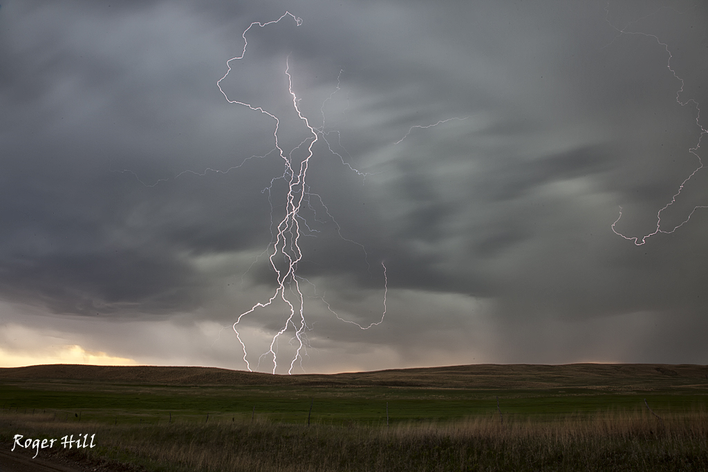
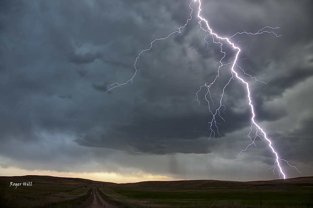
June 4th Montana Stunning Supercell
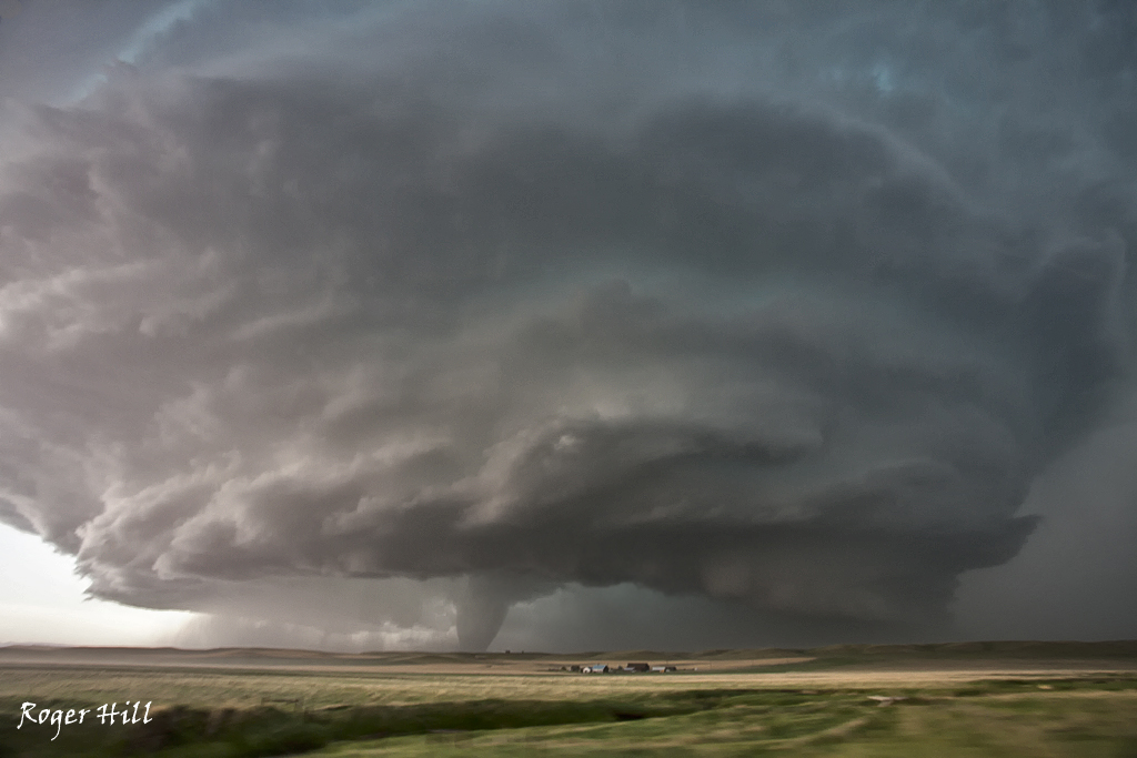
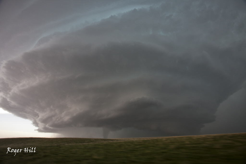
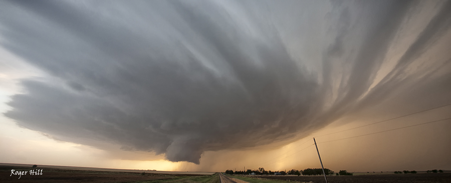
June 4th took us to central Montana. Great flow with a shortwave moving into the Pacific Northwest would help set the stage for storm formation. Ample shear, good instability and moisture, and convergence along the mountains southwest of Great Falls would allow storms for form by late afternoon. A tornado watch was issued for the area as storms formed and intensified near Helena. One supercell moved towards Great Falls and became quite photogenic as it moved northeast towards Ft Benson. This storm became tornado warned and also produced baseball sized hail. One of the prettiest supercells of the year!
May 29th Central Oklahoma Tornadic Supercell
May 29th, what else can be said. I have seen so many tornadoes in the past 20 years on this date. It is like the holy grail for tornadoes. This year would be no different either. We sat near Fairview, Ok watching a cluster of towers go up in a great environment. Good shear, good moisture, great instability and the triple point play. What could go wrong? A storm eventually emerged from the cluster of towers and became an intense supercell. We stayed in front of it from Okeene to Kingfisher and all the way to Yukon. The structure steadily got better and it became tornado warned near Kingfisher. Finally, with help from a left moving cell from the south, our storm produced a weak tornado north of the Yukon/Piedmont area. The best thing about this supercell was definitely its structure!
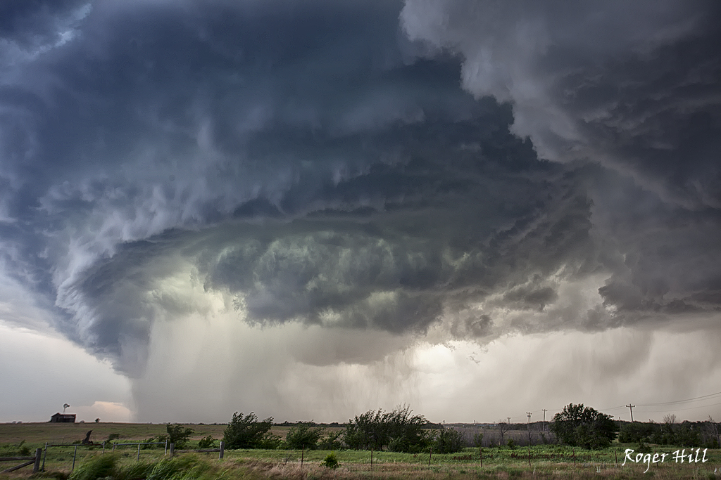
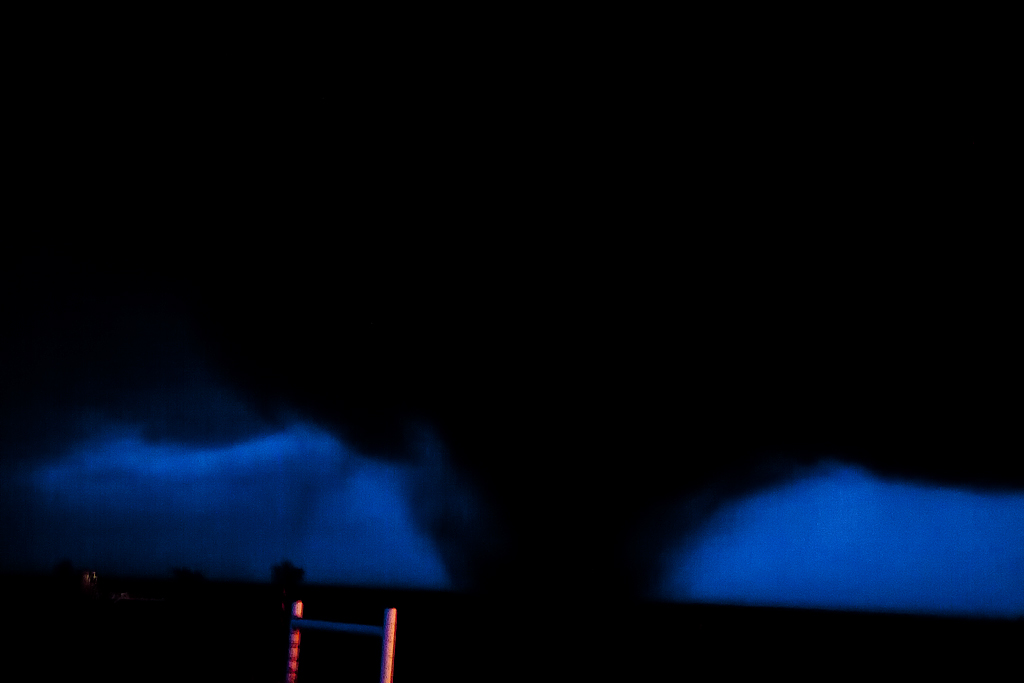
May 25th LaCrosse, Kansas Tornadoes
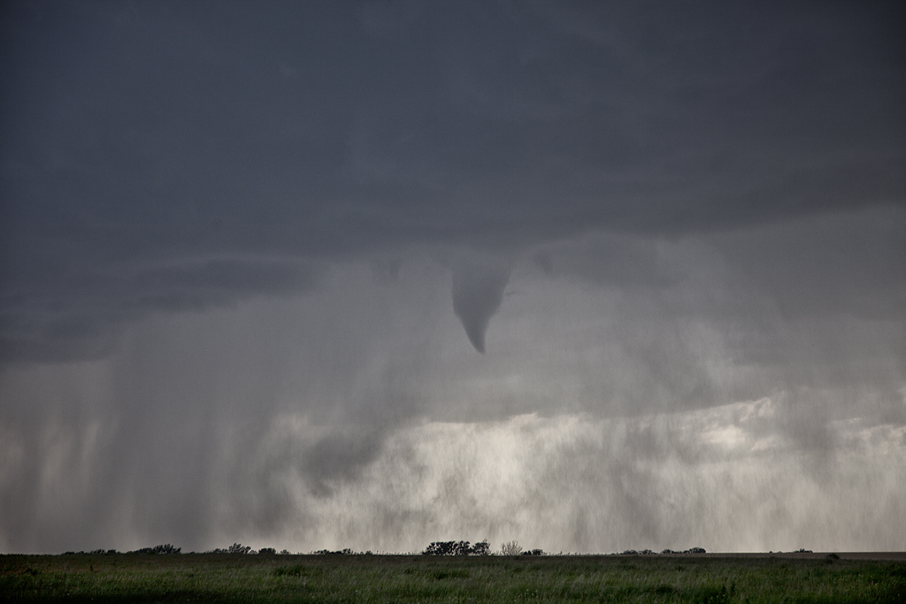
May 25th had tremendous potential. A warm front lay across central Kansas with a dryline intersecting it southwest of LaCrosse. By late afternoon, a supercell formed and moved along the warm front. It quickly became severe and tornado warned. Although reports of a tornado came in, we were directly under the circulation and only experienced RFD and TONS of dirt being kicked up. The storm moved northeast and became very high based and eventually died. By this time, we saw the tail end storm rapidly intensify and nearly anchor, so we blasted back southwest and arrived as the tail end supercell became intensely tornadic.
The structure was top notch with numerous inflow feeder bands wrapping around the north side of the updraft and a block shaped wall cloud with insane rising motion on the northeast side. I figured it was only a matter time before this storm produced and that was certainly an understatement. Just before dark and tapered cone tornado formed between LaCrosse and Hargrave and moved slowly east/northeast over the next 54 minutes! Frequent lightning constantly illuminated the tornado and allowed for some pretty decent photography. The tornado roped out northeast of LaCrosse where another tornado formed from the new mesocyclone. At one time there were actually 3 tornadoes on the ground, with the 3rd to our south actually going through LaCrosse. Fortunately no serious injuries or fatalities occurred from this tornadic supercell.
May 19th Southern Kansas Tornadofest
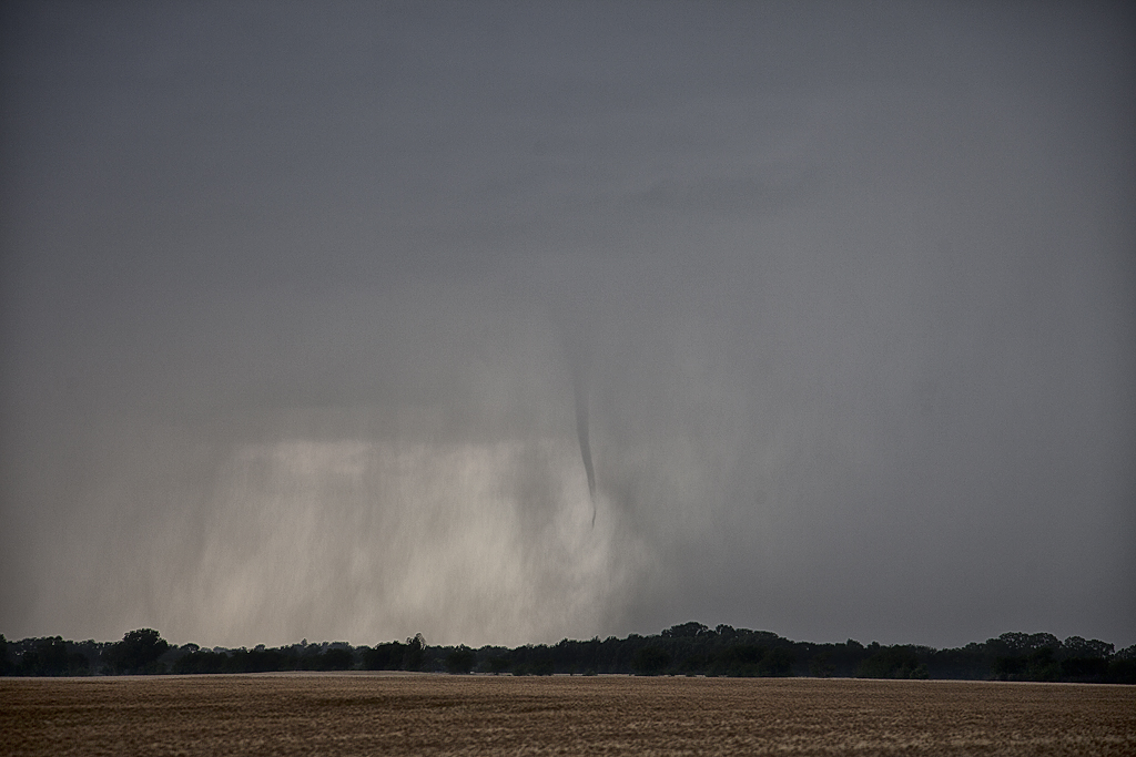
May 19th had some decent hopes of structured supercells. SPC highlighted the southern Nebraska area for higher tornado threat, but we chose to play further south along the dryline. Late afternoon, a line of towers rapidly formed and back built south as the boundary drifted southeast. A couple of these storms exhibited supercellular features, but it wouldn’t be until late afternoon that the boundary rapidly built south with each tower stretching the vorticity along the boundary and producing numerous non-supercell tornadoes. What a crazy day! We saw 5 tornadoes, with the final one being a strong EF3.
May 18th Nebraska High Based Supercell
May 18th continued the trend of decent shear and little low level moisture. We started the day in southwest South Dakota and drifted southeast towards central Nebraska. By the end of the day we would have a high based supercell, which was severe warned, that produced copious amounts of CG strikes, many quite photogenic.
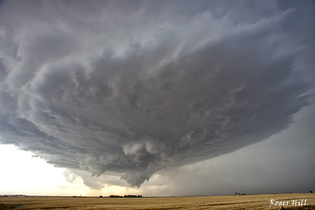
May 4th Oklahoma Supercell
After a long break in the action, May 4th provided a high based supercell with decent structure near Walters, OK. This storm produced hail baseball sized and maintained a nice striated appearance for a couple hours before dissipating. I don’t have a lot of shots from it due to a malfunctioning CF card. Here’s the two I was able to grab.
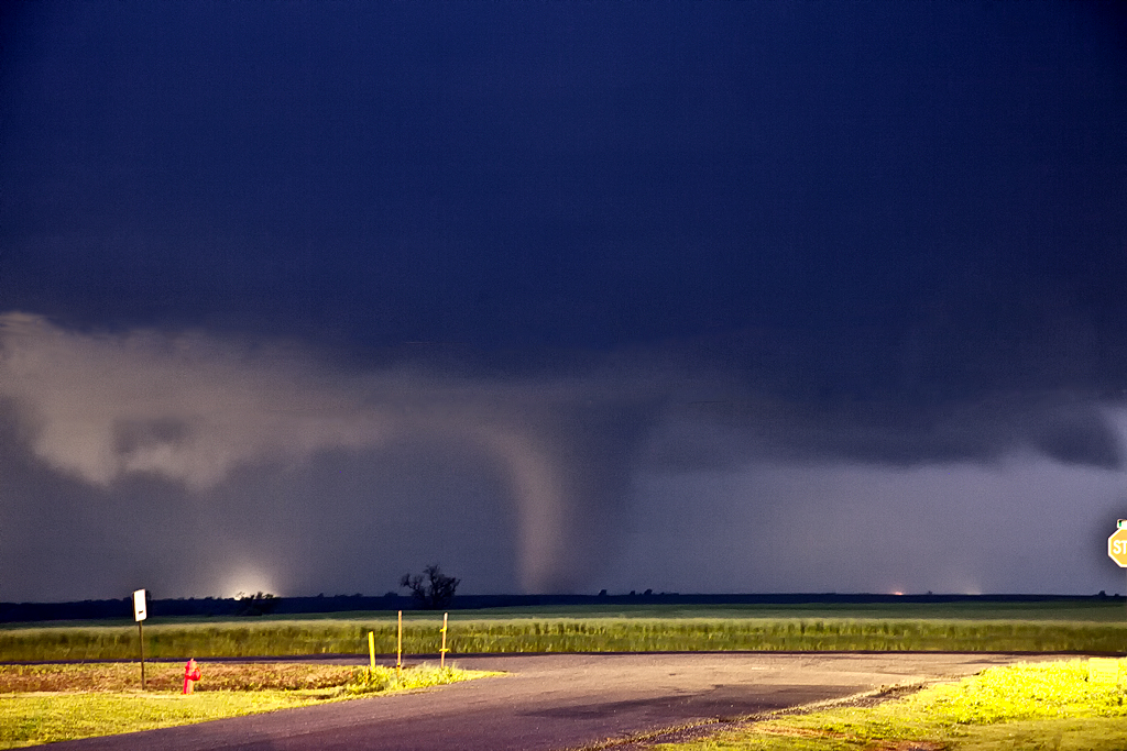
April 14th Kansas/Oklahoma Tornadoes
April 14th was a day that held great promise of long track violent tornadoes. SPC issued a High Risk for the area. We decided that we’d play the dryline down wind to allow storms to intensify as the raced at 50-60 mph towards us. The ultimate goal was to end up in northwest Oklahoma by mid afternoon, by dropping south with each storm until we got to within an hour of initiation point. Only thing is, nature would have the last laugh with us. We captured a tornado warned storm near Macksville that was racing towards Salina. When we saw it, it had weakened considerably, so we let it go. This would be the storm that RE-INTENSIFIED and produced several photogenic strong tornadoes near Salina. So, we dropped further south to a pair of tornado warned supercells heading towards Kingman. First one weakened as well, but briefly intensified and produced a short lived truncated elephant trunk shaped tornado. The second supercell pulsed up and down and produced two brief tornadoes not far from Pretty Prairie. Finally, seeing the storm of the day develop and immediately start producing tornadoes east of Woodward, we blasted south and made Manchester, OK right at dark. A very strong cone, then wedge formed and passed within 400 yards of us and raced into southern Kansas. We stayed with the storm, crossing multiple damage paths and witnessing several more tornadoes before we couldn’t stay up with it as it approached Wichita. This storm would produce anywhere from 15-20 tornadoes along its path from Woodward to northeast of El Dorado. Here’s a few pics from the day, overall a great deal of tornadoes intercepted, but what could have been in daylight for us, just wasn’t meant to be.
March 29th Rockport, MO Tornado Warned Supercell
March 29th took us on a long drive to northwest Missouri. A warm front would be the focus for supercell storms and by mid afternoon SPC issued a tornado watch box for the area. Three storms developed along the boundary and we followed the southern one as it interacted with it and crossed the river into northwest Missouri. It soon became tornado warned. Structure on the storm was very nice, exhibiting classic supercell features. Another storm (followed by an explosion of storms mid evening) developed south of Tarkio, MO. It produced a couple quick spin ups, but none lasting more than a half minute. A bit later it became more organized and reminded me of the April 9, 2011 Mapleton, IA supercell after dark. It came extremely close to producing a tornado as a nice cone shaped funnel developed, but quickly dissipated as it was undercut by cold outflow from storms further north. All in all a fun chase, even without a tornado.
March 18th Crowell, TX Tornado Warned Supercell
March 18th wasn’t a very clear day to me. We knew we had to hit the dryline in northwest Texas/southwest Oklahoma. The first cell of the day developed southwest of Childress and quickly became severe. As we approached it, the base was insanely high. It weakened as it crossed into southwest Oklahoma, where later that evening, it would spawn at least 3 tornadoes. We weren’t there. Instead we dropped south to the tail end storm, now southwest of Crowell, TX. This cell had great structure, produced baseball sized hail, a couple of funnels and tried very hard to produce a legit tornado. It just couldn’t do it. It later shriveled up into a photogenic LP supercell. Analysis showed that the 850 MB winds were weak during its lifetime, and then increased significantly by early evening when it died, and the original high based storm lowered and interacted with the increasing low level shear and produced its tornadoes. If I had to do it all over again, we still would have chosen the storm we did.