
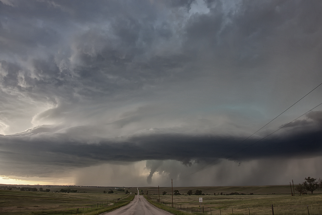
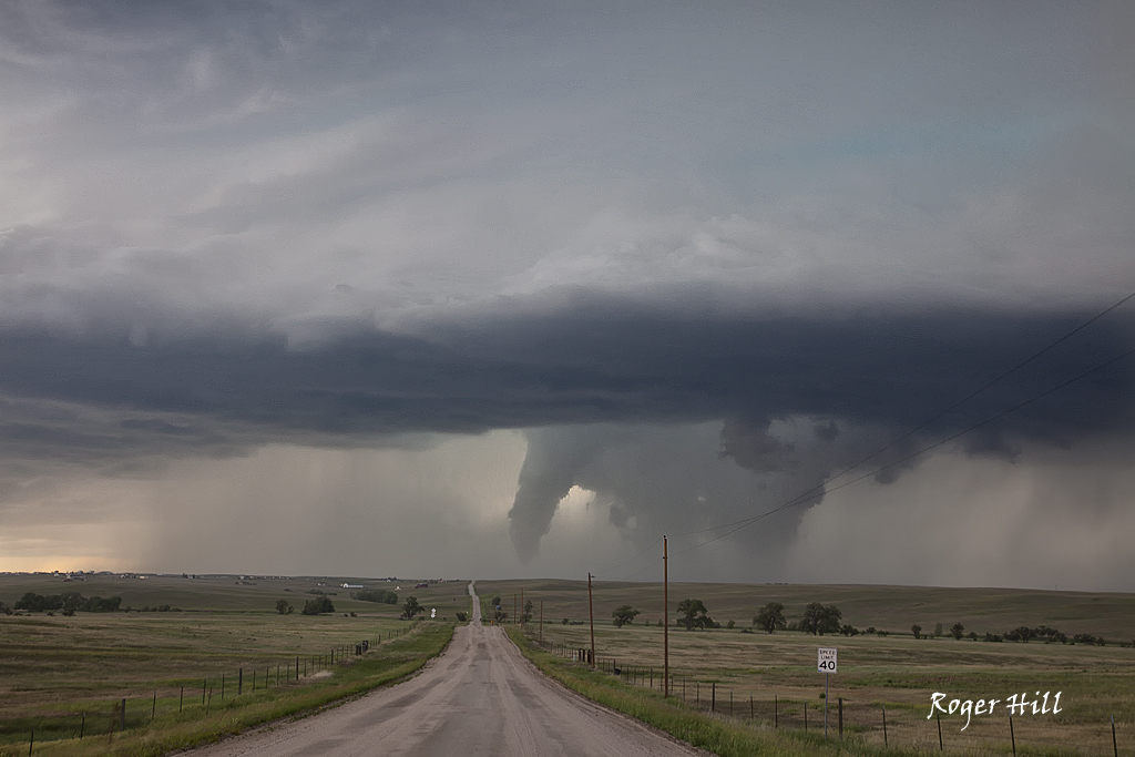
June 6th Elizabeth, CO Tornadic Supercell
June 6th was an interesting day. I didn’t feel all the ingredients were present to the extend needed for strong supercells. Moisture was a bit marginal with temp/dew point spreads near 25 degrees. By late afternoon, the Palmer Divide lit up. An intense supercell eventually formed northeast of Elizabeth. This storm was nearly anchored in the upslope flow and produced copious amounts of hail to baseball size and nearly a half foot of rain. As it back built to the southwest, just northeast of Elizabeth it produced a substantial cone/elephant trunk tornado that was on the ground for 10 minutes. Fun storm to watch and even better when the tornado stays in open terrain and does not cause much damage.
No comments yet.