
June 11th, 2001 Benson, MN Tornadoes
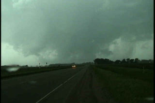
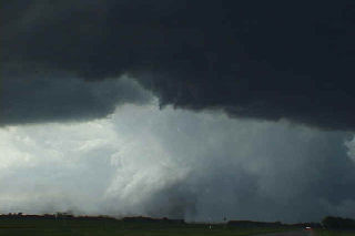
This day was one of my all time favorites. An incredible set up with a warm front lifting northward through southern Minnesota, an approaching short wave and developing cyclone in northeast South Dakota set the stage for explosive thunderstorm development. The day started in Granite Falls, MN under cloudy skies with elevated convection. The morning convection soon cleared and left us with southeast winds at 35 mph with a temp of 90 and a dewpoint of 72!!! WOW!!! All things were pointing to the area northeast of Watertown, SD as the hot spot. Winds were backed wonderfully, but the atmosphere was strongly capped. Shortly after 2 PM, the first surface based tower exploded after several hours of excellent convergence, into a strong supercell that within an hour, produced the Benson tornadoes. This supercell was on the wet side of classic, but morphed into an intense HP storm. By the time it approached the twin cities, we left it for the night. Please check out the photos below, as some are breathtaking!!!
No comments yet.