
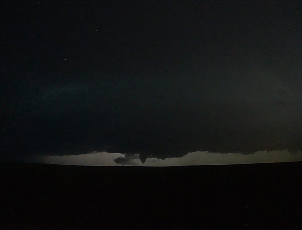
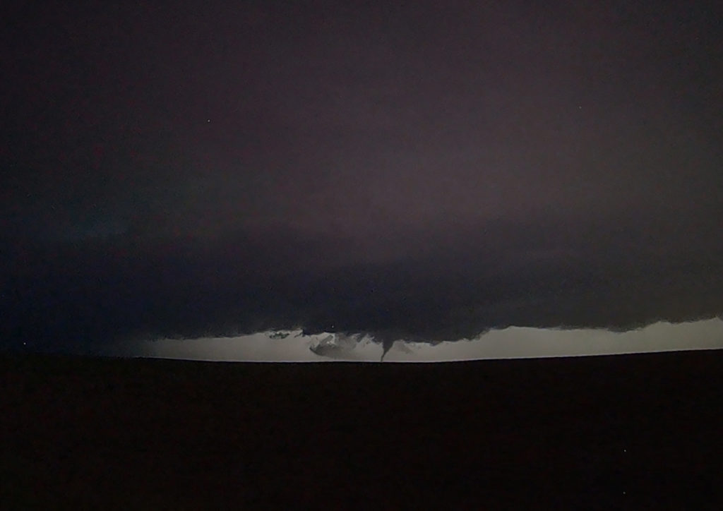
June 12th Central South Dakota Tornadic Supercell
June 12th was a great day for the tours! We intercepted several storms, of which two became strong supercells. Good lift along a boundary, moderate moisture and strong instability as well as shear, would provide the needed ingredients to get these storms firing up. A cluster moved into west central South Dakota and eventually the southern most storm, referred to as “Tail End Charlie” took over the show. The southernmost storm typically gets the best feed of air and usually becomes the most intense. As it moved towards Phillip, South Dakota, it became a strongly rotating supercell. We encountered the south side of the hook as we moved east from town and had winds of 70 mph plus and tennisball hail. Out towards Midland, it took a hard right and become a beast of a storm! Near the I-90 corridor, the storm was an insanely electrified beauty of a mothership! As we watched in the night, you could see a funnel form and touch down. It was later confirmed by the NWS as a tornado. There are a couple video stills in the images below. After a few hours chasing these storms, the lined out so we let them go at midnight and headed to our hotel in Pierre. Enjoy the pics!
No comments yet.