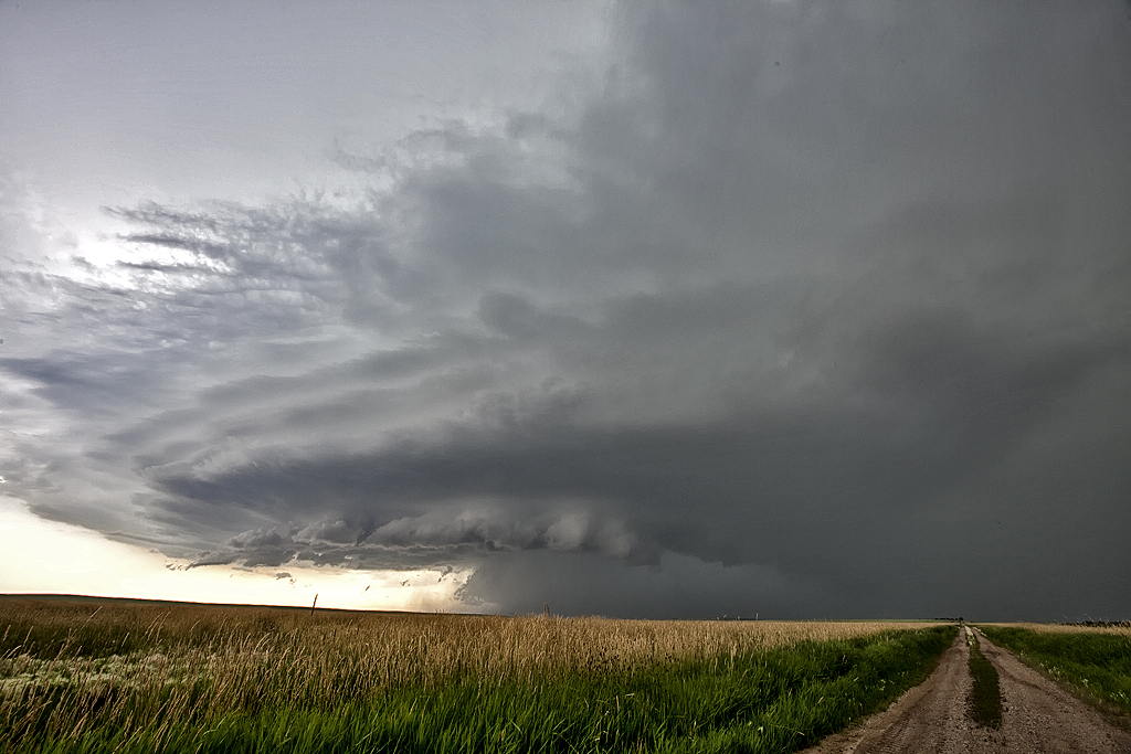
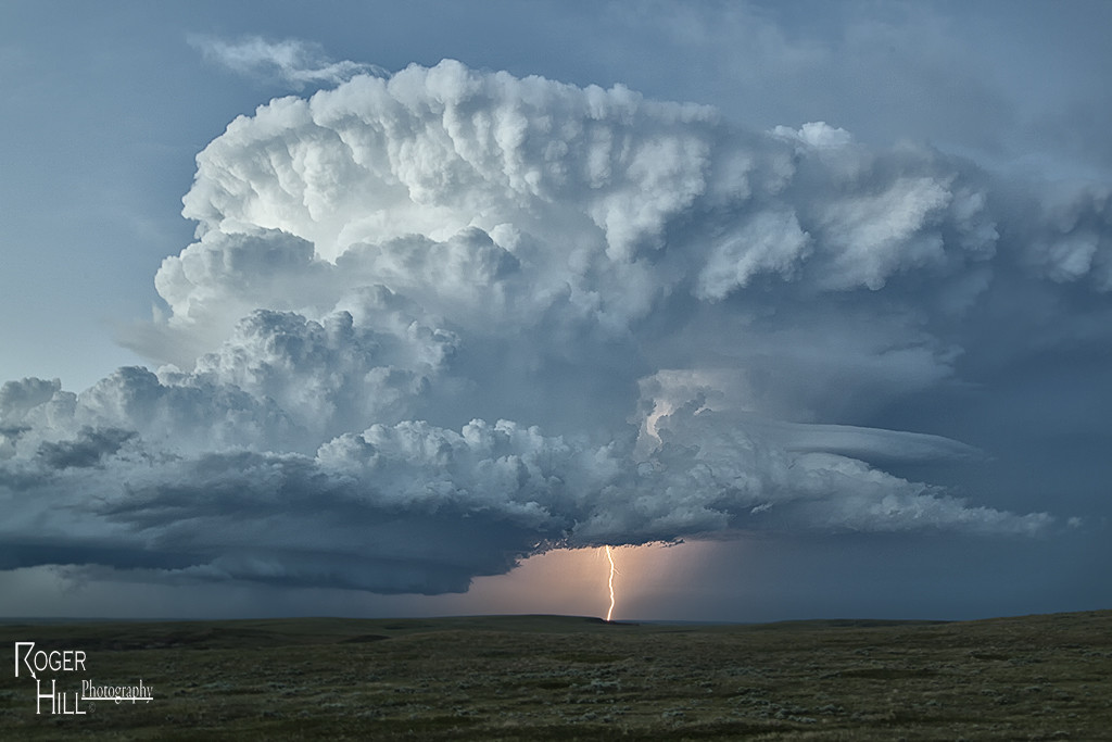
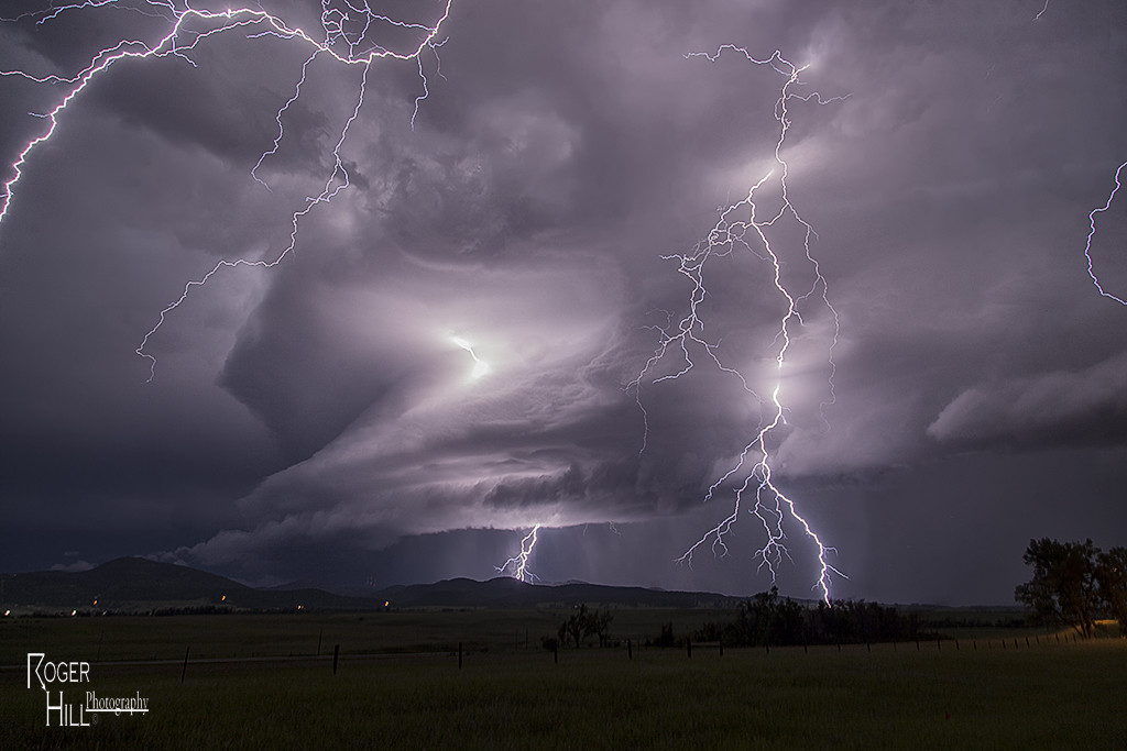
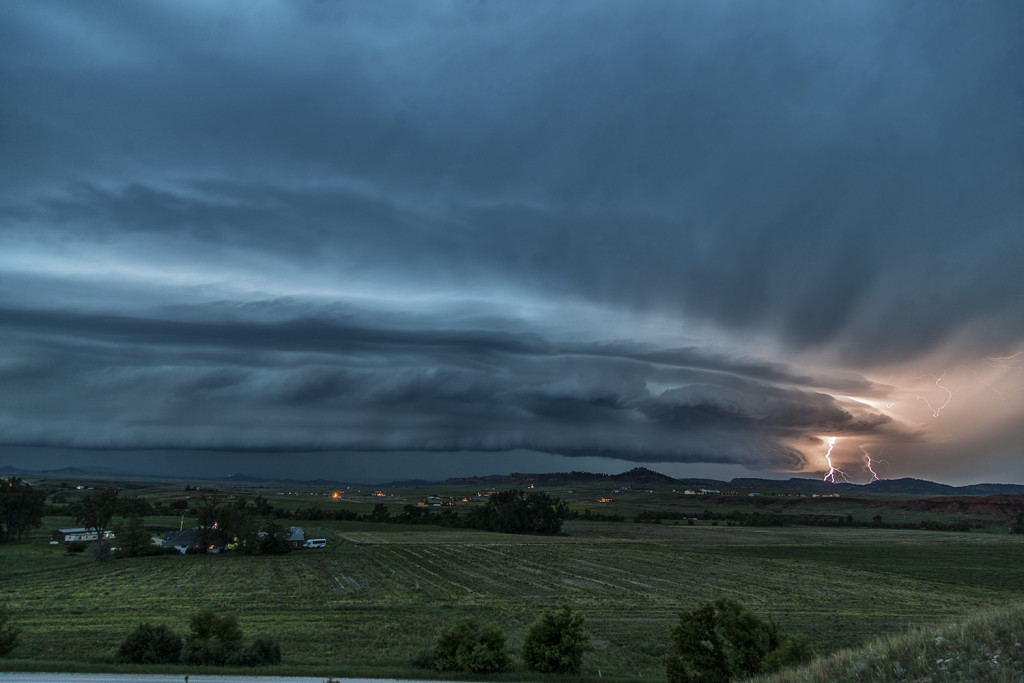
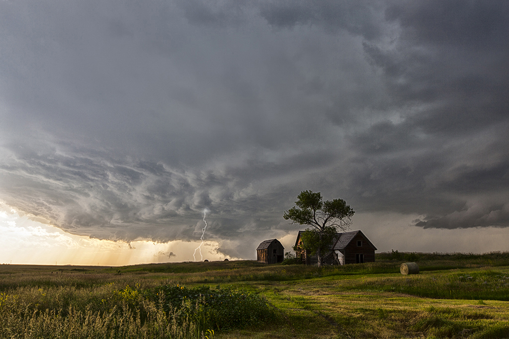
July 17th had incredible potential across the Dakotas. Our Great North Tornado Hunt tour was in place in far northeastern South Dakota awaiting initiation. A subtle short wave trough was moving across the region at peak heating, while 5000 CAPE values developed along with upper 70 dew point readings. An approaching cold front/dryline triple point would spark the first supercells, and then later the cold front would spark several more. We witnessed on such storm develop near Britton, SD which had incredible structure, huge hail to baseball size and a couple funnel clouds. Later another supercell formed near Eden, SD and dropped a tornado southeast of town. We stayed with the storms into western Minnesota where they weakened as they moved out of the strong instability. We finally dropped south towards Watertown, SD for the night as a really pretty shelf cloud approached town. A great day for the Great North tour, and it would be the first of several excellent set ups we had on this tour!
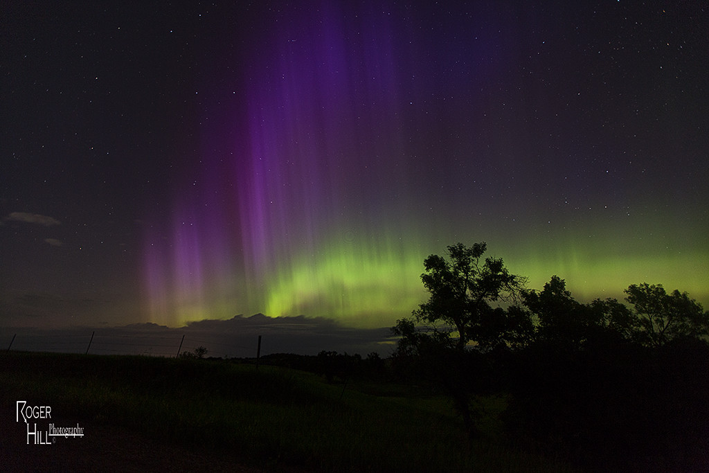
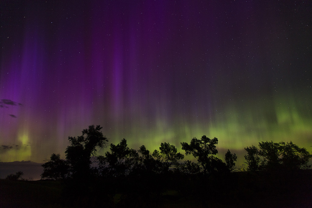
June 22nd Aurora Borealis
Although earthly weather was quiet on June 22nd, a CME that hit the earth that day sparked an amazing aurora display that night. We were in the Spearfish, SD area as darkness fell and the skies lit up in green and purple pillars as the intensifying aurora became visible. We spent a couple hours at night photographing this incredible event! Much fun for all the guests who ventured out with us at night to witness space weather at it’s finest!
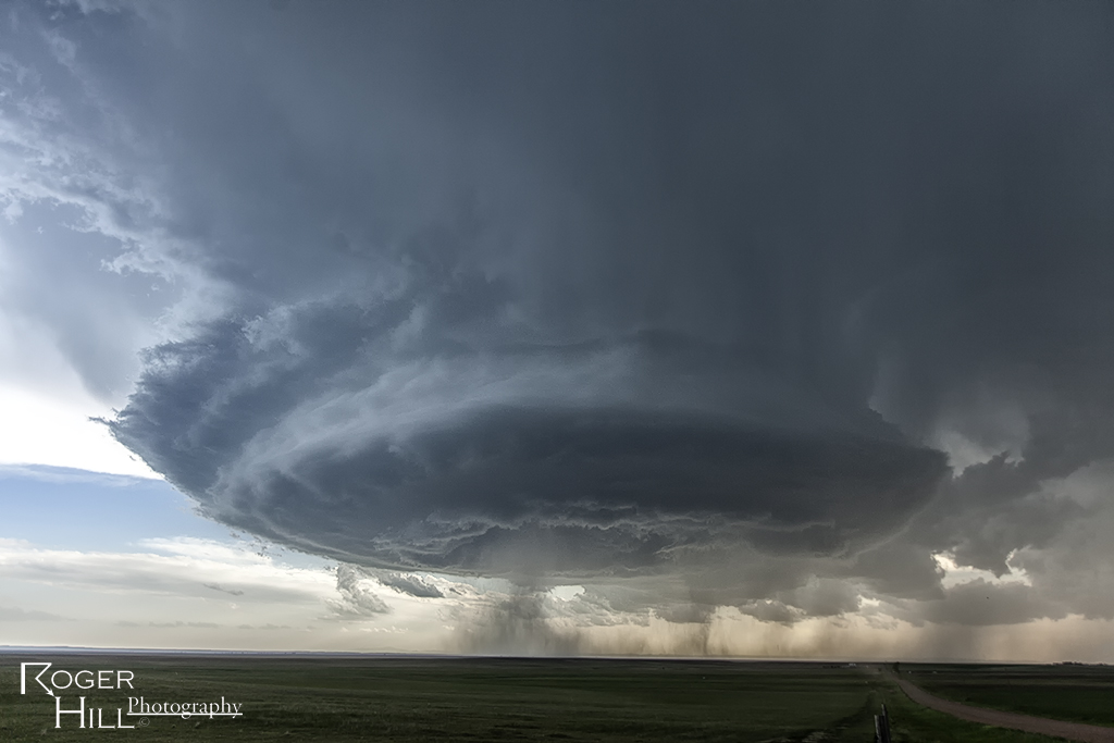
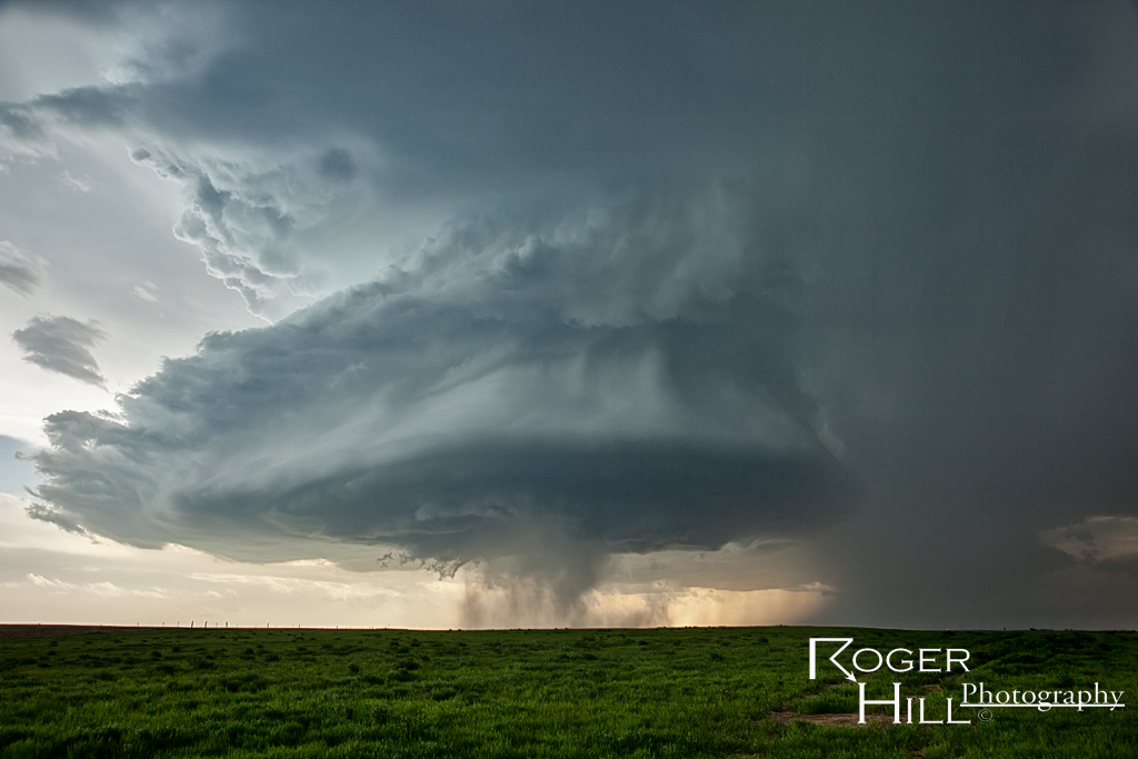
June 21st South Dakota Tornado Outbreak
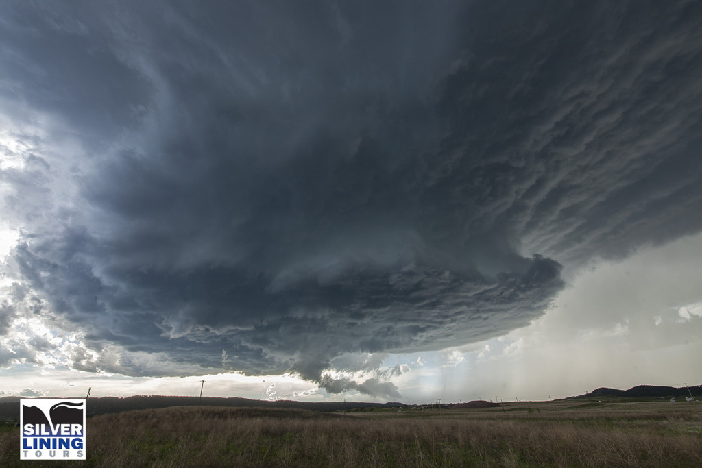
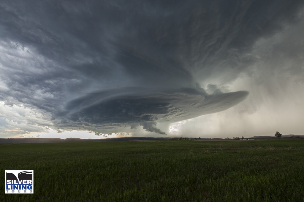
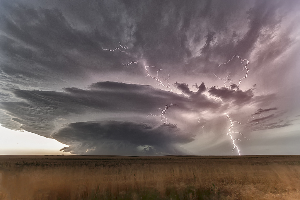
June 21st was a day that had great potential. Very good shear, moisture and instability were in place across the high plains into the western Dakotas. An approaching shortwave trough would provide the necessary lift to spark intense supercells in southeastern Montana. One particular supercell formed near Baker, Montana and cycled several times as it entered northwest South Dakota. This storm would be responsible for a half dozen tornadoes we witnessed across northern South Dakota. The first tornado occurred as the storm really ramped up near Ralph, South Dakota. It would cycle several times and keep producing tornadoes all the way to near Eagle Butte where it dissipated late evening. The structure was some of the best of the season and several tornadoes were quite photogenic! Tour 8 scored big with this gorgeous beast!
June 17th East Central Wyoming Tornado Warned Supercell
June 17th had a short wave trough moving across the northern high plains. Decent moisture and instability was in place to fuel significant storms. However a capping inversion kept storms from forming until late in the day. A storm complex moved out of Montana into eastern Wyoming, and it was this complex that developed significant rotation as a storm in front of the line became absorbed into it and caused it to rotate rapidly. A tornado warning was issued for the western Black Hills as the storm approached Beaulah and into the Spearfish area. The structure as dusk was quite nice and the lightning was amazing! One of the best lightning displays all season so far!
June 1st South Dakota Supercell
For Tour #5 and Photo Tour #2, June 1st took us to the Black Hills area of South Dakota. Good upslope flow coupled with high CAPE values, would produce a very nice supercell storm that anchored itself to the east side of the Black Hills. This storm spun nicely, even tried to produce a tornado, but didn’t quite have enough low level shear to become tornadic. It did,, however, produce tons of very large and damaging hail to baseball size south of Sturgis. The storm persisted for several hours before decreasing in intensity just before dark. Both tours had a very nice treat on this day, and along with great structure, the storm produced some incredible lightning!
July 22, 2014 – South Dakota Beautiful Supercell
As if often the case on this particular tour, storm structure and quality was amazing this day. We started in Rapid City and spent the entire day with one supercell that formed early afternoon. This storm rolled over the Black Hills and turned due south into northwest Nebraska where it became tornado warned. It did not produce a tornado, but the structure was simply a photographers delight! It produced very large hail and an incredible amount of lightning. This was our last tour day of 2014, and a fantastic way to finish the season!
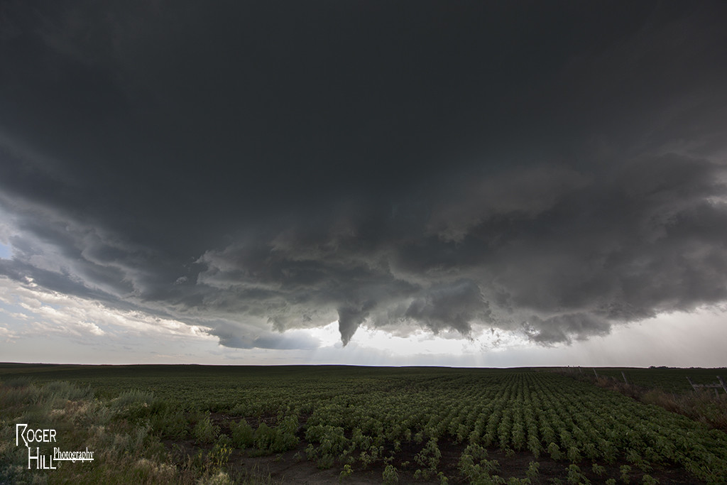
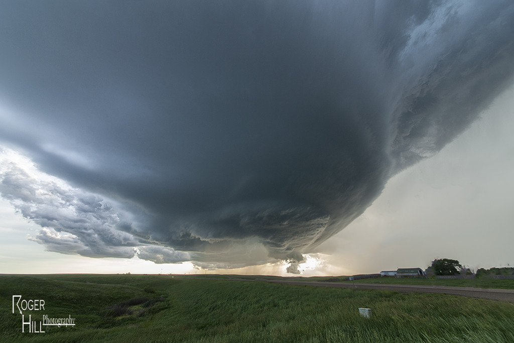
June 18, 2014 Central South Dakota Tornado Outbreak
June 18th was an incredible day in South Dakota! Superb moisture, instability and shear was moving northwest from Nebraska and pooled along a cold front. By mid afternoon numerous storms formed along the boundary and merged into a squall line. This was a bit disheartening to see, but we stayed with the tail end and eventually, as the better shear arrived, supercells formed and produced at least 8 tornadoes we witnessed including a couple of strong tornadoes near Wessington Springs, SD. These storms were amazingly electrified and had great structure as well. We had two different times when we had 2 tornadoes on the ground together. The final set of twins were the last two tornadoes of the event and very photogenic. What an amazing 3 day period we had, were we witnessed nearly 15 tornadoes!
May 25th Western South Dakota Supercells
Decent upslope flow into the Black Hills, along with good moisture and moderate shear, would set the stage for several supercells to develop and move east from the Rapid City area. Structure was quite nice with each of these storms as they spun across the countryside north of I-90. One storm tried hard to become tornadic, while the rest were quite prolific hail producers.
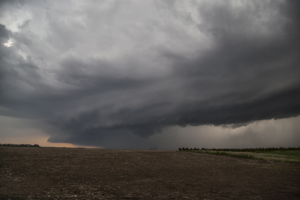
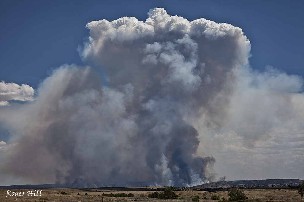
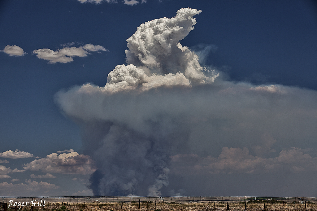
July 16th/17th SD Supercell/WY Fire
July 16th took us to central South Dakota for a marginal set up. Decent flow aloft, limited moisture and decent instability allowed a cluster of storms to form. The tail end storm became a gorgeous supercell and was very electrified. The next day on the way back to Denver, we passed the Sawmill Canyon, Wyoming fire. It was raging out of control and had consumed 13,000 acres.
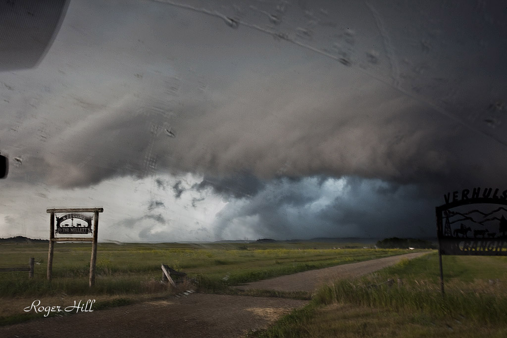
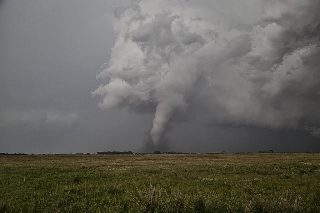
July 18th, 2011 South Dakota Tornado
July 18th would be my last chase day for the month. We started the day in Bismark, ND. By early afternoon a boundary would set up over northern South Dakota. A tornadic supercell formed along this boundary southwest of Reva and anchored itself there for about an hour. We quickly went west and south on the Enchanted Highway and caught up to it in time to watch a substantial tornado. This supercell was fairly HP, but gave us a nice show with a moderately visible cone tornado. As it roped out, a new core on the south side of the supercell, pushed the tornado east as it became pretty visible. Most of the duration of the 12-14 minute tornado, it was poorly contrasted. Fortunately it occurred in a area that has little to no population. This storm was also highly electrified with numerous very close and intense CGs occurring.