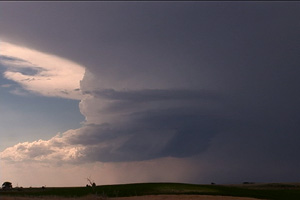
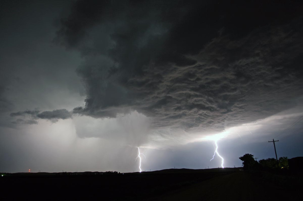
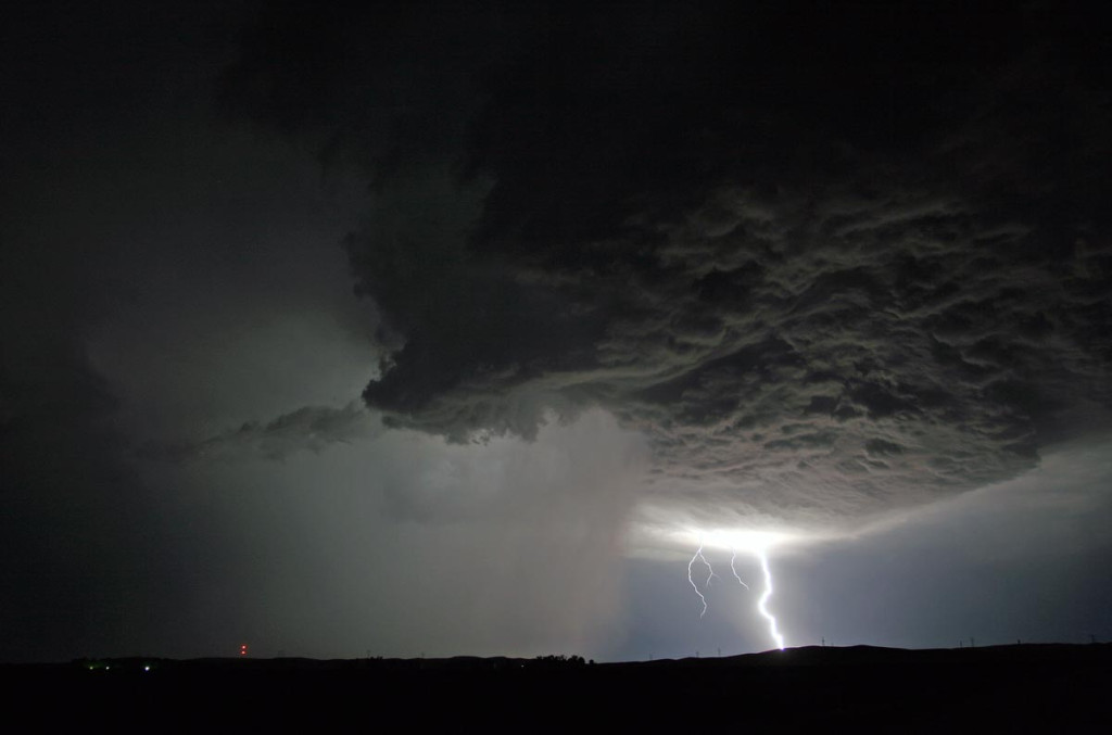
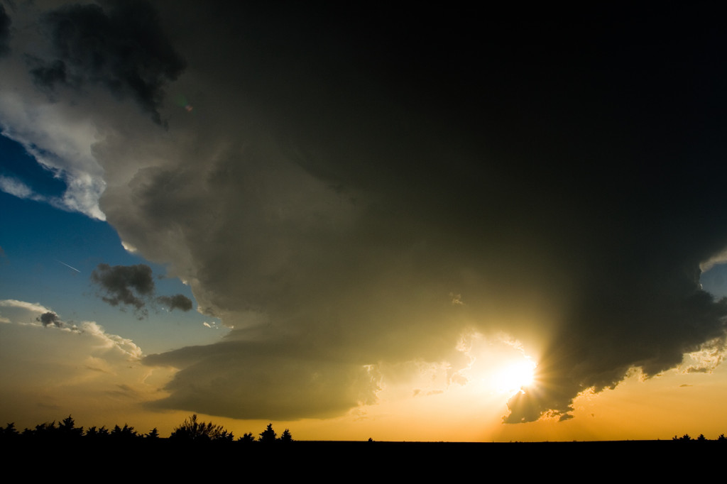
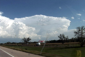
I didn’t have a lot of hope for this day. Limited moisture and CAPE, along with respectable shear, I thought would result in high based storms, producing marginal hail. I did not expect a tornado warned higher based supercell to form and become one of the prettiest storms of the young season thus far. We started with trashy storms near Scottsbluff and watched as this storm developed amidst the piles of crappy cumulus towers associated with those storms. We finally let it pummel s with golfball sized hail near Chappell, NE.
May 29th, 2008 Nebraska and Kansas Tornadofest
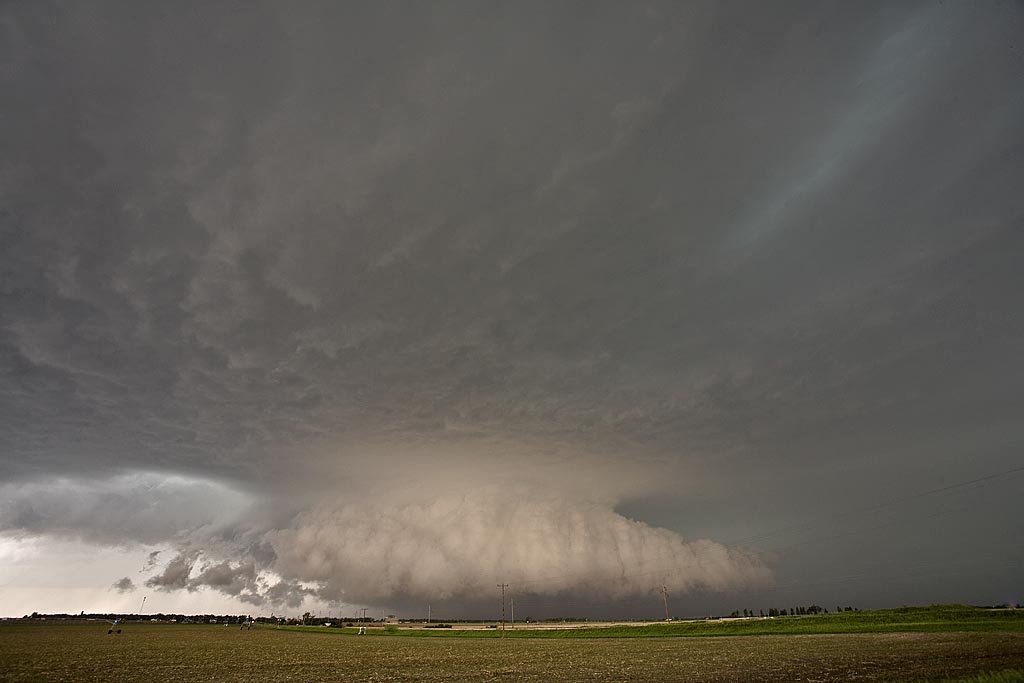
May 29th was advertised as a High Risk from the Storm Prediction Center. It seemed all ingredients were in place for a significant severe weather event, including strong to violent tornadoes. We decided to play the warm front along the KS/NE border area and as far west as we could. The first supercell of the day formed north of Mc Cook and became tornado warned almost instantly. It produced the Kearney, Nebraska tornado that caused significant damage. We followed the storm to east of Kearney when it became totally rain choked. We then dropped south into north central Kansas and caught the cyclic tornadic supercell from Tipton, Kansas, northeast towards Jewell, Kansas. The storm was a sight to behold!
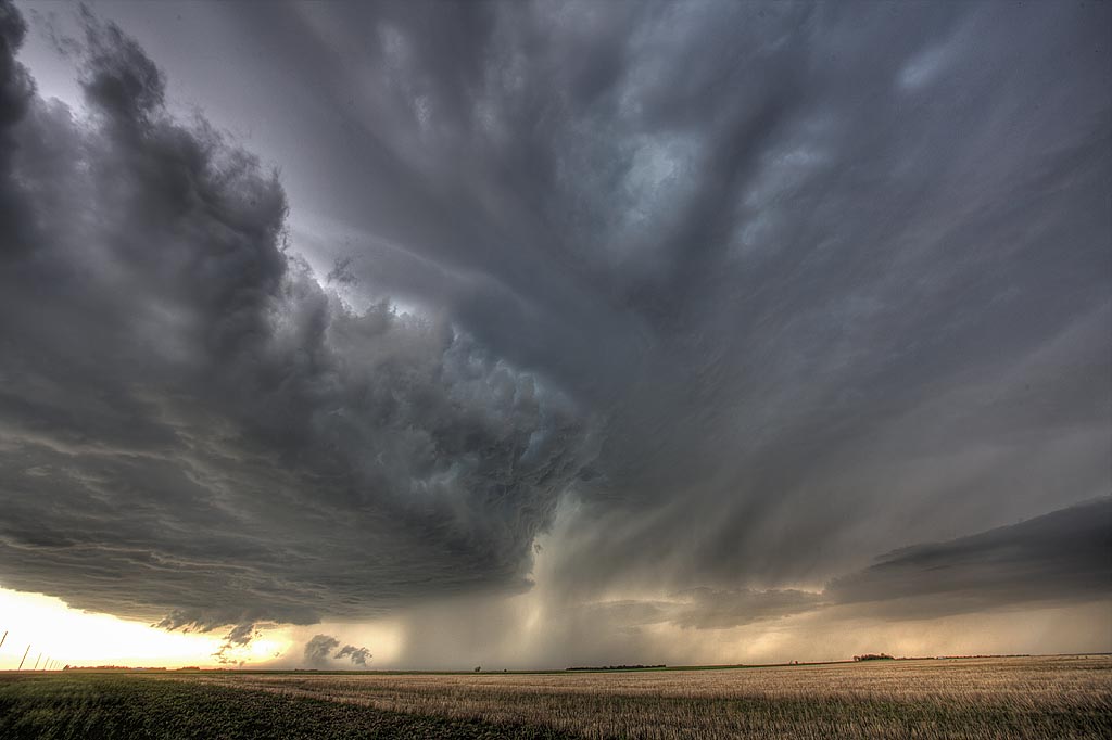
September 6th, 2007 South Central Nebraska Supercell
Good shear, great moisture and instability, and a boundary would set the stage for severe storms in Nebraska September 6th. I headed out to my target of Lexington, NE and arrived by mid afternoon. Cells tried and tried to form, each time getting choked by the cap. Finally early evening, several supercells formed. The storm shown above was tornado warned and at times ther appeared to be funnels back in the notch of this HP. One time a cone shaped funnel extended halfway to the ground, but I could not confirm any tornadic touchdown. We did encounter hail golfball size with this activity.
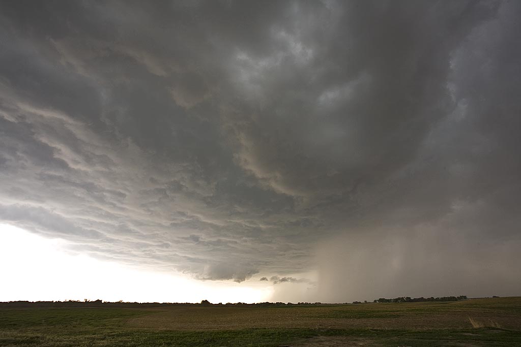
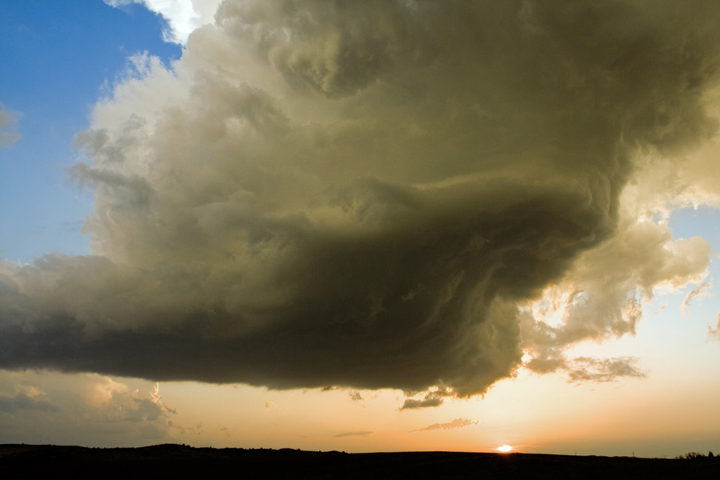
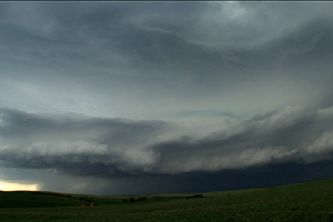
August 14th, 2007 Southwest Nebraska Supercells
August 14th was a day that I was hoping would provide for a great nighttime lightning opportunity. A short wave was timed so that intense thunderstorm development would occur during the early evening. I was not disappointed. Great moisture and instability would couple with lift along a stationary boundary to provide intense supercell thunderstorms. The storm pictured here produced golfball sized hail, 75 MPH winds and two funnel clouds that I saw.
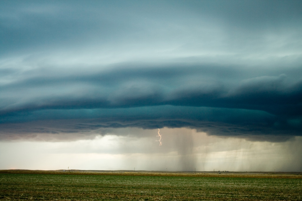
June 21st, 2007 South Dakota and Nebraska Supercells
It is a rare occasion that you get woken up at 6 AM with a TORNADO WARNED supercell out your window! June 21st was one of those days! A cluster of supercells developed overnight and moved southeast across south central South Dakota. We intercepted one near Kimball, SD that produced 4.25 diameter hail! Later that day, an old boundary would provide the lift and convergence to develop the best storm of the day, that also produced hail to 3.5″ in diameter!
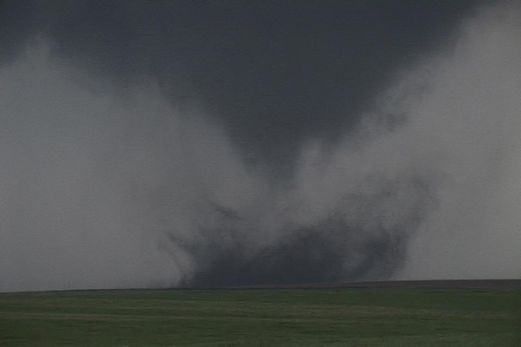
April 20, 2007 Moorefield, Nebraska Tornadic Supercell
Since April 20th was my birthday and there was a respectable chance for severe storms, Caryn and I headed out on i-76 towards Imperial, Nebraska to play the strong upslope flow with good shear, but marginal moisture. Dewpoints were expected to increase as the evening progressed, but what we ended up with was much more than I had planned on! A couple of LPish type storms developed around 6 PM and then just before dark, a tornadic beast emerged from the tail end of the complex and produced several tornadoes that caused considerable damage between Moorefield and Gothenburg.
March 23rd/24th, 2007 Eastern Colorado and Southwest Nebraska Storms
A strong closed low was to be the culprit for sever weather across Colorado and Nebraska on March 23rd and 24th. the most intense storms and tornadic supercells developed over eastern New Mexico, while Colorado just didn’t have enough deep moisture to get intense storms to form. Marginal supercell structures formed and were quite photogenic. On the 24th, poor lapse rates and marginal moisture would spell doom for what appeared on paper to be a decent set up. A couple of tornado occurred in northeast Colorado on Saturday, with a possible brief tornado near Hayes Center, Nebraska.
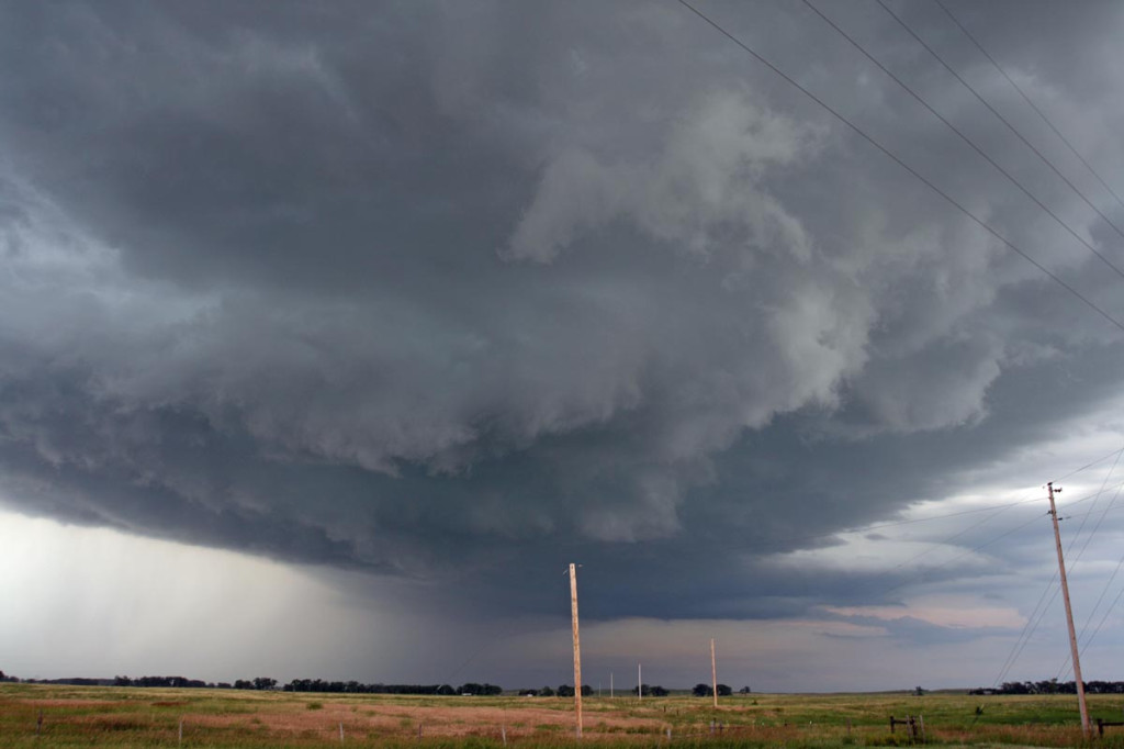
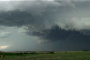
September 15th, 2006 Nebraska Tornadic Supercell
September 15th was in my opinion a classic “day before the big day” scenario over south central Nebraska. Adequate shear and lift were available, but quality low level moisture return was the main problem. By later afternoon storms exploded near Holdridge. Several supercells would form and move quickly northeast at 40 MPH. One storm developed near Hastings and tracked northeast producing a 4 minute long tornado about 5 miles south of I-80. This storm also produced hail golfball to tennisball sized.
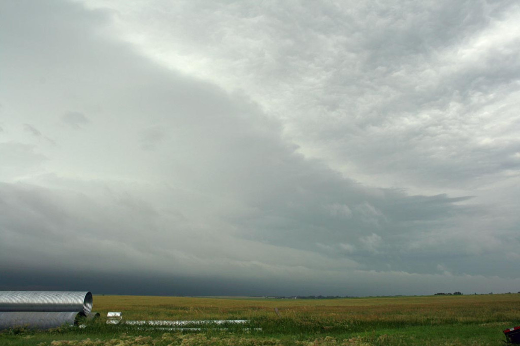
July 13th, 2006 Greeley, Nebraska Supercell
July 13th had a great set up potential for Nebraska. Strong shear, a nice boundary and mid 70s dewpoints would all come together and produce a nice supercell in north central Nebraska. I came from Grand Island north to catch it. SPC mesoanalysis page showed the best of the best conditions feeding into that storm! (I just couldn’t go for the elevated trashy crap heading towards OMA) I sat just south of Greeley to watch it before heading west towards Ord. I was looking west at it, and it had a nice soda can/bell shape to it. Nice structure, tried to produce, but just couldn’t. Typical 2006. The core had solid 1.5″ to 2″ diameter hail from it. I also encountered winds gusting to 82 MPH (measured!) not far from Greeley when it gusted out.
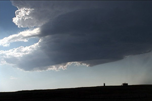
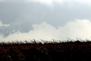
June 23rd, 2006 Northwest Nebraska Tornadic Supercell
June 23rd was a day that had promise for high based storms in western Nebraska. It lived up to its potential and more! We caught the first supercell of the day that formed northwest of Scottsbluff and was a nice LP storm. The second LP storm formed northeast of Torrington and had very nice structure. And finally the storm of the day formed west of the Black Hills in northeast Wyoming and tracked southeast into northwest Nebraska. This storm had beautiful HP supercell structure and produced a couple of short lived tornadoes, one of which is shown below.