Intercepted a few supercells west of and near Scottsbluff, Nebraska. Upslope flow combined with decent instability set the stage for supercell development. A cell merger near Scottsbluff that occurred on an outflow boundary allowed a messy mesocyclone to spin up and produce a fairly brief tornado that caused some damage to buildings, power lines, trees and flipped cars near Melbeta. We got very close to the circulation.
July 31, 2009 Kansas Tornadic Supercell
What a pleasant surprise this day was! I was hoping for a couple of high based supercells in western Kansas and certainly got much more than I hoped for! Several supercells developed from southwest Nebraska southward along a boundary in western Kansas. Caryn and I intercepted a tornadic storm just south of Gove that produced hail almost golfball sized as well as at least 2, possibly 3 tornadoes.
July 13, 2009 Valentine, Nebraska Amazing Supercell
July 13th was one of those days you don’t soon forget. A supercell formed near Rapid City, SD and tracked all the way southeast of Valentine, NE by late evening. It was a storm to behold! Beautiful structure, likely a couple tornadoes buried in rain and hail to baseball size was the story of this day. It was tornado warned for over 6 hours!
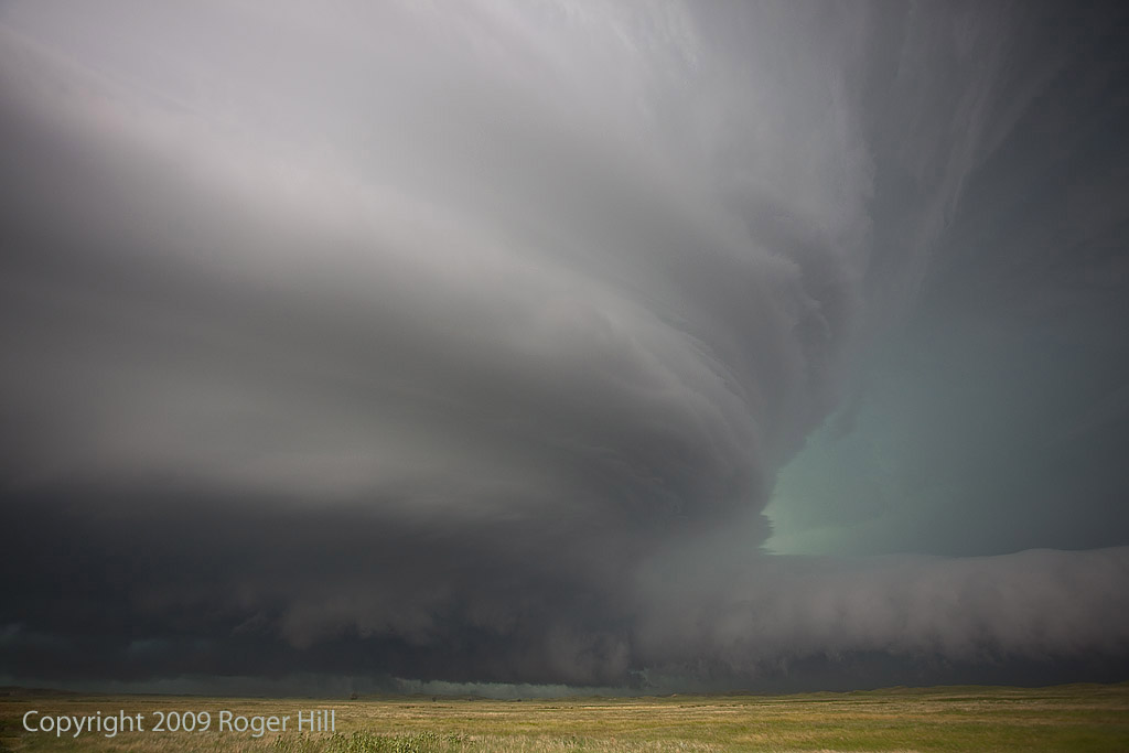
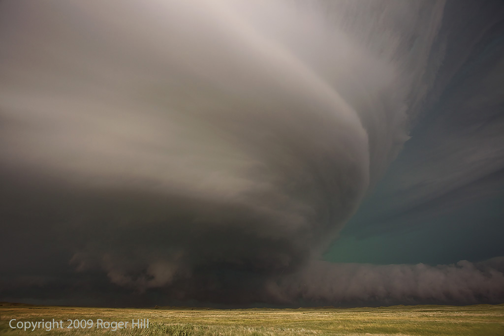
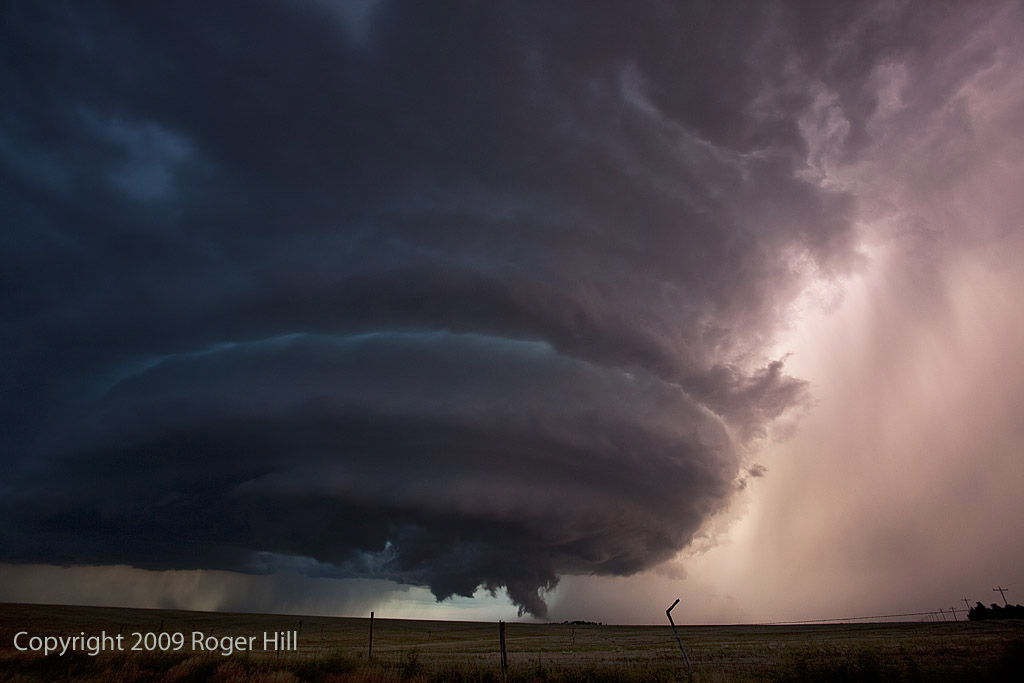
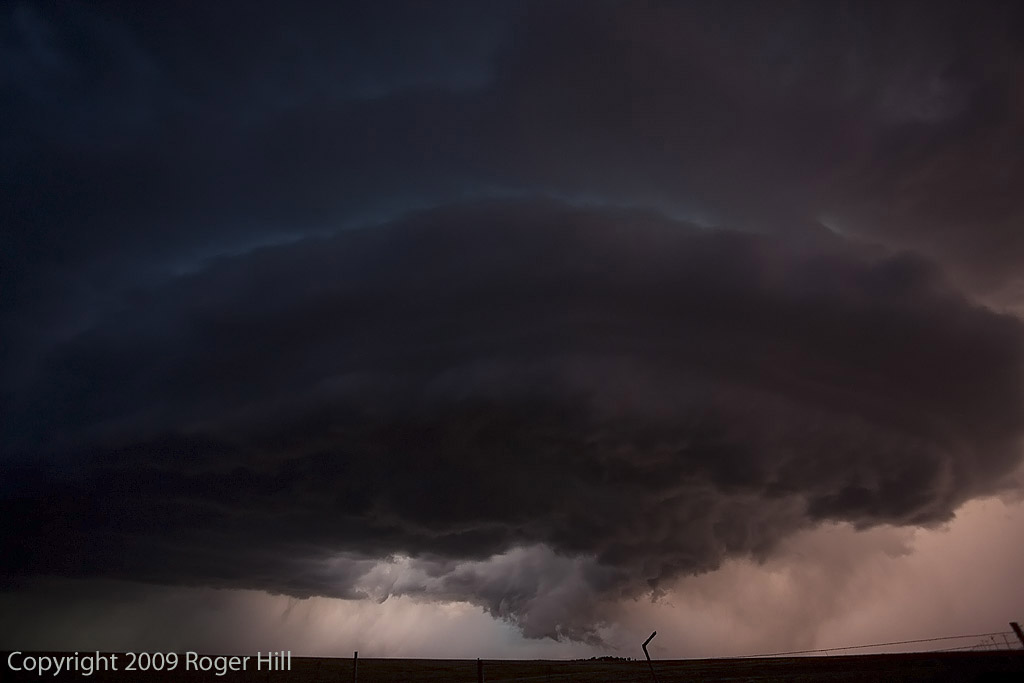
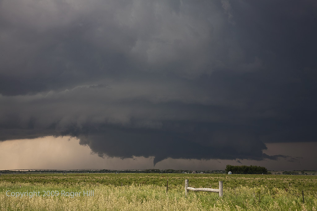
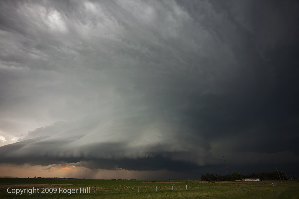
June 17, 2009 Central Nebraska Tornadoes
June 17th was certainly a day I will never forget. All parameters pointed to a triple point boundary in central Nebraska, just north of Kearney. By late afternoon, an intense tornadic supercell developed and tracked eastward through Grand Island and Aurora, producing a large and destructive tornado just west of Aurora. We would witness half dozen tornadoes this day, culminating with the Aurora, Nebraska monster. I only put photos up here and no video stills, thus only 2 tornadoes are in photos. Here is a wild 5 minute video from this event:
June 6, 2009 Nebraska Supercells
June 6th was an in between day for me and the tours, thus I couldn’t resist a highly sheared environment in western Nebraska. Caryn and I, along with a couple of guests, intercepted 2 beautifully structured and tornado warned supercells. The first near Thedford and the second near Hershey. The structure and electrification of the second storm was absolutely breath taking!
Late May 2009 Images
From mid through late May, nature did not cooperate with an active severe weather pattern. A large ridge of high pressure, along with a persistent gulf coastal frontal boundary would prevent decent moisture from returning to the plains states. When you operate a tour, you still have to find the little nuggets nature gives you. The pictures below are those nuggets from May 19 through 31st.
First 25 days of April, 2009
This is a collection of photos from storms I chased during the first 25 days of April. They are at various locations as shown with each photo’s caption.
August 11th through 17th, 2008 Colorado Storms
Over a several day period, severe storms developed over eastern Colorado and western Nebraska. I was able to chase several days. Decent upslope flow, along with fair moisture, instability and shear would allow for organized storms, including supercells to develop. The results of my chases during this time are shown below. Everyday, I was on a storm that had a tornado warning.
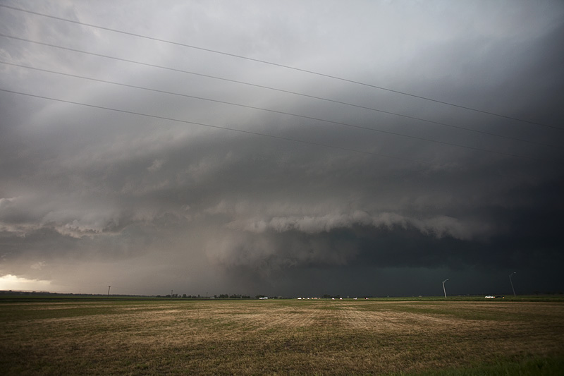
July 15th/16th Nebraska and South Dakota Tornado Warned Storms
July 15 and 16 took me to northern Nebraska and South Dakota to play storms along the dryline. Shear wasn’t expected to be very strong, but enough to help generate supercells, and to my surprise tornado warned supercells. July 15th took us to Nebraska where a large supercell developed west of O’Neill. This storm was fairly high based, but rotating nonetheless. It produced golfball sized hail and had very high winds once it lined out. July 16th took me to central South Dakota along the Missouri River where numerous severe storms formed near dark. Lightning was decent and the hail was large, also to golfball sized.
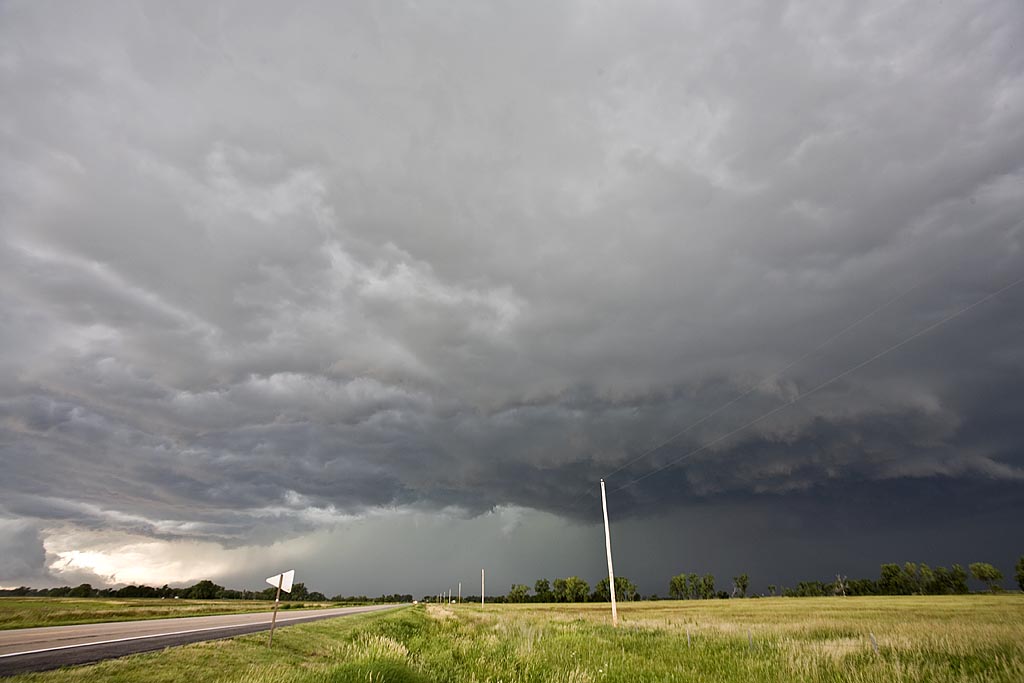
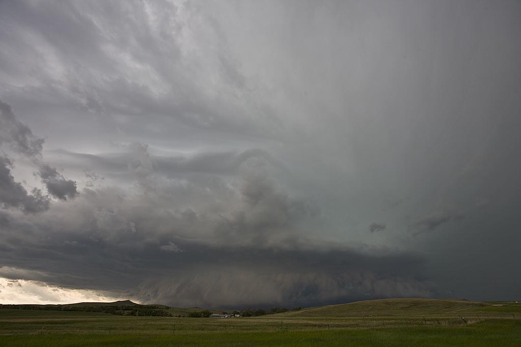
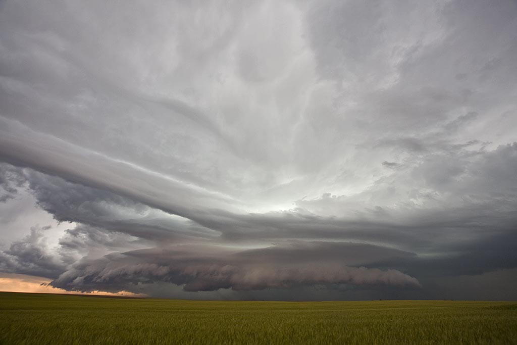
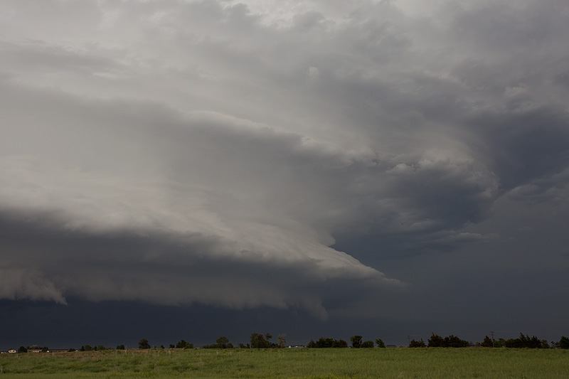
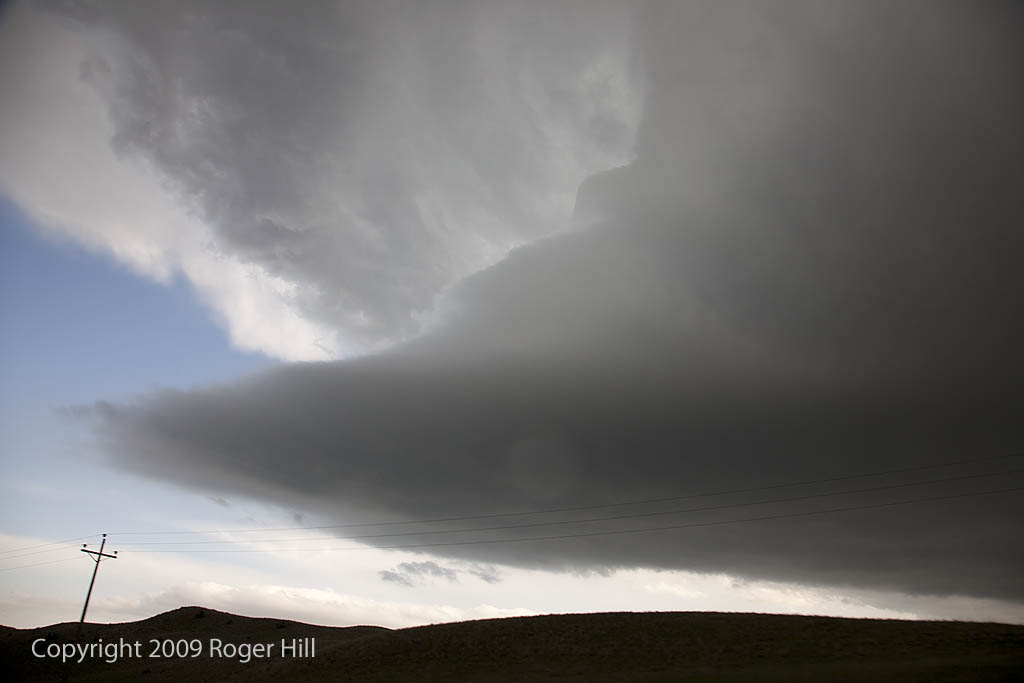
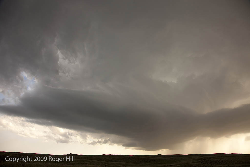
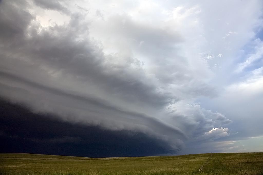
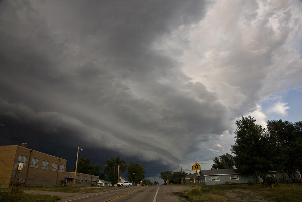
June 23rd and 24th, 2008 Northern Plains Supercells
June 23rd and 24th kept us in the northern plains, from Nebraska to North Dakota. Ample moisture, decent shear and good instability would provide for severe storms on both days. Several tornado warned and severe warned storms would form, but would not produce tornadoes. Instead very large hail to baseball size and strong outflow winds would be the primary severe weather modes. Structure of HP supercells and a magnificent shelf cloud from a bowed out line in North Dakota on the 24th would give me great photo opportunities.