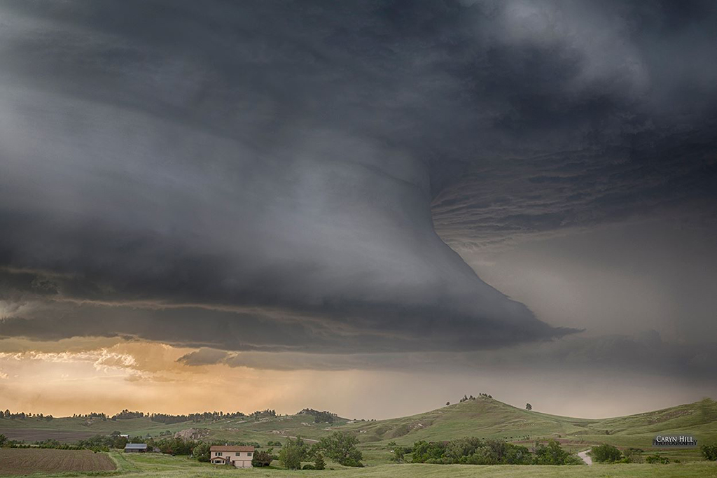
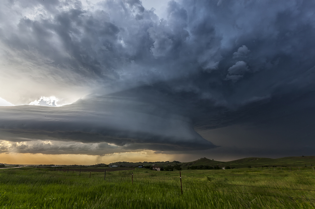
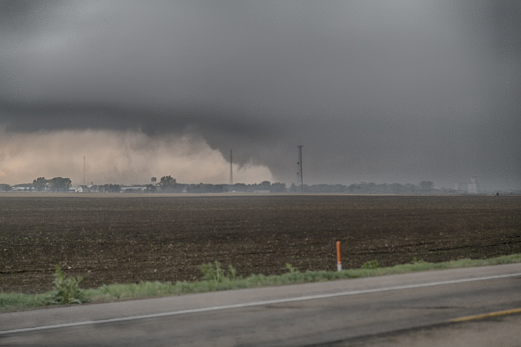
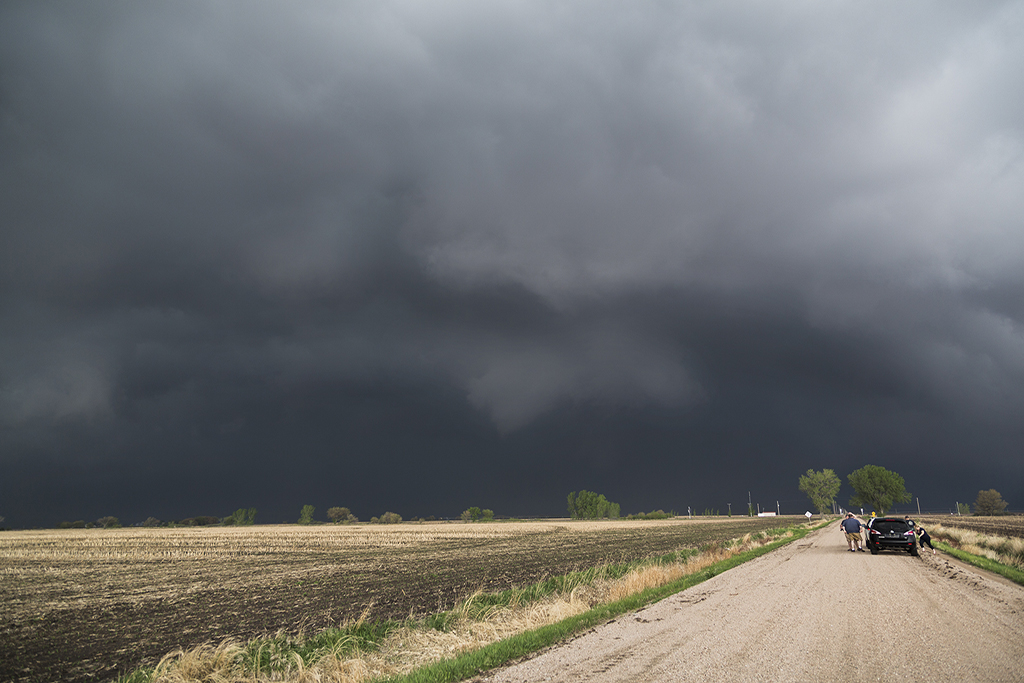
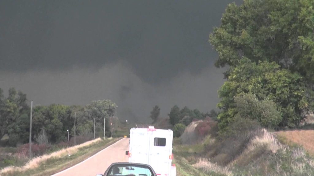
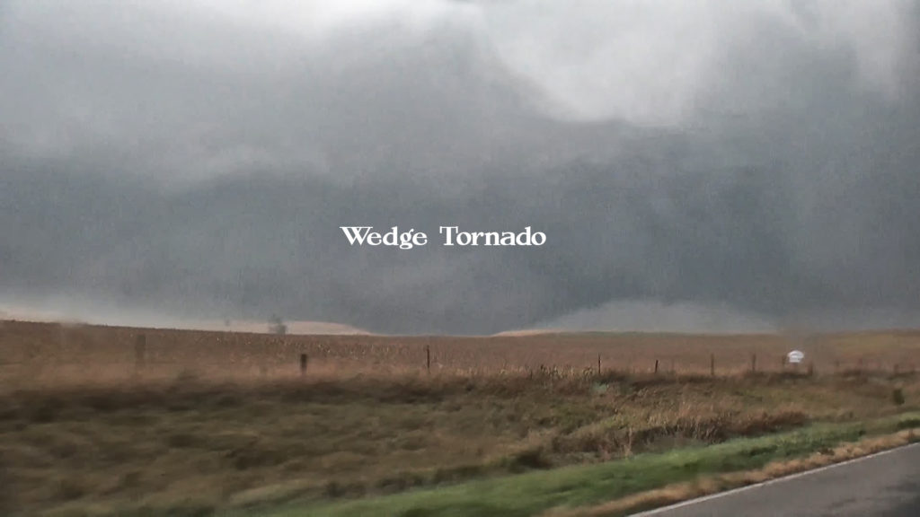
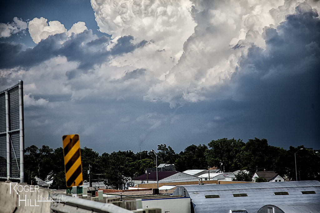
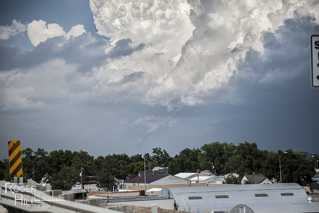
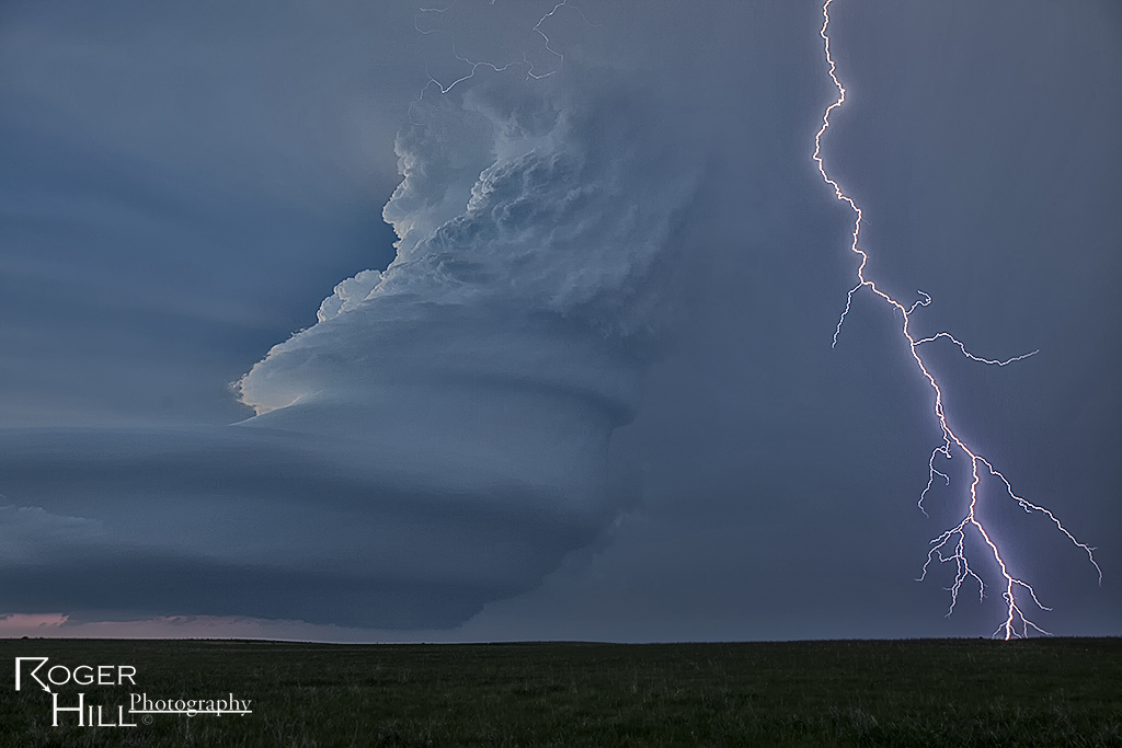
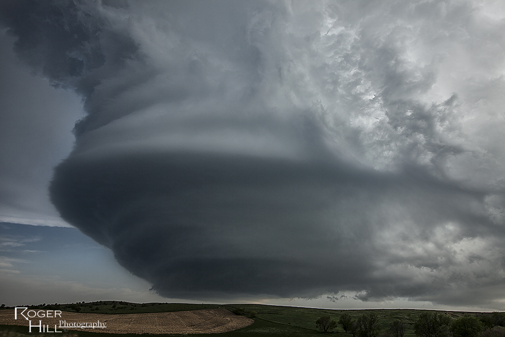
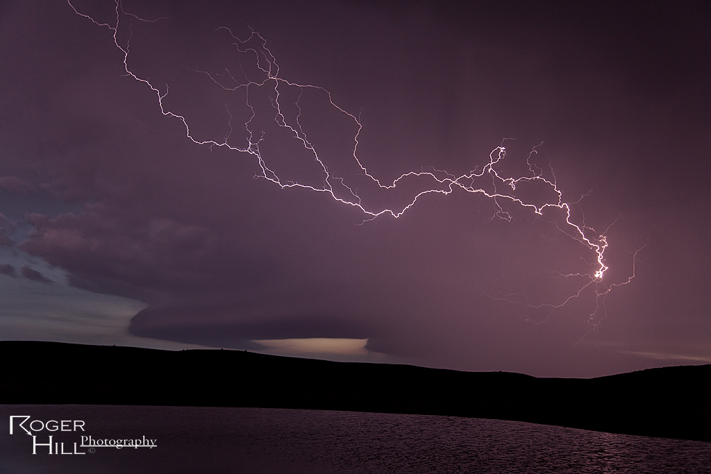
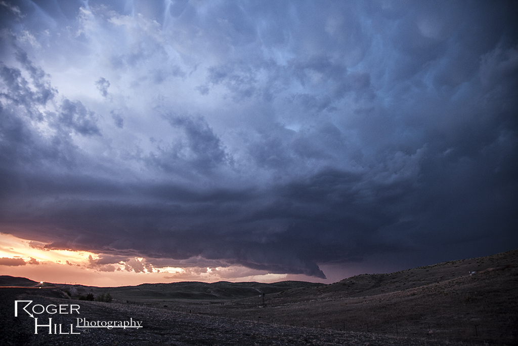
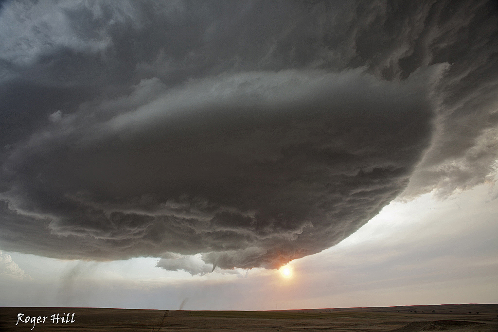
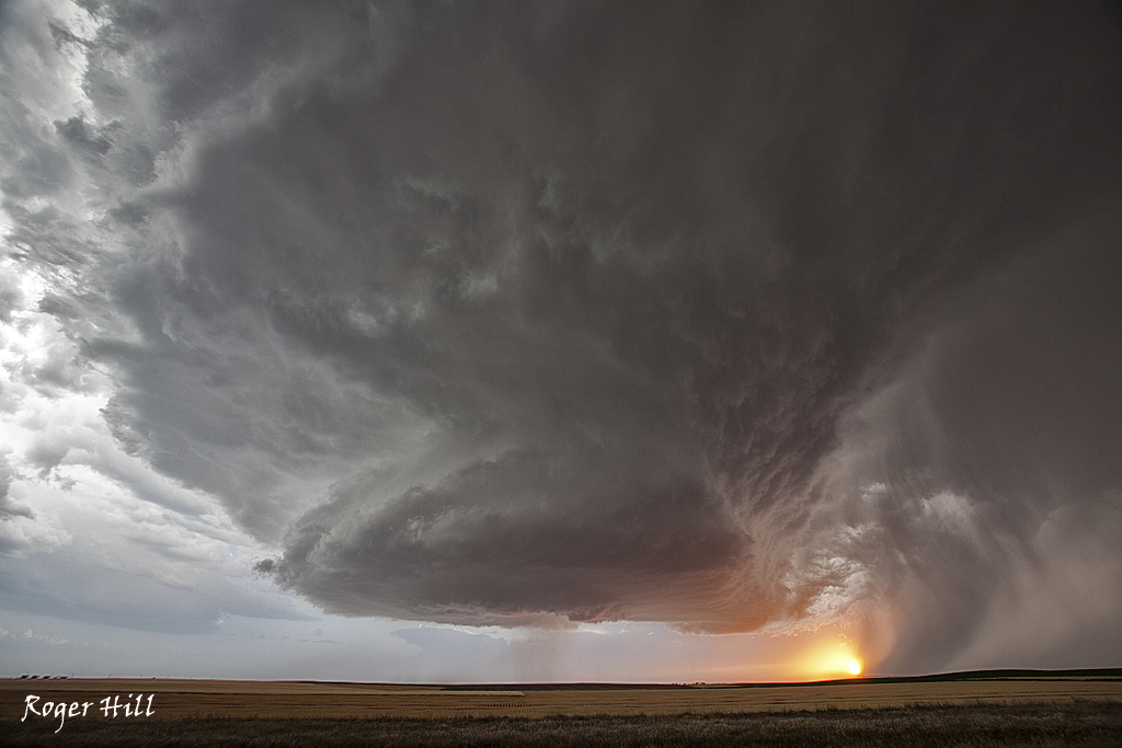
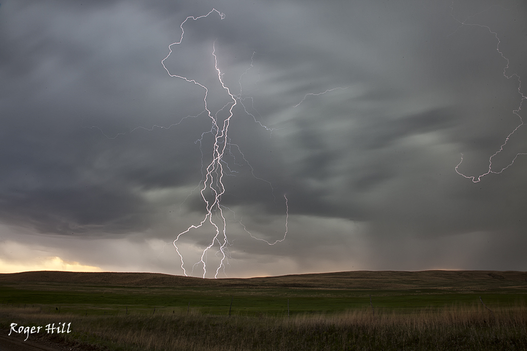
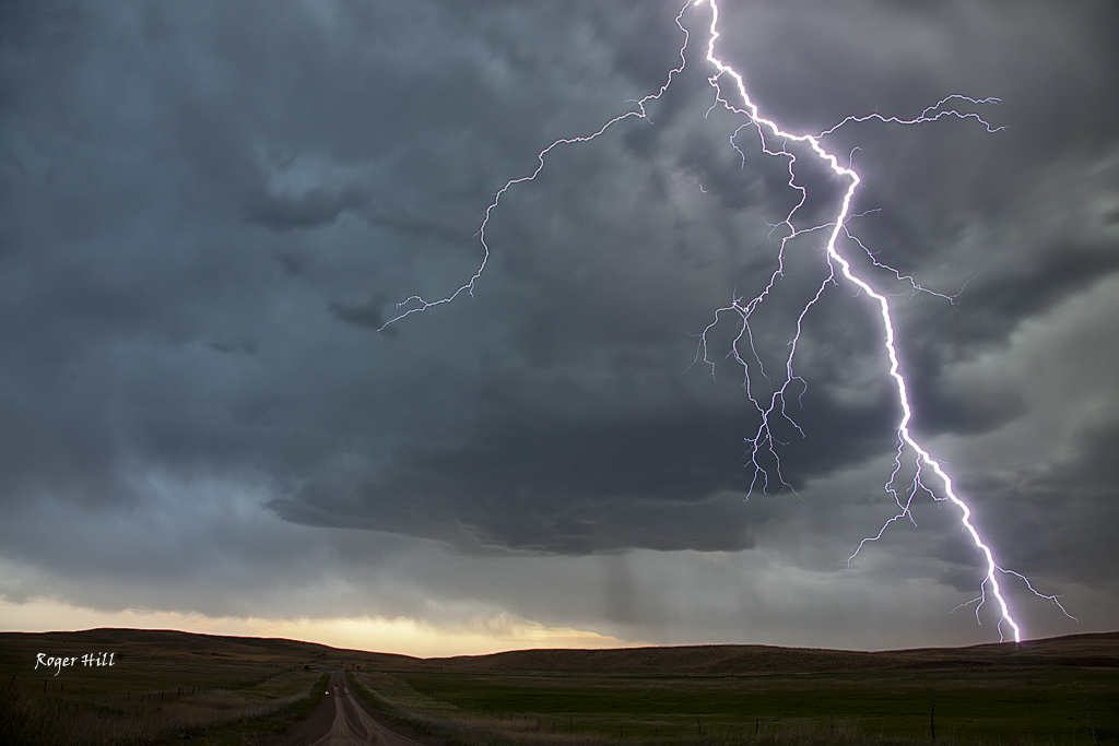
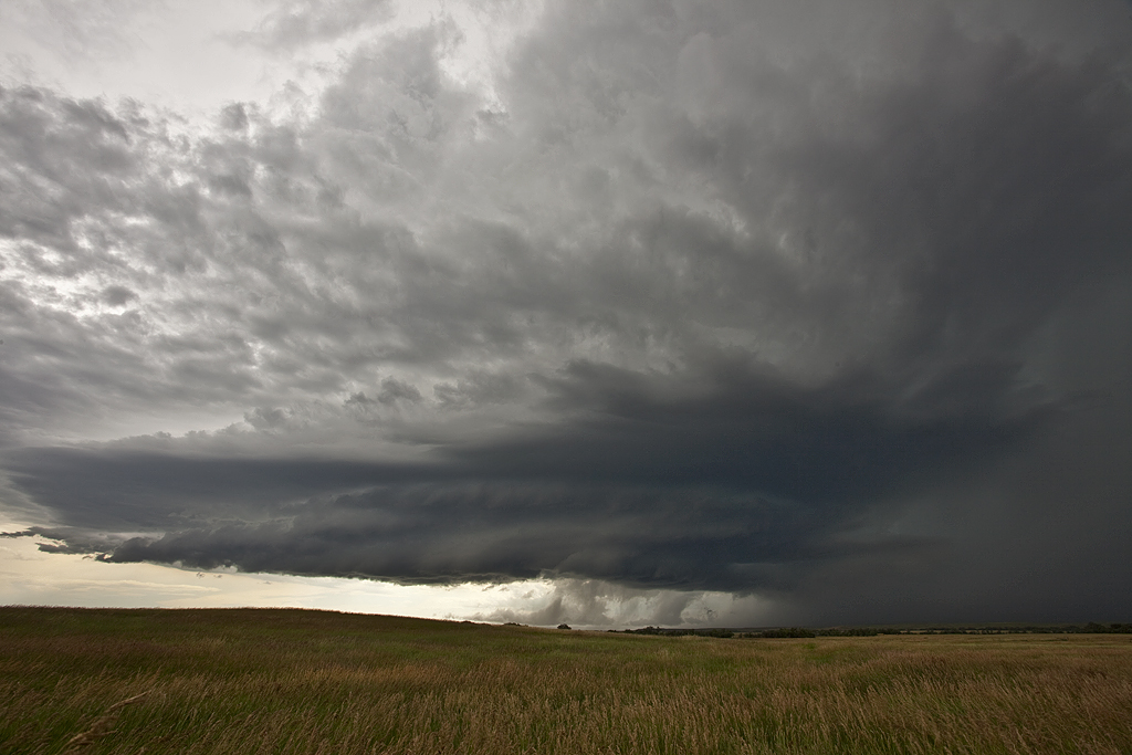
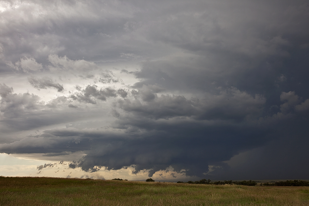
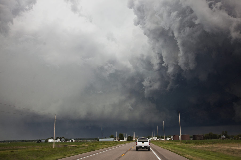
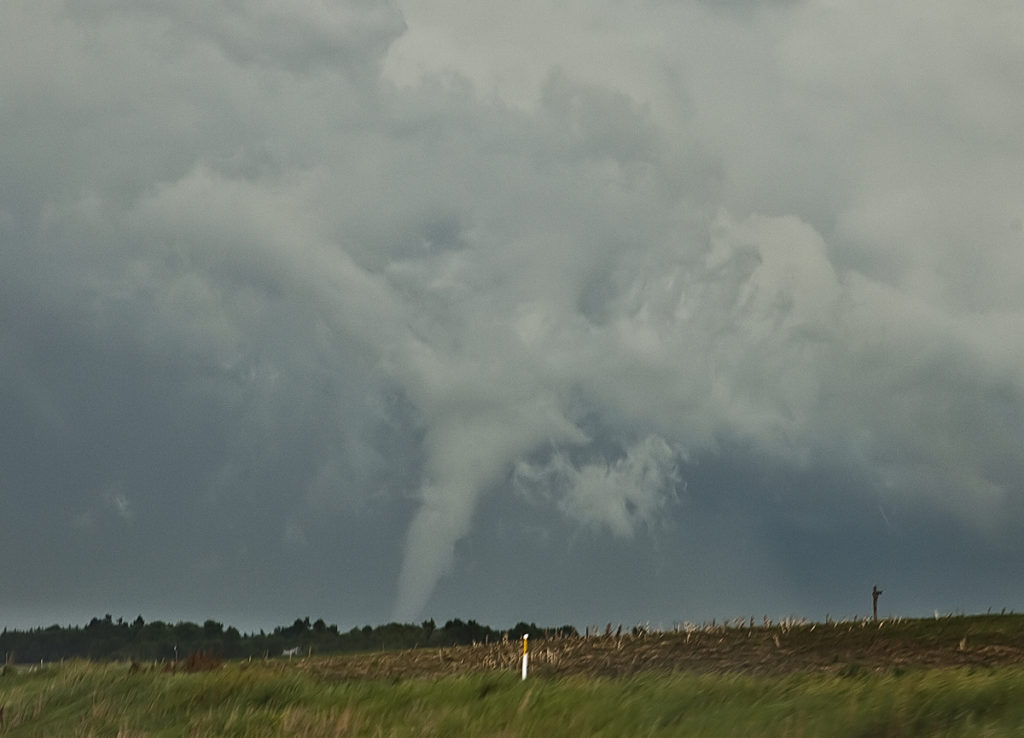
Tag Archives | Nebraska

May 26th Central Nebraska Tornado Warned Supercell

Wasn’t really confident in a decent storm on May 26th. Nature sure changed that though in a hurry! An intense, highly striated supercell formed northeast of Broken Bow, Nebraska and became one of the best structured storms of 2013. It was tornado warned for hours as well.  The storm produced baseball sized hail and was also quite electrified in its lifetime.

June 22nd Nebraska Briefly Tornadic Supercell

June 22nd had some great potential. A warm front lay across the NE/SD border, with a dryline extending south from it. I have to admit, my target that day was the warm front/dry line intersection near Lusk, then eastward as storms could potentially ride the warm front. Indeed, the storm of the day did just that and we missed it due to the this being the final day of the tour and our tendency to lean south towards the Cheyenne ridge, which was also a viable target. We intercepted a supercell near Sidney, NE that rode eastward and became a very nice supercell. It produced a brief, 2 minute tornado, before becoming extremely photogenic.

May 18th Nebraska High Based Supercell

May 18th continued the trend of decent shear and little low level moisture. We started the day in southwest South Dakota and drifted southeast towards central Nebraska. By the end of the day we would have a high based supercell, which was severe warned, that produced copious amounts of CG strikes, many quite photogenic.

July 11th, 2011 Western, Nebraska Sculpted Supercell

July 11th resulted in a lot more than I thought we would get. Modest CAPE and shear ended up producing a few pretty supercells, one of which anchored east of Chadron, NE.  Storms had decent structure and respectable electrification. We sat around Chadron for a big part of the afternoon until things finally started developing. Several funnel lookalikes occurred that were called in as funnels/tornadoes, but of course were later discounted.

June 20th, 2011 Nebraska Tornadoes

This day had tons of potential. But the question was where to chase. First target of north central Kansas early on panned out as one tornadic beast formed and produced numerous tornadoes. Check out Mike Umscheid’s “Under the Meso” website for what he witnessed there. Spectacular! The second target, along I-80 from Kearney eastward also panned out. There were a couple of very tornadic supercells there that produced several large and photogenic tornadoes. The worst thing in the world would be to get caught between the targets, and low and behold, THE MOST FRUSTRATING DAY of 2011 award, goes to this day. Dave Gold came out to chase with us and too much hesitation on which target to play cost us dearly. We still witnessed 6 tornadoes, but the ole “what could have been” (and what SHOULD have been) haunts me to this day. Wow, awful results. Every chaser has a day or two each year they regret, this is THE one for me for 2011.

June 19th, 2011 Southwest Nebraska Tornadic Supercell

One of the frustrating days of the season. We sat in Ft Morgan, CO too long as storm exploded in Colorado and southwest Nebraska. We tried in vain to get to the storm near McCook, only to be greeted with a rotating storm that had already produced its last tornado. It tried several more times, but couldn’t do it. Then we watched at night as a marvelous cork screwed updraft lit up the sky.

June 7, 2010 Scottsbluff, Nebraska Tornado

Intercepted a few supercells west of and near Scottsbluff, Nebraska. Upslope flow combined with decent instability set the stage for supercell development. A cell merger near Scottsbluff that occurred on an outflow boundary allowed a messy mesocyclone to spin up and produce a fairly brief tornado that caused some damage to buildings, power lines, trees and flipped cars near Melbeta. We got very close to the circulation.

July 31, 2009 Kansas Tornadic Supercell

What a pleasant surprise this day was! I was hoping for a couple of high based supercells in western Kansas and certainly got much more than I hoped for! Several supercells developed from southwest Nebraska southward along a boundary in western Kansas. Caryn and I intercepted a tornadic storm just south of Gove that produced hail almost golfball sized as well as at least 2, possibly 3 tornadoes.

July 13, 2009 Valentine, Nebraska Amazing Supercell

July 13th was one of those days you don’t soon forget. A supercell formed near Rapid City, SD and tracked all the way southeast of Valentine, NE by late evening. It was a storm to behold! Beautiful structure, likely a couple tornadoes buried in rain and hail to baseball size was the story of this day. It was tornado warned for over 6 hours!

June 17, 2009 Central Nebraska Tornadoes

June 17th was certainly a day I will never forget. All parameters pointed to a triple point boundary in central Nebraska, just north of Kearney. By late afternoon, an intense tornadic supercell developed and tracked eastward through Grand Island and Aurora, producing a large and destructive tornado just west of Aurora. We would witness half dozen tornadoes this day, culminating with the Aurora, Nebraska monster. I only put photos up here and no video stills, thus only 2 tornadoes are in photos. Here is a wild 5 minute video from this event: