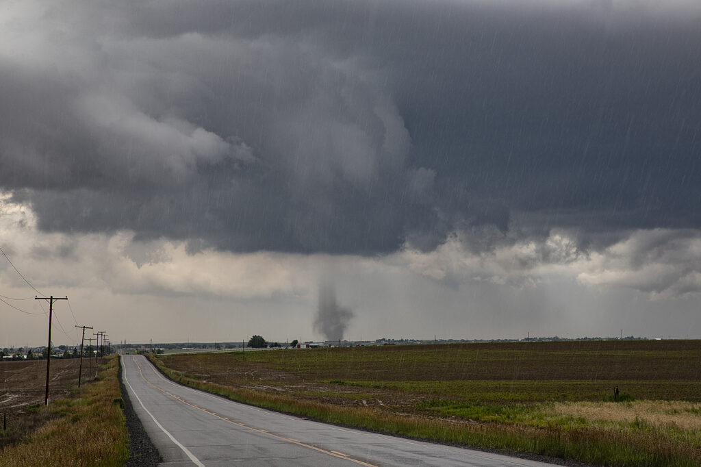
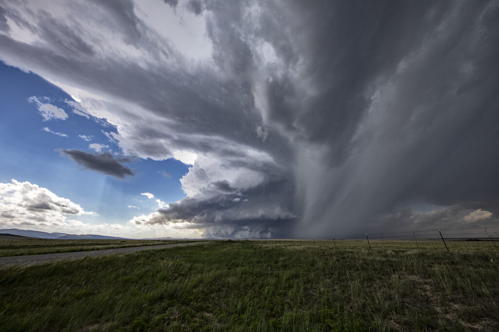
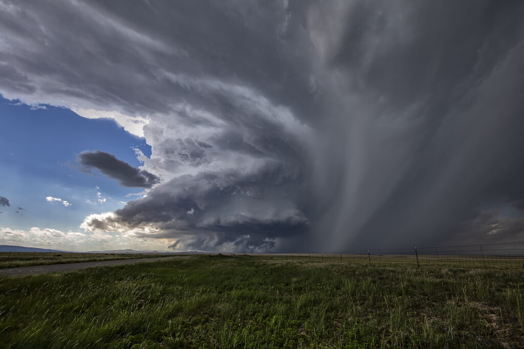
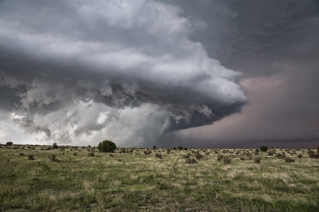
May 1st showed plenty of opportunity for severe storms, however the best tornado threat was in 2 different area, the Texas panhandle, and north central Kansas. Since we couldn’t make it to Texas in time, we chose the northern target. Moisture was limited and it was going to be close to get moisture this far north before storm initiation occurred. Storms formed rapidly later afternoon and intensified during the evening. 2 supercells emerged with the tail end storm eventually becoming the dominant cell. As it moved across north central Kansas in the evening it continued to intensify. It stayed along and just on the cool side of an old outflow boundary south of Interstate 70. Inflow was quite strong, and lighting frequent. At sunset, it ramped up in intensity and produced a couple of brief tornadoes under the front edge of the updraft as RFD surged around from the south side. Both tornadoes were weak and lasted only 2-4 minutes each. We eventually let is go as it continued to move north of the boundary since we had to be in Texas the next day. A fun day, with decent results, but had the supercell attached to the boundary it could have been quite a bit more tornadic. Enjoy the photos!

April 26th Iowa Violent Tornado Outbreak
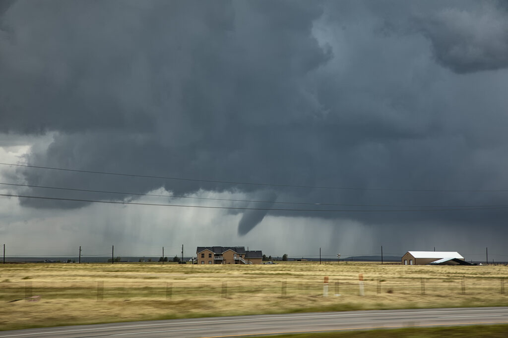
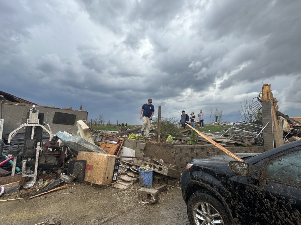
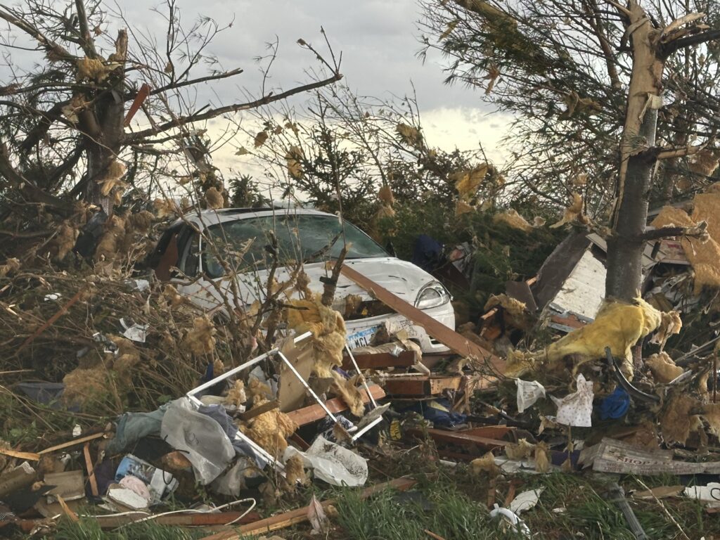
April 26th had the appearance of a major tornado outbreak. It certainly lived up to the hype! We had spent the night in Salina, Kansas and targeted Nebraska City, NE to Creston, Iowa for tornadic supercells. Strong wind shear, with dew points in the lower 60s and surface based instability of 2500 CAPE would set the stage for the event. We arrived in the Nebraska City area mid afternoon, as a supercell produced a couple of tornadoes between Lincoln and Omaha, Nebraska. Due to storm motion and speed, we could not catch up to it, so we decided to stay put. An hour later storms erupted along a confluence line near the Missouri river and quickly gained rotation. Near Council Bluffs we decided to go east and get in front of a tornado warned storm. When we saw it, it was ready to produce a tornado. As it approached a cone shaped tornado formed, turning into an 800 yard wide EF3 wedge tornado as it crossed the road within a half mile of us. It completely destroyed 2 farmsteads along highway 92 and as we approached them, nobody was there to help the residents. We immediately stopped and went into search and rescue mode. We found a family trapped in their storm shelter as their home collapsed on them. After removing a lot of debris as a few other chasers stopped to help, we were able to get them freed. Shook up, but healthy, attention turned to the other farm. An elderly woman and her dog were buried in debris as her house was demolished except for the walls. They also were able to be rescued. Soon paramedics and the local fire department arrived as we directed them to the residents and told them about propane tank leaks. At that point, it was time for us to leave and let the authorities do their jobs they did so well!
By the time we were able to depart the scene, it was too late to keep chasing as the tornadic supercell was 15 miles north moving away. It went on and produced more strong tornadoes near Minden and Harlen as we turned south to make the journey back to Oklahoma City. I do NOT regret missing the other tornadoes to stop and render help to those in need. Given the opportunity to do it again, there would be no hesitation!!! People are far more important than weather. Thanks to all who stopped that day to help families in desperate need of assistance.
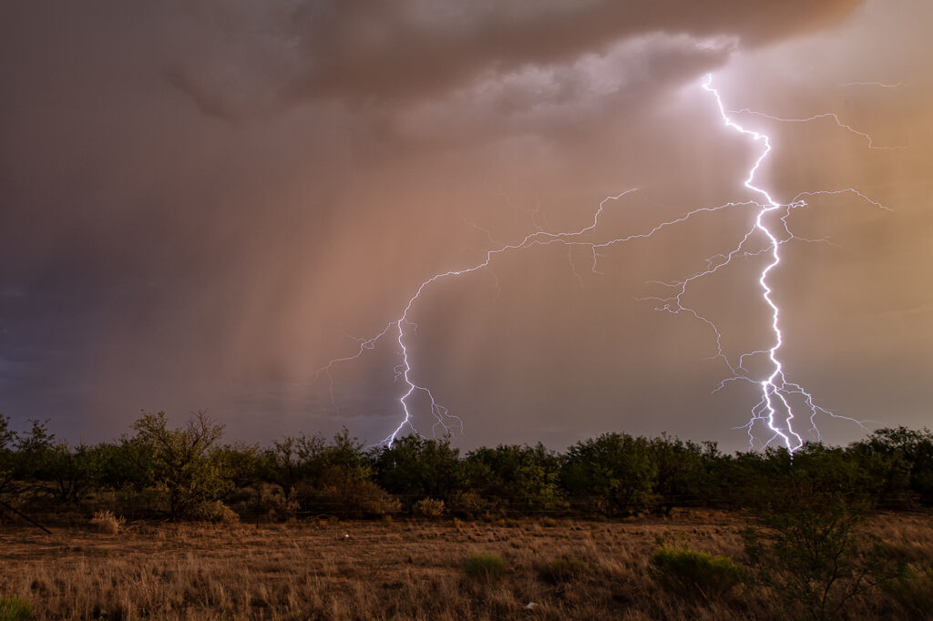
April 23rd Sweetwater, Texas High Based Supercell
April 23rd promised some decent severe weather opportunities. However due to lack of good moisture, storms were high based. We intercepted one storm northwest of Sweetwater and stayed with it all the way south of Abilene where it gusted out. Structure was pretty and the hail up to golfball sized. It was also a pretty decent lightning producer. As it reached maturity and started weakening an haboob developed spewing red dirt all over. Winds were gusting over 70mph. All in all a decent day for the ingredients available to produce intense storms. Enjoy the pics!

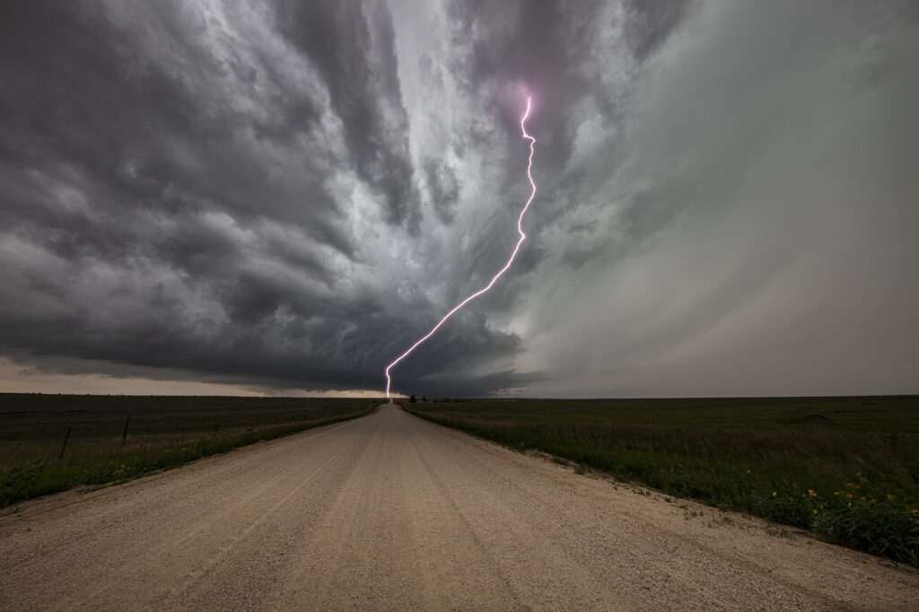
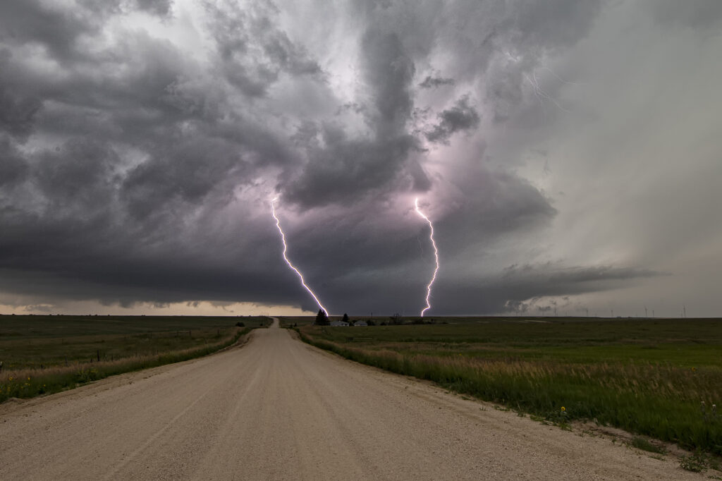
March 13th Rossville, Kansas Tornado
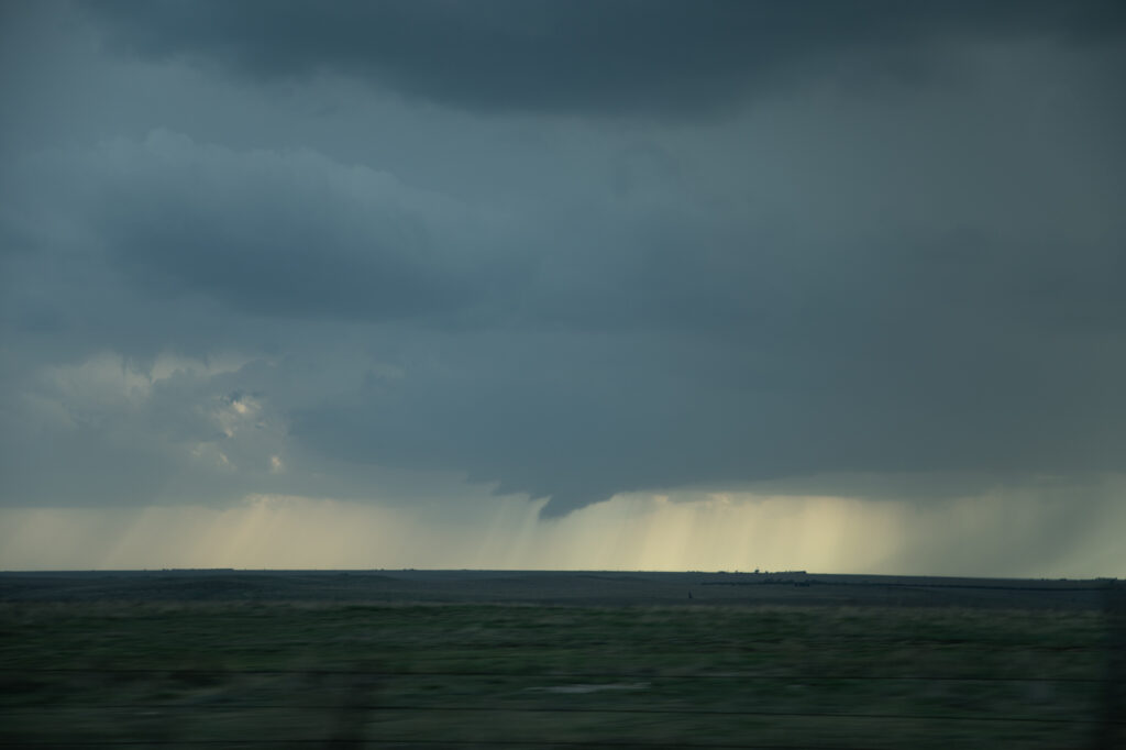
March 13th saw our first ON CALL tour of 2024 take place. We chased the 13th and 14th and intercepted either tornadic supercells or tornado warned supercells both days. March 13th took us to central/eastern Kansas to play the warm front/dryline triple point. Most models suggested storms would form there and also along the warm front. And they did both! We jumped on the first strongly rotating supercell east of Alma and watched it intensify and become tornadic after dark. A second supercell to our west also became tornadic near Alta Vista. Unfortunately, since we were committed to the initial eastern cell, we could not make it back west to play the Alta Vista cell. As our cell crossed I-70 west of Topeka it became tornado warned with two large cone funnels extending halfway to the ground. The eastern funnel touched down and became a tornado which lasted close to 10 minutes near the town of Rossville. We stayed with the storm all the way to Hoyt, where a tornado was also reported. We could not confirm one as anything was completely rain wrapped.
March 14th we chased in eastern Oklahoma and western Arkansas and intercepted several tornado warned storms. No tornadoes were confirmed, however hail nearly grapefruit sized occurred. We ended up near Atoka, OK at the end of the day chasing a tornado warned storm just north of town.
Overall, a great way to start the 2024 chase season!!!!
Here’s a You tube link of our video from this day: https://youtu.be/uuLlzTRFcA0
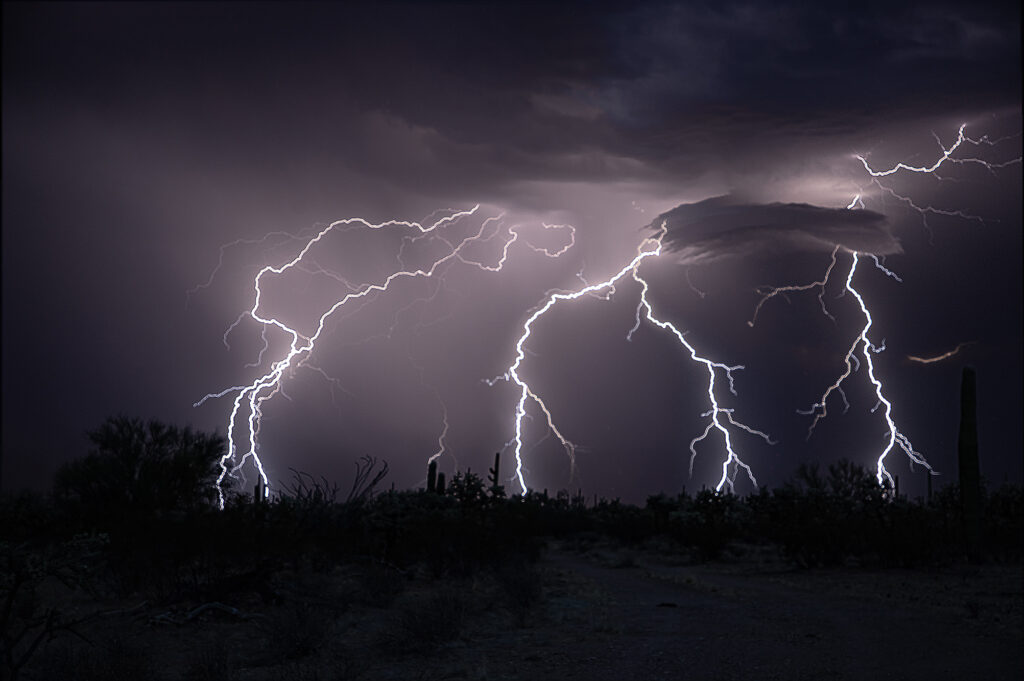
July 29 -August 8 Arizona Monsoon Storms
Each year we run a tour in the desert southwest from Tucson we call the Desert Thunder Tour. Its specific purpose is to photograph the incredible lightning that occurs during this period. The 2023 monsoons haven’t been very good thus far, however we were still able to capture many great lightning strikes in southeast Arizona and also near Sedona. Nothing prettier than the desert landscape filled with cactus and red rock foregrounds to set the stage for a beautiful lightning image! Please enjoy them!
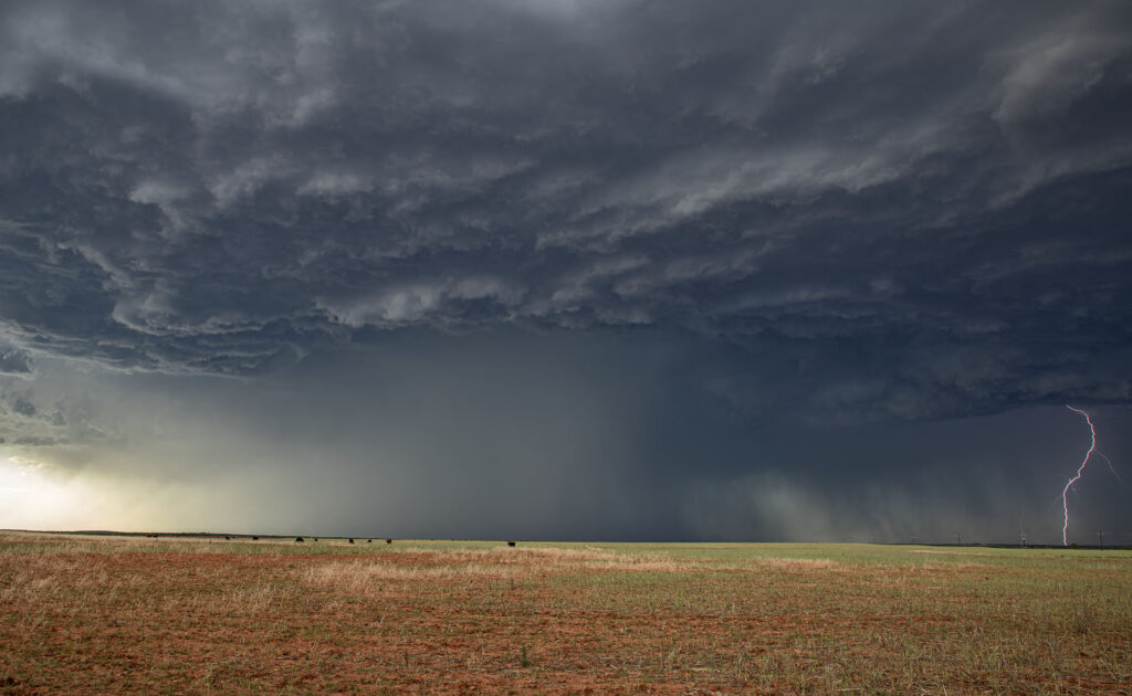
July 20th Southeast Colorado Tornado Warned Supercell
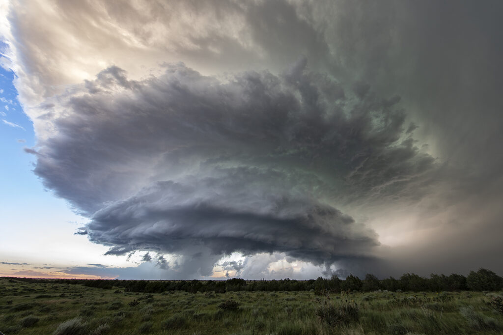
July 20th featured good shear, excellent moisture and instability, and the Palmer Divide to produce storms with upslope flow. Mid afternoon a supercell formed near Simla, Colorado and turn to the south. As it did, it was rotating very strongly and may have produced a couple of broad, weak tornadoes. The lightning was absolutely insane with the supercell and the hail was quite large, up to softball sized! As the storm moved south, it was interfered with by another supercell and the southern storm became the dominant supercell. It moved southeast and eventually collided with northeast moving storm near LaJunta. Over the next 45 minutes it struggled to maintain any intensity until it finally pushed through all the left moving storms. It became tornado warned near Las Animas and had quite strong rear flank winds along with very large hail. We ended up letting it go as we needed to be back in Denver that evening. A great local chase for our tour group and one of the prettier supercells and lightning shows on the season! Enjoy the pics!!!
July 15th Northeast New Mexico Supercell
July 15th had a lot going for it. Strong northwest flow aloft would generate good shear with surface southeast winds. High dewpoints in the 60s at high elevations, would also generate a lot of instability. The upslope flow helped develop a well structured supercell near Wagon Mound, New Mexico. This storm was well structured and also produced huge hail baseball sized. The low levels never could tighten up enough to produce a tornado, however the supercell spun southward toward I-40 near Cuervo. It was severe warned for over 4 hours as it moved towards the south. Eventually we let it go as numerous storms blew up around it and thus reduced its ability to continue to maintain its strength. Fun chase over the plains and canyons of northeast New Mexico and fortunately to road network allowed us to continue chasing it all afternoon and early evening.
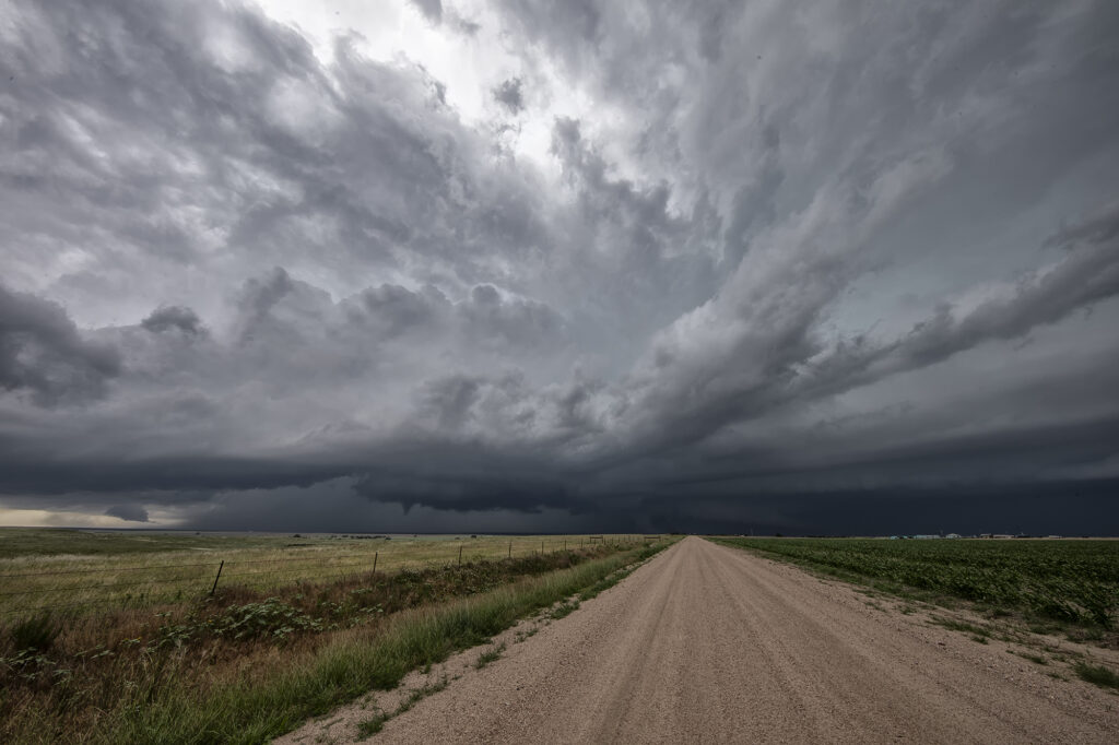
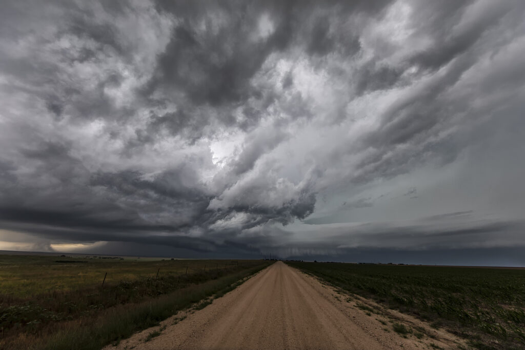
July 13th Eastern Colorado Tornado Warned Supercell
July 13th featured a play in eastern Colorado along an old outflow boundary from previous day convection. Storms formed fairly early, by 1pm along this boundary. It didn’t take long for them to become well organized and severe warned. One cell developed an impressive hook on radar and spun strongly. It produced a couple of funnel clouds, but nothing that touched down. Structure was nice, but storms became HP in nature as they moved almost due south in northwesterly flow aloft. Another cell formed southwest of the first and became tornado warned. We blasted towards it since our storm was weakening due to ingesting outflow air from the new storm. As we arrived on the new cell, it was quite messy and never looked like it would produce anything. We stayed with it for a couple more hours until numerous storms exploded between LaJunta and Lamar, CO. At that point, we called it a day and dropped south to our hotel in the Oklahoma panhandle. A fun day and our first supercell came very close to producing a tornado! Enjoy the pics!
July 8th LaJunta, Colorado Tornadic Supercell
July 8th was the arrival day for our final tour of the year, Tour #9 the Great North Tornado Hunt. Due to the weather forecast that day, we took the group out for a chase in southeast Colorado. A supercell formed east of Colorado Springs late afternoon and spun like crazy all the way to Kim, CO near the New Mexico border. With strong shear, good moisture and instability in place, the storm would become a long-lived supercell and produce hail 3.5 inches diameter, as well as a nice tornado north of Kim that was on the ground for a few minutes. The structure of this supercell was one of the best of 2023! By mid evening it dissipated, so we went back to Denver to get ready for our official start of the tour. A great way to spend arrival day chasing a stunning tornadic supercell! Enjoy the pics!!
July 6th Aurora/Watkins, CO Tornadoes
It’s always fun when severe weather keeps you in your own backyard! Such was the case on July 6th! A boundary stretched across the Aurora/Watkins areas and by mid afternoon, storms rapidly developed. Soon a tornado formed south of I-70 touching down for a few minutes. About 30 minutes later, a landspout tornado formed along the boundary just northeast of Watkins persisting for several minutes. We stayed with the storms to see if any other tornadoes would form along the boundary, but as if often the case, wind fields were disrupted by ongoing storms, thus lessoning the chance another tornado would occur. Great backyard chase!