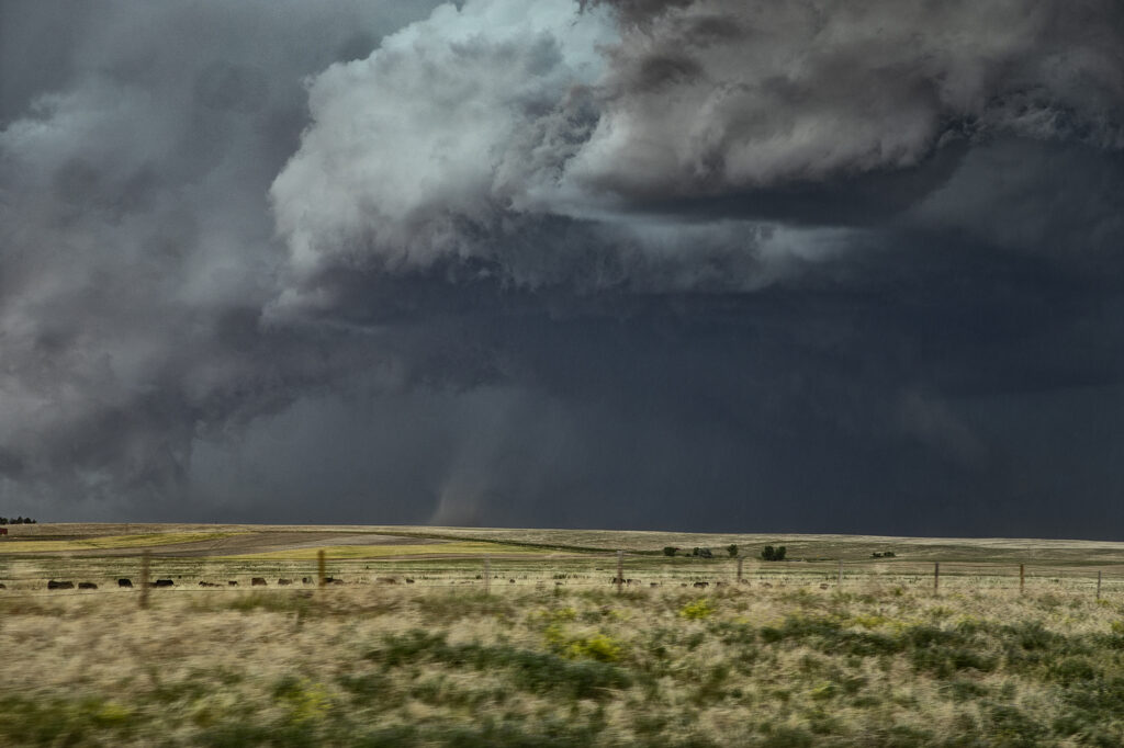
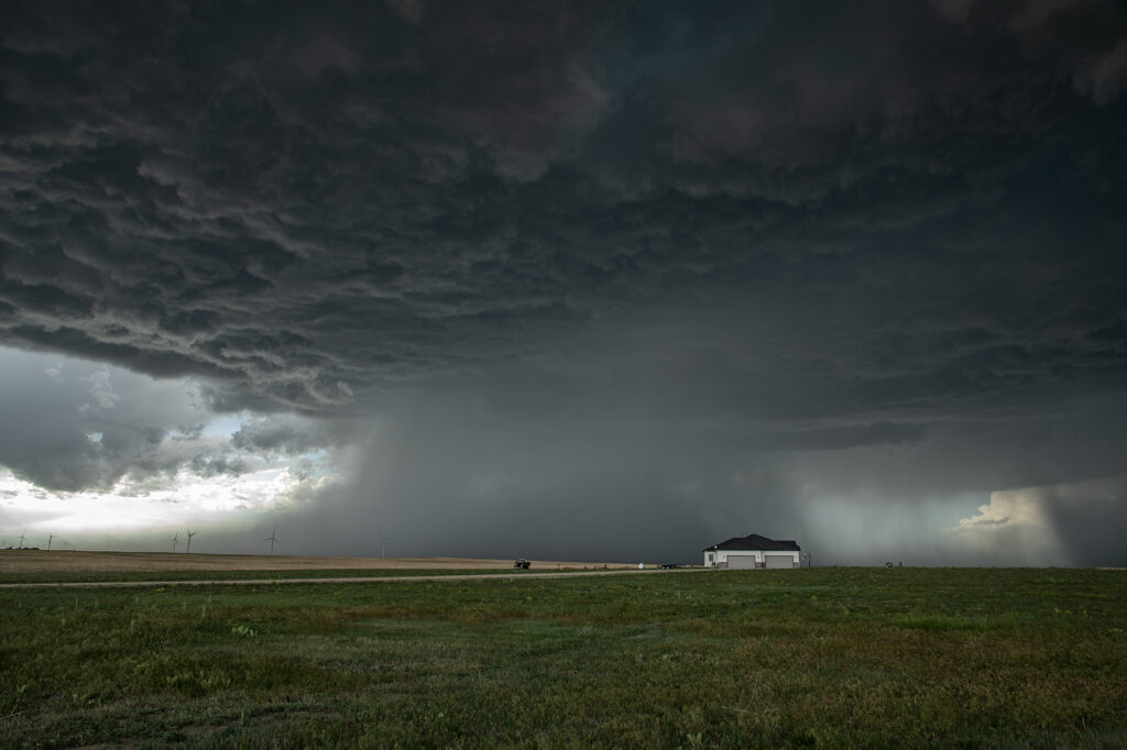
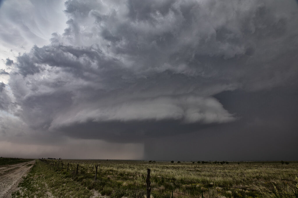
June 20th took us to the high plains to play the Chugwater Convergence Zone. Moisture was less than optimal, but shear and lift along the boundary would be sufficient to generate severe thunderstorms, including a couple of supercells. We arrived west of Scottsbluff, NE to find a storm already mature and severe. As it moved east towards Hawk Spring, a slender tornado formed and was on the ground for several minutes. We turned east of town on a dirt road only to get blasted by 80mph plus winds from the rear flank of the supercell. By the time we could work southeast and then north to get back in front of it, the storm was now a line of severe thunderstorms. Soon, as they became outflow dominant, we left them and called it a night. Fun day and a surprise tornado is always welcomed! Enjoy the pics!

June 16th McCook, Nebraska Gorgeous Supercell
June 16th brought us to southwest Nebraska near McCook. A triple point focused potential storm development in the area with extreme heat (temps over 100) along the dryline with dewpoints near 70 along the warm front. Many updrafts tried to form in the area near the triple point, with one updraft succeeding in sustaining itself at the triple point. The storm sat and spun for several hours. The structure was quite pretty and periodically the storm produced copious amounts of lightning. Although never a real threat to produce tornadoes due to higher cloud bases, a couple of wall clouds formed and one bowl spun for several minutes. The storm persisted towards sunset then slowly weakened as it drifted slowly northward. An exceptional day based on how model portrayed the set up. Enjoy the pics!


June 12th Central Minnesota Tornado Warned Supercell
June 12th featured awesome shear, but a dearth of low level moisture. Dewpoints in the 50s to low 60s wouldn’t be enough to get intense tornadic storms to form. Most storms were higher based and quickly became outflow dominant. We positioned ourselves near Wadena, MN and chased a storm that formed southwest of there straight down I-94 towards the Twin Cities. The storm spun hard, but had a tendency to be linear and quite gusty. Another cell formed along a boundary just to the east and acquired supercell characteristics. It developed a lowering that someone report a tornado from. From our vantage point, I had a hard time believing that report. Another over zealous chaser in action! We stayed with our storm and near St Cloud, it became tornado warned. At one point it had a lowering that looked like a broad funnel forming, however, that’s as far as it went. Soon the gust front hit us and we called it a day. A bit of a frustrating day in which there was some decent potential for nice supercells and even a couple of tornadoes, but to no avail.

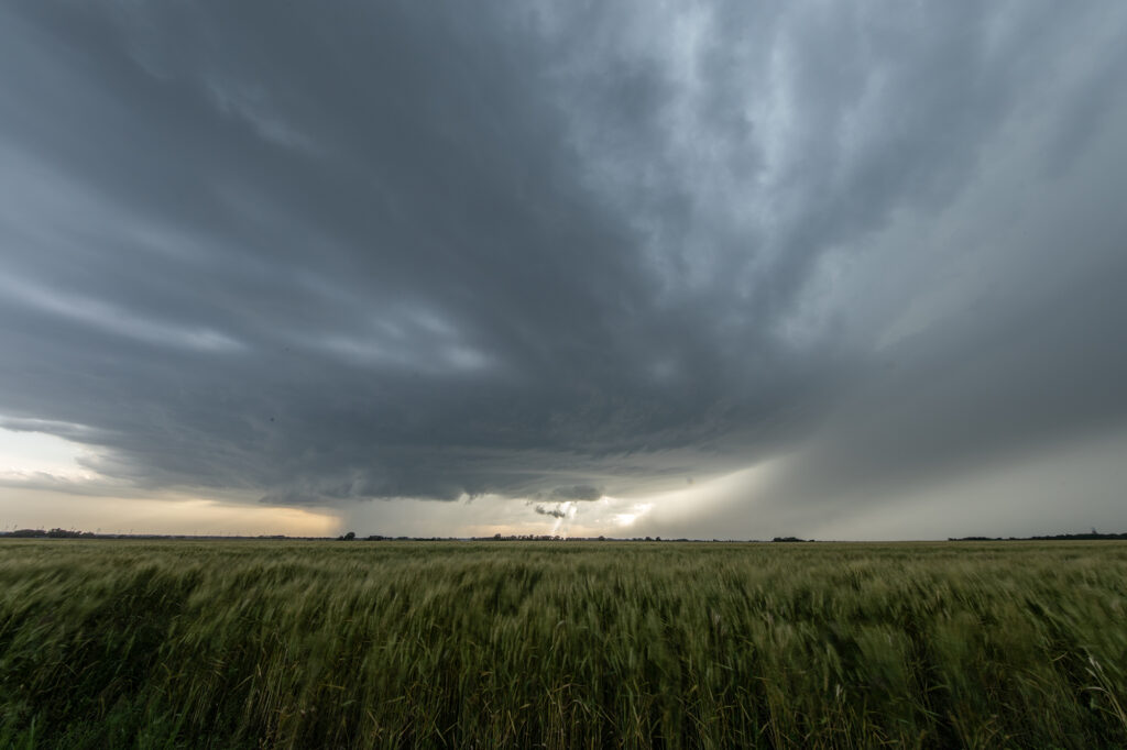
May 31st Eastern Colorado Supercell
May 31st featured a short wave trough moving across Colorado, with limited moisture, but strong shear. Most models developed storms off the Palmer Divide, intensifying as they moved east/southeast. That is exactly what happened. A storm started spinning and became tornado warned west of Cedar Point, but never showed strong enough rotation to produce a tornado. Another storm formed to the south of it and ended up being the storm of the day. As it steadily intensified, a severe thunderstorm warning was issued for it. As it approached Limon a DESTRUCTIVE STORM warning was issued for hail baseball sized. We encountered hail about golfball size as we had to punch the core and get ahead of it south of Hugo. About 10 miles south of town, structure became quite nice and a lowering formed with slow rotation. I thought for a bit that it might produce a tornado, but to no avail. It never could balance its updraft and downdraft well. With the sun getting low in the sky and having to be back in Denver soon, we waived goodbye one last time and headed home. A fun day and close to Denver made it an even better treat! Enjoy the pics!
May 30th West Texas Supercells
May 30th brought an interesting chase. A sharp dryline and an outflow boundary would intersect over west Texas and provide the focal point for severe weather. Storms formed at the triple point but could not sustain themselves for very long as they moved out into more stable air. We ended up dropping south from Morton, Texas to Denver City, Texas as one storm formed, hooked hard and tried to produce. In the end the only storm that produced was near Midland, Texas as it dropped two substantial tornadoes. Our storms looked good, but due to a bit higher cloud bases, they could not get a circulation down to the ground. Overall a fun day but a bit frustrating as we were so close but not close enough with our storms.
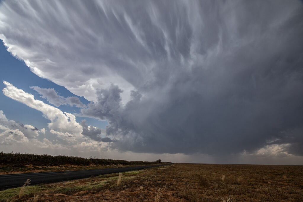
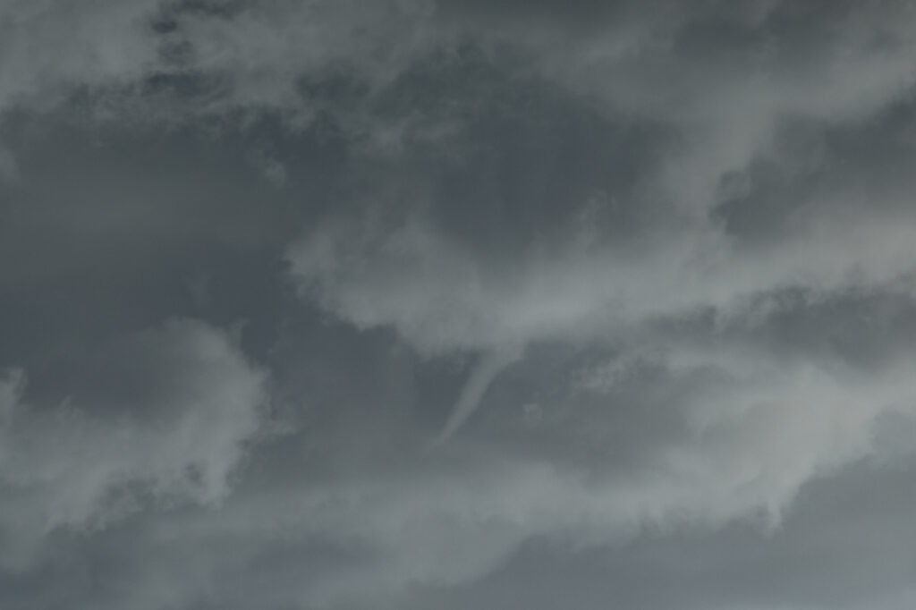
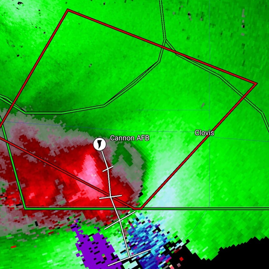
May 29th Clovis New Mexico Tornadic Supercell
May 29th was a marginal day at best. Southeast Colorado looked like the place to be. However, with moisture pooling along a boundary in east central New Mexico, I had a hunch that would produce decent supercells late in the day and evening. The Colorado target got interesting and produced a couple tornado warned storms ( See the previous chase account for the Prime Time Minitour!!!), but I chose to wait and see what would happen in New Mexico. I was not disappointed!!!! By early evening as a short wave trough approached, storms developed northwest of Clovis. It didn’t take long to see they were anchored and would start spinning quickly. As we approached the northeast side of Clovis, a tornado warning was issued. Numerous images from various locals and also my defunked video camera showed what appeared to be a cone tornado northwest of town. The NWS in ABQ is currently validating the tornado based on images, video and local chasers in the area. We nearly had the storm to ourselves, which is quite rare in this day and age!!!! We dropped through Clovis and ended up north of Portales, NM and sat and watched the storm spin like crazy. It was constantly tornado warned. The structure was absolutely top notch, even in the dark and hook after hook formed on this anchored supercell! Finally, by late evening, things started winding down, so we drove to Amarillo to our hotel for the night. One of the BEST structured supercells of 2024, even in the dark! Please enjoy the pics and NO they are not photoshopped!!!!

May 29th Southeast Colorado Tornado Warned Supercells
May 29th brought the last tour day of the Prime Time Mini-tour and Mother Nature brought some nice storms for the ride back to Denver. Started the day in Lubbock, TX with a plan to chase around the Springfield, CO area. Moisture started to mix out in that area, but a nice cumulus field started to build just west of Lamar as a weak La Junta low was forming. We headed for that area and watched from just south of Highway 50 as cells developed between Caddoa and Lubers. As the cells consolidated, lightning became more frequent and we got some nice lightning photos. The southernmost cell then became severe warned and we headed towards the east side of Wiley to stay in front of the strengthening southern storm. After a short time, we had to reposition to the east again along county road 196 and then south to Highway 50. During this time, the cell just to the north of our storm became tornado warned (radar indicated). Unable to get closer to the northern cell, we were able to watch that supercell and the southern LP supercell from our position. As both supercells began turning hard right over and just to the east of Lamar, we took dirt roads to get to a great vantage point looking over open land and observing both cells. The northern supercell was once again was radar indicated tornado warned, but no tornado was observed nor reported. The storms were nearly stationary at this point, moving southeast very slowly which allowed us lots of time to watch and admire. As darkness set in, we decided to start our 4 hour drive back to Denver. Working our way around the south side of the storm, we were treated to an incredible view of the structure of the southern LP cell, causing us to stop and take more pictures. A great day was had by all, super way to end the 4 day tour!


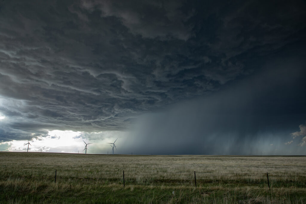
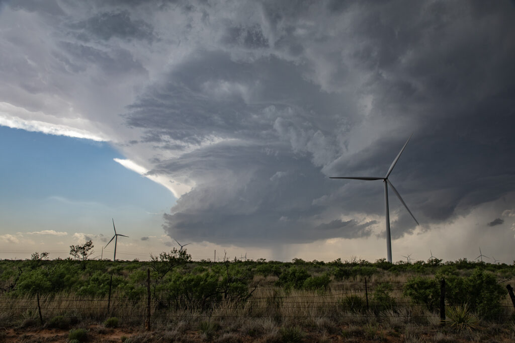
May 28th Morton, Texas Supercell with HUGE hail
May 28th set up had a dryline in west Texas, with strong southeast winds bringing modest moisture westward. Moderate CAPE developed as well and storms formed mid afternoon along the dryline. Storms pulsed quite a bit, and due to straight hodographs, storms split and many mergers occurred. Eventually a supercell developed, anchored near Morton. Structure became better, but due to modest moisture, the cloud base was too high to produce tornadoes. As it moved east it encountered a boundary and spun nicely. After several cycles, it produced 5 inch diameter hail west of Lubbock! We blew it off as it weakened and played further south with a supercell that had softball sized hail. The tornado threat this day was quite low due to high bases, but with strong shear in place and low freezing levels, storms were prolific hail producers.

May 15th Ponca City, Oklahoma Supercell
May 15th featured a boundary across far southern Kansas into northern Oklahoma. Strong convergence, decent moisture and good shear would set the stage for supercells to form along it. By mid afternoon, storms did just that. One main supercell developed and right turned into northern Oklahoma. Structure was very nice and at one point it even produced a funnel halfway to the ground. The supercell was a prolific hail producer with stones falling as large as softballs. As it moved east, it eventually out ran the instability and weakened near dark. One of the prettier supercell of this year so far, and even though it didn’t produce a tornado, the guests loved it! Enjoy the pics!

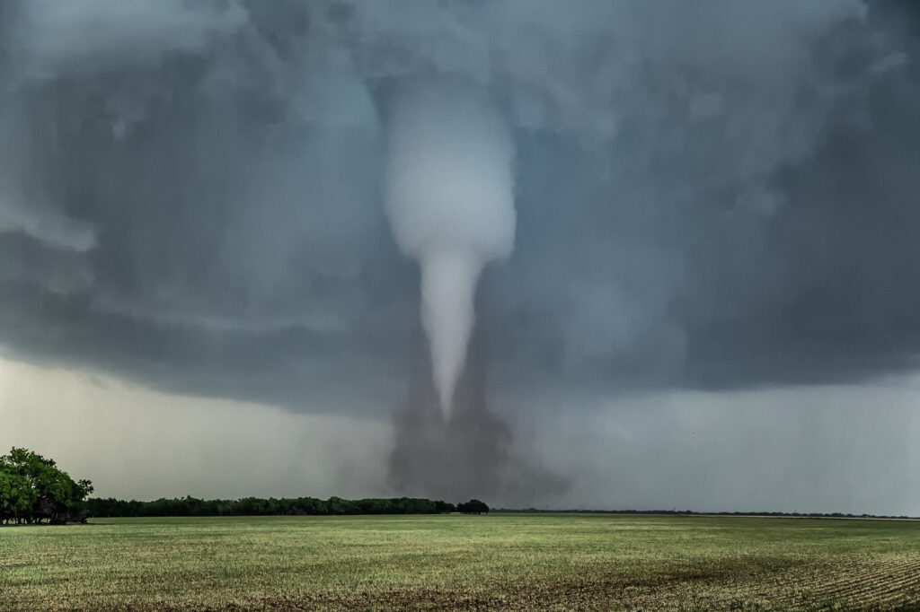
May 2nd Hawley, Texas Violent Tornado
May 2nd featured a weak boundary in central Texas that would be the focus for storm development late in the day. Numerous storms formed along the boundary. Due to shear profiles, storm splits and mergers were evident. By mid to late afternoon a few storms formed along highway 277 north of Abilene, Texas. One split happened that passed in front of a right moving supercell near Anson and caused it to increase rotation rapidly. West of Anson a tornado touched down and was on the ground for a few minutes. As the old occluded mesocyclone weakened and dissipated, another one formed to the east/southeast of the first one. Soon rapid rotation occurred and eventually led to a small funnel. The funnel ascended and descended several times before it finally touched down northwest of Hawley. As the tornado firmly planted, a debris cloud formed. The tapered tornado widened into a text book drill press type tornado, with its strongest winds at ground level. The waterfall sound of the roar of the tornado was quite audible as it churned towards highway 277. Unfortunately it hit a couple houses, levelling them in its wake. The tornado then moved southeast and dissipated. All in all it was on the ground for over 20 minutes. The damage it causes was sporadic, but was rated high end EF3.
A great chase day, but with sad results due to the destruction the tornado caused. You NEVER want to see that happen anywhere. Fortunately the NWS in Abilene was able to give advanced warning to local residents, which resulted in no fatalities, but a few injuries did occur. Our thoughts and prayers to go to those families who were affected by this violent tornado.