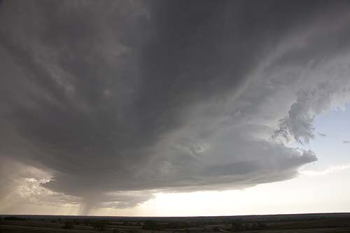
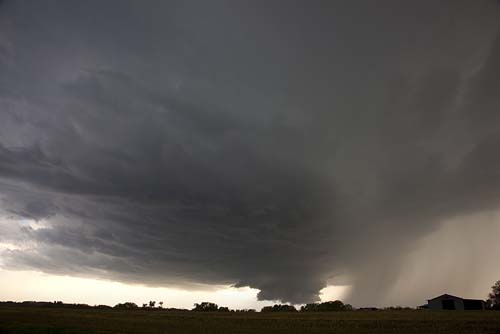
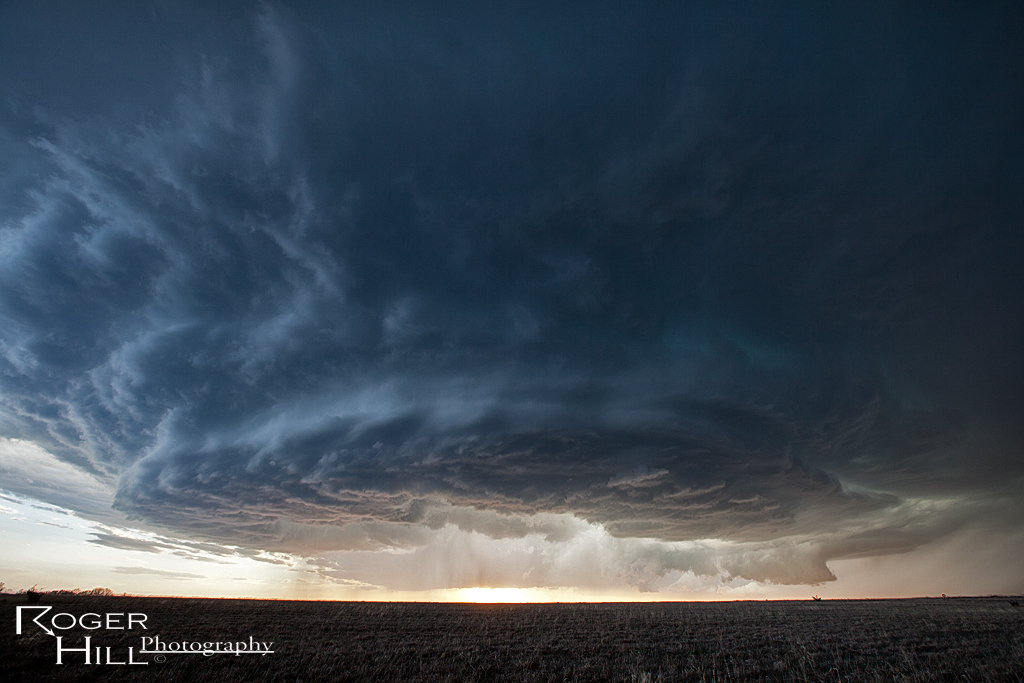
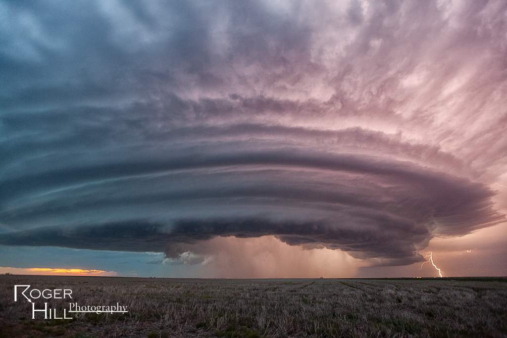
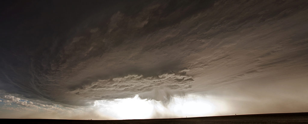
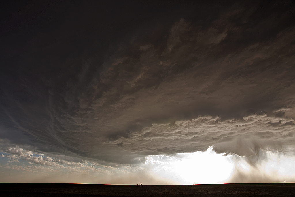
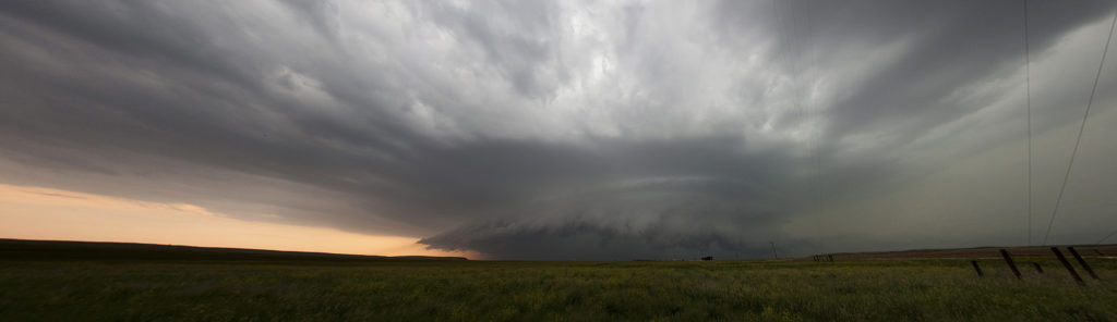
May 7th had that typical early May feel in Kansas, with one exception, lack of moisture. Shear was fantastic, as well as a boundary for storms to fire on. By late afternoon one supercell formed that would be the storm of the day. It survived for about 7 hours and produced insanely beautiful structure, great lightning and copious amounts of hail. Had the dewpoints been in the 60s instead of mid 50s, it would likely have become violently tornadic. A fun chase and one of the prettiest storms of 2013 for me!
May 25th LaCrosse, Kansas Tornadoes
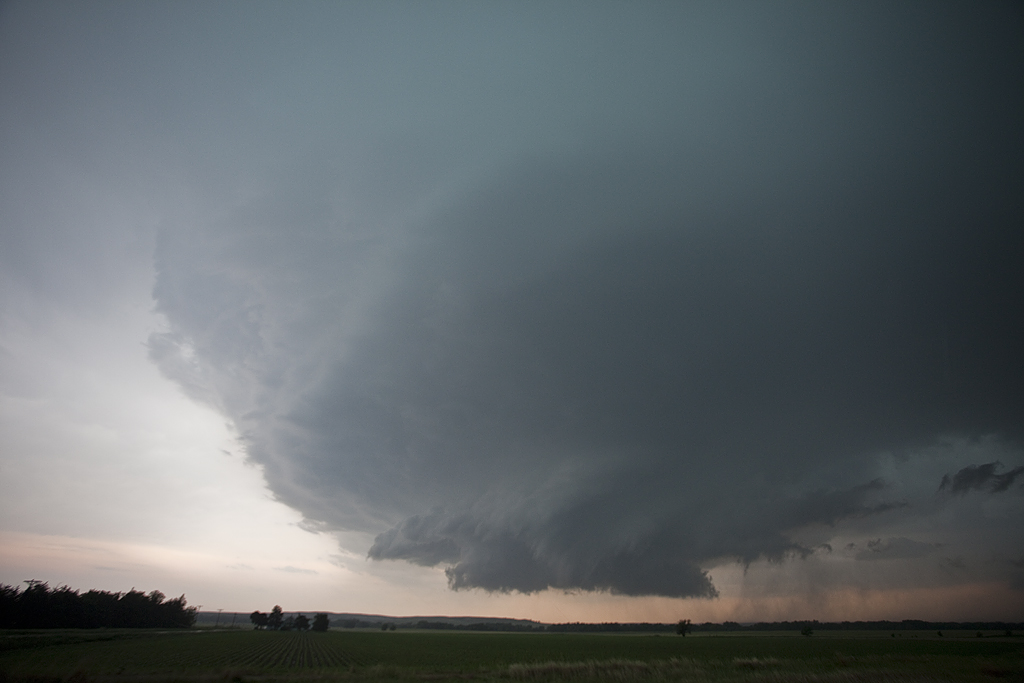
May 25th had tremendous potential. A warm front lay across central Kansas with a dryline intersecting it southwest of LaCrosse. By late afternoon, a supercell formed and moved along the warm front. It quickly became severe and tornado warned. Although reports of a tornado came in, we were directly under the circulation and only experienced RFD and TONS of dirt being kicked up. The storm moved northeast and became very high based and eventually died. By this time, we saw the tail end storm rapidly intensify and nearly anchor, so we blasted back southwest and arrived as the tail end supercell became intensely tornadic.
The structure was top notch with numerous inflow feeder bands wrapping around the north side of the updraft and a block shaped wall cloud with insane rising motion on the northeast side. I figured it was only a matter time before this storm produced and that was certainly an understatement. Just before dark and tapered cone tornado formed between LaCrosse and Hargrave and moved slowly east/northeast over the next 54 minutes! Frequent lightning constantly illuminated the tornado and allowed for some pretty decent photography. The tornado roped out northeast of LaCrosse where another tornado formed from the new mesocyclone. At one time there were actually 3 tornadoes on the ground, with the 3rd to our south actually going through LaCrosse. Fortunately no serious injuries or fatalities occurred from this tornadic supercell.
May 19th Southern Kansas Tornadofest
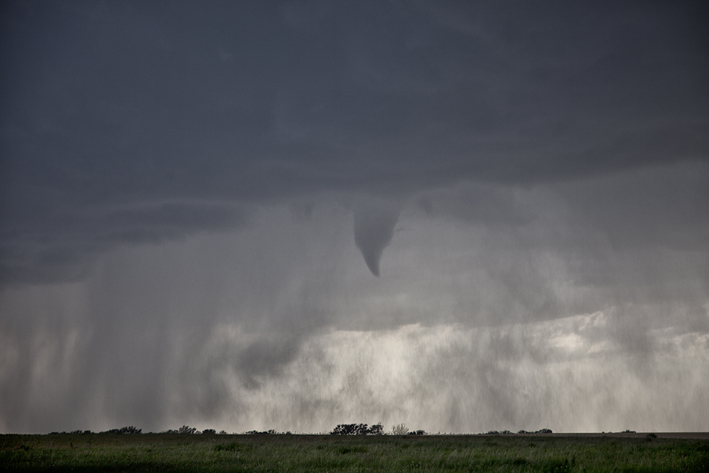
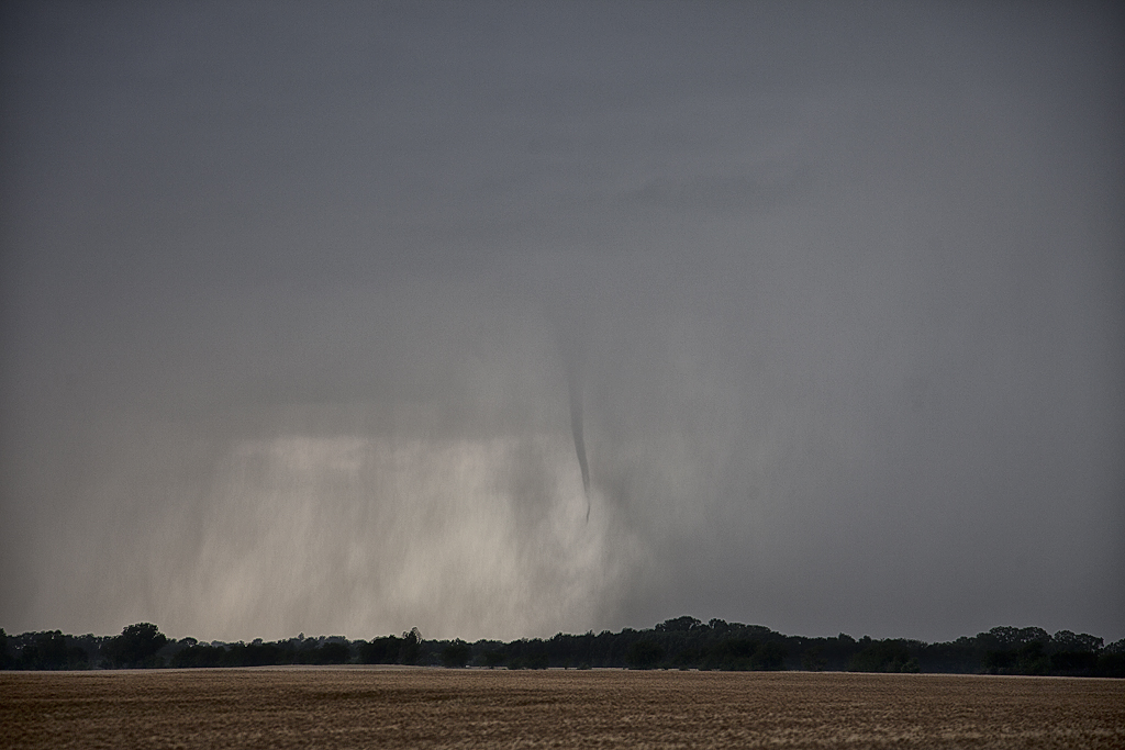
May 19th had some decent hopes of structured supercells. SPC highlighted the southern Nebraska area for higher tornado threat, but we chose to play further south along the dryline. Late afternoon, a line of towers rapidly formed and back built south as the boundary drifted southeast. A couple of these storms exhibited supercellular features, but it wouldn’t be until late afternoon that the boundary rapidly built south with each tower stretching the vorticity along the boundary and producing numerous non-supercell tornadoes. What a crazy day! We saw 5 tornadoes, with the final one being a strong EF3.
April 14th Kansas/Oklahoma Tornadoes
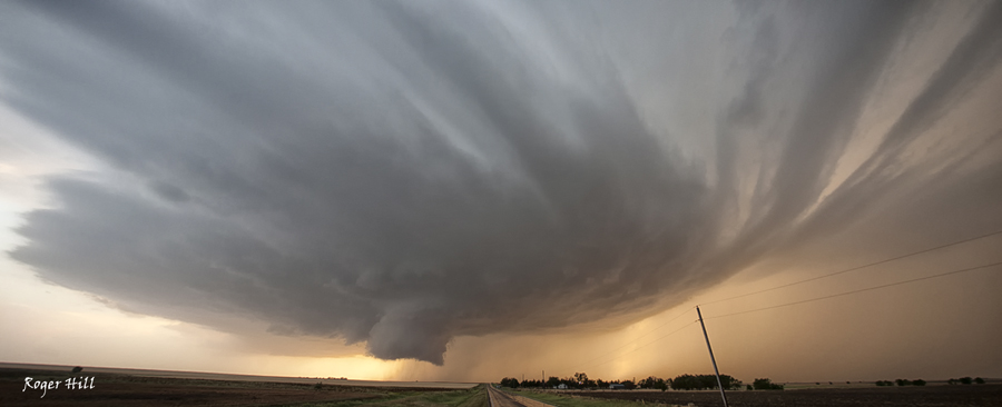
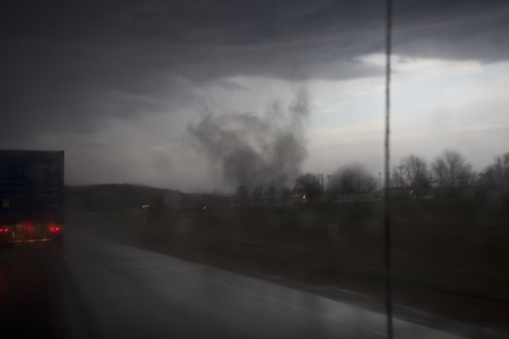
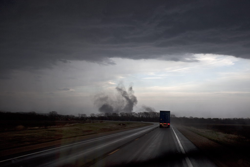
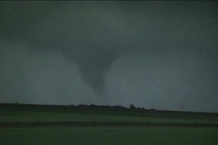
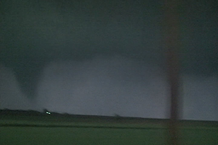
April 14th was a day that held great promise of long track violent tornadoes. SPC issued a High Risk for the area. We decided that we’d play the dryline down wind to allow storms to intensify as the raced at 50-60 mph towards us. The ultimate goal was to end up in northwest Oklahoma by mid afternoon, by dropping south with each storm until we got to within an hour of initiation point. Only thing is, nature would have the last laugh with us. We captured a tornado warned storm near Macksville that was racing towards Salina. When we saw it, it had weakened considerably, so we let it go. This would be the storm that RE-INTENSIFIED and produced several photogenic strong tornadoes near Salina. So, we dropped further south to a pair of tornado warned supercells heading towards Kingman. First one weakened as well, but briefly intensified and produced a short lived truncated elephant trunk shaped tornado. The second supercell pulsed up and down and produced two brief tornadoes not far from Pretty Prairie. Finally, seeing the storm of the day develop and immediately start producing tornadoes east of Woodward, we blasted south and made Manchester, OK right at dark. A very strong cone, then wedge formed and passed within 400 yards of us and raced into southern Kansas. We stayed with the storm, crossing multiple damage paths and witnessing several more tornadoes before we couldn’t stay up with it as it approached Wichita. This storm would produce anywhere from 15-20 tornadoes along its path from Woodward to northeast of El Dorado. Here’s a few pics from the day, overall a great deal of tornadoes intercepted, but what could have been in daylight for us, just wasn’t meant to be.
June 15th, 2011 Western Kansas High Based Supercells
I wasn’t expecting to even chase on June 15th, let alone catch a couple of pretty high based supercells in western Kansas. We intercepted one storm north of Scott City, and another north of Garden City that were both very pretty high based storms. Limited moisture, marginal instability and relatively weak shear would limit the threat, nonetheless, a couple great photo opportunities became available!
June 1st, 2011 Northern Kansas Tornado Warned Supercells
I wasn’t expecting much this day, as weak flow aloft would ensure numerous HP type storms would form. In the end that is exactly what happened. Too many supercells clumped close together would make viewing extremely messy and hard. We captured two storms that were at least viewable and both were tornado warned. Both occurred not too far from Stockton, Kansas.
May 21, 2011 Topeka, KS Tornadic Supercell
Chased May 21st near the Topeka area. Shear didn’t look that spectacular, nor did moisture, but with some Kansas magic anything can happen. We sat just west of Topeka watching towers go up north and southwest. Finally we committed to two storms southwest of us, one left mover and one right (that ended up developing into the Topeka storm). This storm had superb structure almost its entire life cycle, and finally produced a tornado near Lake Perry that I could only get a 30 second video of. All the shots below are from my 5d Mark II, but one last video grab from my Z7U of the tornado as we lost it in the trees. ARRRGHH! To be sitting there the entire time and then to not be able to get close to this tornado was frustrating to say the least.
April 3, 2011 Lawrence, KS Gustnado/Tornado
April 3rd brought Caryn and I to eastern Kansas to play the dryline/front intersection. By late afternoon a supercell developed and tracked just north of the boundary, occasionally pulling it into it. The high based nature of the storm limited its ability to produce a significant tornado, however, just north of Lawrence on US24 the storm spun up “something” that has been dubbed a tornado, landspout and a gustnado. It did cause damage to irrigation systems, trees and destroyed a building. Due to the strong RFD associated with this, I would be more inclined to call it a gustnado or a weak tornado. The debate will go on.
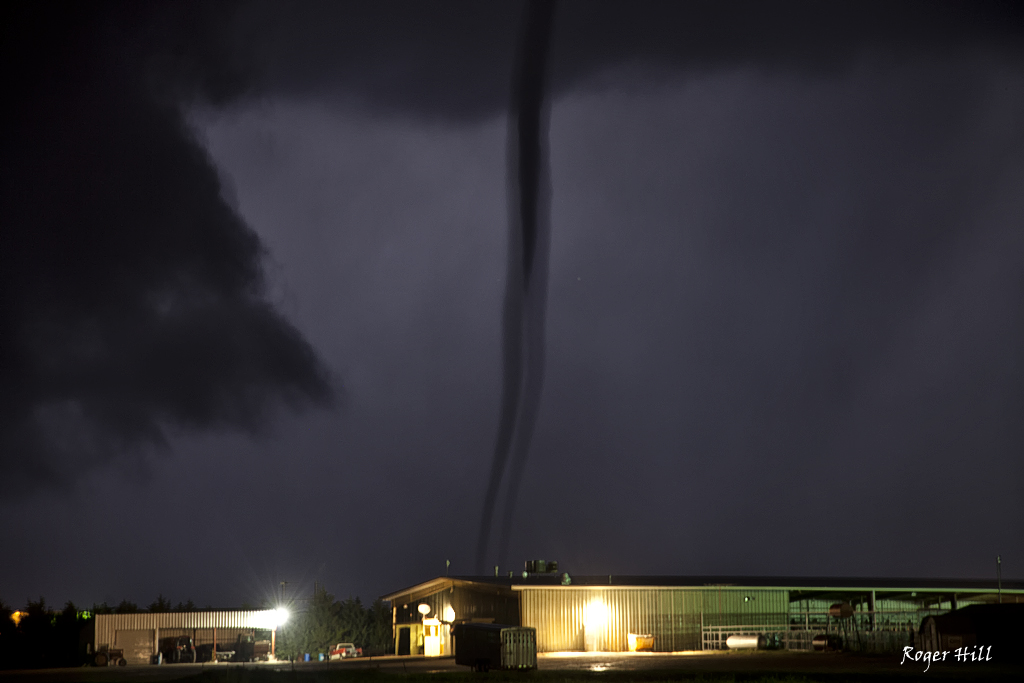
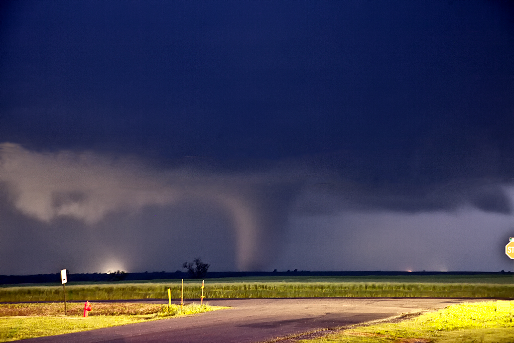
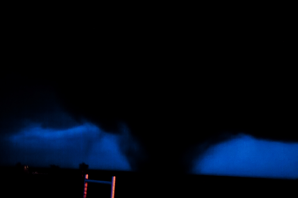
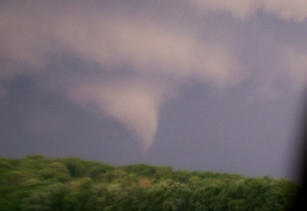
May 23, 2010 Northwest Kansas Nighttime Tornado
Not much to show here as the only shots I got were in the dark of the slender cone. There was another tornado just after this, a tapered elephant trunk that the NWS in Goodland could see from their office. The shots here are all video stills.
April 29, 2010 Washington, Kansas Tornadic Supercell
April 29th took us to central/northern Kansas to play a boundary. Moisture was not optimal that day, but lift and shear were great. A supercell formed southwest of Cuba, Kansas and looked pretty respectable. It had a decent non-rotating wall cloud for a long time. Finally as it moved north of Washington, a new lowering started spinning rapidly, eventually putting down a brief tornado as it came directly overhead blasting us with strong WARM RFD winds. The wall cloud passed directly overhead giving us a moment of intensity hoping it would not drop a tornado until it passed us. It was on the ground off and on for about 3 minutes before dissipating.
Check out this video time lapse: