
May 25th LaCrosse, Kansas Tornadoes
May 25th had tremendous potential. A warm front lay across central Kansas with a dryline intersecting it southwest of LaCrosse. By late afternoon, a supercell formed and moved along the warm front. It quickly became severe and tornado warned. Although reports of a tornado came in, we were directly under the circulation and only experienced RFD and TONS of dirt being kicked up. The storm moved northeast and became very high based and eventually died. By this time, we saw the tail end storm rapidly intensify and nearly anchor, so we blasted back southwest and arrived as the tail end supercell became intensely tornadic.
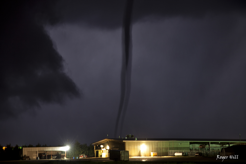
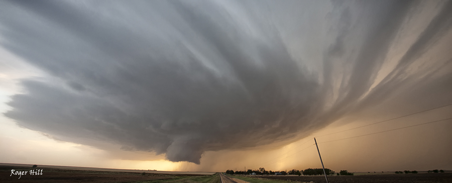
The structure was top notch with numerous inflow feeder bands wrapping around the north side of the updraft and a block shaped wall cloud with insane rising motion on the northeast side. I figured it was only a matter time before this storm produced and that was certainly an understatement. Just before dark and tapered cone tornado formed between LaCrosse and Hargrave and moved slowly east/northeast over the next 54 minutes! Frequent lightning constantly illuminated the tornado and allowed for some pretty decent photography. The tornado roped out northeast of LaCrosse where another tornado formed from the new mesocyclone. At one time there were actually 3 tornadoes on the ground, with the 3rd to our south actually going through LaCrosse. Fortunately no serious injuries or fatalities occurred from this tornadic supercell.
No comments yet.