Tag Archives | Kansas

April 29, 2010 Washington, Kansas Tornadic Supercell

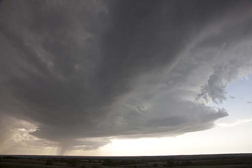
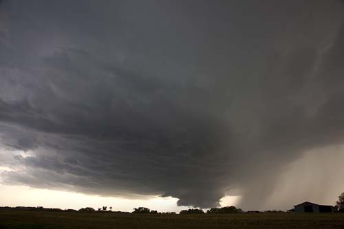
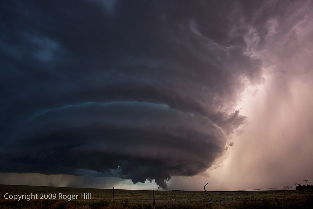
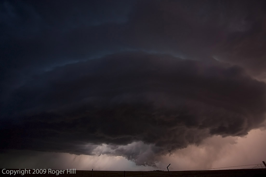
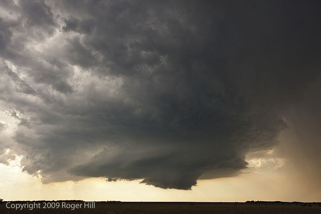
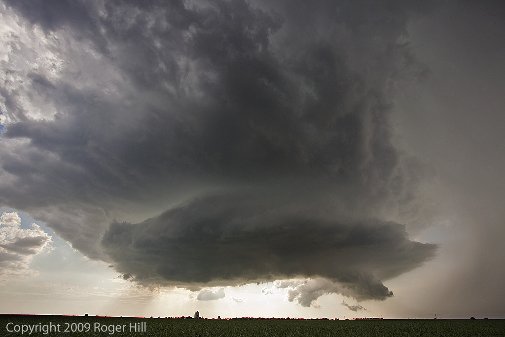
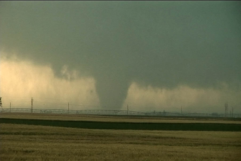
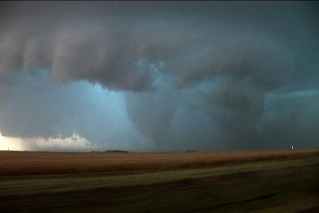
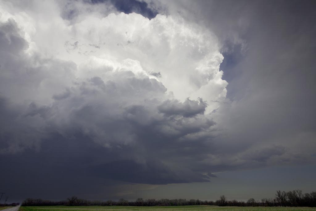
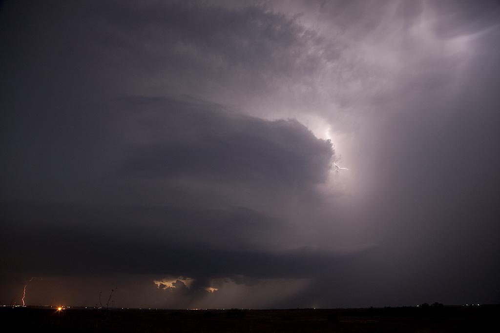
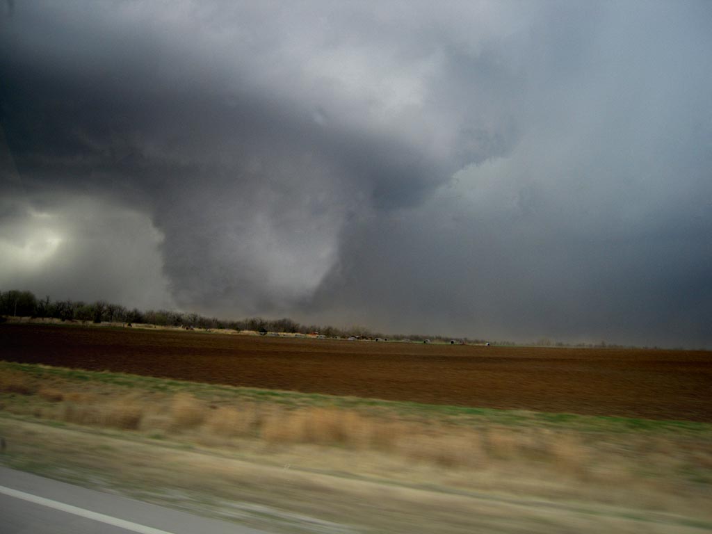
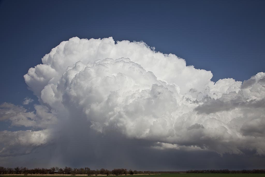
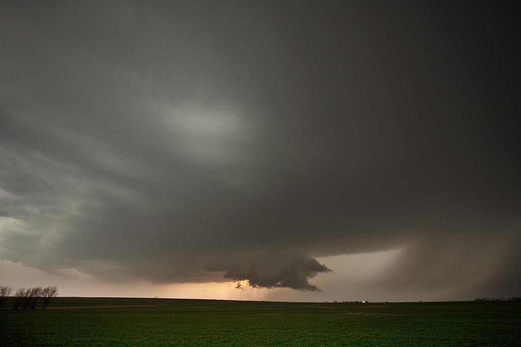
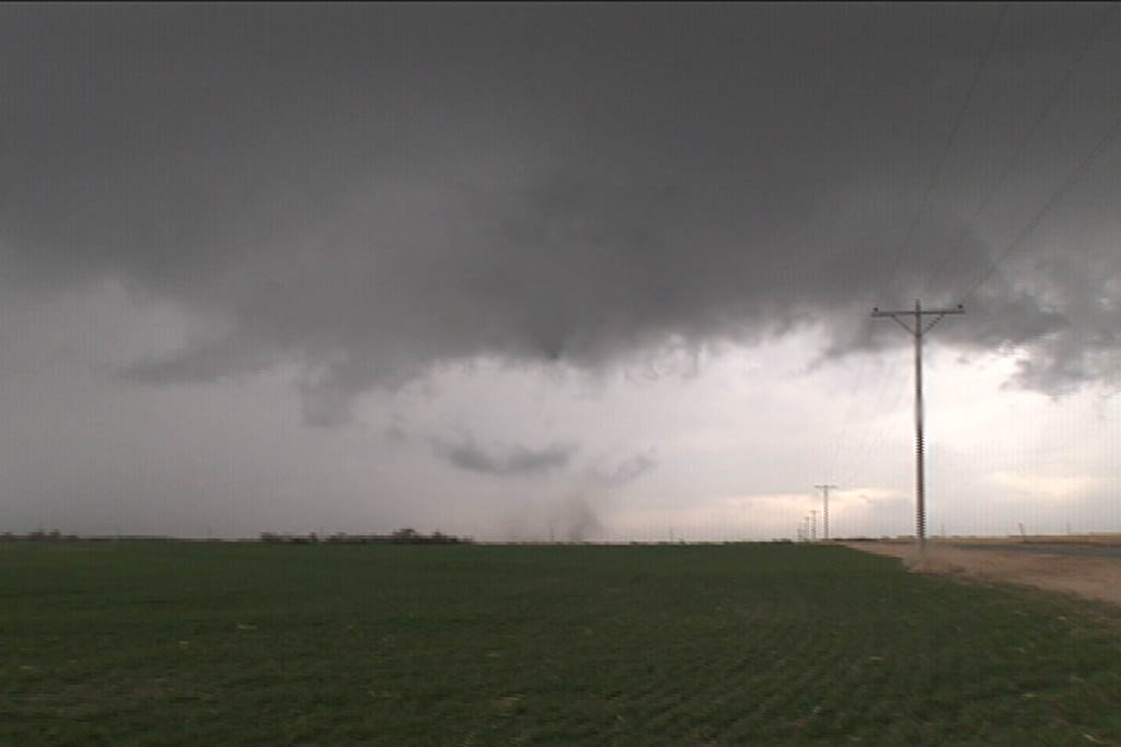
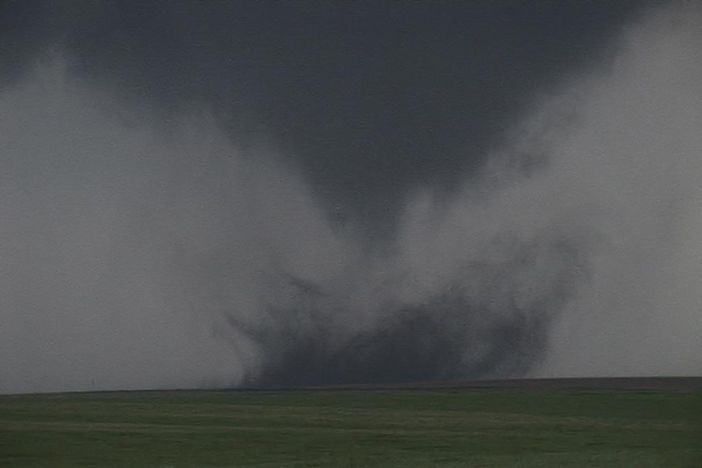
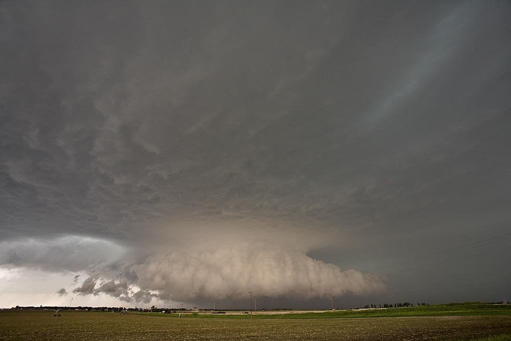
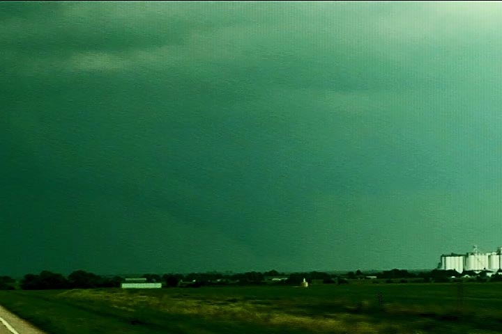
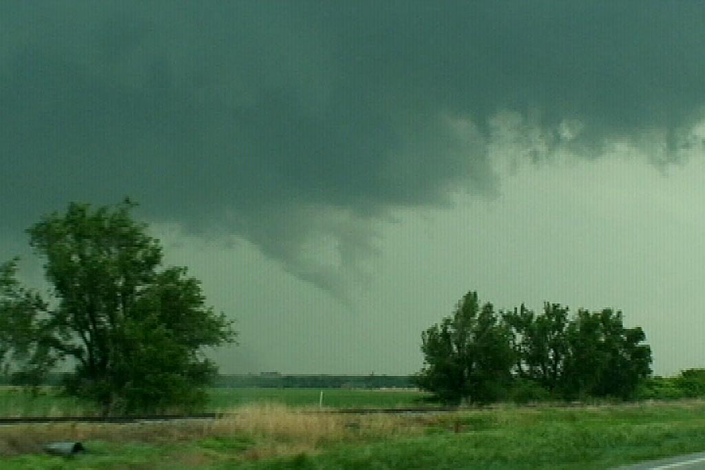
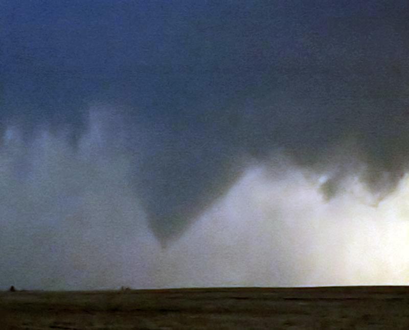
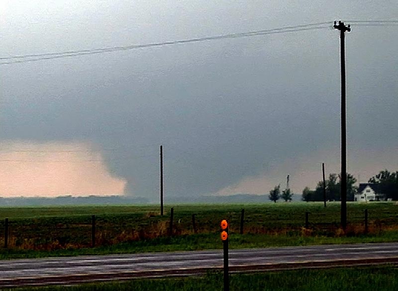
April 29th took us to central/northern Kansas to play a boundary. Moisture was not optimal that day, but lift and shear were great. A supercell formed southwest of Cuba, Kansas and looked pretty respectable. It had a decent non-rotating wall cloud for a long time. Finally as it moved north of Washington, a new lowering started spinning rapidly, eventually putting down a brief tornado as it came directly overhead blasting us with strong WARM RFD winds. The wall cloud passed directly overhead giving us a moment of intensity hoping it would not drop a tornado until it passed us. It was on the ground off and on for about 3 minutes before dissipating.

Check out this video time lapse:

July 31, 2009 Kansas Tornadic Supercell

What a pleasant surprise this day was! I was hoping for a couple of high based supercells in western Kansas and certainly got much more than I hoped for! Several supercells developed from southwest Nebraska southward along a boundary in western Kansas. Caryn and I intercepted a tornadic storm just south of Gove that produced hail almost golfball sized as well as at least 2, possibly 3 tornadoes.

July 20, 2009 Kansas Beautiful Supercell

July 20th had decent promise for severe storms. An old boundary lay northwest to southeast across Kansas, with increasing shear and lift with an approaching wave. Severe storms formed along the boundary, with a storm I intercepted in central Kansas near Great Bend. The storm of the day was in southwest Nebraska, but this storm as well was tornado warned. Check out this new time lapse video:

June 15, 2009 Kansas Tornadoes

June 15th was a strange day. Early on it looked like the area along the Kansas/Nebraska border would provide the best opportunities for severe storms and tornadoes. We ended up playing the dry punch in southwest Kansas, and intercepted a tornadic supercell near Belpre, Kansas. Later that evening, there were tornadic supercells in southern Nebraska as well.

First 25 days of April, 2009

This is a collection of photos from storms I chased during the first 25 days of April. They are at various locations as shown with each photo’s caption.

March 23, 2009 Arkansas City, KS Tornadoes

March 23rd was a day full of strong dynamics but limited moisture/instability. My plan was to head to the I-35 corridor south of Wichita and play where the best moisture/instability intersected the dryline. We caught a nice supercell, albeit high based near Kingman, KS which was severe, produced tons of hail and had a respectable wall cloud. However, the best storm of the day would form south of Enid, Ok and move into the Arkansas City, Kansas area by late afternoon and produce two fairly weak tornadoes. The structure of the storm was by far better than I had anticipated. Later, we dropped into the Oklahoma City area to play the tail end storms for lightning. We weren’t disappointed.

March 7, 2009 Hutchinson, Kansas Tornadic Supercell

March 7th was a day of decent kinematics, but limited moisture. Nonetheless, intense supercell storms formed along the triple point in south central Kansas and intensified as they moved northeast through the instability axis. Most of these storms had decent structure and rotation, with several tornado reports occurring around the Hutchinson area. We intercepted on tornadic storm and several other rotating nicely structured supercells.

May 29th, 2008 Nebraska and Kansas Tornadofest

May 29th was advertised as a High Risk from the Storm Prediction Center. It seemed all ingredients were in place for a significant severe weather event, including strong to violent tornadoes. We decided to play the warm front along the KS/NE border area and as far west as we could. The first supercell of the day formed north of Mc Cook and became tornado warned almost instantly. It produced the Kearney, Nebraska tornado that caused significant damage. We followed the storm to east of Kearney when it became totally rain choked. We then dropped south into north central Kansas and caught the cyclic tornadic supercell from Tipton, Kansas, northeast towards Jewell, Kansas. The storm was a sight to behold!

May 25th Kansas Supercell and Tornado

May 25th was a day I wish I had been in Iowa. However, good shortwave energy, good shear, moisture and instability would keep me in Kansas. I caught two nicely structured supercells this day, one of which produced a landspout type tornado that persisted for about 5 minutes. The first supercell, south of Hays,, was tornado warned and actually produced a few very weak brief touchdowns. We had chased farther west on a tornado warned storm that ended up VERY high based, and thus missed the initial “dusty multivortex” tornado report. I fully believe the report based on what we saw. The second storm just east of the first had pretty structure and produced the landspout.

May 22/23rd, 2008 Kansas Tornadoes

May 22 and 23 were advertised as big days for the central plains. Moderate and High Risks were issued by SPC and well justified. Numerous supercells exploded, especially in Kansas both days and we were fortunate to intercept a few of them. On May 22nd, we were on a storm that would produce tornadoes near Collyer, Kansas, but due to a flat tire we couldn’t keep up with it. The day was salvaged as we intercepted a massive supercell near Wakeeney, Kansas that produced two confirmed tornadoes.

May 23rd would be the best of both worlds where we would intercept two sets of supercells that produced tornadoes near Quinter, Kansas with one being EF4. However due to the state patrol rightfully blocking the interstate, we were only able to get about 4 miles from it. Check out the video stills below. I didn’t shoot many stills due to having to spend my time navigating to keep up with these rapidly moving supercells.