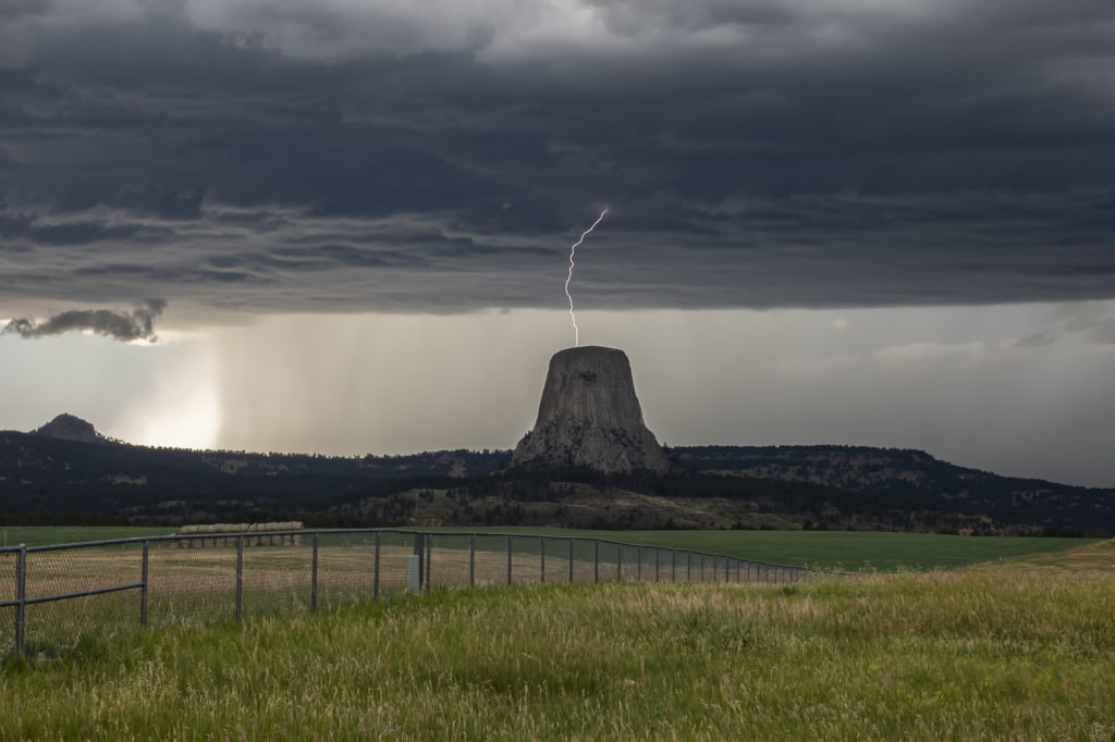
July 19th was a spectacular day! Good moisture, high instability, good wind shear and a boundary along the Wyoming/Montana border would set the stage for intense supercell development. One such storm formed northwest of Devil’s Tower and drifted southeast. As it crossed Devil’s Tower we had quite the lightning show! I managed to capture a bolt hitting the top of the tower! As the storm moved southeast near Sundance it became extremely electrified producing a CG every 3-4 seconds! At one point, it had an appearance like it was ready to produce a tornado. We lost visibility in the hills and could not confirm one way or another if it did. Later, a second supercell tracked southeast from near Buffalo, WY down to Lusk, WY. This storm constantly spun hard, had pretty structure and was also tornado warned numerous times! It’s structure was top notch and had various rotating wall clouds throughout it’s life. But, as continued to be the theme for 2020, storms had great structure but just couldn’t produce significant tornadoes. Overall it was my favorite day in July for chasing, and one we captured some incredible photos! Enjoy!
July 14th Southeast Colorado Tornado Warned Supercell
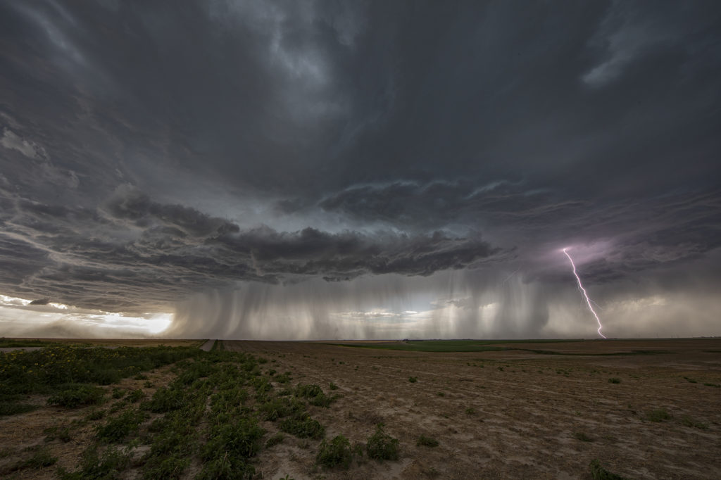
July 14th kept us in Colorado to chase off the Palmer Divide into southeast Colorado. A sagging cold front we push moisture westward into the Palmer Divide, causing storms to develop by mid afternoon. Those storms produced copious amounts of hail, but became undercut by outlfow and died. The boundary pushed south as more storms formed along it east of Pueblo. Near the town of Sugar City, one storm formed and spun hard. It quickly became tornado warned and stayed that way for a few hours. A couple of times, it had the look like it wanted to drop a tornado, but it never did. As it merged with numerous storms west of Lamar, the storm interaction with others caused it to produce a quick 1 minute spin up. The structure with this supercell was quite nice. It was also quite electrified! Eventually this cluster of storms pushed into western Kansas and weakened as we followed it east to Garden City. Great day! Beautiful storm and it certainly tried to get very interesting! Please click on a pic for a larger image. Enjoy!

July 13 Eastern Colorado/Western Kansas Supercells
July 13th was the second day of our Tour 9, Great North Tornado Hunt tour, and it took us east of Denver towards the Kansas border. Decent shear, limited moisture and CAPE, and an approaching dryline, would set the stage for high based storms to form. As the storms moved into Kansas, they intensified and the bases came down. We had a couple very pretty rotating storms in far western Kansas that were quite electrified. The final storm of the day was a very nicely structured LP supercell near Leoti, that spewed out numerous lightning strikes and intercloud discharges. I thought for a minute that it had some tornado potential, however the base lifted, the wall cloud dissipated and it eventually died as well. A fun day, great storms and super lightning. Please click on a pic for a larger photo. Enjoy!
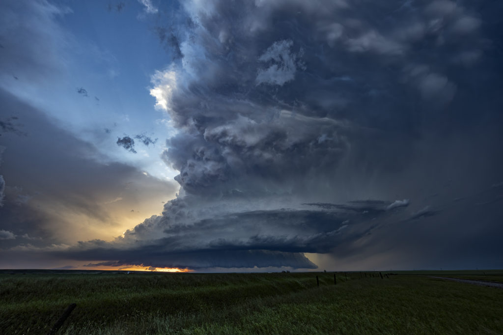
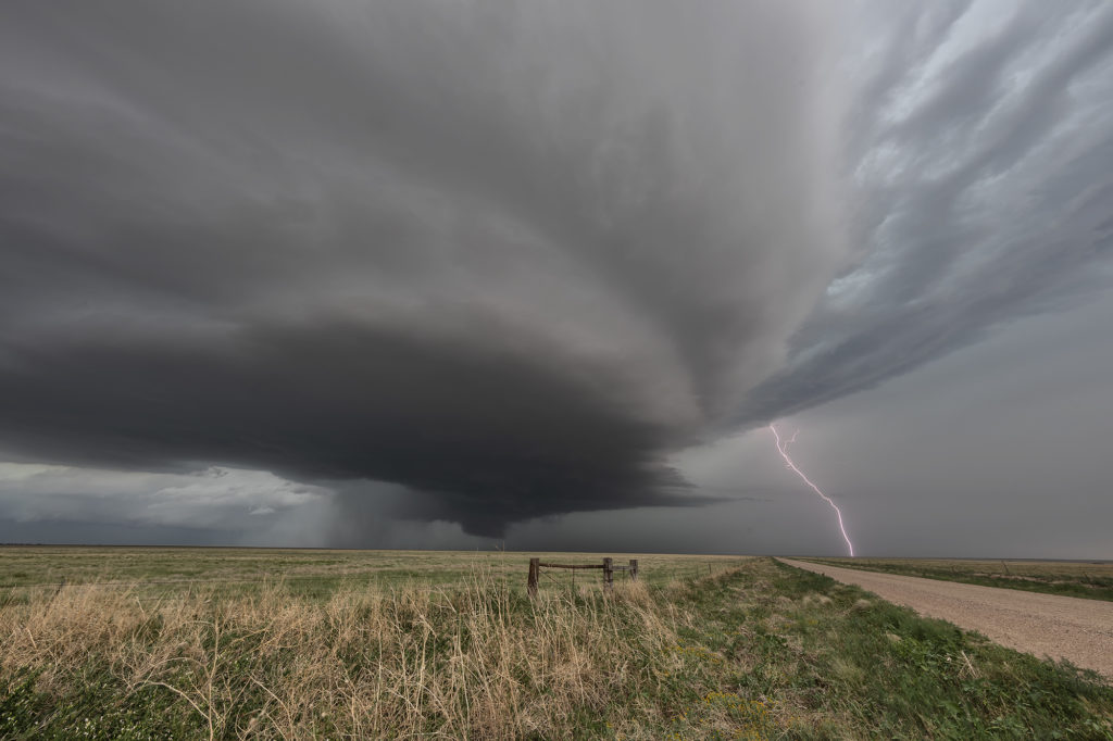
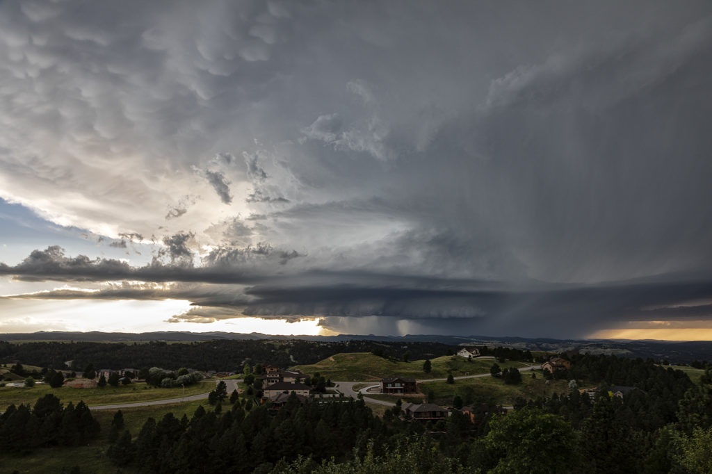
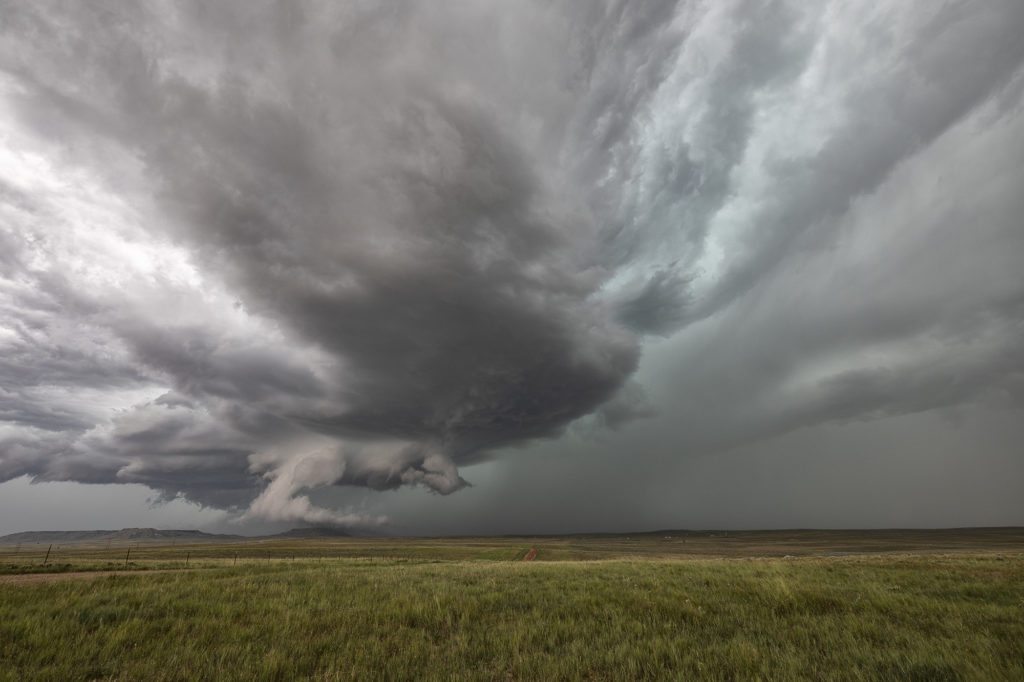
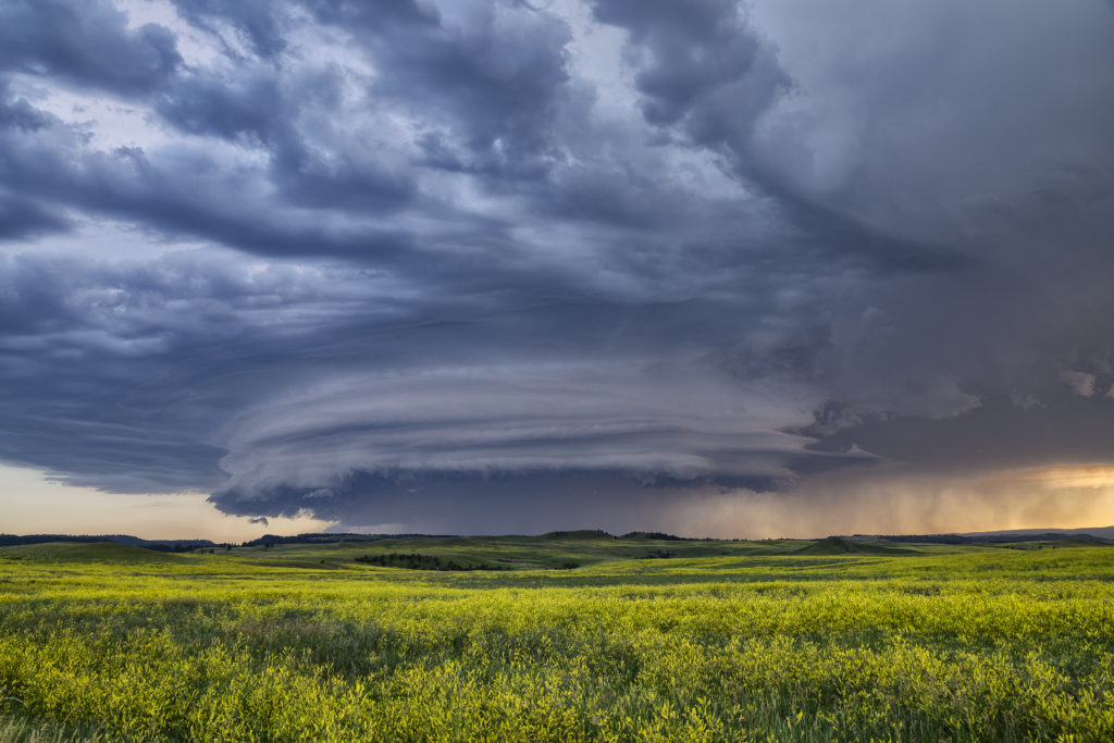
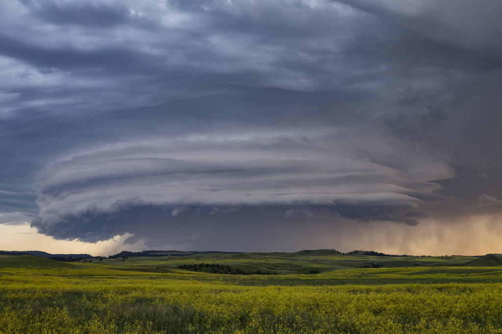
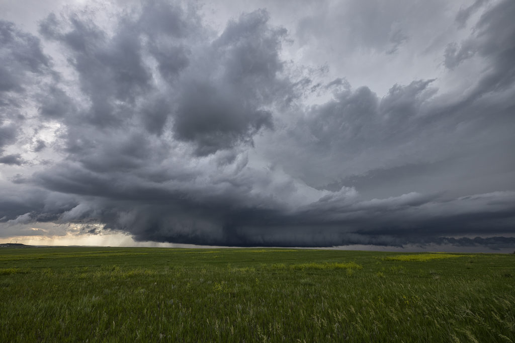
July 6th/7th Northeast Wyoming/Southwest South Dakota Tornadic Supercell and Severe Storms
July 6th was an inbetween day for our tours. However, as we often do, if there is a decent set up, we’ll run one of our on call tours. That’s exactly what we did the 6th and 7th! On July 6th we started in Denver and blasted to southeast Montana where storms were forecast to form along a boundary with good instability and shear. We’ve seen numerous tornadoes in this region over the years and some outstanding supercells! Today would be no different! We made it south of Broadus, MT and turned east on a dirt road near Biddle. We had a great view of the developing supercell. As we continued east, the forward flank core caught up with us so Caryn had to push it a bit to get out of the heavy rain so we wouldn’t get stuck. Low and behold as we were blasting east on muddy roads, trying to get south of Alzada to head south towards Hulett, WY, our wonderful storm tornadoed. Couldn’t see it from our location, thanks to horrid road network. However, if you were north of Hulett, you had a decent, albeit distant view. We stayed with the storm as it crossed the Black Hills near MT Rushmore and onto the nearly plains. It became a stunningly beautiful supercell as it tracked towards the Badlands. Gorgeous!
On the 7th we played southeast Montana again. However moisture quality was much poorer than the day before. Storms formed along a boundary and became a squall line as they moved east. They were still pretty and offered some very photogenic moments! We stayed in front of them back to Rapid City, SD where we spent the night before returning to Denver the next day.
Please click on a photo for a larger image. Enjoy!
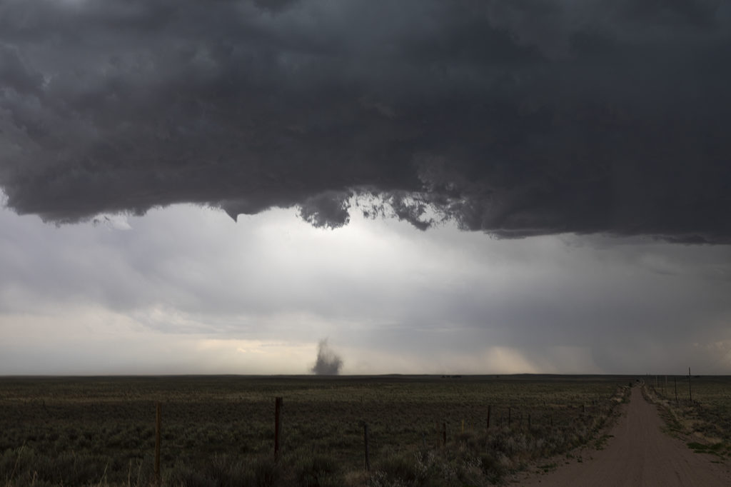
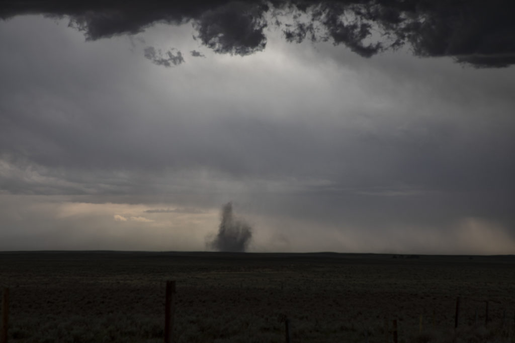
July 3rd Northeast Colorado Tornadoes
July 3rd brought us back to Colorado for the final day of the Photo Tour. Nature decided to give us some pre4th fireworks! A boundary set up north/south of a line from Ft Morgan to east of Limon. Intense storms formed along it and with a wind shift in place, two landspout tornadoes formed that we were able to witness. They lasted several minutes each before dissipating. Storms were quite sever with hail tennisball sized and lots of lightning as well. We intercepted the first cells on highway 71 south of Brush and followed the southward building line from there. Good shear, moderate CAPE, but limited low level moisture fueled the severe storms till eventually they gusted out and weakened. Fun final day of chasing for the tour before returning to Denver later in the evening. Please click on a pic for a larger image. Enjoy!
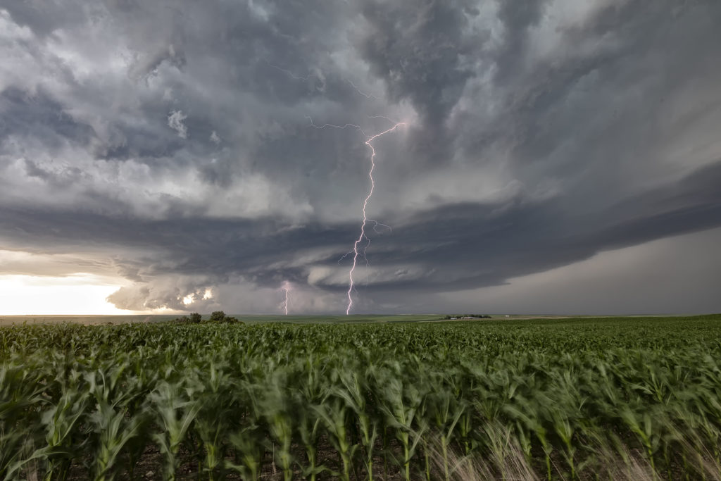
July 15th Northeast Wyoming Potentially Tornadic Supercell
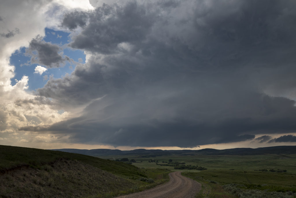
July 15th had the right stuff. Good moisture, instability and lift were available, however shear was a touch weak. Storms formed over the southern end of the Big Horn mountains in Wyoming and tracked east/southeast becoming severe. One particular cell near the Pumpkin Buttes area southwest of Gillette, quickly intensified and became a strong supercell thunderstorm. Strong low level shear along a boundary caused it to spin viciously. A couple of funnels formed, but we could never confirm anything on the ground. However by the appearance and the damage we saw afterwards, it would not be a surprise if there was a tornado. The storm was quite electrified and intense. As it moved off the buttes towards Wright, it steadily weakened and dissipated east of that area.
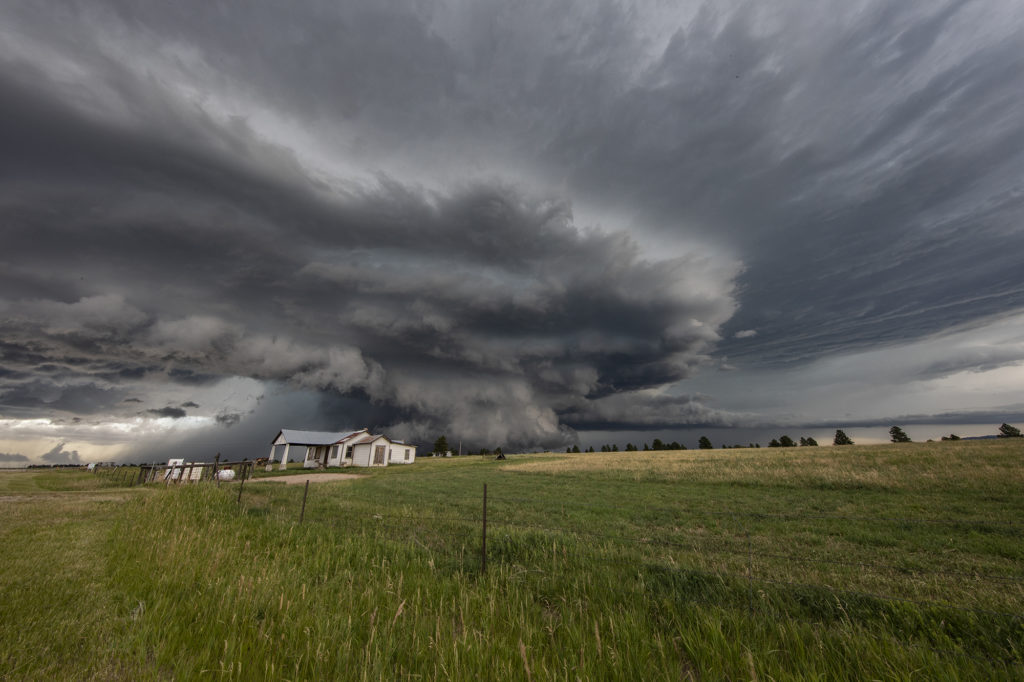
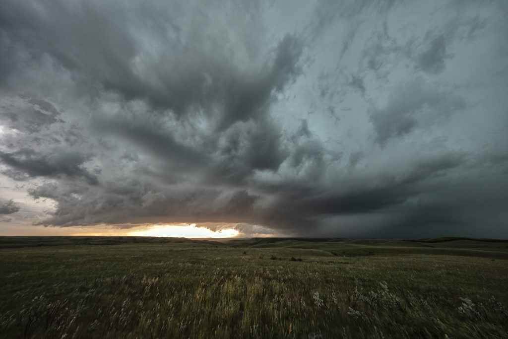
July 11th Black Hills of South Dakota Severe Storm
We weren’t expecting much on July 11th. Nature decided to give us a pretty storm southwest of Spearfish, SD late day. The cell was very photogenic, and throw in the fields of sweet clover and you had a winner! The cell traveled for a few hours across northeast Wyoming into western South Dakota, where it dissipated over the Black Hills. Very pretty to watch and photograph! Enjoy the pics!
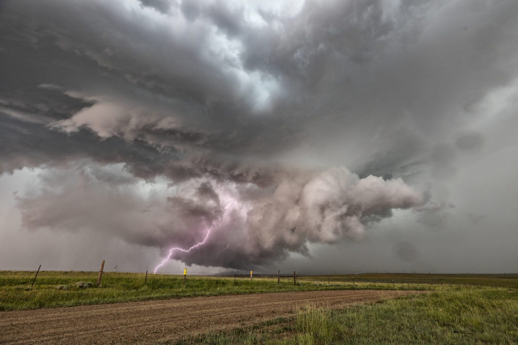
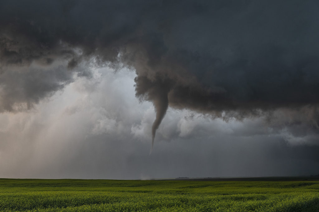
July 4th Chugwater, Wyoming Tornado
What a way to spend the 4th of July! We decided mid morning that it looked too tempting not to chase this day. Upslope flow into the Laramie Range in southeast Wyoming was the hot spot. Good shear, instability and moisture would help form an intense supercell mid afternoon. This storm crossed the Laramie Range and intensified as it moved east off the higher terrain. We were just west, then southwest of town as the storm spun hard. A funnel formed and nearly touched down as it crossed the mountains. Once close to town a very low and strongly rotating wall cloud formed. Soon a nice cone shaped tornado touched down and stay on the ground for nearly 25 minutes! It crossed I-25 south of town and as the cell moved east it encountered more stable air and weakened.
This supercell had fantastic structure, intense cloud to ground lightning and baseball sized hail. The tornado caused no damage thankfully and was a treat to watch and photograph. In hindsight I wish we would have stayed south of it instead to trying to stay in front of the storm. The views from the south were stunning! A fun way for us to spend the 4th of July. Once we got back home after dark, we had our own private fireworks from a large pack we bough last year in Missouri. Enjoy the pics!
July 10th Killdeer, Saskatchewan Canada Tornadofest
July 10th lived up to the potential forecast models showed! A strong shortwave trough would traverse across southern Canada and Montana, as a dryline/cold front and associated warm front would slide slowly east. Strong shear, deep moisture, high CAPE and several boundaries would be the focus on severe storms. The question would be whether or not they would be isolated or clusters/linear. Fortunately a cluster of supercells formed over southern Saskatchewan and the tail end cell anchored along the warm front west of Killdeer. This storm would become a tornado machine as it produced at least 11 tornadoes we counted. More may have occurred as multiple occlusions occurred and some were quite messy with low visibility. This was one of the best tornadic events we’ve witnessed in Canada in 20 years of tours! Fortunately the tornadoes stayed over rural countryside and did little damage. A couple of these were quite strong. This storm slowly moved east riding the warm front all the time and eventually was choked off by outflow from a linear complex over Montana. Amazing event and a great way to end our tour season! Enjoy the photos and video stills!
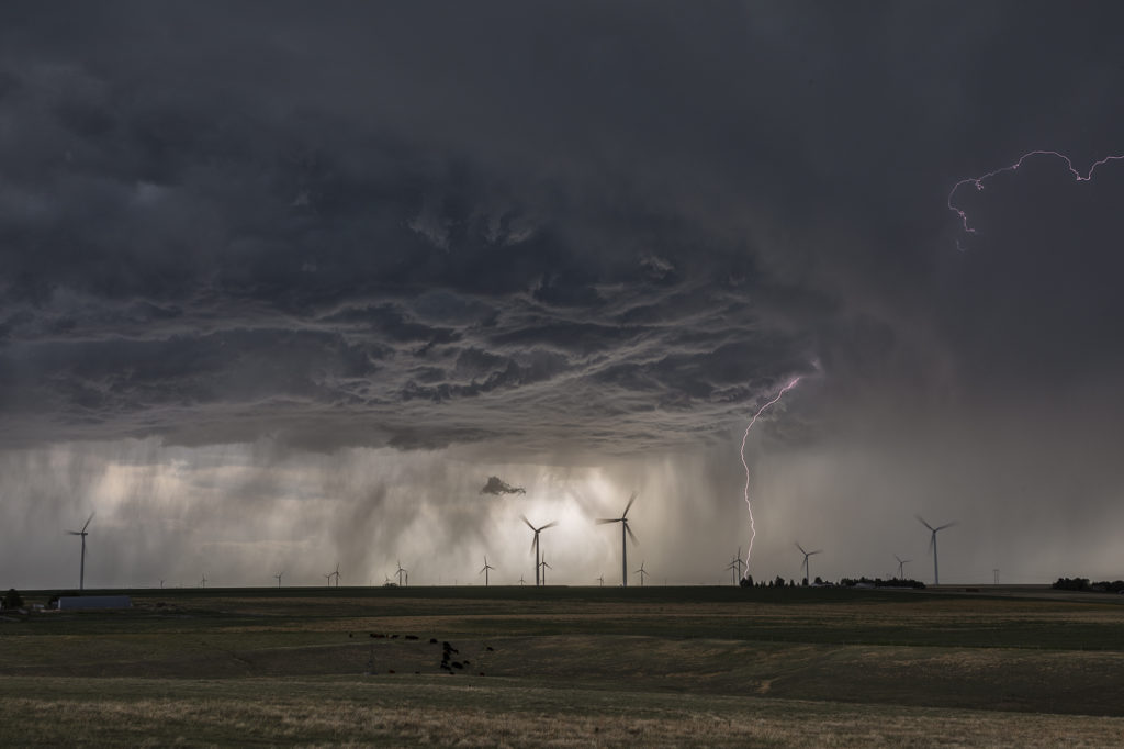
July 9th Northeast Montana Tornadic Supercell
July 9th had big potential. It wasn’t clear whether that would be across the international border into Canada or if storms would right turn along a warm front into northeast Montana and northwest North Dakota. Fortunately, for ease of chasing, storms crossed into the US and gave us quite a show! An intense supercell cycled and really ramped up as it crossed north of Plentywood, Montana. Due to high CAPE, strong deep layer shear, dew points in the lower 70s and the aforementioned warm front, the stage was set! This supercell became a monster, the storm of the day, as it rolled through Plentywood, MT and into far northwest North Dakota. Huge hail to baseball size, microburst winds of nearly 120 mph and an EF1 tornado that hit Plentywood, would be the highlight this day. A second supercell soon followed the path of the first and had just amazing structure as it rolled through Plentywood. Highways ended up being blocked due to debris from downed trees, power lines and houses through town. Fortunately there were no fatalities. Check out the photos below. Enjoy!!!