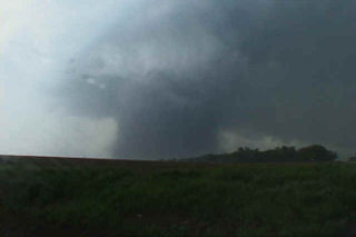
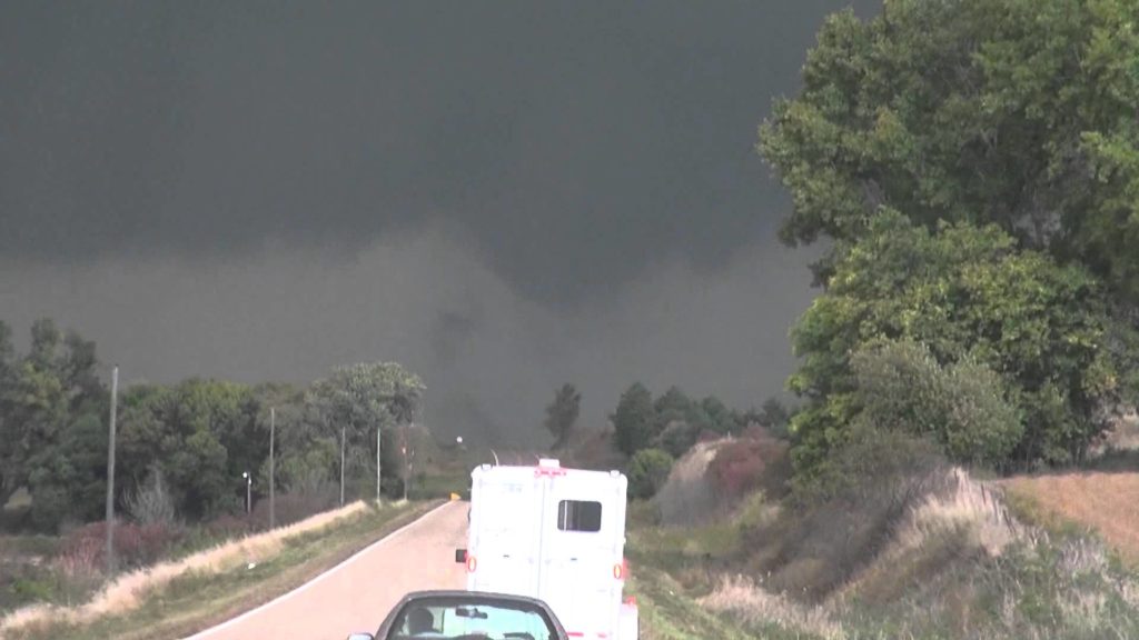
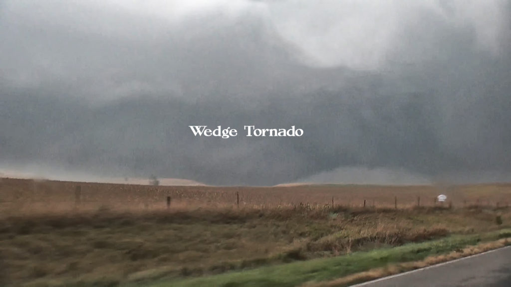
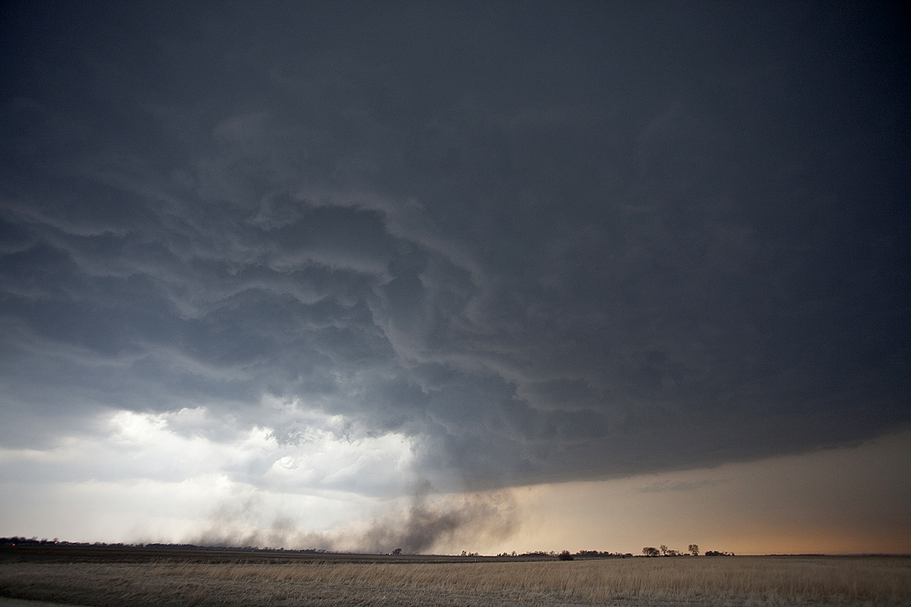
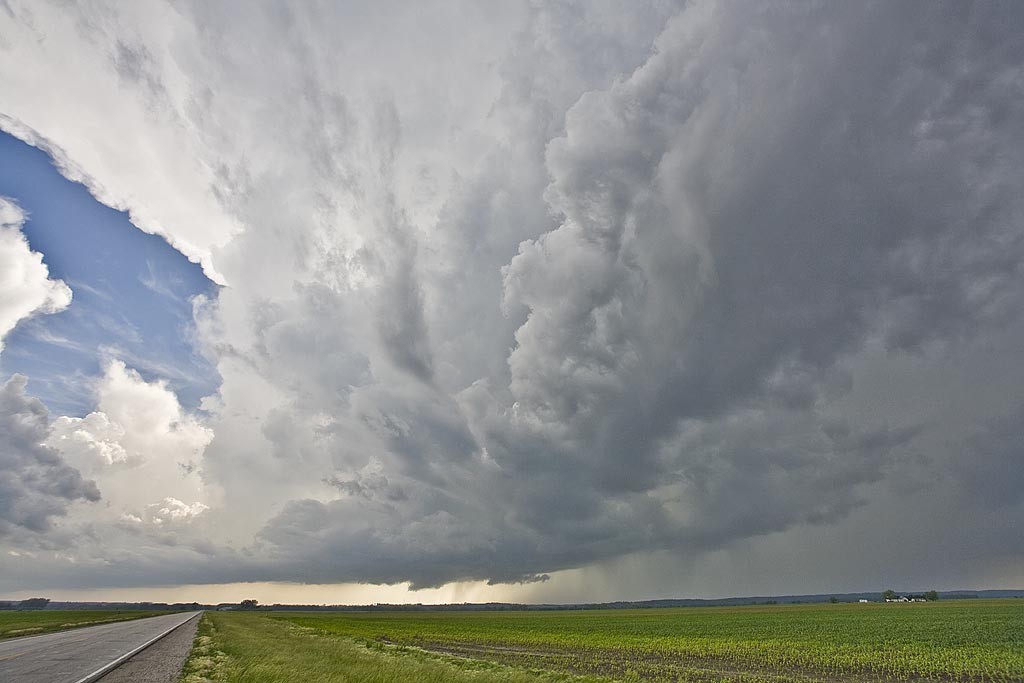
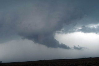
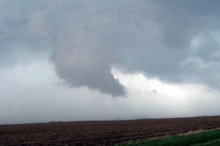
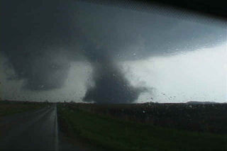
October 4th looked crazy on paper. Great shear, super lift, great instability and moisture for Oct spelled big trouble for the folks in eastern Nebraska and western Iowa. We left early morning in heavy snow and fog from our home in Colorado, and headed towards Lincoln, NE where we’d decide to head north or east. A supercell formed north of Columbus and was moving away from us so we decided to play the patience game for something further east. Soon a wedge tornado formed from the first supercell and we were feeling pretty bummed. Finally our storm got going as it crossed into western Iowa, dropping a large tornado west of Sloan. After an occlusion, a second, third and fourth tornado formed and the latter becoming a large 1.5 mile wide wedge heading near Climbing Hill northeast towards Cherokee. We had to stop the trip as we encountered a destroyed farmstead north of Climbing Hill, where our search resulted in no injuries, except farm animals. Fortunately, no fatalaties occurred that day, but a lot of destruction of property. Here’s a 10 minute video from this day:
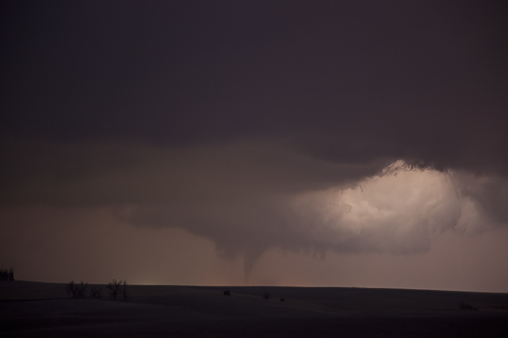
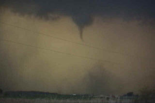
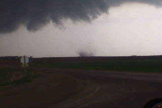
April 9, 2011 Mapleton, IA Tornadic Supercell
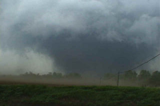
April 9th took us to the warm front in western/northwestern Iowa. A supercell developed on the southern flank of a cluster of storms, and became the storm of the day. Very good shear, moisture and instability would allow this beast to spin for hours! We witnessed 12 tornadoes from this monster, with many strong tornadoes occurring after dark. Photography is tricky when you don’t get a ton of lightning, thus a few of the images are a bit blurring caused by long exposures at high ISO.
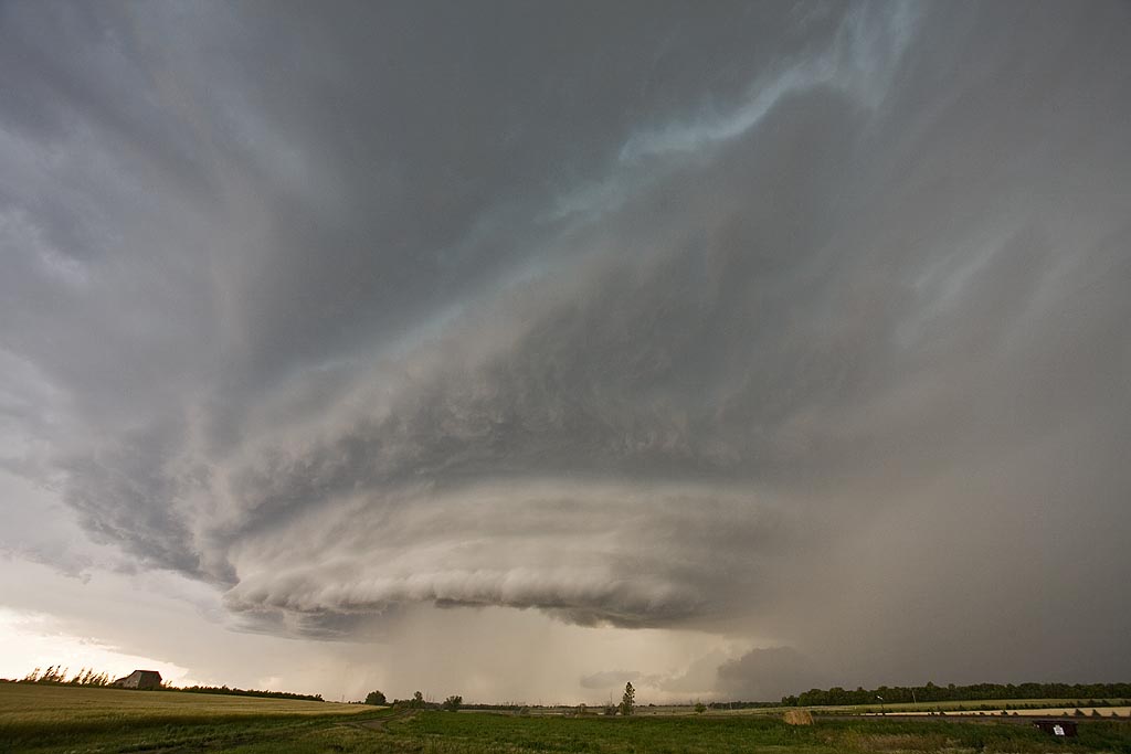
July 19th, 2008 North Dakota Incredible Supercell!
July 19th was a day I thought we would be in Canada. A strong trough, with good moisture and instability tracked along the US and Canada border. A boundary had formed from northwest North Dakota into western Iowa and would be the focal point for severe storms. We intercepted a supercell near Williston, North Dakota and tracked it well south of Bismark, North Dakota, over a 10 hour chase! It was either severe or tornado warned the entire time. What a beautiful storm. It arguably was the prettiest supercell of the year. It produced dozens of severe hail reports including hail baseball sized.
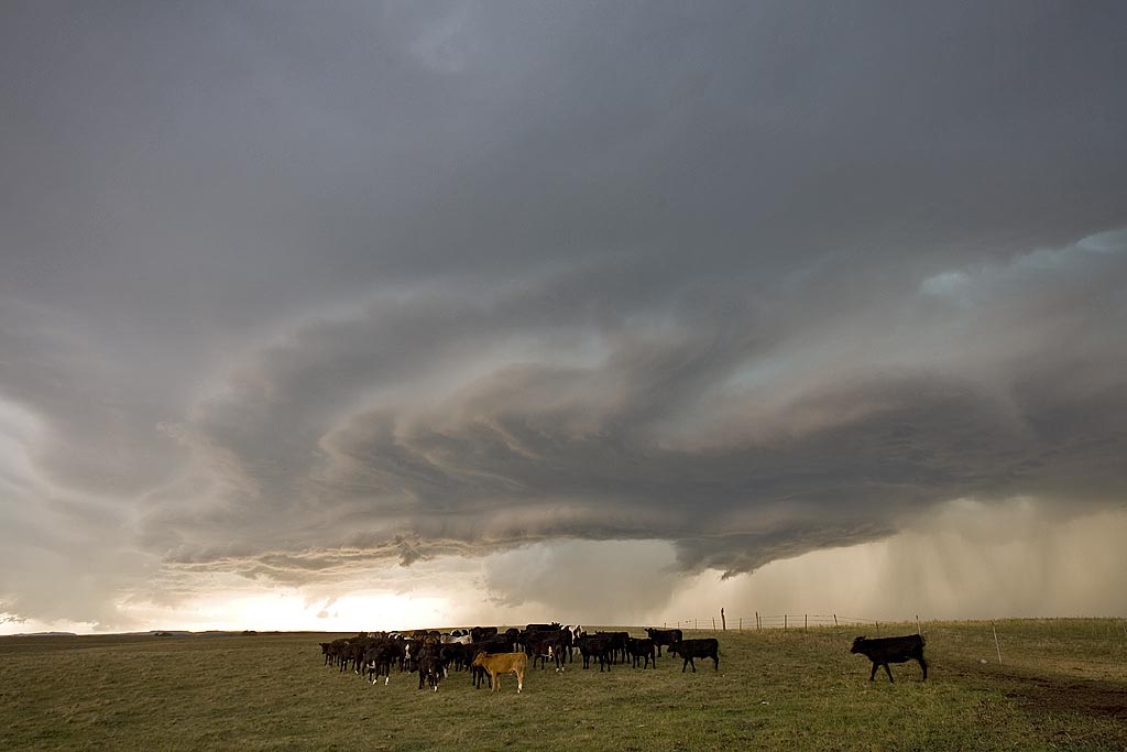
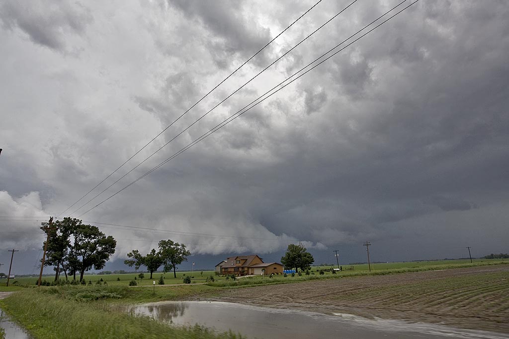
June 11th, 2008 Iowa Tornadic Supercells
June 11th was highly advertised as a big tornado potential day. Shortwave energy was ejecting from the high plains and would interact with a boundary from northern Kansas through Iowa and Minnesota. By the end of the day, several fatal tornadoes would occur, with the most noted being the Little Sioux, Iowa tornado and the Manhattan, Kansas tornado. We chased in Iowa this day and intercepted several storms that had tornado warnings, including the Little Sioux storm, which was quite messy and rain clogged.
June 6th, 2006 Eastern Iowa Supercells
June 6 was a day that had decent supercell potential, but we underestimated the tornado potential farther north. Several tornadoes touched down in Wisconsin, which was too far for us to get to. We played the outflow boundary/front intersection over eastern Iowa. By mid afternoon, a supercell developed near Iowa City that became tornado warned for 2 hours, followed by 2 more supercells farther south in Washington county and finally Ottumwa that were beautifully structured. The corkscrew supercell above was near Ottumwa and was tornado warned, and rightfully so! In the end, the low level flow was just too weak to produce an significant tornadic activity.
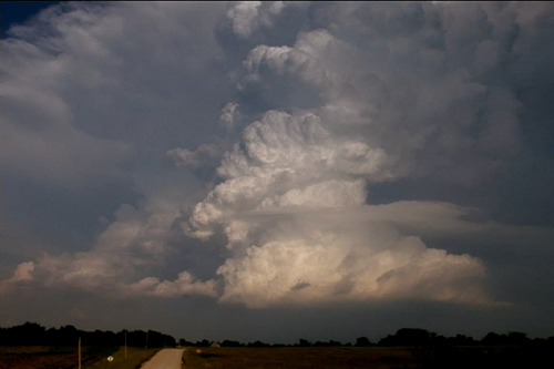
May 8th, 2004 Dallas County, Iowa Tornadic Supercells
This day took me to Iowa for high based supercells. The set up wasn’t ideal with only low to mid 50’s dewpoints with temps in the mid 80’s. By mid afternoon convergence along a west/east oriented boundary would be the focal point for severe thunderstorms where moisture pooled along the boundary. Storms fired in Green county and back built and moved southeast into Dallas county. This storm produced 2″ diameter hail and had decent structure. During its first cycle, it produced a weak tornado for about 1 minute. Later when it went HP, it had a very nice rotating wall cloud. Finally it lined out around 9:30 PM and moved south of Des Moines.
May 11th, 2000 Blackhawk County, IA Tornadoes
This page contains several more photos of tornadoes and storm structure from the Waterloo/Blackhawk county, Iowa tornadic supercell of May 11, 2000. After extensive review of my video, I have confirmed 7 tornadoes from this supercell. Images of all 7 tornadoes are contained on my Iowa pages. So, please check out all the pages, and enjoy!
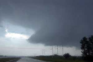
May 11th, 2000 Dunkerton, Iowa F3 Tornado
This is the second damaging tornado from the cyclic supercell on May 11, 2000 in Blackhawk county, Iowa. This tornado formed to the southeast of the decaying original tornado and ended up damaging part of the town of Dunkerton. Unfortunately, Dunkerton had been damaged in 1999 by floods, and now was to suffer again only a year later. The tornado traveled in a northeast direction and clipped the western side of town causing up to F3 damage to some buildings.
May 11th, 2000 Waterloo & Blackhawk County, Iowa
The events that occurred on May 11, 2000 will be etched in my mind till I die. It was the first time Dr Gold and Roger Hill chased together and witnessed the amazing tornadoes from this day! The incredible supercell that spawned at least 10 tornadoes that evening will go down as the single most incredible tornadic storm I have ever witnessed. This page will only contain the first of the tornadoes witnessed that day. The Dunkerton, Iowa F3 and those afterwards will be in the next 2 pages to come. This page is dedicated to the F4 wedge that barely missed the Waterloo area, but did cause significant damage, including injuries and one death on that date.
The set up on May 11 was iffy, but explosive. Everything was in place from a deep low in northwest Iowa, to surface temps and dewpoint in the 80s/70s respectively, CAPE values over 6,000, and good shear with strong backed surface winds. The main concern was an incredibly strong cap in place that would be difficult to break. At 6 PM CDT, a tornado watch was issued, and within an hour an explosive storm developed northwest of Waterloo. The photos that follow were taken from my Sony TRV900 digital camcorder. The closest shots were within 3/4 mile from this F4 killer tornado. Other stills will be added a they become available when I get my slides developed.