
May 11th, 2000 Waterloo & Blackhawk County, Iowa
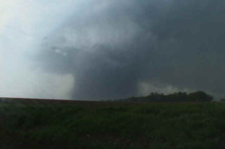
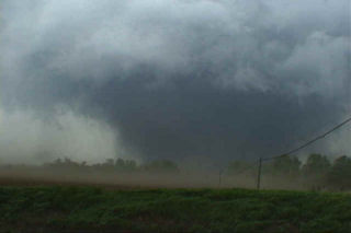
The events that occurred on May 11, 2000 will be etched in my mind till I die. It was the first time Dr Gold and Roger Hill chased together and witnessed the amazing tornadoes from this day! The incredible supercell that spawned at least 10 tornadoes that evening will go down as the single most incredible tornadic storm I have ever witnessed. This page will only contain the first of the tornadoes witnessed that day. The Dunkerton, Iowa F3 and those afterwards will be in the next 2 pages to come. This page is dedicated to the F4 wedge that barely missed the Waterloo area, but did cause significant damage, including injuries and one death on that date.
The set up on May 11 was iffy, but explosive. Everything was in place from a deep low in northwest Iowa, to surface temps and dewpoint in the 80s/70s respectively, CAPE values over 6,000, and good shear with strong backed surface winds. The main concern was an incredibly strong cap in place that would be difficult to break. At 6 PM CDT, a tornado watch was issued, and within an hour an explosive storm developed northwest of Waterloo. The photos that follow were taken from my Sony TRV900 digital camcorder. The closest shots were within 3/4 mile from this F4 killer tornado. Other stills will be added a they become available when I get my slides developed.
No comments yet.