
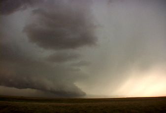
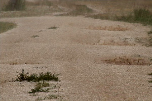
August 30th, 2006 Eastern Colorado Hailstorm
August 30th showed some potential for initially high based convection to get better organized as it moved east off the Palmer Divide into better moisture. That is exactly what it did. Nice upslope flow underneath 30-40 kts mid level westerly flow would provide strong enough shear for storms to become supercellular and produce large hail. Several storms developed on the eastern side of Denver, then most east into a line. However the tail end storm, as is often the case, became a nicely rotating supercell that produced hail to golfball sized. The structure was very nice with HP type characteristics. As the storms approached the Kansas border the dissipated.
No comments yet.