
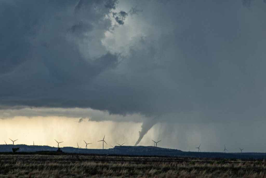
April 24th, 2025 Matador, Texas Tornadic Supercell
What a day April 24th was!! There was a high threat for supercells and if one could latch on to a boundary in place it had the potential to produce tornadoes. Strong shear, great moisture for late April standards, and good instability were all present. I headed down from Woodward to the Texas Rolling Plains. When I arrived, a supercell had formed and started spinning hard not far from Silverton. As I approached it from the east at Turkey, I encountered baseball sized hail and dropped south to get out of it. I set up my camera and soon an elephant trunk shaped tornado formed. It planted firmly for about 10 minutes before dissipating. Soon the storm started reorganizing and I dropped south to just north of Matador. It cycled and developed a wall cloud, then a bowl and then a multivortex tornado. That turned into a huge cone, then close to a wedge before becoming rain wrapped. It was on the ground for probably 25-30 minutes!! After that the storm became quite HP and, having to be back in Oklahoma City that night, I left it and proceeded back to our base city. An amazing day, structure, 2 tornadoes, huge hail and lightning. Enjoy the pics!

No comments yet.