Here is a compilation of a few days worth of strong/severe storm photos. June 25th-27th weren’t spectacular by any means, but the period did give some pretty storm photography opportunities.
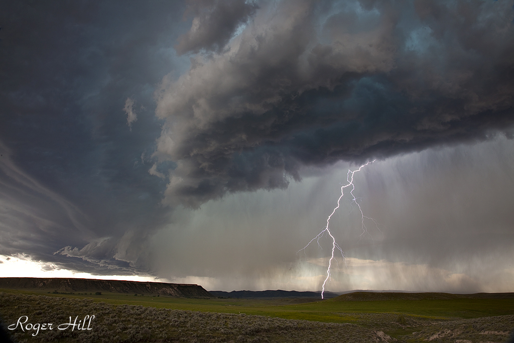
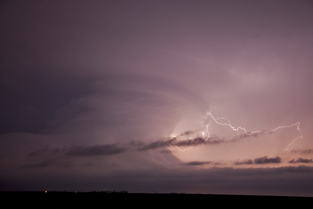
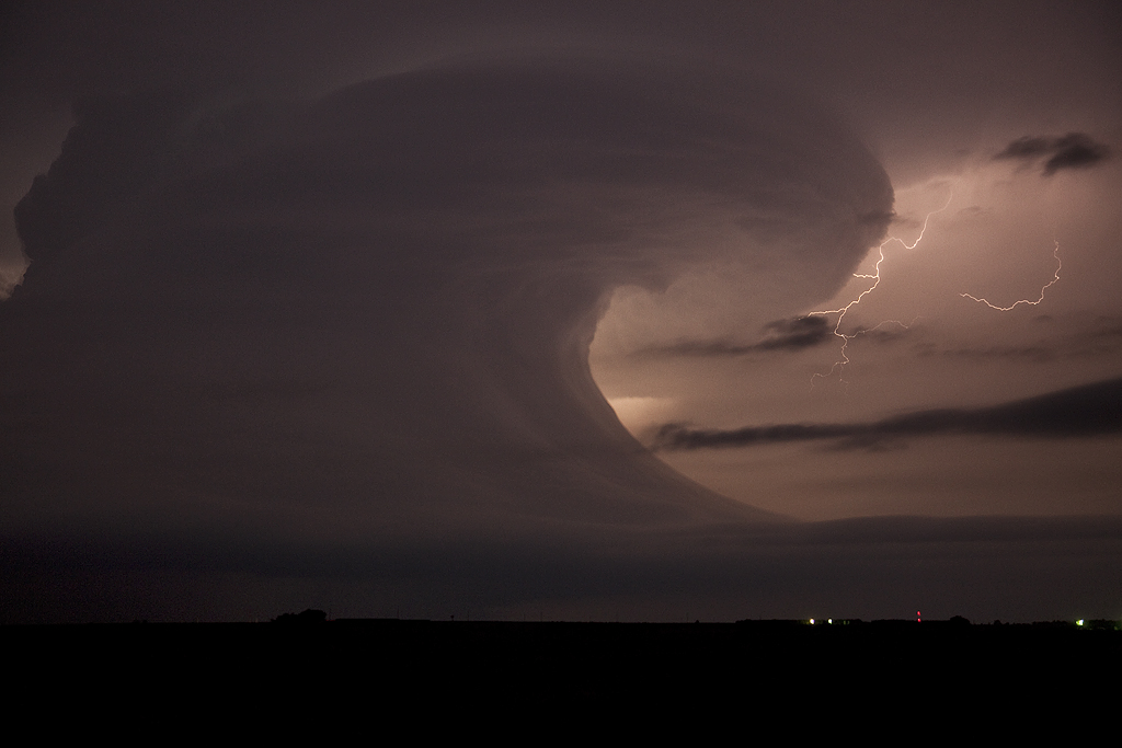
June 24th, 2011 Douglas, WY Supercell
This storm was very pretty, although high based. It provided some decent lightning, which, fortunately I was able to capture a shot of. It was a severe warned high based supercell that started west of Casper and by the time it made it to Douglas, it lined out and became a gusty storm.
June 20th, 2011 Nebraska Tornadoes
This day had tons of potential. But the question was where to chase. First target of north central Kansas early on panned out as one tornadic beast formed and produced numerous tornadoes. Check out Mike Umscheid’s “Under the Meso” website for what he witnessed there. Spectacular! The second target, along I-80 from Kearney eastward also panned out. There were a couple of very tornadic supercells there that produced several large and photogenic tornadoes. The worst thing in the world would be to get caught between the targets, and low and behold, THE MOST FRUSTRATING DAY of 2011 award, goes to this day. Dave Gold came out to chase with us and too much hesitation on which target to play cost us dearly. We still witnessed 6 tornadoes, but the ole “what could have been” (and what SHOULD have been) haunts me to this day. Wow, awful results. Every chaser has a day or two each year they regret, this is THE one for me for 2011.
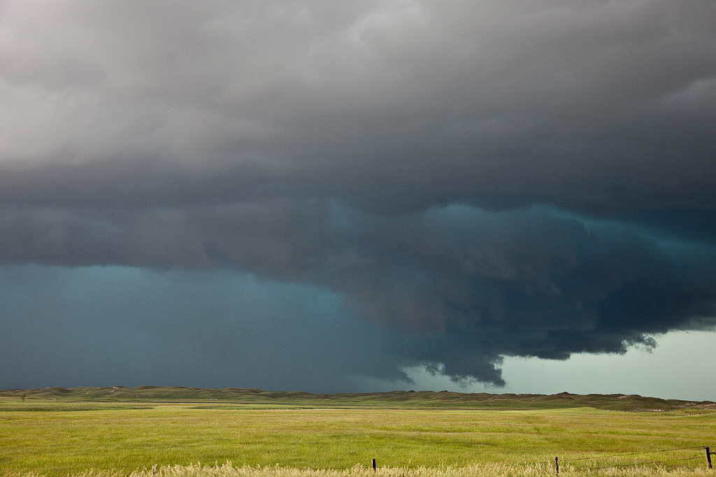
June 19th, 2011 Southwest Nebraska Tornadic Supercell
One of the frustrating days of the season. We sat in Ft Morgan, CO too long as storm exploded in Colorado and southwest Nebraska. We tried in vain to get to the storm near McCook, only to be greeted with a rotating storm that had already produced its last tornado. It tried several more times, but couldn’t do it. Then we watched at night as a marvelous cork screwed updraft lit up the sky.
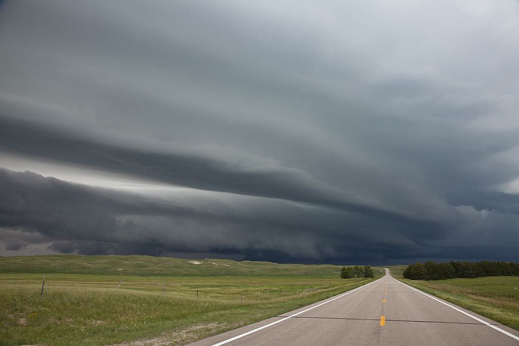
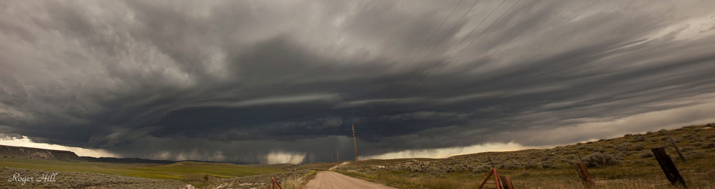
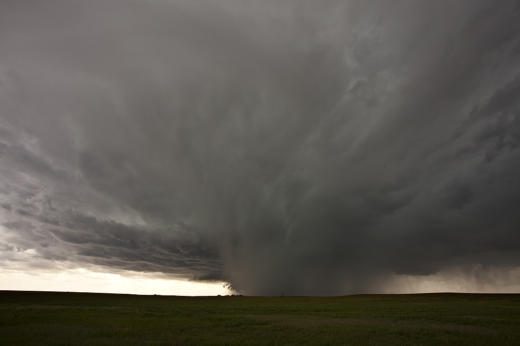
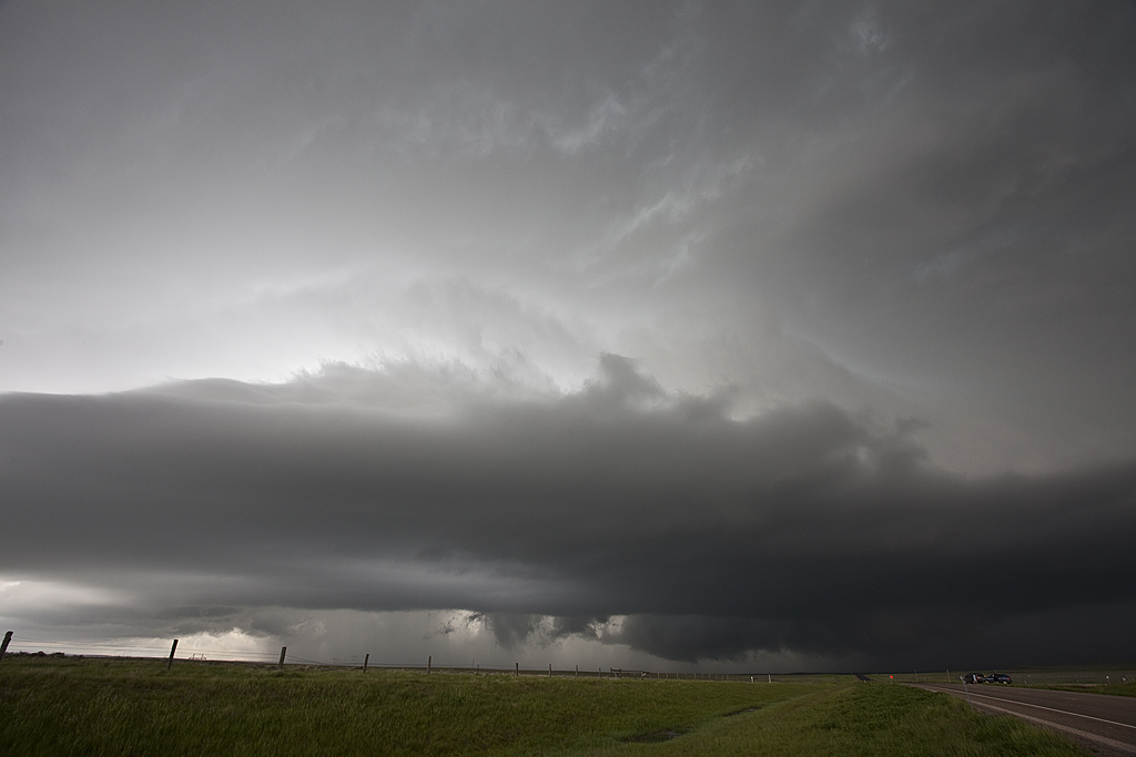
June 17th, 2011 Colorado Tornado Warned Supercell
June 17th kept me along the Palmer Divide in eastern Colorado. A few storms developed by mid afternoon, with the tail end storm becoming a nice supercell. It became tornado warned for about 2 hours of its life. Finally, it was undercut by cold outflow from old storms to its north, which eventually led to its demise. It did have pretty structure, produced tennis ball sized hail, and copious amounts of lightning.
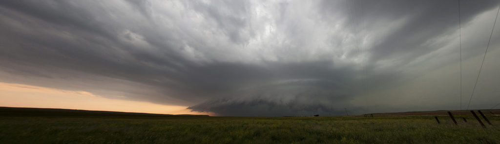
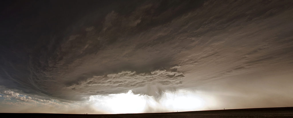
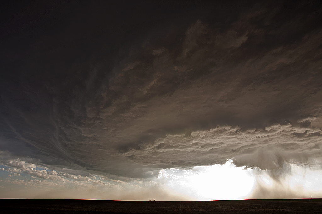
June 15th, 2011 Western Kansas High Based Supercells
I wasn’t expecting to even chase on June 15th, let alone catch a couple of pretty high based supercells in western Kansas. We intercepted one storm north of Scott City, and another north of Garden City that were both very pretty high based storms. Limited moisture, marginal instability and relatively weak shear would limit the threat, nonetheless, a couple great photo opportunities became available!
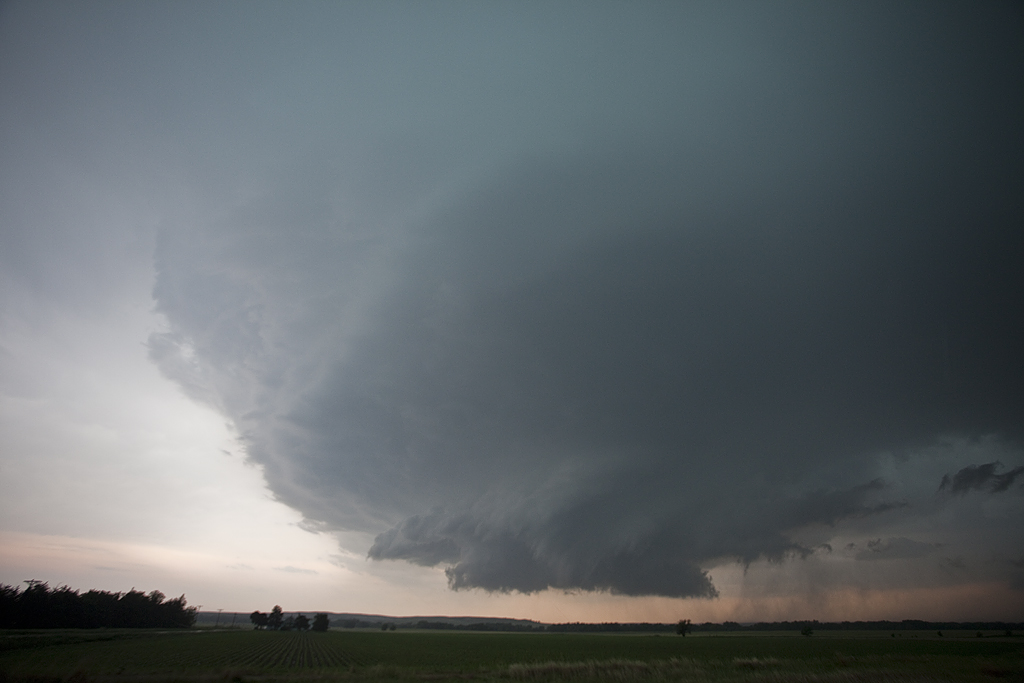
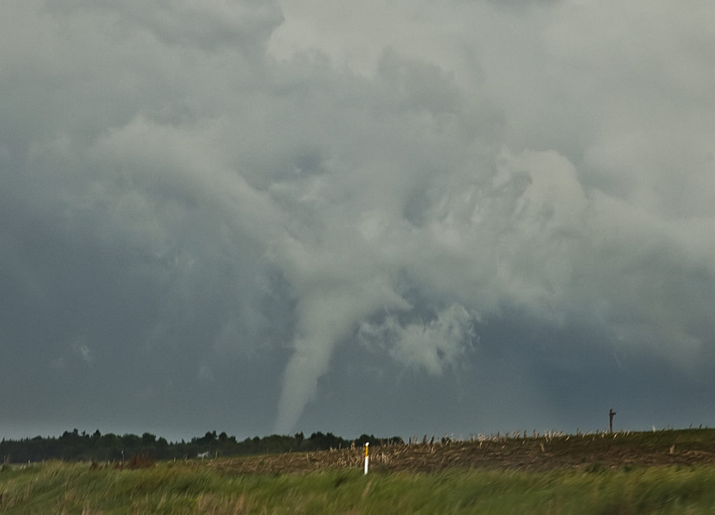
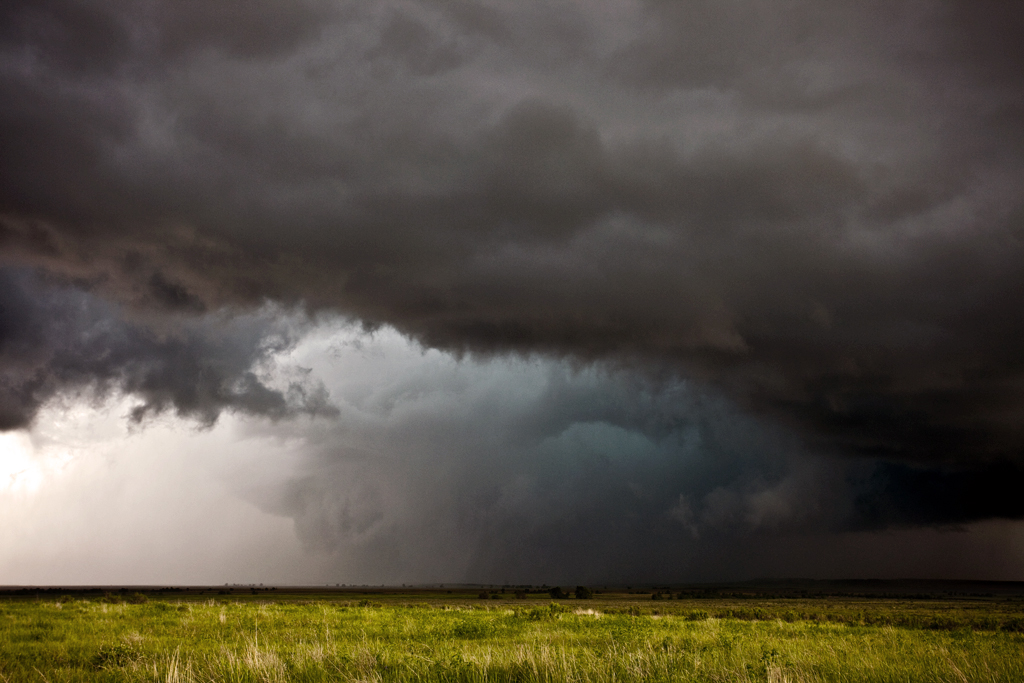
June 12th, 2011 Southeast Montana Tornadic Supercell
June 12th took us to southeast Montana for day 1 of Tour 6. Good moisture, instability and shear would combine with upslope flow into the higher terrain of southeast Montana to develop an HP supercell. This storm tracked southeast and produced a mostly rain wrapped tornado north of Alzada near Albion, MT. Look closely in the photos and you can make out the tornado. It officially received an EF1 rating by the NWS in Billings.
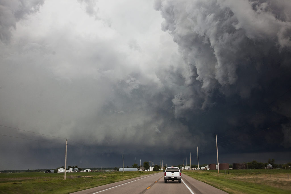
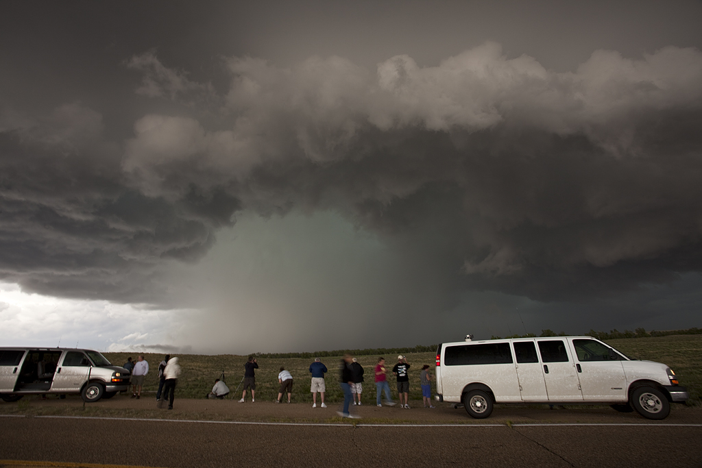
June 1st, 2011 Northern Kansas Tornado Warned Supercells
I wasn’t expecting much this day, as weak flow aloft would ensure numerous HP type storms would form. In the end that is exactly what happened. Too many supercells clumped close together would make viewing extremely messy and hard. We captured two storms that were at least viewable and both were tornado warned. Both occurred not too far from Stockton, Kansas.