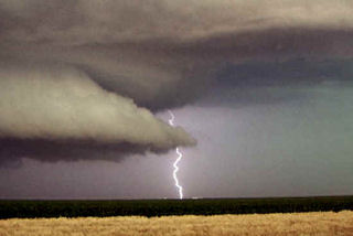
June 30 was a surprise day! Things did not look that great to start, but intense instability along with an old outflow boundary would provide the focal point for severe thunderstorms. Elevated storms developed during the morning and early afternoon, followed by surface based storms along outflow boundaries later that day. We raced east from Wichita to catch this beast as it became an intense supercell. It produced at least one if not more tornadoes. One tornado was reported after we left it with a damage path of 500 yards!
June 29th, 2005 Southwest Minnesota Tornadoes
The set up this day was conducive to supercells. A dryline/cold front would advance across far western Minnesota and provide the focal point for thunderstorm development. We started in west central Minnesota north of Marshall. Convection developed and went linear quickly. So we dropped south where the cap was stronger and caught a nice isolated supercell. This storm produced at least 2 tornadoes we could confirm.
June 26th, 2005 Dakotas Tornadic Supercells
Being the first day of the tour, we drove QUICKLY to South Dakota where we caught a decent supercell. Conditions looked good with high instability, decent shear and an outlfow boundary from previous night convection to focus intense convection on. It produced a couple of weak tornadoes before lining out. We then blew it off and drove towards the Bismarck, ND area where we caught a nice sculpted supercell that produced a couple of weak circulations.
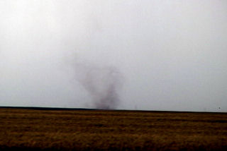
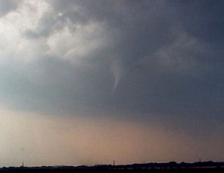
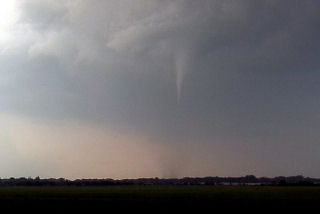
June 16th, 2005 Southwest Kansas Tornadic Supercell
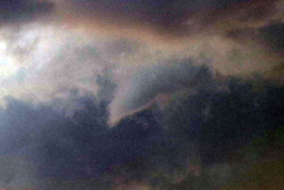
This day was actually a surprise. An old outflow boundary across southwest Kansas into northwest Oklahoma would provide sufficient convergence and lift to develop supercells this day. One such beast developed near Garden City and intensified as it moved southeast. It produced a landspout and had beautiful structure.
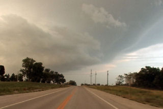
June 12th, 2005 Kent County, Texas Tornadofest
June 12 had the look and feel of a decent tornadic set up in the eastern Texas panhandle. A strong dryline, coupled with an old outflow boundary from overnight convection, high dewpoints and instability would set the stage for tornadic supercells this day. We blasted from Denver all the way to east of Lubbock to catch this monster. As we arrived a strong supercell became anchored in Kent county enhancing its shear, which would help it produce numerous tornadoes. This storm did not move much at all during its life cycle.
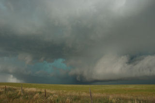
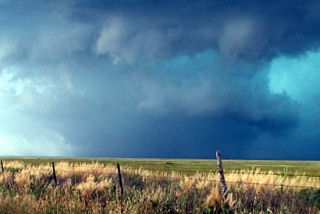
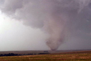
June 9th, 2005 North Central Kansas Tornadofest
June 9 had that feel to it. Everything was coming into place for a significant tornado outbreak. A triple point was situated over northwest Kansas, slowly drifting east. Very unstable, moist air was streaming in from the south, and with an approaching short wave trough, it was only a matter of time before rapid severe thunderstorm development would occur. I sat north of I-70, southwest of Hill City and watched the storm of the year develop from a small cumulus tower and become a prolific tornado producing monster.
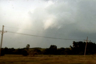
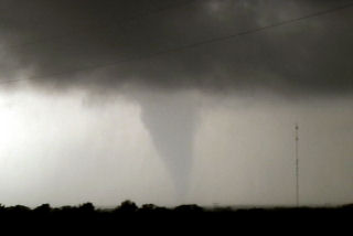
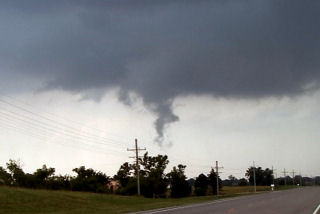
June 8th, 2005 Oskaloosa, Kansas Tornadic Supercell
I must admit, this day caught me by surprise. We started in eastern South Dakota. After morning analysis and looking at model data, it appeared to be a respectable chance for large supercells in eastern Kansas with extreme instability and decent shear. As we arrived in Jefferson county, Kansas a supercell exploded from a small cumulus tower. Within 20 minutes the top was at 60,000 feet. Within another 30 minutes a tornado formed. This tornado narrowly missed the town of Oskaloosa.
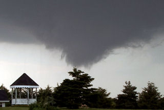
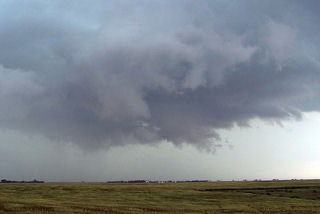
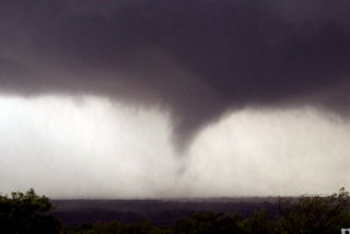
June 7th, 2005 South Dakota Badlands Supercell & Tornado
June 7 looked like a big tornado day in South Dakota. By the end of the day, it would be disappointing from the aspect, but the supercell I caught that day was special. The structure was phenomenal!!! This storm formed on the western end of the Badlands, and slowly tracked east/northeast towards I-90. This storm produced at least 1 tornado, and hail to 3″ in diameter. The prettiest part about this supercell was the structure.
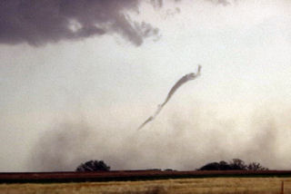
June 6th, 2005 Ekalaka, Montana Tornadic Supercell
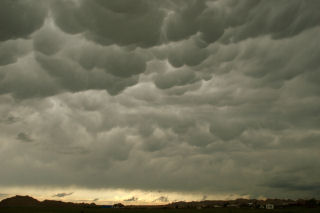
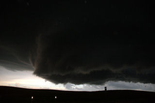
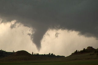
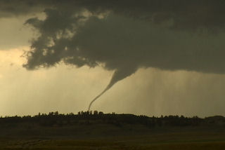
What an interesting day this turned out to be. We started in Gillette, WY, blasted to Ekalaka, MT and sat north of town and waited, and waited and waited 🙂 Finally a high based little LP updraft developed, as usual, and was severe warned. The interesting thing with this is it was feeding on 72/56 air. It moved north and weakened. Then another storm RAPIDLY developed and intensified, southwest of town. This storm became a BEAUTIFUL striated stack of plates supercell, and quickly developed a nice wall cloud. Condensation streamed in from the northeast and soon a lowering was observed almost to the ground. Rotation developed and a funnel formed AWAY from the wall cloud. It extended a third of the way to the ground and dissipated.
Then a second funnel formed without being connected to the base, then developed a debris cloud and connected to the base!! Bizarre tornado! It stayed on the ground maybe 2 minutes and dissipated too. A third funnel formed and became a gorgeous elephant trunk tornado with INTENSE rotation and cascading motion in the cloud base. This also lasted 2-3 minutes. It also was rotating around the outer edge of the meso. A fourth funnel formed, a truncated cone, and became tornadic too with a debris cloud. This one lasted at least 5-6 minutes before dissipating. Eventually the lowering wrapped in rain, and then the rain curtains parted revealing a long slender funnel halfway to the ground!! What a surprise! I was NOT expecting this type of a supercell today at all!!
May 31st & June 2nd, 2005 Texas & Colorado Supercells
Despite strong shear and better moisture, both of these days would prove unfruitful for tornadoes. However, two incredible supercells developed that had beautiful structure. The second supercell, June 2, also produced a weak tornadic circulation near Arriba, Colorado. Both of these storms turned HP, and produced hail baseball to softball size.