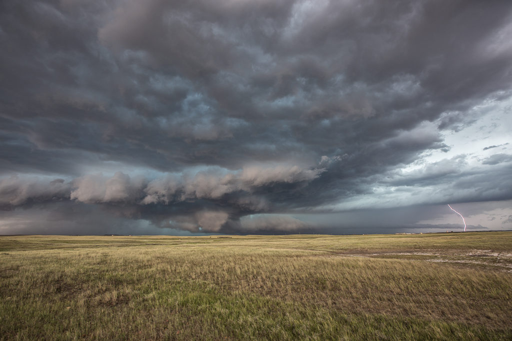
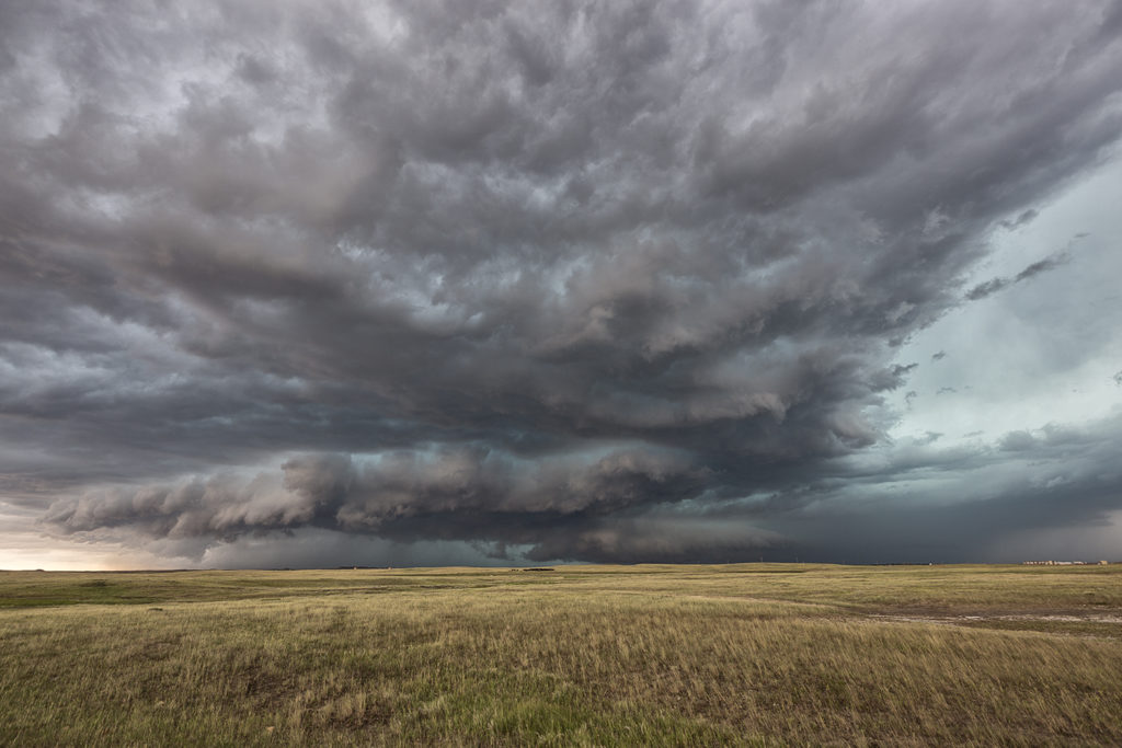
July 17th was a high plains upslope set up. Southeast winds along a boundary would funnel moisture into the Cheyenne ridge. A supercell formed early afternoon near Chugwater, WY and would right turn and track down the boundary into northeast Colorado. This storm was outflow dominant most of its life cycle and was a major hail producer. In Colorado it became tornado warned, although not a big threat in my opinion since it was outflow dominant. We came across some beautiful landscapes to photograph the storm, and everyone had a great time with it. The storm never produced a tornado but it did produce significant hail the size of baseballs along its path. This was to be the last great day for the season as we wrapped up tours and headed home to Denver. Thank you all for a wonderful tour season. We have the best guests and guides on the planet!
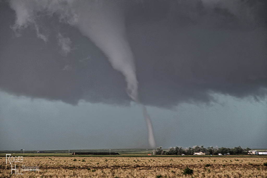
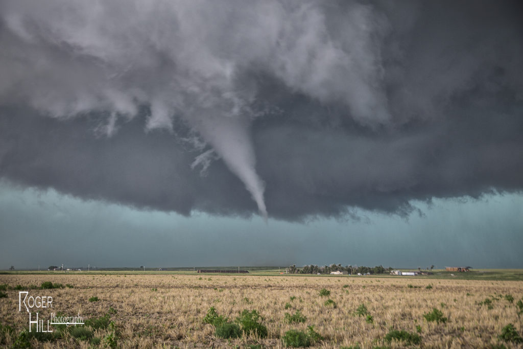
July 15th Syracuse, Kansas Tornado
July 15th had big potential. An outflow boundary lay across the Kansas/Colorado border area by early afternoon. A cold front intersected that boundary near Cheyenne Wells, CO. Deep moisture, strong shear and high instability formed along and east of the boundary. By 2pm a severe storm formed and quickly became supercellular. It tracked due south right along the outflow boundary. We encountered huge hail the size of baseballs to softballs near Arapahoe, Colorado. Fortunately we did not lose any windows. We dropped south and had to stay on the western side of the storm where very hot and dry air was being entrained in the supercell creating a violent downdraft with intense blowing dirt and 90 mph winds. Finally at Granada, CO we were able to go east and get into the better moisture. As our storm gusted out, another storm formed on the boundary and ingested 84/70 air! A lowering quickly formed and within 20 minutes started rotating. A truncated cone funnel formed and dissipated 5 minutes later. We were right in the path of the mesocyclone. We moved a mile east and stopped. Rotation dramatically increased and soon a tapered white funnel formed. Another one formed and wrapped around the larger one. The larger funnel touched down and became a stout stovepipe tornado. It widened into a large cone. I couldn’t believe my eyes! Was this May or July? This was the largest July tornado I had ever witnessed in Kansas. The tornado moved south with a large debris cloud and after 19 minutes, roped out. It was quite the sight to see! An absolutely amazing day for the Great North Tornado Hunt tour again!
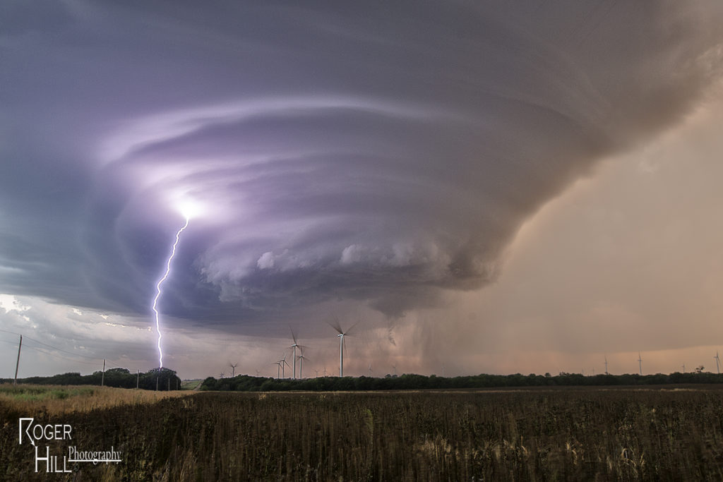
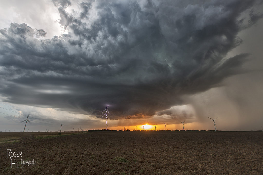
July 13th Peckham, Oklahoma Gorgeous Supercell
July 13th was the second great day for the Great North Tornado Hunt tour. We started the day in Wichita. Extreme heat and instability would form that afternoon with temperatures near 100F and dewpoints in the upper 70s. Cells tried to form for a couple hours along a dryline/outflow boundary composite, and finally by around 5pm a significant supercell formed just west of Arkansas City, KS. This storm quickly became severe for large hail to tennisball size. As it continued to intensify, it moved due south towards northern Oklahoma near Peckham. This storm was a striated beast. It had continuous lightning, huge hail to baseball sized, and a wall cloud that spun like crazy. By mid evening, the storm weakened as it merged with other cells to its west, and eventually lined out moving into central Oklahoma. One of my favorite nontornadic chases of 2016!
July 10th Eastern Montana Tornado Warned Supercell
July 10th was day one for the Great North Tornado Hunt. A strong area of low pressure over southern Montana and an associated warm front extending east of there would provide the lift to produce numerous storms, including a few supercells. We intercepted the only tornado warned supercell in the country near Baker, Montana and followed it eastward along the boundary as it spun wildly. A few of times it appeared to produce a couple of funnels and even a brief dirt swirl under one, but the story with this beast was the pretty structure and amazing green colors. This supercell produced very large baseball sized hail and had long inflow bands eastward from the updraft. The open prairieland of eastern Montana always gives a great foreground for one of nature’s most violent storms, the supercell. A fun way to start off the final tour of the year!