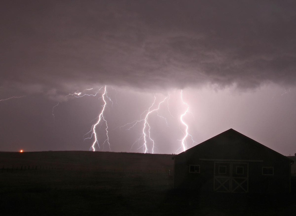
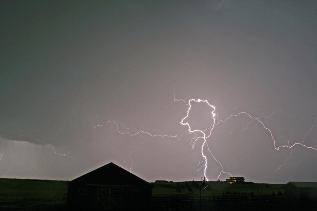
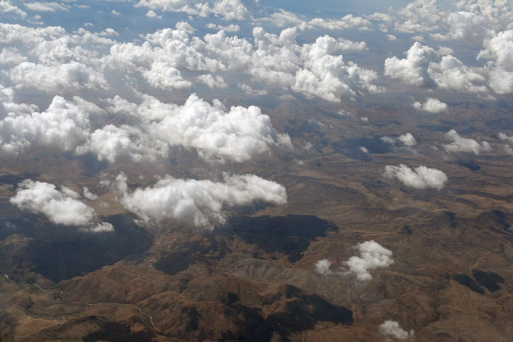
The first week of August brought good monsoon moisture to Colorado. Good instability, reasonable dewpoints, but weak flow aloft , would cause intense pulse type storms to develop, some severe with large hail and high winds throughout the eastern plains of Colorado. Due to the higher bases on these storms, gorgeous lightning displays filled the skies after dark.
July 21st – 26th, 2007 Tucson, Arizona Monsoon Trip
What a fun week this turned out to be! Our tour company, Silver Lining Tours, is going to operate a new tour called Desert Thunder in 2008. So, my wife Caryn and I, along with our good friend Alister Chapman headed to Tucson to film the monsoon storms. We were NOT disappointed! During an active monsoon, as this was, storms formed daily off the higher terrain east of south of Tucson, then propagated and rebuilt on thunderstorm outflow winds, on the desert flatlands. These storms a extremely photogenic, producing intense lighting, haboobs (dirt storms, some QUITE dangerous as you will see below), and flash flooding. This turned out to be one of my favorite NON-tornadic ventures of the year.
July 11th and 12th, 2007 Colorado Supercells
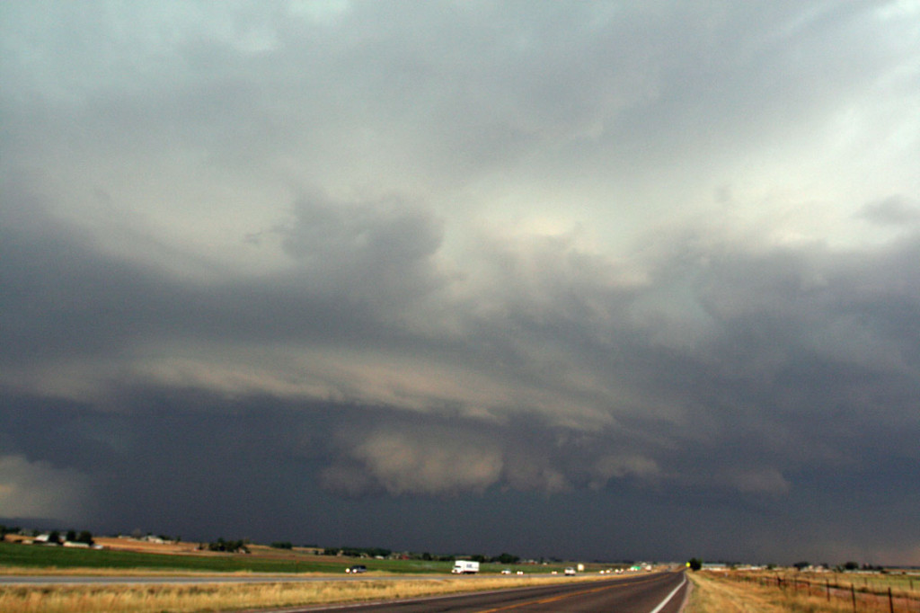
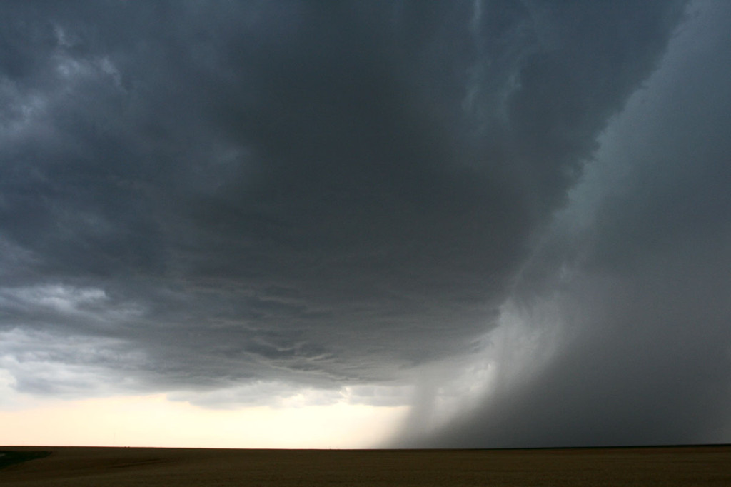
July 11th and 12th provided Colorado some much needed moisture, but also some very large hail. Many areas in northeast Colorado experienced crop devastation due to copious amounts of golfball and larger sized hail during this time period. Moderate northwest flow aloft, with upslope southeasterly surface winds would create decent wind shear, while moderate instability would develop. On July 11, storms formed along a convergence boundary over east central Colorado and became severe, taking on relatively high based supercell features. I caught one such beast just north of Limon that produced 1.5″ diameter hail. On July 12th, I wasn’t going to chase, but storms forming along a boundary over southeast Wyoming, and dropping into northeast Colorado, would give me a great reason to chase. I encountered hail to golfball sized north of Ft Collins along I-25 as the storm was rotating quite nicely, even in the lowest levels. Despite a tornado warning for that area, no tornado was confirmed. Although it certainly tried!
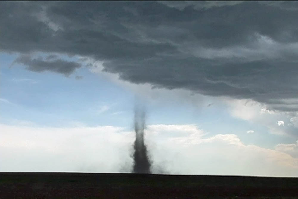
July 3rd, 2007 Kit Carson County, Colorado Tornadofest
Started the day contemplating a chase, but didn’t know for sure if I would. By late morning, strong and rock hard towers were developing south of my house . Just finishing our tours, I was tired, and was headed into town to take care of some mailings. But, seeing the convection south of me, I couldn’t resist. I blasted down I-70 headed for Limon around noon. Shortly after I got on 70, NWS PUB issued a tornado warning for the area southwest of Limon, CO in northeast El Paso county. Radar was pretty clear to see the boundary with various areas of interest along it. However before I even arrived in Limon, the developing cells dissipated.
I decided to go to the Post Office and mail my packages while I was there, and when I came out around 1:30 PM MDT I noticed a rather large area of towering cumulus off to my northeast, northwest of Flagler. More rapidly growing cumulus were developing along the boundary, which was as clear as day. What bothered me was my 91/44 ob at Limon, but noticed much better moisture farther northeast. So, off I went! I headed east bound of I-70 and watched as the towers developed into two young thunderstorms.
About 10 miles west of Flager, and about 5 miles north of I-70, a small tornado developed. This tornado quickly became visible to cloud base with a fairly transparent tube of dirt. It lasted only 4 minutes from 3:14 -3:18 PM MDT. The young thunderstorm farthest west developed a flared base, cork screwed updraft and even a clear slot, so I pushed east to get on it. At 3:21 PM, another debris cloud formed and by 3: 26 PM was completely to could base where a small funnel appeared. By 3:29 PM, the tornado had a rather large pear shaped debris cloud and was simply gorgeous to watch. At 3:31, the next tornado formed just west of it under a new tower. It persisted for 4 minutes before dissipating. Meanwhile the original tornado was continuing to strengthen. At 3:34 PM, a long slender grey funnel appeared just east of the clear slot and at 3:36 PM it touched down. At 3:38 PM two tornadoes criss crossed each other and made for a wild photo op!!! At 3:41 pm the one tornado lifted, while the supercell tornado continued. At 3:45 another tornado formed west of the supercell tornado, and another tornado formed southeast. Quite a wild shot with 3 on the ground at the same time! The farthest west tornado diminished and lifted at 3:49, while the supercell tornado persisted until 3:51. The farther east tornado lifted at 3:53.
Now is when the real fun begins! At 3:57 PM, I was near the junction of Kit Carson County Roads AA and 13, northwest of Siebert. A debris swirl formed about 100 yards to my north. Thinking it wasn’t much of anything, I pulled over and got out of my van to watch. As I turned around, a coal black debris swirl formed about 300 yards to my south! I grabbed my cameras and them up. By 4:03 PM, the southern tornado became VERY strong with debris to cloud base and was the most photogenic nonsupercell tornado I have ever photographed! At 4:07 I turned around to grab another lens and saw a HUGE tornado just to my north. I couldn’t believe my eyes! This was only about 200 yards away. It had a 300 yard debris cloud with a fat grey funnel directly overhead and extended from a very pronounced clear slot on the east side of a beautiful circular updraft! The wind speeds at the surface were QUITE strong around it as you could see multiple vortices rotating in it and inflow jets streaming into it. Gorgeous site! Meanwhile at 4:13 PM the tornado to my south diminished and lifted. I decided to head north on CR 13 and see how close I could get safely to the large tornado. I came within literally 50 yards of the debris cloud and stopped, filming every precious moment. The noise was horrendous!!!!!!! I saw pieces of tin flying around the base, along with fence posts and barbed wire. Soon, a telephone pole snapped off. I could see what looked like a couple dead animals in the field it had just crossed. This tornado moved northeast, then north and finally northwest, just missing the county sheriff’s farmhouse, while his horses totally panicked trying to escape. At 4:22 PM, it dissipated, while yet another tornado formed to its west under a new tower. This fairly thin and snaking tornado lasted from 4:29 – 4:34 before giving in to developing cores.
As I headed south on 59 to Seibert hail to quarter size starting falling on me.
What a crazy day!