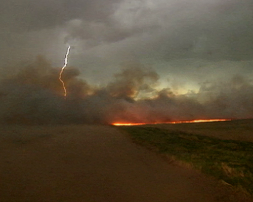
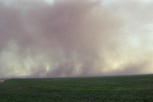
April 23rd was a day that had plenty of dynamics, but questionable moisture, as has been the case many times this spring so far. I caught an outflow domimant severe thunderstorm complex east of Dodge City early, then caught the best supercell of the day near Salina, as strong lift occurred near the warm front. The outflow dominant storms produced lots of lightning and strong winds, as shown above when lightning sparked an intense wildfire east of Great Bend. The Salina supercell was rooted in the boundary layer and tried hard to produce a tornado. It also produced hail to golfball size.
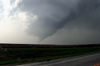
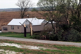
April 15th, 2006 Otoe County, NE Tornado
April 15th brought me out to chase. Models were conflicting on the amount of moisture that would be available, but one thing for sure was that all other ingredients would be in place for rotating supercells. By mid afternoon, dewpoints had risen into the upper 50s to near 60F and that was enough to produce strong updrafts which allowed the shear to take over and produce tornadoes. I caught one such tornadic supercell as it entered Otoe county, Nebraska, about 50 miles south of Omaha.