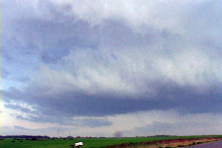
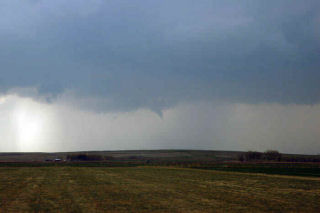
April 19 was an interesting set up. A large closed low over the inter-mountain west would meander without moving much eastward this day. A surface low would develop over northeast Colorado with a boundary extending into Nebraska. This boundary would be to focus for severe thunderstorm development. Several storm first formed north into Nebraska and went severe. I decided to play the tail end storm which ended up being the prettiest storm of the day. Explosive convection developed north of Sterling mid afternoon as a substantial LP supercell formed. This storm produced at least one brief tornado, if not two!
April 10th, 2005 St. John, Kansas Supercell & Funnels
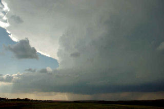
April 10 was a day I wouldn’t soon forget. We had to leave Denver early to escape a raging blizzard. We were able to get out in front of it and into the warm sector under sunny skies. This was a tough day forecast wise for me as it looked like the dryline bulge would be the place to play. We later discovered too much dry air and a perpendicular orientation of the mid level winds to the dryline would cause the storms to form in a line instead of discreet supercells. Too much dry air never let the storm updrafts get organized for long periods. Later we also found out about the tornadoes in Trego county, to our north. We had actually taken off from the Pratt area to head back north and play that spot, but changed our minds. Live and learn. Thank goodness it is early season!