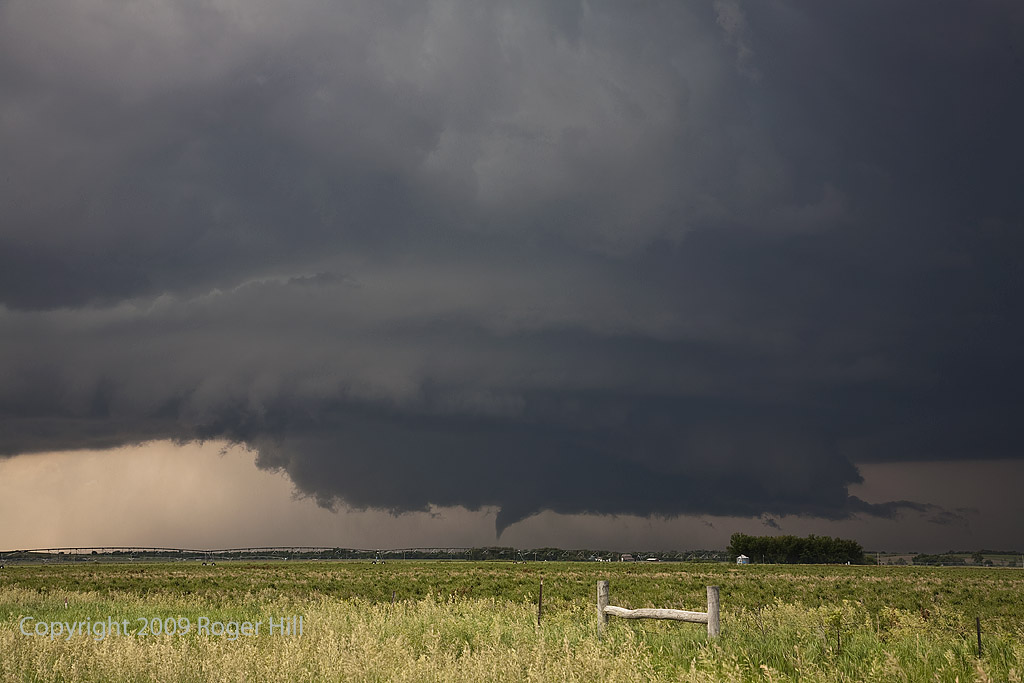
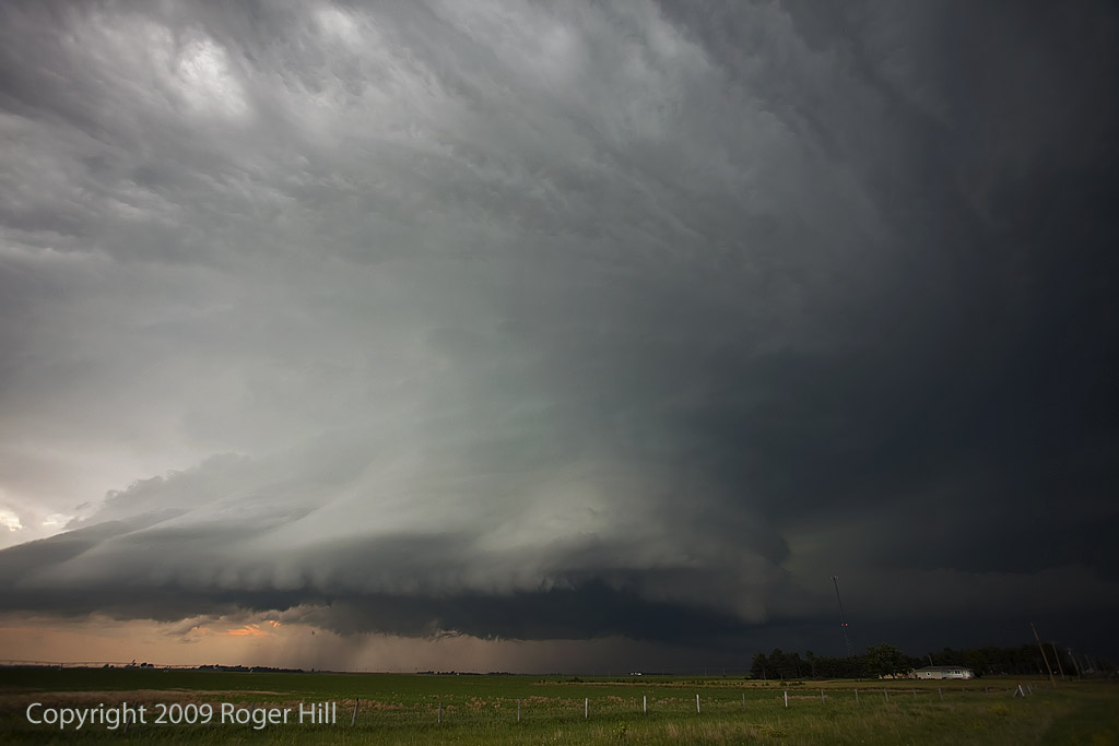
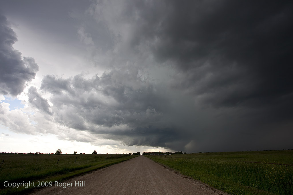
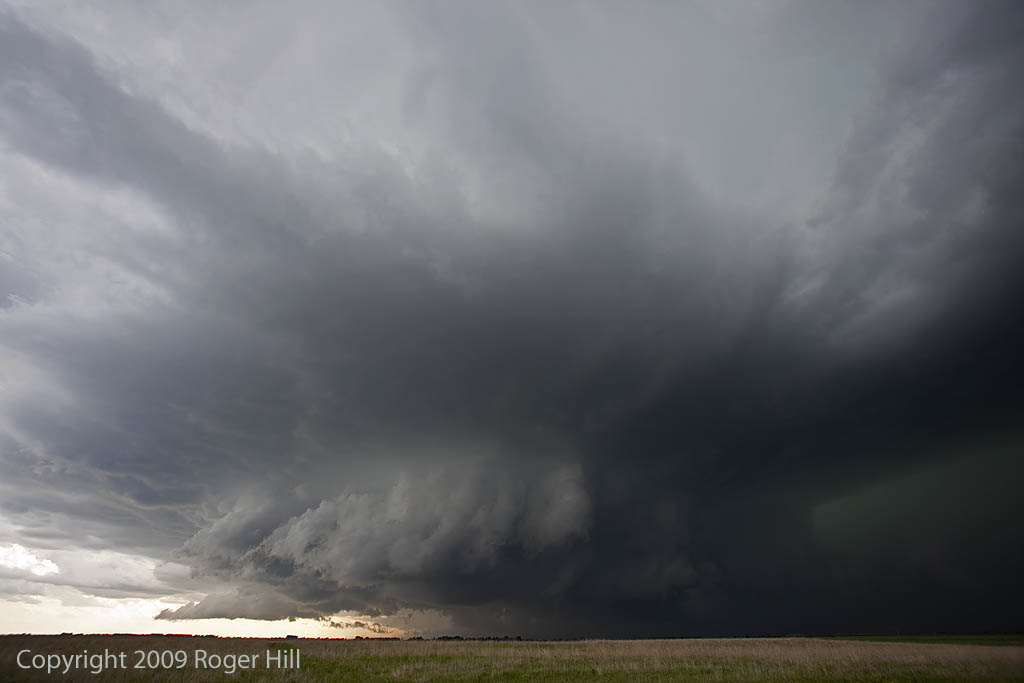
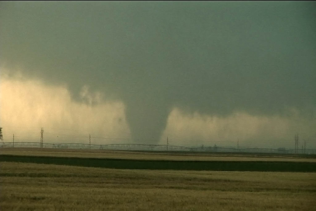
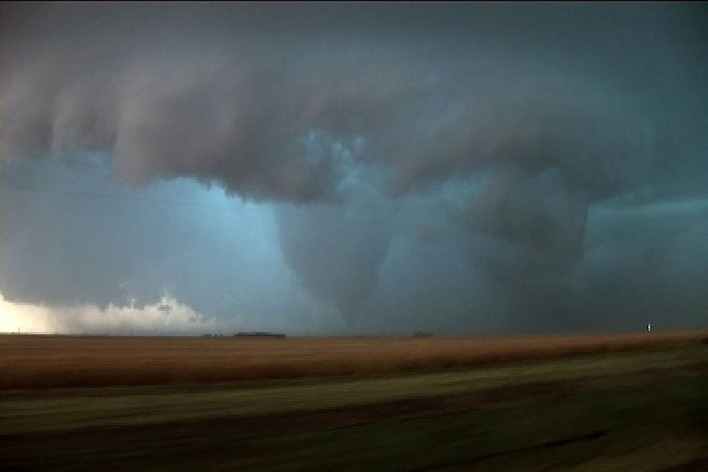
June 17th was certainly a day I will never forget. All parameters pointed to a triple point boundary in central Nebraska, just north of Kearney. By late afternoon, an intense tornadic supercell developed and tracked eastward through Grand Island and Aurora, producing a large and destructive tornado just west of Aurora. We would witness half dozen tornadoes this day, culminating with the Aurora, Nebraska monster. I only put photos up here and no video stills, thus only 2 tornadoes are in photos. Here is a wild 5 minute video from this event:
June 16, 2009 South Dakota Tornado Warned Supercell
June 16th was a surprise day. We were figuring on a down day or a day that had very marginal potential. By late morning, several storms developed along the east side of a surface low in northern South Dakota. Many were tornado warned. We couldn’t get there in time coming up from Salina, Kansas, but we did manage to catch the storm that was the largest and longest tornado warned in South Dakota. It had beautiful structure and very large hail. Also it produced a large, but weak tornado that ripped through the Menno area causing lots of tree damage and damage to several tin buildings.
June 15, 2009 Kansas Tornadoes
June 15th was a strange day. Early on it looked like the area along the Kansas/Nebraska border would provide the best opportunities for severe storms and tornadoes. We ended up playing the dry punch in southwest Kansas, and intercepted a tornadic supercell near Belpre, Kansas. Later that evening, there were tornadic supercells in southern Nebraska as well.
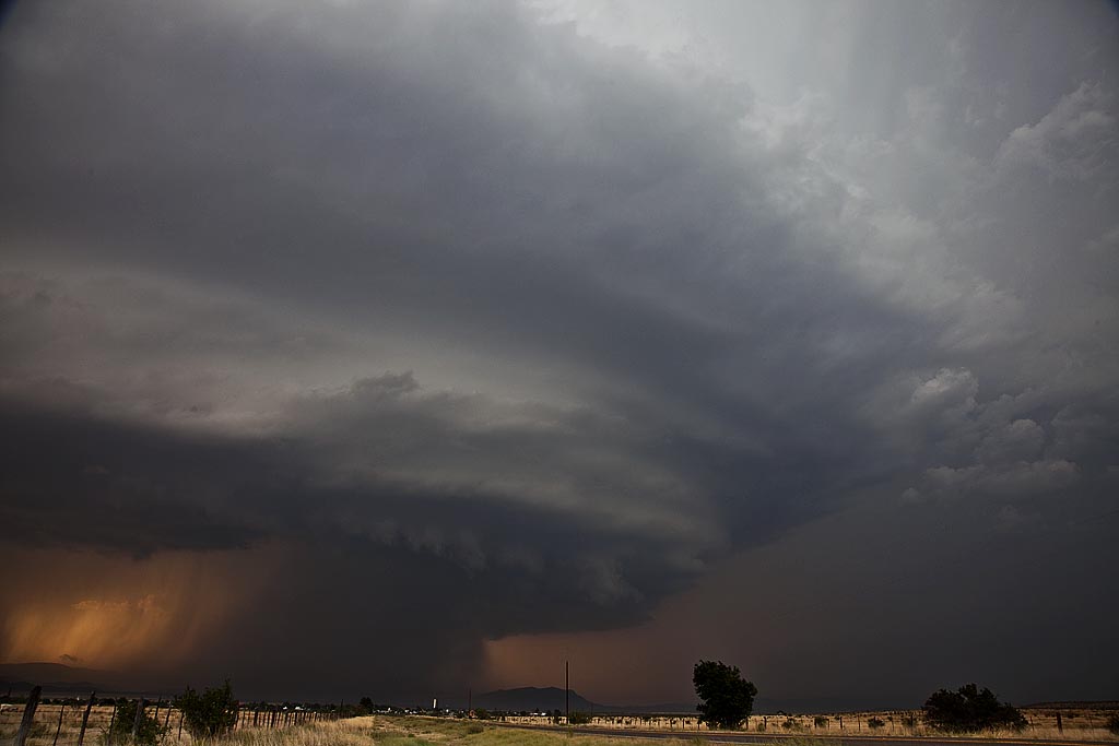
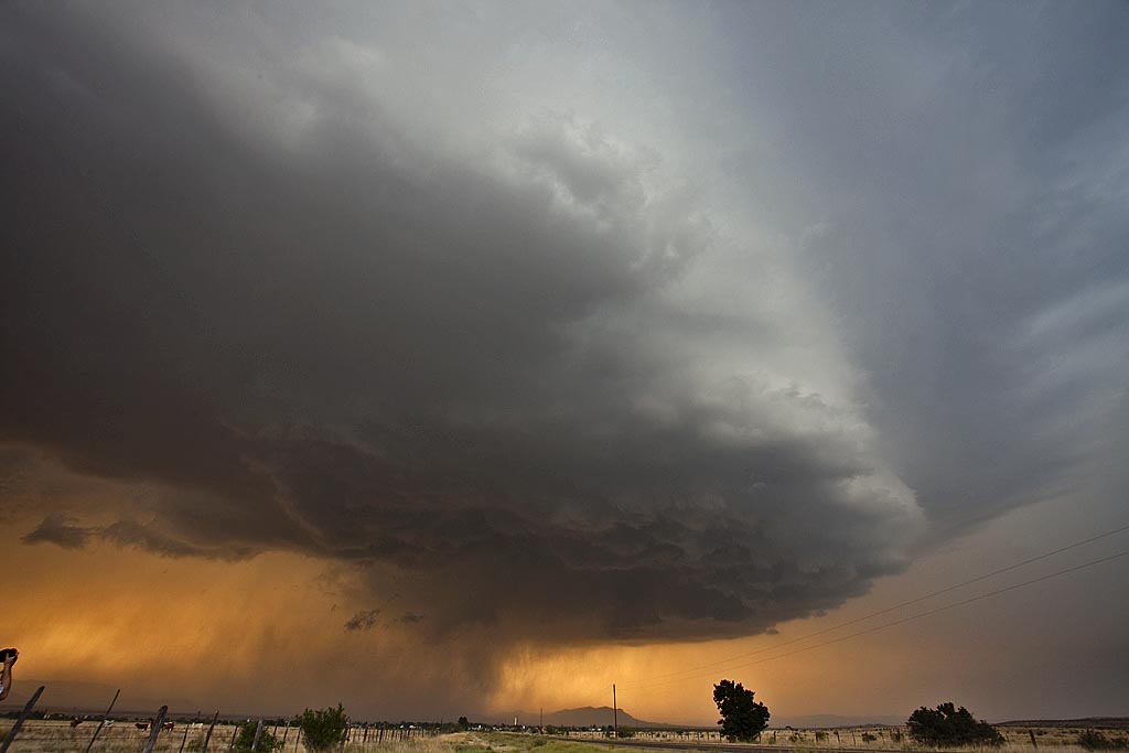
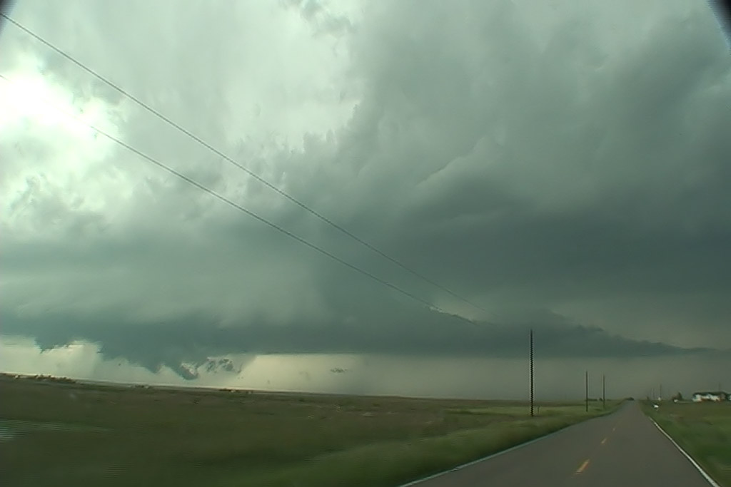
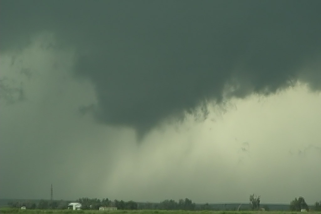
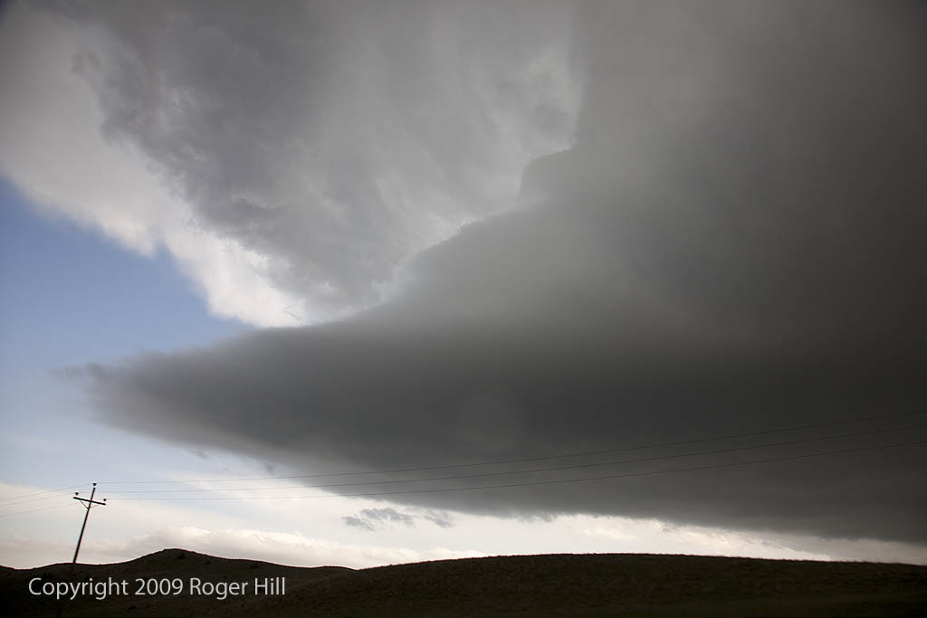
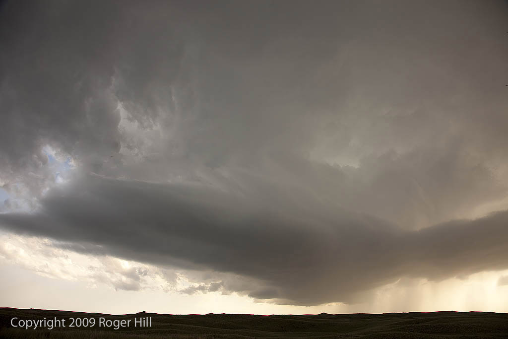
June 13, 2009 Adams County, Colorado Tornadic Supercell
June 13th was the arrival day for my next tour. As such, Murphy’s Law always seems to be in place! After a visit with Caryn at her horse show (which she kicked butt!), I frantically drove to the hotel, grabbed all the guests and off we went to chase this beast, just north of my house!
It was a fantastically structured monster, with a classic supercell appearance, clear slot with rapid rising scud east of it, long streaming beaver tail and barber pole appearance to the updraft. Although it did not produce any significant tornadoes, it did produce two small, but photogenic tornadoes. I was in such a hurry I forgot to grab my still camera, but I always have my dashcam to shoot video and grab a few stills from.
June 11, 2009 Southeast Colorado Beautiful Supercells
June 11th looked like a good setup in Colorado. Good upslope flow, an old boundary, good shear and moisture, would set the stage for tornado warned supercells east and southeast of Pueblo, CO. We intercepted two such storms, both of which had fantastic structure and tried all they could to produce tornadoes. In the end though, weak low level winds would inhibit much in the way of tornado formation.
June 6, 2009 Nebraska Supercells
June 6th was an in between day for me and the tours, thus I couldn’t resist a highly sheared environment in western Nebraska. Caryn and I, along with a couple of guests, intercepted 2 beautifully structured and tornado warned supercells. The first near Thedford and the second near Hershey. The structure and electrification of the second storm was absolutely breath taking!
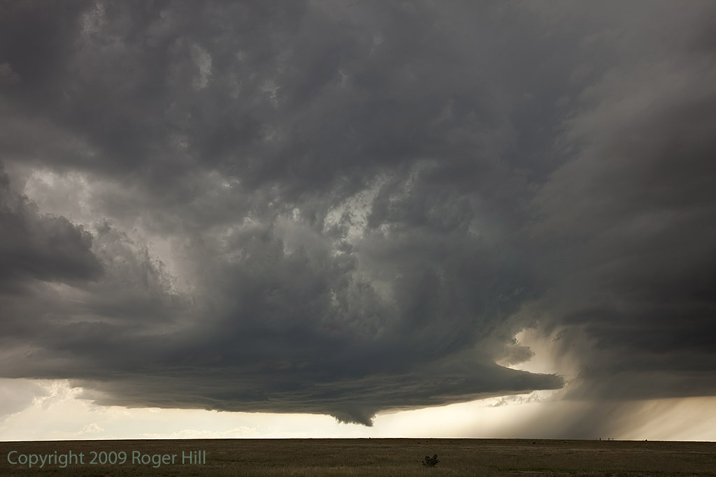
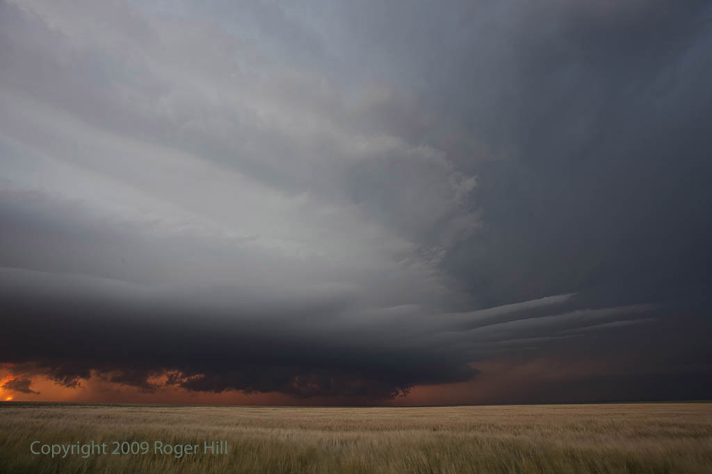
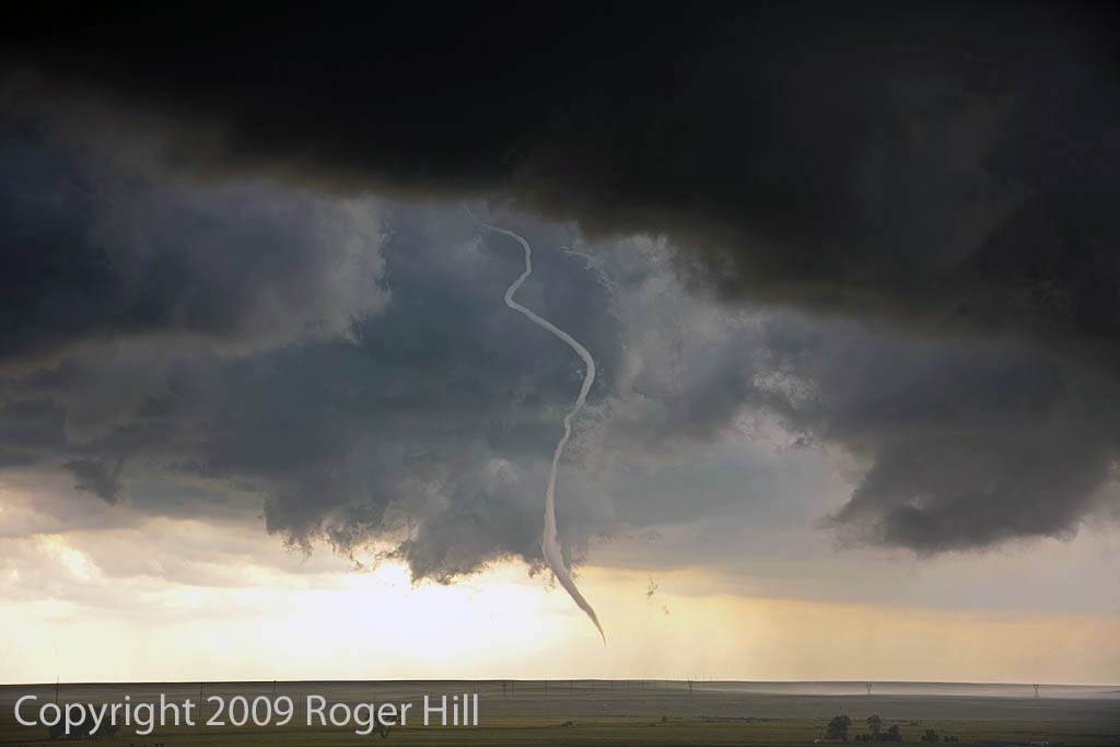
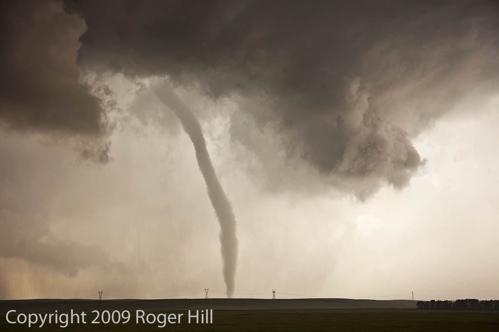
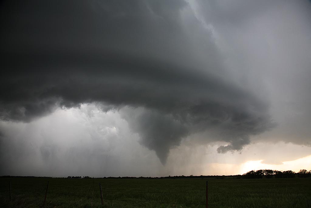
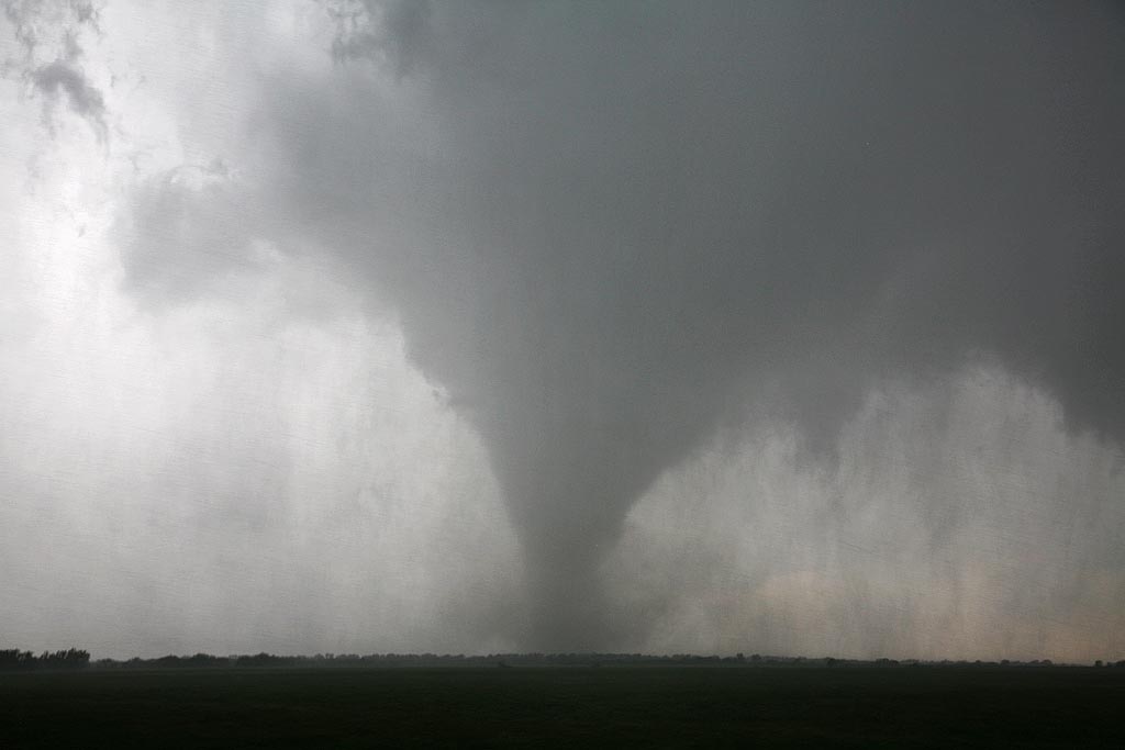
June 5, 2009 LaGrange, Wyoming Tornadic Supercell
Probably one of the most well documented tornadoes in history by Vortex II and The Weather Channel. We intercepted the entire life cycle of this gorgeous tornado and supercell from west of LaGrange till its dissipation well into Nebraska. This tornado was on the ground for nearly 30 minutes moving at speeds less than 30 mph.
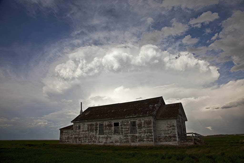
Late May 2009 Images
From mid through late May, nature did not cooperate with an active severe weather pattern. A large ridge of high pressure, along with a persistent gulf coastal frontal boundary would prevent decent moisture from returning to the plains states. When you operate a tour, you still have to find the little nuggets nature gives you. The pictures below are those nuggets from May 19 through 31st.
May 13, 2009 Kay County, Oklahoma Tornado
May 13th took us to the Kansas/Oklahoma border. Our initial target was north central Missouri but due to a late night in northwest Texas, it wasn’t going to happen. We positioned ourselves north of near Blackwell and watched as numerous cells developed on the front until finally a decent supercell formed just to our west. It quickly started rotating and produced a very nice tornado that was on the ground for over 15 minutes. Please click on the video link for a neat 2 minute video and click on the photos for a larger image of this very pretty and well structured tornado.
May 10, 2009 Marathon, Texas Beautiful Supercell
May 10th I wasn’t expecting much at all. High temp/dewpoint spreads, weak surface flow as well as 500 MB flow, and a fairly stout cap, would leave me skeptical about any decent storms. However, nature would have the last laugh as she provided us with a spectacularly structured supercell off the Davis Mountains in southwest Texas. High based storms first formed and became severe along the north and eastern parts of the mountains, with one cell becoming a beastly storm. It tracked east, then south towards Marathon and eventually into the Big Bend region. This storm would also produce copious amounts of hail near Marathon.