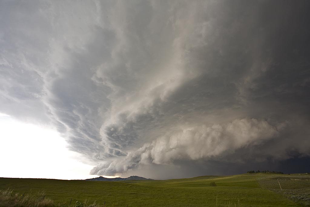
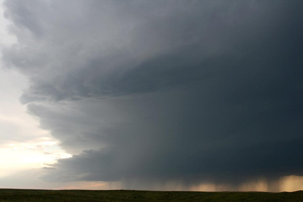
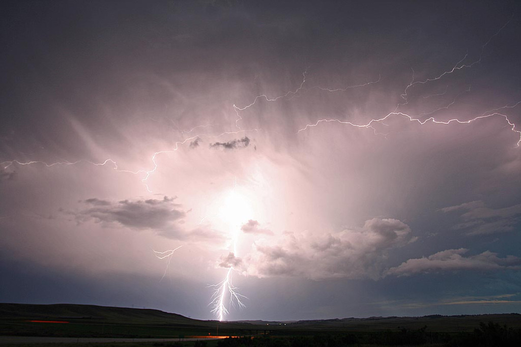
July 8th I couldn’t resist the drive to northeast Wyoming and southwest North Dakota for what looked like a decent setup. A slowly advancing cold front, along with a dryline intercepting it, ample moisture and instability, would provide a favorable environment for severe storms, supercells and tornadoes. Unfortunately, that rare occurance that the triple point didn’t produce a long lived supercell, while tornadic supercells formed north and south of us came to a reality. Still, we had two nicely structured supercells, the latter of which shown above came very close to producing a tornado.
June 5, 2009 LaGrange, Wyoming Tornadic Supercell
Probably one of the most well documented tornadoes in history by Vortex II and The Weather Channel. We intercepted the entire life cycle of this gorgeous tornado and supercell from west of LaGrange till its dissipation well into Nebraska. This tornado was on the ground for nearly 30 minutes moving at speeds less than 30 mph.
Late May 2009 Images
From mid through late May, nature did not cooperate with an active severe weather pattern. A large ridge of high pressure, along with a persistent gulf coastal frontal boundary would prevent decent moisture from returning to the plains states. When you operate a tour, you still have to find the little nuggets nature gives you. The pictures below are those nuggets from May 19 through 31st.
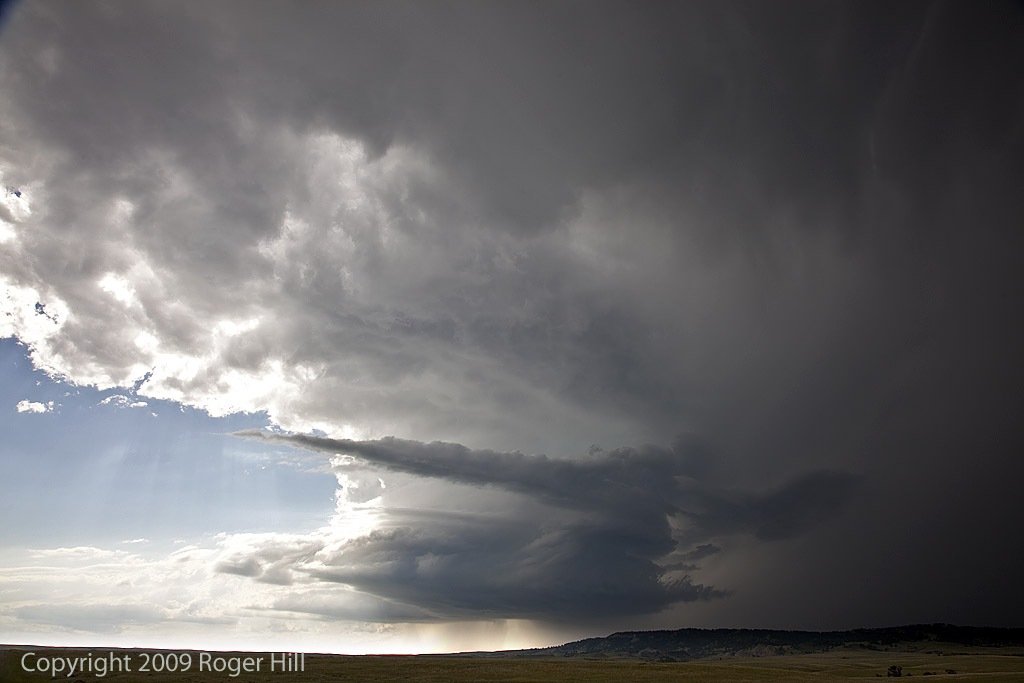
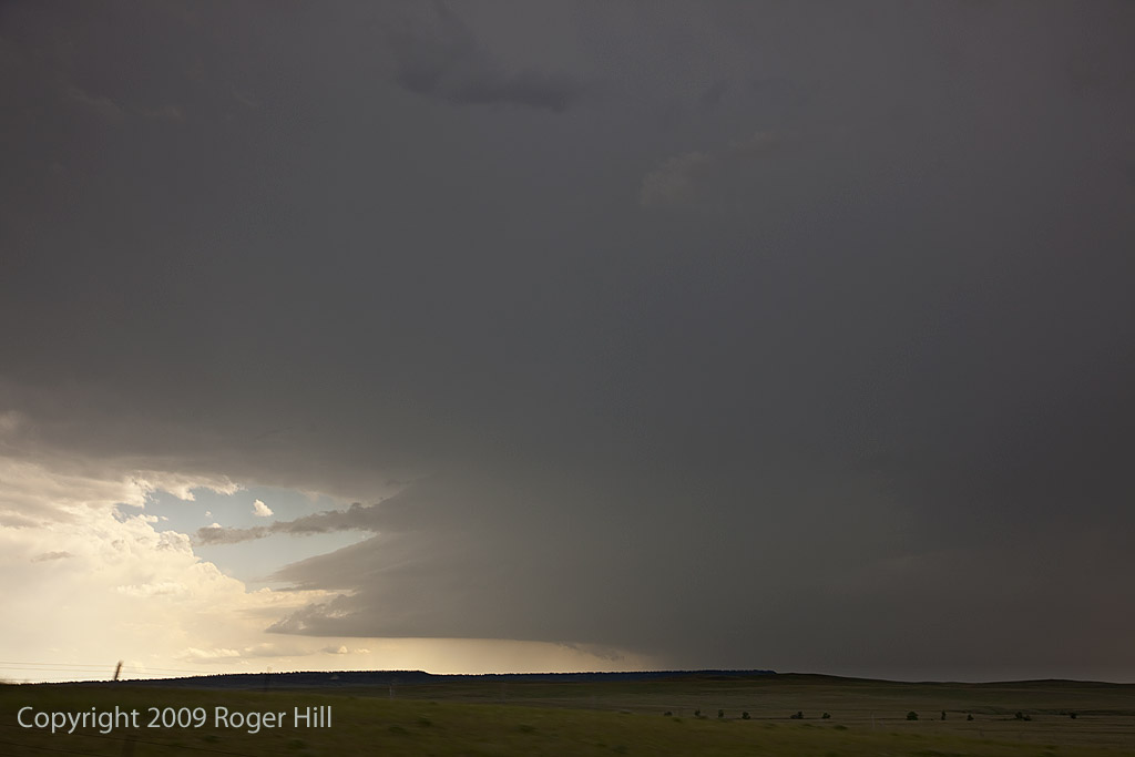
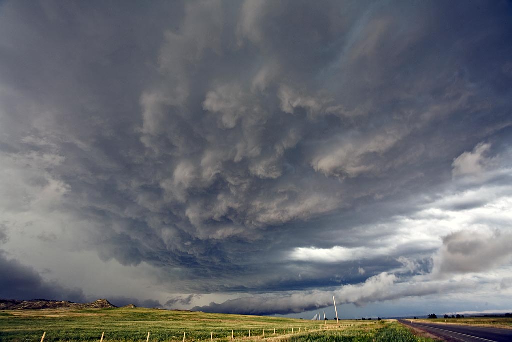
July 18th, 2008 Wyoming Supercell
July 18th had good hope for supercells, but less chance for tornadoes. Good shear, along with moderate instability and weak low level moisture would be sufficient for storms to form. By mid afternoon, supercells exploded along the Big Horn mountains and moved eastward across northeast Wyoming. I intercepted this storm north of Gillette. The supercell contained 2″ diameter hail, very strong winds and it tried very hard to produce as it blasted across the Black Hills.
August 22nd, 2007 Wyoming Supercells
August 22nd was a day that showed promise. Two plays existed. You could either play the upslope where better shear was present in southeast Wyoming, or you played the front where better instability and moisture existed. I chose the upslope being much closer to home. By early afternoon, I headed out to play cells that were developing in the upslope regime along the Laramie Range. The first cell was a classic supercell, with rotation and golf ball size hail. Low level shear just wasn’t strong enough to produce a tornado. Late afternoon, another cell emerged out of a line and developed pretty structure. It was also severe with golf ball size hail. Scariest thing occurred as I was southwest of Kimball, out of my van and filming the second storm. While taking still photos a bolt of lightning hit a telephone pole about 500 feet away from me and literally jolted me. One of the closest experiences I have had!
June 27th, 2007 Wyoming Beauty
June 27th did not hold great promise for severe weather. However, the threat for strong storms was enough to get us north from Denver to north central Wyoming, south of Buffalo. Several storms developed, a couple marginally severe, and gave us a pretty scenic view interacting with the mountains and plains.
July 20th, 2006 Goshen County, WY Supercell
July 20 promised to be a day with decent shear, instability and moisture, with a strong wave moving southeast out of Montana late in the day. Morning cloudiness cast a doubt on anything decent happening, but by noon, the mid level clouds eroded and good surface heating commenced. It didn’t take long for storms to fire up, and this storm became the storm of the day, producing tennisball sized hail, at least two funnels and intense lightning. It developed along I-25 south of Chugwater, WY and dissipated along the WY/NE border. It was one of the prettier storms of 2006!
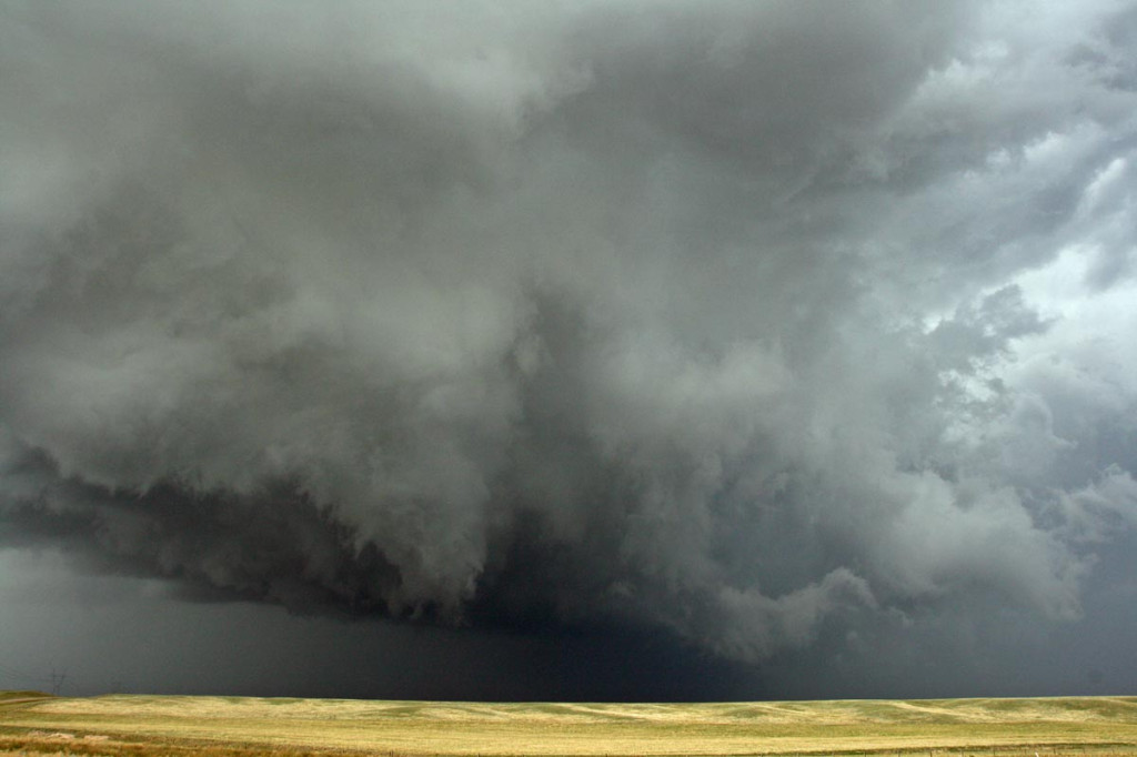
June 14th, 2006 Crow Agency, MT Hailstorm
June 14 ended up being a disasterous day for us. The day started out with lots of promise as a strong wave was moving across the intermountain west with tons of shear. Moisture was fair and we expected some nice rotating supercells. We drove west of Broadus, MT in search of a new and intense supercell that formed west of Sheridan, WY and was tracking north. As we approached it near Crow Agency it bowed out and became a deviant moving storm. We tried to get back east to get ahead of it, but traffic soon stopped us as we took the brunt of this monster hailstorm. Wind of 95 MPH drove hail to golfball size into the vans and knocked out windows, injuring Caryn with flying glass and hailstones. After a quick trip to the emergency room, she was ok, but with tons of bruises.
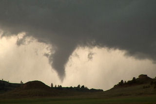
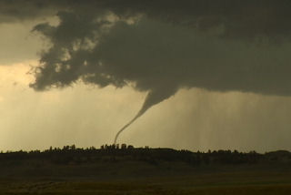
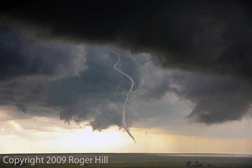
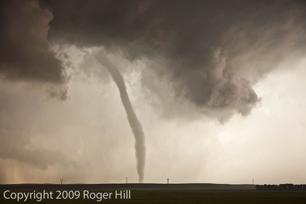
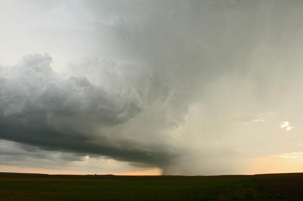
June 6th, 2005 Ekalaka, Montana Tornadic Supercell
What an interesting day this turned out to be. We started in Gillette, WY, blasted to Ekalaka, MT and sat north of town and waited, and waited and waited 🙂 Finally a high based little LP updraft developed, as usual, and was severe warned. The interesting thing with this is it was feeding on 72/56 air. It moved north and weakened. Then another storm RAPIDLY developed and intensified, southwest of town. This storm became a BEAUTIFUL striated stack of plates supercell, and quickly developed a nice wall cloud. Condensation streamed in from the northeast and soon a lowering was observed almost to the ground. Rotation developed and a funnel formed AWAY from the wall cloud. It extended a third of the way to the ground and dissipated.
Then a second funnel formed without being connected to the base, then developed a debris cloud and connected to the base!! Bizarre tornado! It stayed on the ground maybe 2 minutes and dissipated too. A third funnel formed and became a gorgeous elephant trunk tornado with INTENSE rotation and cascading motion in the cloud base. This also lasted 2-3 minutes. It also was rotating around the outer edge of the meso. A fourth funnel formed, a truncated cone, and became tornadic too with a debris cloud. This one lasted at least 5-6 minutes before dissipating. Eventually the lowering wrapped in rain, and then the rain curtains parted revealing a long slender funnel halfway to the ground!! What a surprise! I was NOT expecting this type of a supercell today at all!!