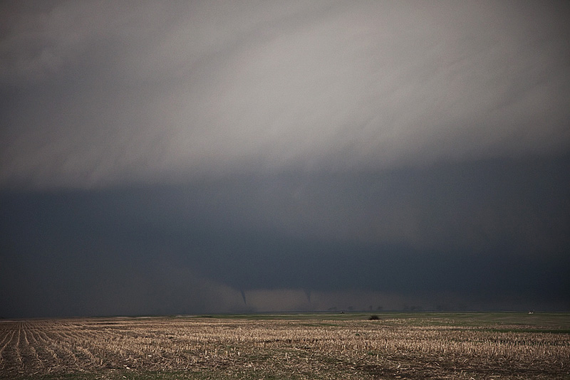
June 13th was the first day of our historic Tour 6 (31 tornadoes total on this tour!). We were a bit late to see the first tornado from this HP supercell southwest of Slapout, OK. By the time we arrived, it was cycling, with several occlusions occuring before it finally cycled and produced a fairly stout, low contrast, partially rain wrapped tornado. A second small and brief tornado occurred after the first one wrapped completely in rain. Fun day, even though we were a bit too late for the most photogenic tornado of the day.
June 10, 2010 Last Chance, Colorado Tornadoes
June 10th had very good instability and moisture, and fairly decent shear. Upslope flow at the surface with moderate southwesterly flow aloft would set the stage for supercell development off the Palmer Divide and the Cheyenne Ridge in Colorado. We ended up a bit late to the Palmer Divide to chase the Last Chance storm due to a large tornado warned supercell near the Cheyenne Ridge northward, but we soon left it and made it in time to witness two tornadoes and gorgeous structure of the Last Chance supercell. Some of these images are digital stills and a few others are video grabs from Caryn’s camcorder.
June 7, 2010 Scottsbluff, Nebraska Tornado
Intercepted a few supercells west of and near Scottsbluff, Nebraska. Upslope flow combined with decent instability set the stage for supercell development. A cell merger near Scottsbluff that occurred on an outflow boundary allowed a messy mesocyclone to spin up and produce a fairly brief tornado that caused some damage to buildings, power lines, trees and flipped cars near Melbeta. We got very close to the circulation.
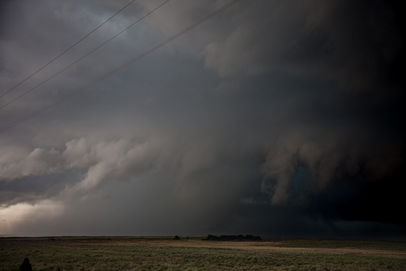
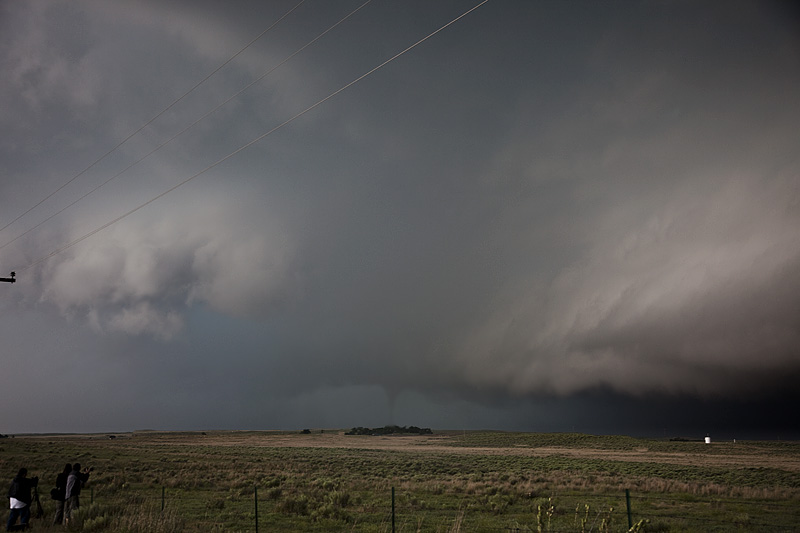
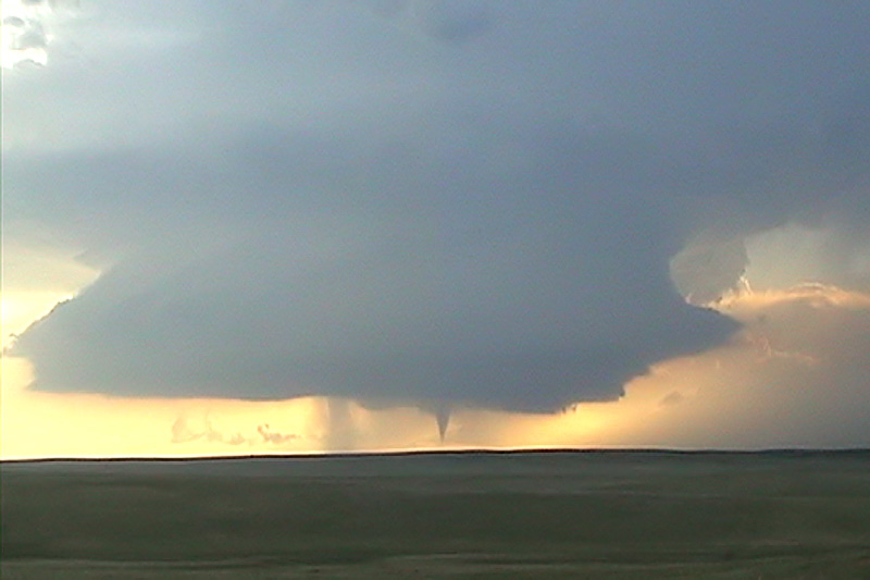
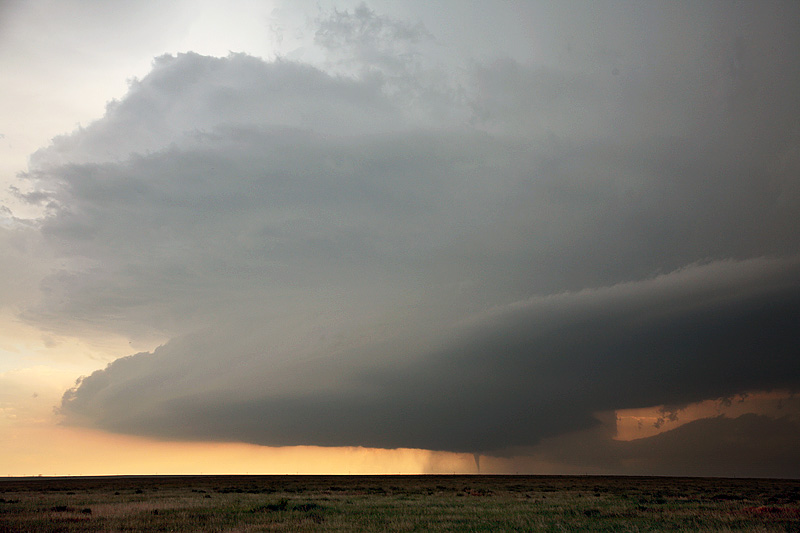
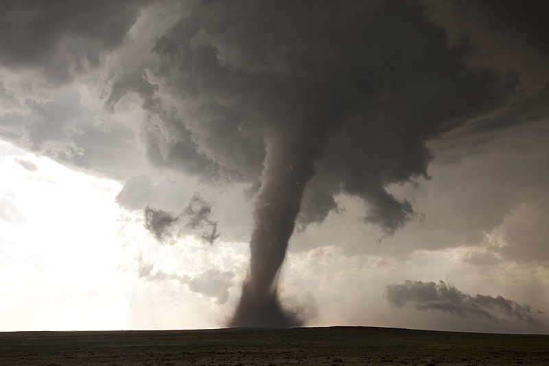
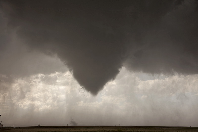
May 31, 2010 Southeast Colorado Tornadofest!
What an amazing day! We started in Amarillo and noticed a nice pinch point where the winds turned from south to east just north of the Raton Mesa in Baca county. We blasted north to find a magnificent supercell. It produced 5 tornadoes that we could confirm, and possibly 2 others. Two of the tornadoes were on the ground for over 20 minutes. It traveled only 40 miles in its 10 hour lifcycle! It formed just after noon and was still warned at 10 PM that evening.
Here is the first video from the Pritchett tornado. The Campo tornado video is below.
May 26, 2010 Denver, Colorado Tornado Warned Supercell
An active Denver Cyclone contributed to the development of a supercell near DIA. This storm tried hard a couple of time to produce a tornado. Intense upward motion in the wall cloud was noted with a strong inflow jet on two occasions. This storm also produced copious amounts of golf ball sized hail. The structure was quite pretty.
May 25, 2010 Southeast Colorado Tornado
May 25th had some hope of dryline supercells in eastern Colorado. After a landspout fest that we missed due to sticking to our target near Springfield, Colorado, we were treated to a fantastic supercell and a 10 minute cone tornado! This supercell was nearly stationary for several hours before dissipating.
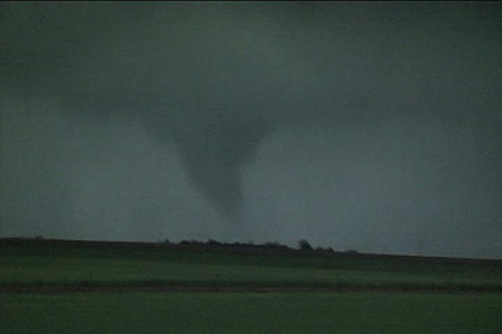
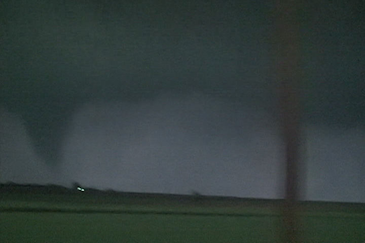
May 23, 2010 Northwest Kansas Nighttime Tornado
Not much to show here as the only shots I got were in the dark of the slender cone. There was another tornado just after this, a tapered elephant trunk that the NWS in Goodland could see from their office. The shots here are all video stills.
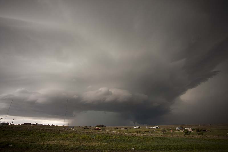
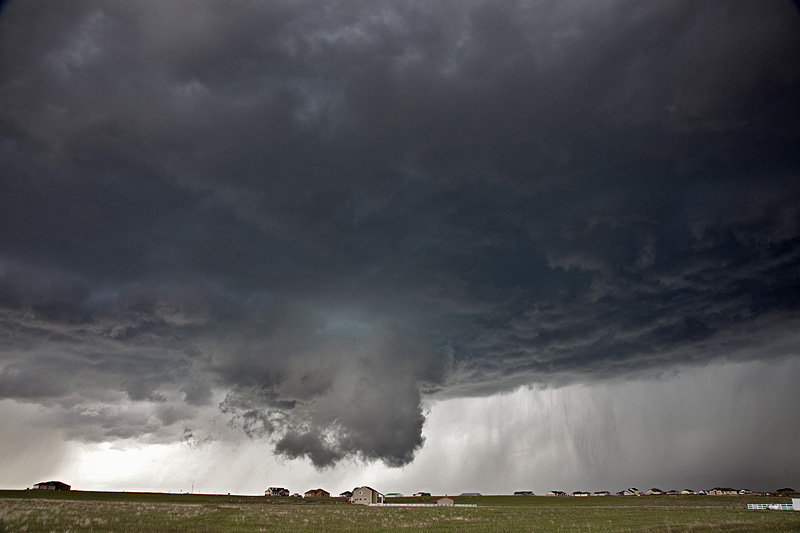
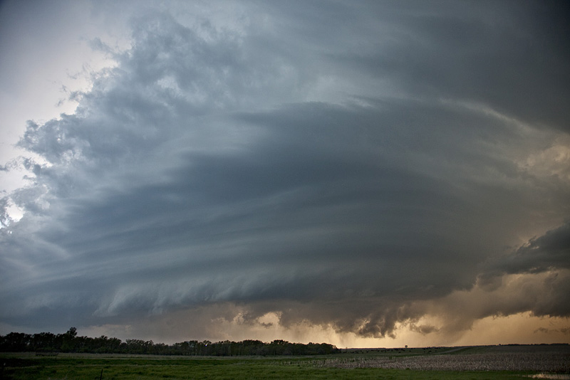
May 22, 2010 Bowdle, South Dakota Tornado Outbreak!
May 22nd was a day that had high risk/high reward written all over it. There really wasn’t much anywhere else to chase. We played the triple point in north central South Dakota and were rewarded with one of the prettiest and most violent tornado producing storms of the year. Several storms formed along the triple point and congealed into one beastly tornadic supercell that produced at least half dozen or more tornadoes. The large wedge in the photos below was an EF4 and we were able to get within a quarter mile of it before it started spewing debris around us. The structure of the monster was breathtaking as it dropped tornado after tornado between Bowdle and points northeast from there. Enjoy the photos and video, but keep in mind people’s lives were changed by the monster.
May 19, 2010 Oklahoma Tornadic Supercell
We intercepted a tornadic supercell in central Oklahoma near Dover, that produced a nice cone tornado. This became almost completely rain wrapped as it moved rapidly eastward. Due to the TIV and support crew blocking the road, we almost had a collision course with this tornado. We were very fortunate the tornado passed just to our south or else disaster could have happened. One of these days, chasers are going to die due to congestion, stupidity and irresponsibility.

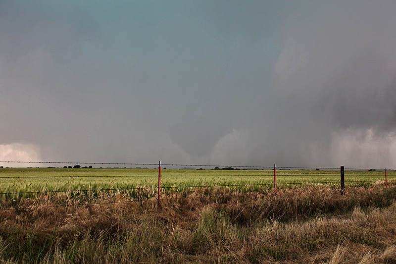
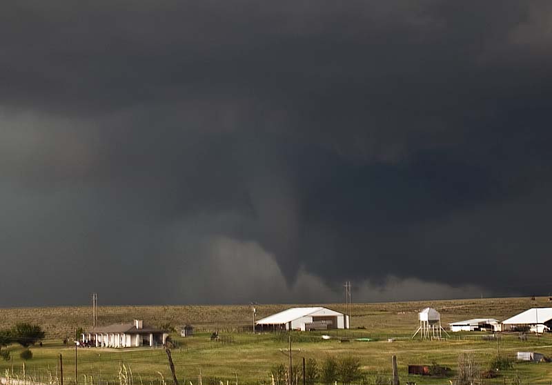
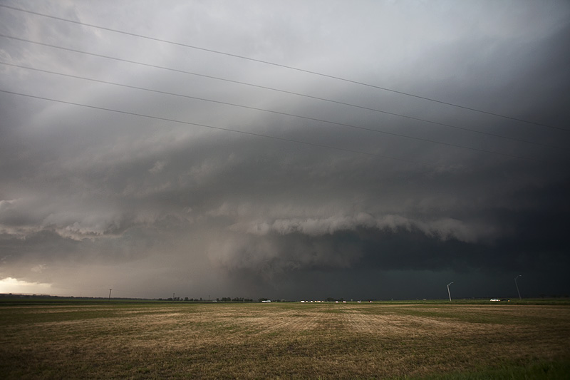
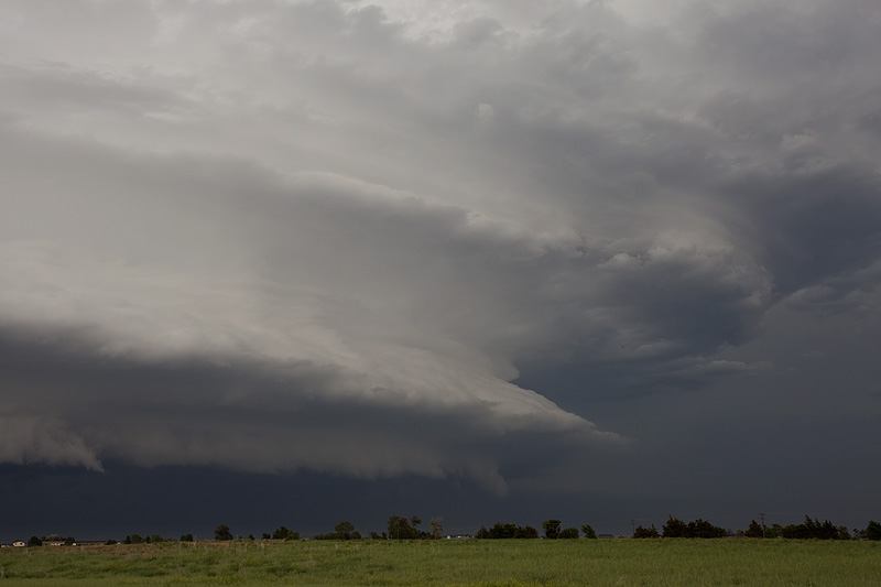
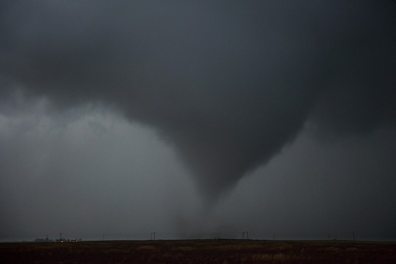
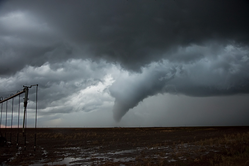
May 18, 2010 Texas Panhandle Supercell and Tornadoes
The setup May 18th was one of a weak boundary in the Texas panhandle, with good moisture and instability filtering in as the day went on. A strong shortwave trough was forecast to arrive during late afternoon, providing increased lift and ascent for storm development. A supercell formed by late afternoon southwest of Dalhart, and tracked/developed southeast towards Dumas. This storm was a classic cyclic tornadic supercell, and also produced copious amounts of significant hail. A very audible hail roar was quite easily heard as the storm spun and moved east of Dumas. We intercepted 4 tornadoes from the supercell. It tried several times to produce significant low level rotation, and at one point east of Dumas, I thought we would get a large tornado. It couldn’t stay focused long enough for that to happen. Finally, as it approached Stinnett, it produced a nice stovepipe tornado.