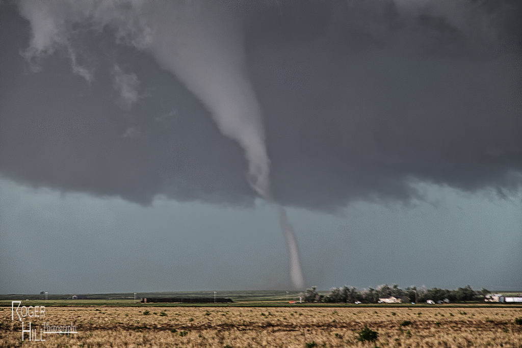
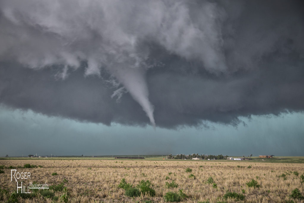
July 15th had big potential. An outflow boundary lay across the Kansas/Colorado border area by early afternoon. A cold front intersected that boundary near Cheyenne Wells, CO. Deep moisture, strong shear and high instability formed along and east of the boundary. By 2pm a severe storm formed and quickly became supercellular. It tracked due south right along the outflow boundary. We encountered huge hail the size of baseballs to softballs near Arapahoe, Colorado. Fortunately we did not lose any windows. We dropped south and had to stay on the western side of the storm where very hot and dry air was being entrained in the supercell creating a violent downdraft with intense blowing dirt and 90 mph winds. Finally at Granada, CO we were able to go east and get into the better moisture. As our storm gusted out, another storm formed on the boundary and ingested 84/70 air! A lowering quickly formed and within 20 minutes started rotating. A truncated cone funnel formed and dissipated 5 minutes later. We were right in the path of the mesocyclone. We moved a mile east and stopped. Rotation dramatically increased and soon a tapered white funnel formed. Another one formed and wrapped around the larger one. The larger funnel touched down and became a stout stovepipe tornado. It widened into a large cone. I couldn’t believe my eyes! Was this May or July? This was the largest July tornado I had ever witnessed in Kansas. The tornado moved south with a large debris cloud and after 19 minutes, roped out. It was quite the sight to see! An absolutely amazing day for the Great North Tornado Hunt tour again!