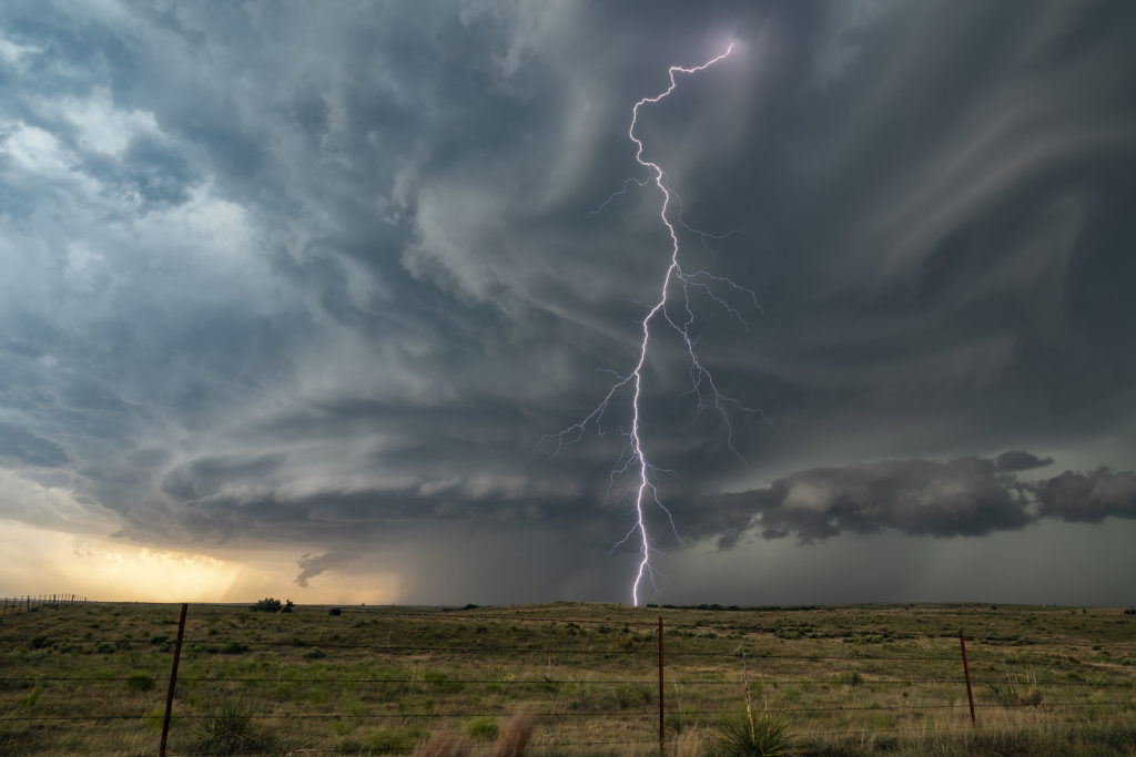
Eastern Oklahoma was the target on May 15th. Extreme instability and moisture as well as a cold front would provide the ingredients for severe storms this day. A supercell developed along I-40 near Henrietta, OK and drifted south. More storms formed south of there and continued through the evening. Very high wind, huge hail and heavy rain would accompany them as the built south. We were on several different cells that gave us some good structure and great lightning. No tornadoes occurred, but the storms were quite pretty nonetheless! Enjoy the pics!
May 14th Southern Kansas/Northern Oklahoma Supercells
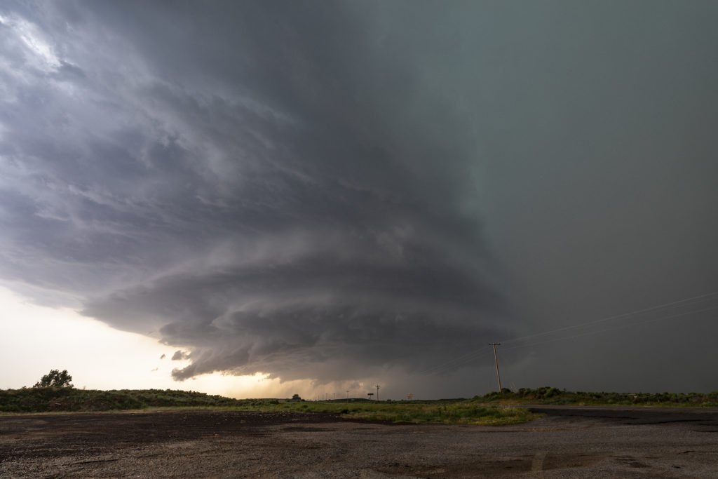
Lack of low level moisture was the theme this day. Good shear was present, however due to limited moisture, cloud bases were too high to produce tornadoes. Storms formed over south central Kansas and right turned into northwest Oklahoma as they became supercells. One storm even developed a clear slot and tried to produce a funnel. The intense lightning caused several grassland fires as well. Hail to the size of tennisballs also fell. They persisted through early evening before weakening due to loss of daytime heating. Very photogenic to say the least!
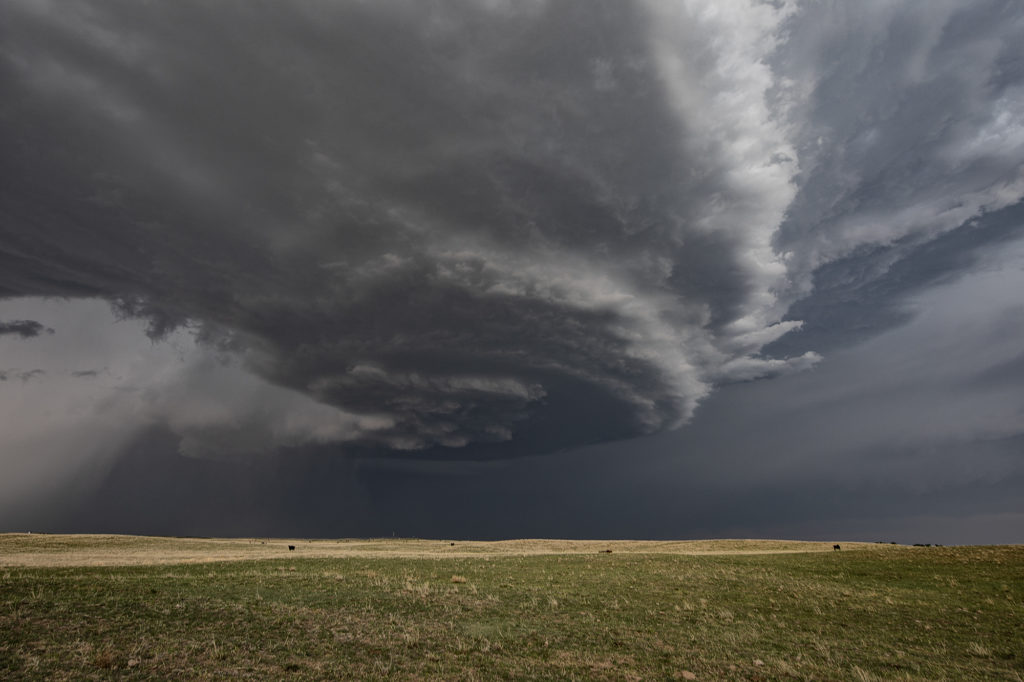
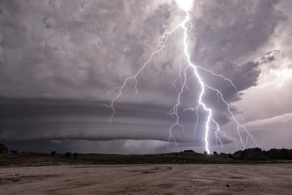
May 13th Northern Oklahoma Supercells
May 13th was a fairly marginal day as forecast. Some models tried to break out storms in southern Kansas and northern Oklahoma. We decided to chase down by the OK/KS border area and see if anything would form. Indeed it did! A couple of slow moving LP supercells developed and had decent structure and golfball hail. During the early evening hours, another supercell formed just southwest of the now decaying storms and became a formidable storm! Structure was of the classic supercell type and is spun like crazy in the dark. At one point we though it could even produce a tornado due to strong low level rotation. However it was not to be. A fun day, some good storms and great lightning in the night!
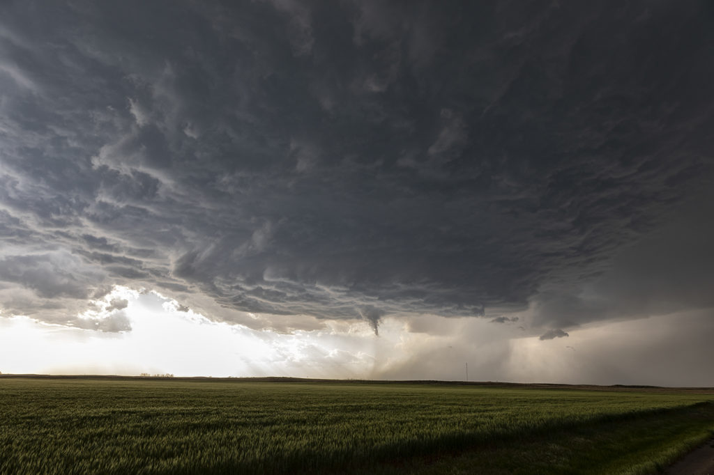
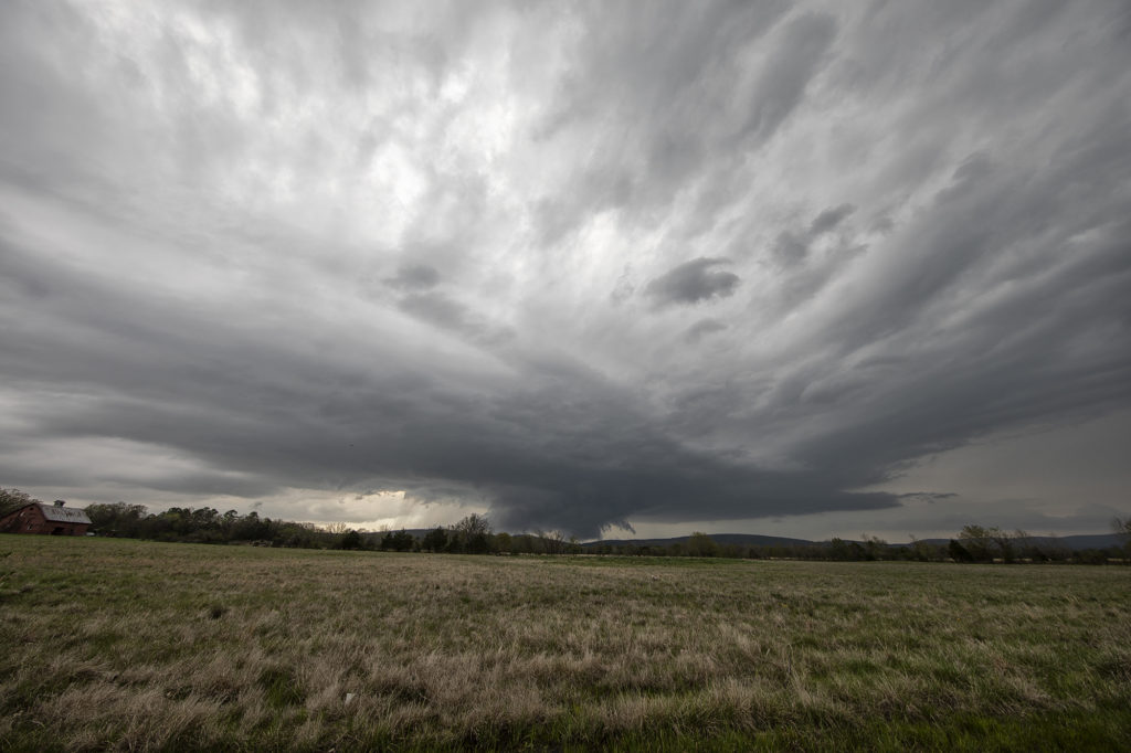
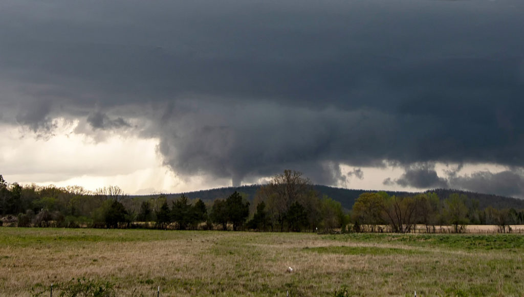
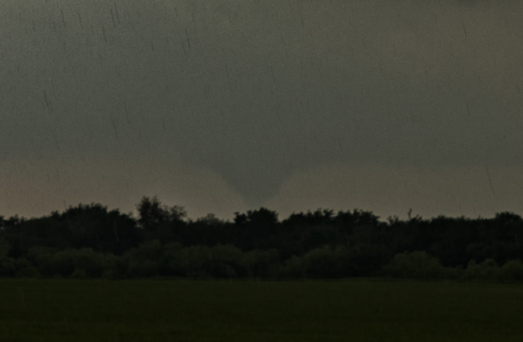
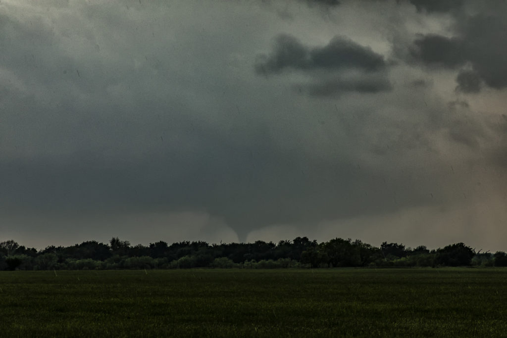
April 11th, 2022 Talihina, Oklahoma Tornado
We couldn’t resist running an on call tour during the week of April 11th. We gathered the guests early in the morning and departed Denver, headed for southeastern Oklahoma. Tough countryside to chase in with the Ouachita and Kiamichi mountains providing plenty of obstacles. However the set up would too good on paper to resist making the 850 miles trek there! High dewpoints, high CAPE, strong shear and a lingering boundary would provide all the ingredients needed for supercells. As we blasted there, about 120 miles out a supercell formed, earlier than models showed, and moved slowly eastward through Ft Smith, Arkansas. Knowing there was no way to catch it, we set our sights on another storm southwest of there. As we approached , it became better organized and soon became severe. We dropped south at Sallisaw, OK toward Poteau and it was evident we needed to get even further southwest to cut in front of this now tornado warned supercell. Coming over the mountains near Talimena State Park, we got a glimpse of a huge block shaped wall cloud. As we approached Talihina, we stopped to watch it wrap up. Within a few minutes it dropped a tapered cone tornado.
Not wanting to let is go through the mountains, we followed it eastward as radar continued to show a massive hook echo, often indicative of a potential tornado. We ended up the Talimena Scenic Drive, which is a stunning high road with views of the mountains at many places. We were on top at 2000 ft with a view of a massive wall cloud to our north and several cg lightning strikes. We stayed with the storm for another hour as sunset came and darkness ensued. We let the storm go as it was steadily weakening and heading into Arkansas. A fantastic chase, caught our first tornado of the year, and was reminded just how difficult it is chasing in the mountains of eastern OK/western AR! Enjoy the pics!
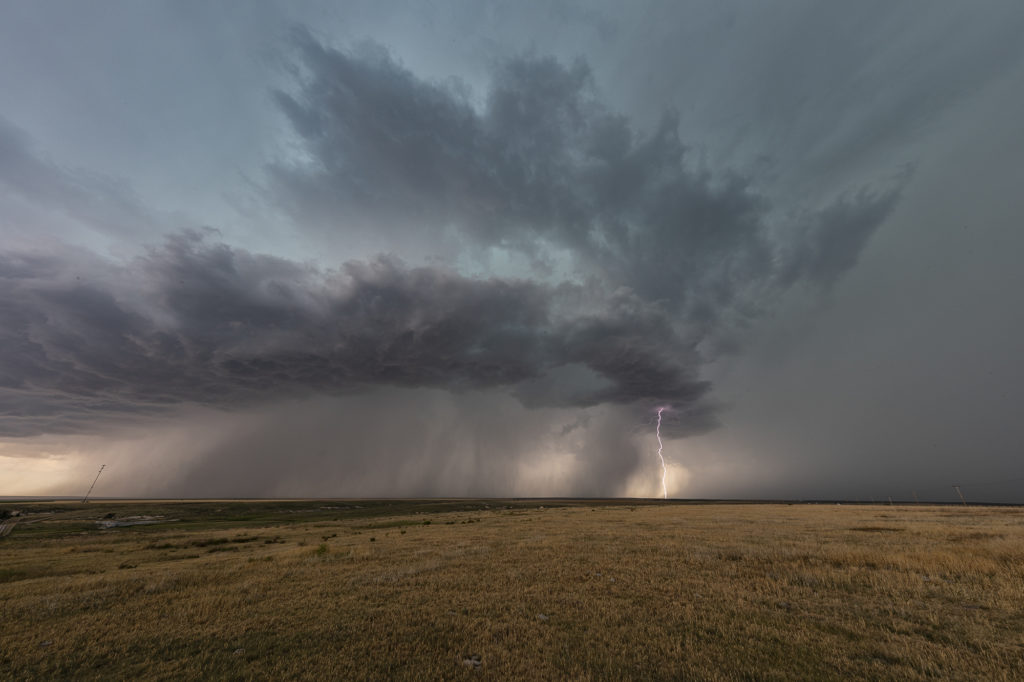
June 21st Western Kansas Supercell
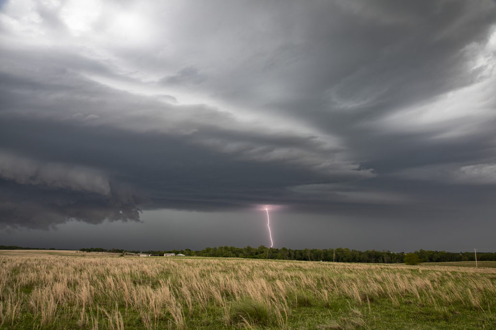
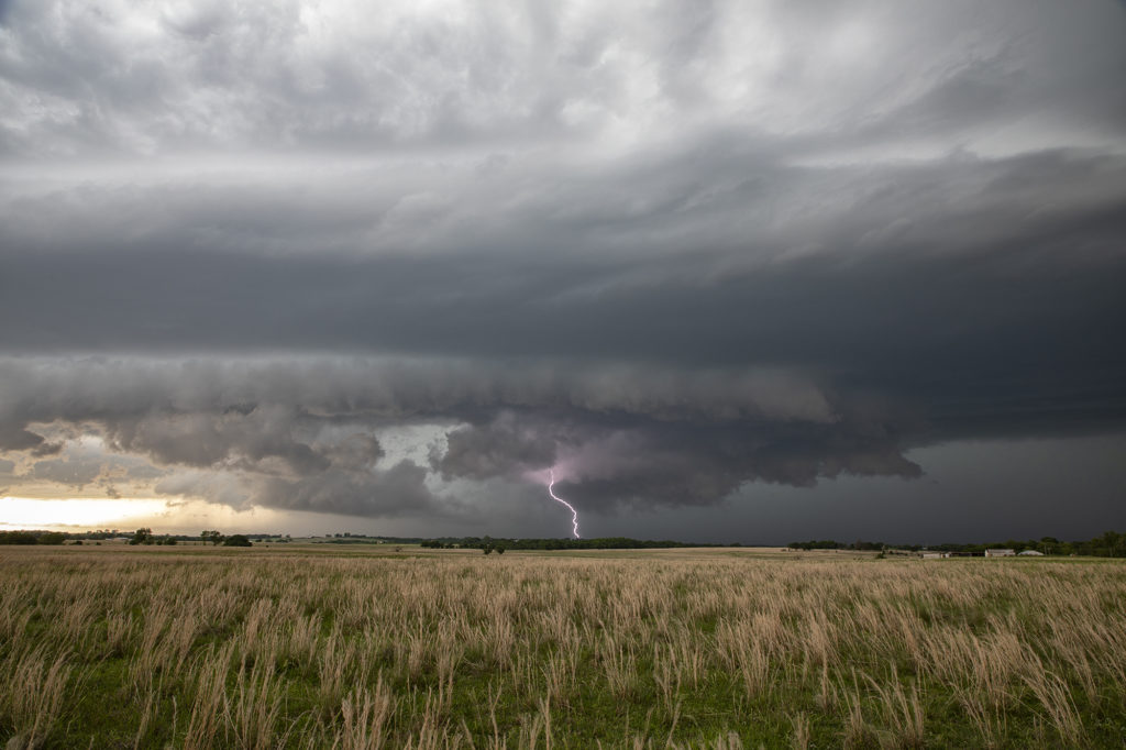
June 21st looked like a big messy day. Forecast was for thunderstorms, including supercells to form along multiple boundaries in western Kansas. It was thought that storms would congeal into a large MCS and track into northern Oklahoma later. That is in fact exactly what happened. Storms formed first along a weak front in northwest Kansas and tracked south. Other storms formed along old outflow boundaries in southwest Kansas. Eventually they all merged in a large high wind producing MCS. Moisture was marginal, but shear and CAPE were fairly high. As they became outflow dominant, a fast moving convective system produced 80 mph winds and golfball sized hail as it tracked in the Oklahoma panhandle. It was a fun day for lightning, and a well defined shelf cloud formed with the complex. Please click on an image for a larger photo. Enjoy!
May 14th Orion, Oklahoma Possibly Tornadic Supercell
We weren’t expecting much on May 14th. We had gone to northwest Oklahoma to watch a triple point area for storm development. Shear, moisture and instability were there, but so was a strong capping inversion. Some models forecast storms late, and others showed no initiation whatsoever. We waited and watched a couple LPish storms form and quickly die as the cap was too strong. We decided to head down I-40 towards OKC and see if anything would form. It certainly did! Off to our north, an updraft formed and looked to struggle. Eventually it intensified and we went north to catch it. We intercepted the strongly rotating updraft northeast of Seiling near the town of Orion. Structure was fantastic. It developed a low hang, rotating wall cloud, which looked like it produced a tornado. We could not absolutely confirm it, however other chasers in the areas said there was a brief touch down. We witnessed a couple of funnels as well. We stayed with the storm until it weakened late evening and then headed off to Oklahoma City. Great day for what appeared to be marginal at best! Please click on a photo to see a larger image. Enjoy!
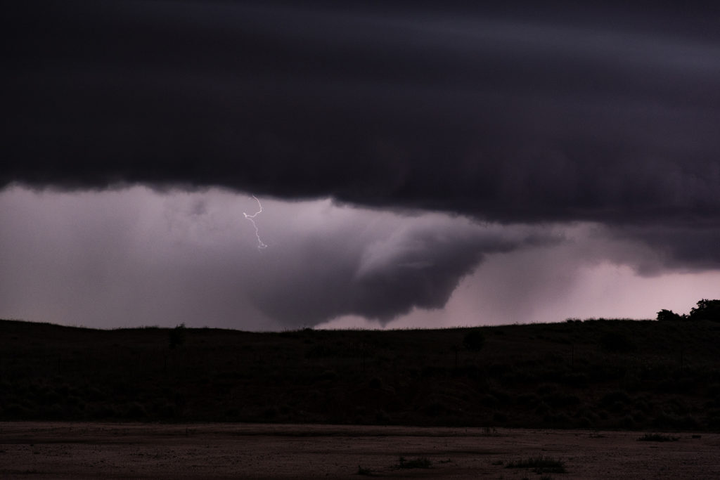
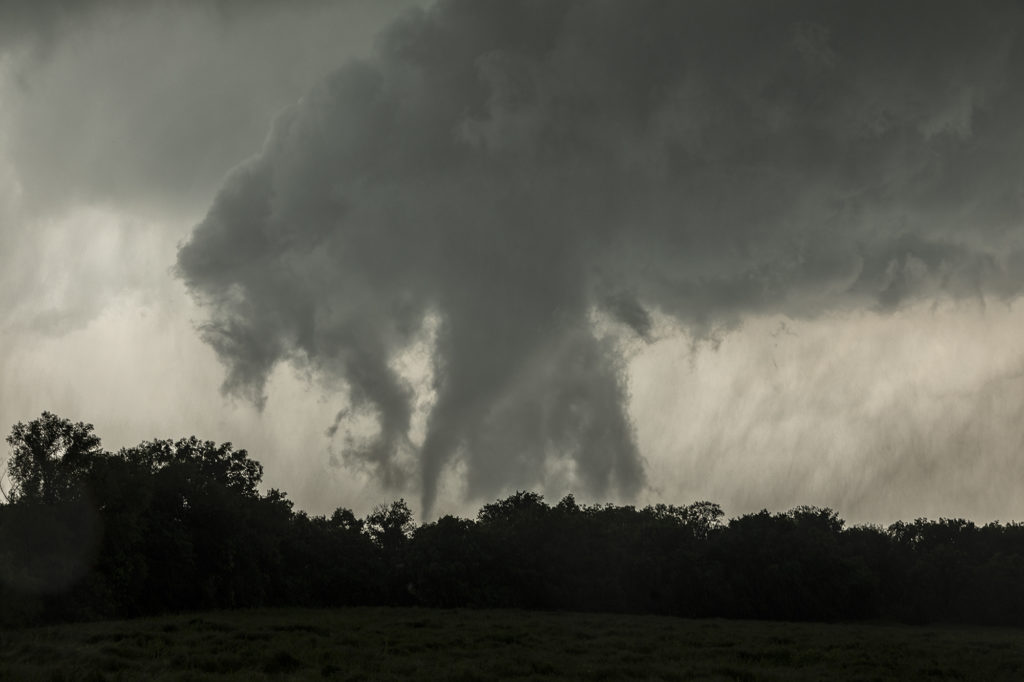
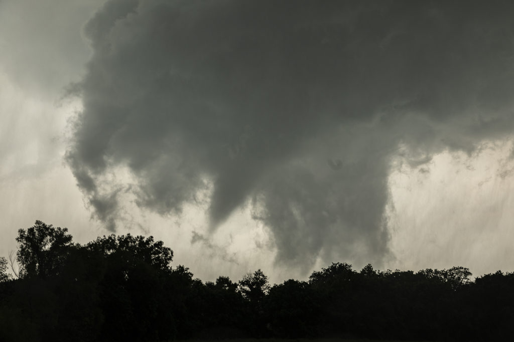
May 22nd Northeast Oklahoma Tornadoes
May 22nd featured incredible surface moisture and very high CAPE values as well. I was a bit concerned with upper level winds, but down low it appeared sufficient for tornadic supercells, especially with vertical stretching due to strong instability. We started the day heading towards northeast Oklahoma in the Tulsa vicinity. By mid afternoon storms exploded near I-40 well southwest of the city, so we headed that way. We arrived west of Okmulgee as a tornadic supercell approached. It produced a nice multivortex tornado about 1 mile to our west, followed by a cone just north of us. As the storm moved northeast it weakened as a second tornadic supercell approached town. This storm would produce at least 2 more tornadoes that we could confirm and possibly a 3rd brief tornado northeast of the city. Structure was nice and for last May storm motion wasn’t extremely fast. All in all a fun day. Later in the evening a couple intense tornadoes occurred in Missouri that fortunately did not cause any loss of life. Enjoy the pics below!
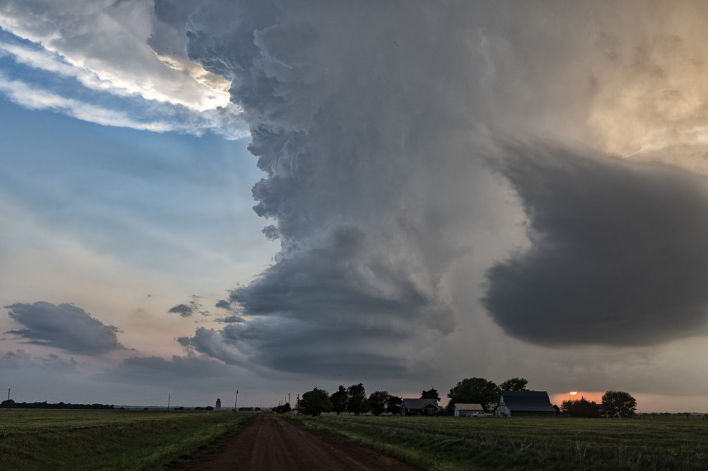
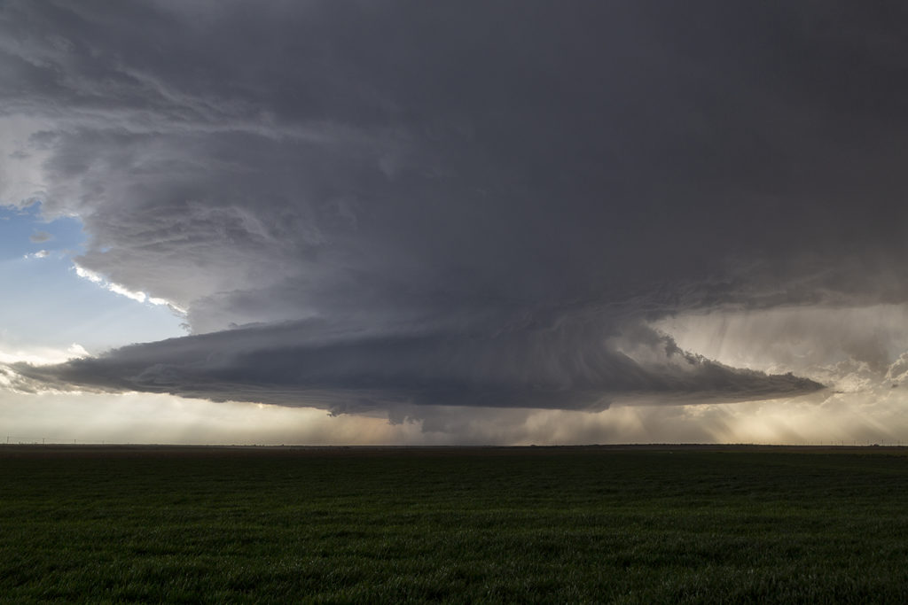
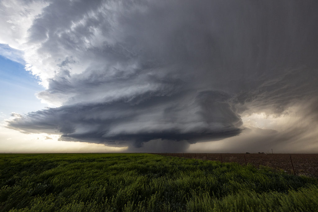
April 30th Red River Area Tornadic Supercell
A day of big hopes was April 30th. Great moisture, high CAPE and strong deep layer shear would set the stage for supercell development. We started the day in Wichita Falls, Texas only to move across the Red River into southern Oklahoma. It appeared that storms would form along a cold front and intensify as they crossed the river into Oklahoma. We played with a cell near Randlett, OK initially, which never did much. It was severe, but never looked like a threat to produce tornadoes. Eventually a couple of cells formed in front of the cold front and rapidly became severe. One storm near Byers, Texas dropped a significant tornado just across the Red River from us. We figured since the storm was moving northeast at 35 mph that we would stay on the Oklahoma side of the river (since there are FEW crossings!) and wait for the storm and tornado to approach. To our much surprise the tornado dissipated and the supercell died as it came to us! There was NO reason for the NEW supercell to abruptly diminish! However it did, but not before we were able to get some photos of the structure and of the tornado in the distance. It was only about 8 miles away when it’s demise occurred. Fun day, frustrating day, but we all enjoyed ourselves!
April 3rd Southwest Oklahoma Supercell
April 3rd took us to southwest Oklahoma to film a commercial for Chevy Silverado trucks. After 2 days of intense filming in Colorado, we took the film crew to southwest Oklahoma in search of a supercell storm. It did not disappoint! Late afternoon a storm formed southwest of Wellington, Texas and moved into southwest Oklahoma near Hollis as it intensified into a formidable supercell! Fantastic structure, hail the size of tennisballs and nice lightning greeted us and the film crew. We stayed with the storm till sunset south of Snyder and then let it go. The tv crew was astonished at the sight of the supercell and came away with fantastic footage to use in the commercial. It will air late spring first on CNN and then later on other channels.
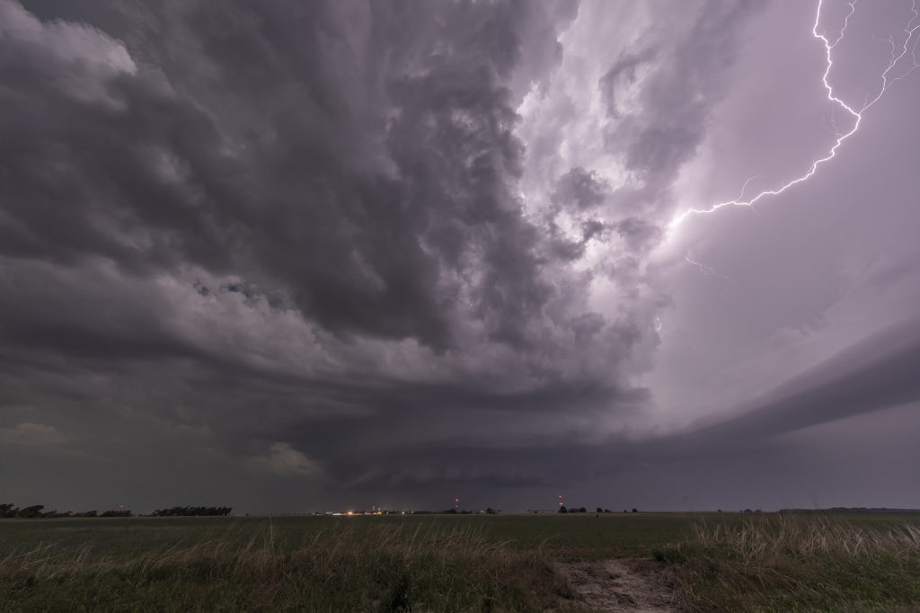
June 12th Oklahoma Panhandle Supercell
June 12th really didn’t look that good on paper. Weak wind shear should have resulted in storms being multicellular or pulse. However, one storm formed on the Kansas border and drifted southwest and became a very pretty supercell. The big story with this storm was lightning and structure. At one point this storm was producing cgs at the rate of 5 per minute. Instability was quite strong and lapse rates were very steep. The storm drifted westward for several hours and maintained its intensity. At one point it was a pretty stack of plates looking supercell. Colors were fantastic as well. Kudos to local fire departments for getting out and putting out the grass fires that were caused by this cell! There were many!! Mid evening the storm weakened and still gave us quite the light show as we drove to our hotel. Enjoy!