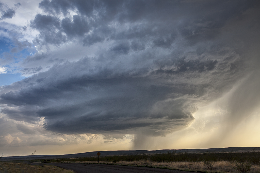
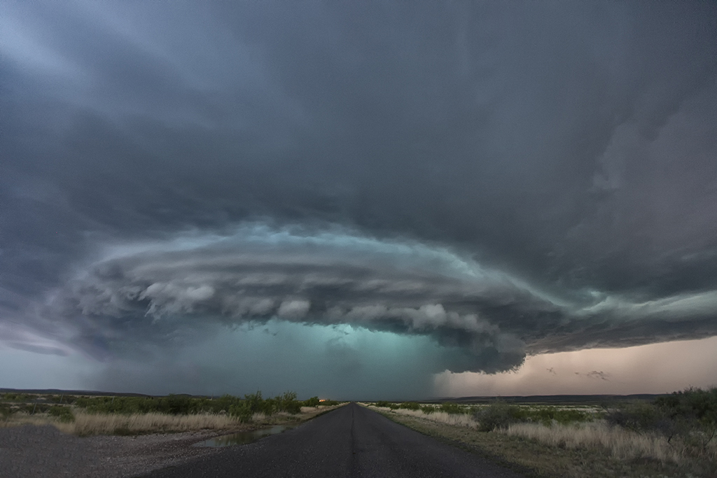
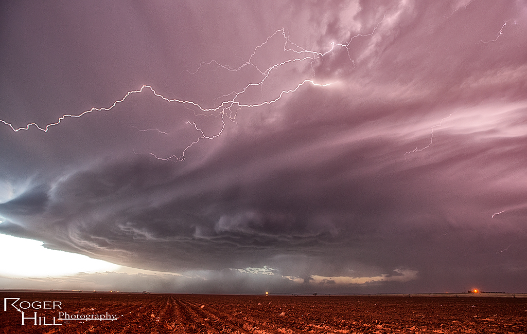
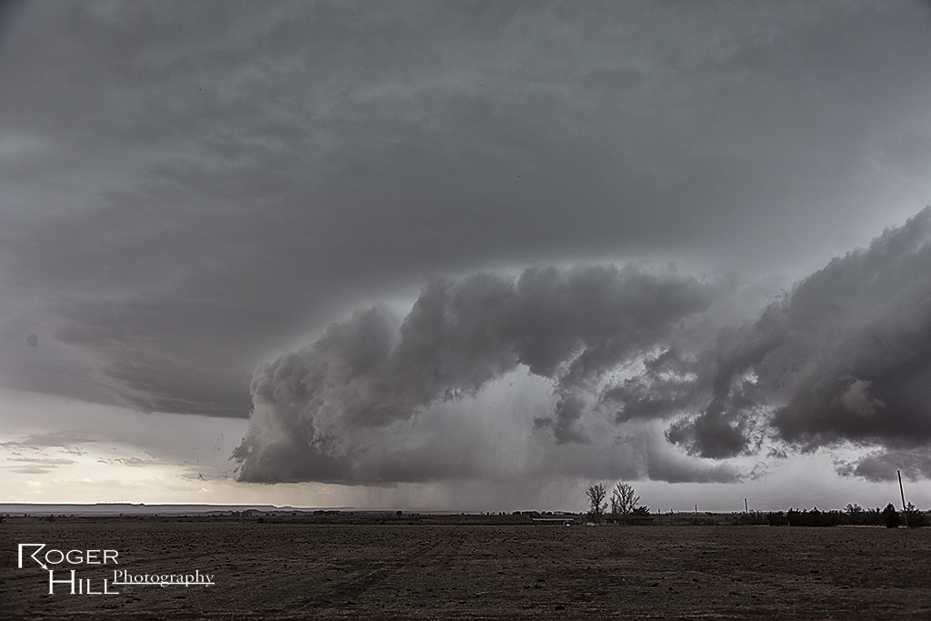
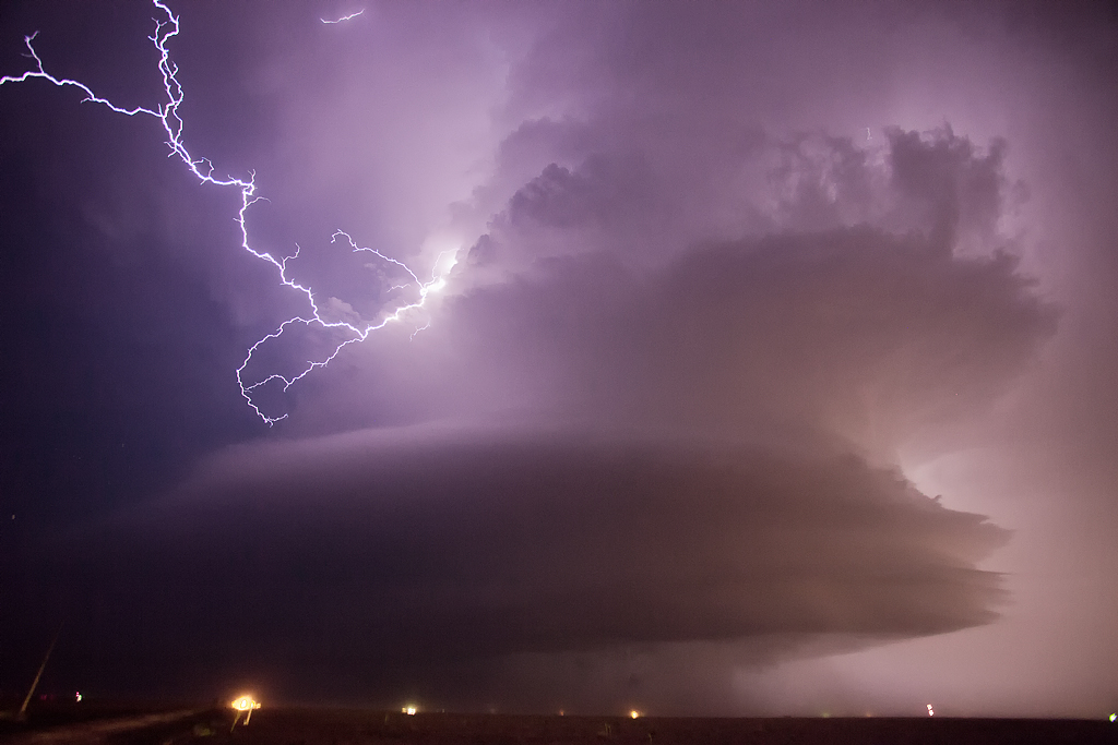
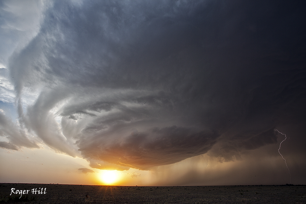
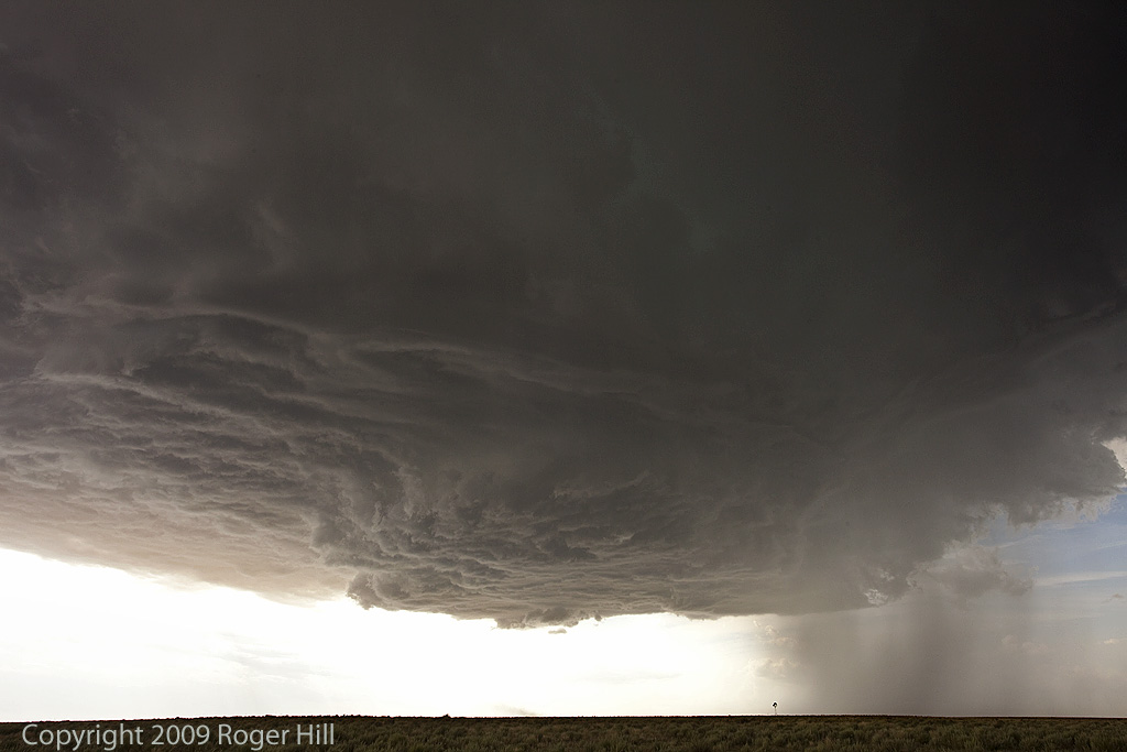
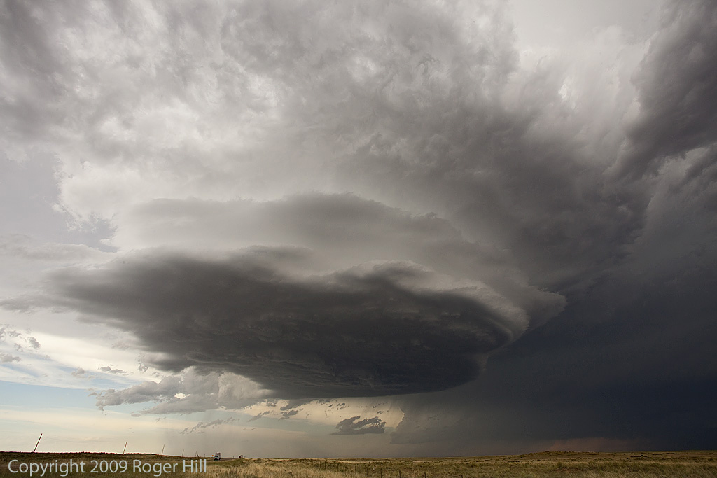
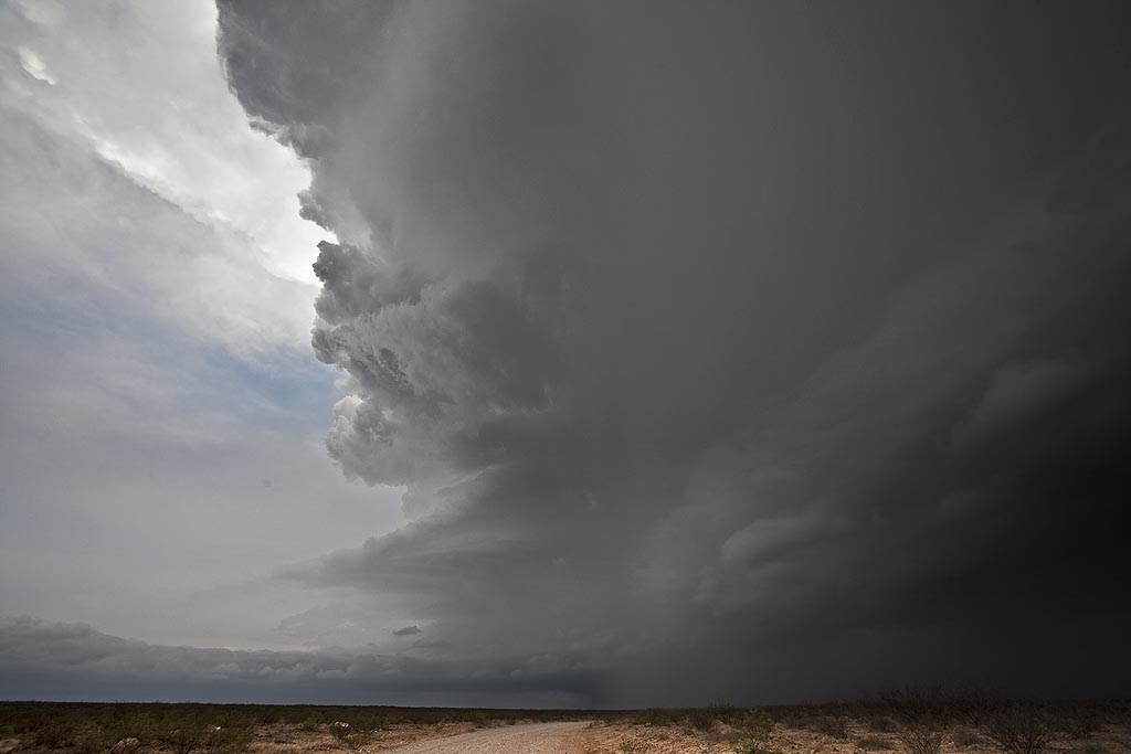
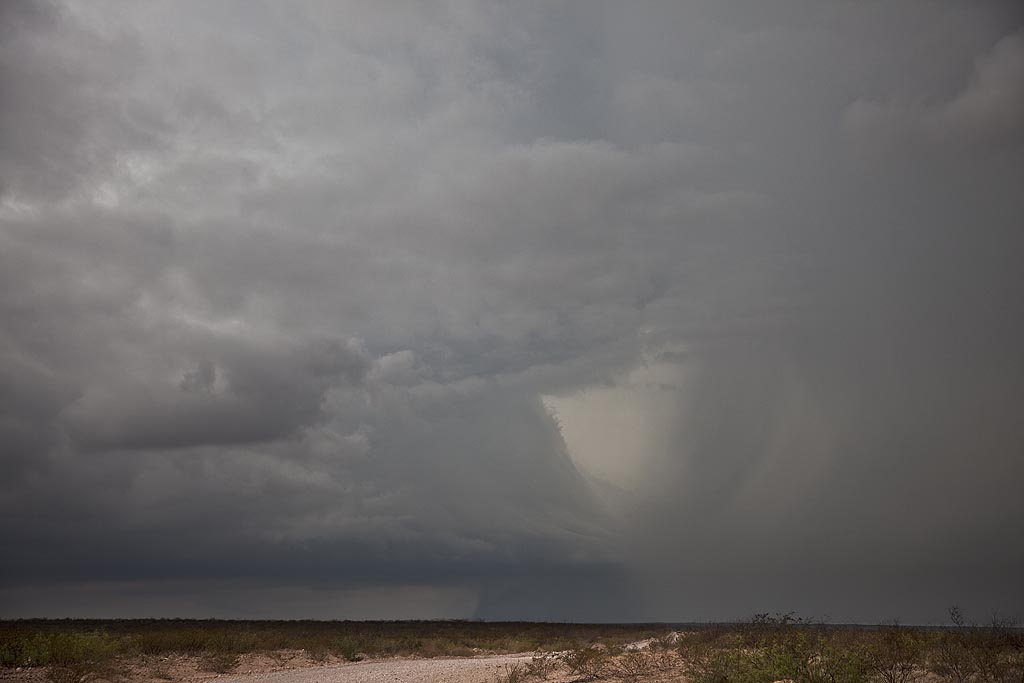
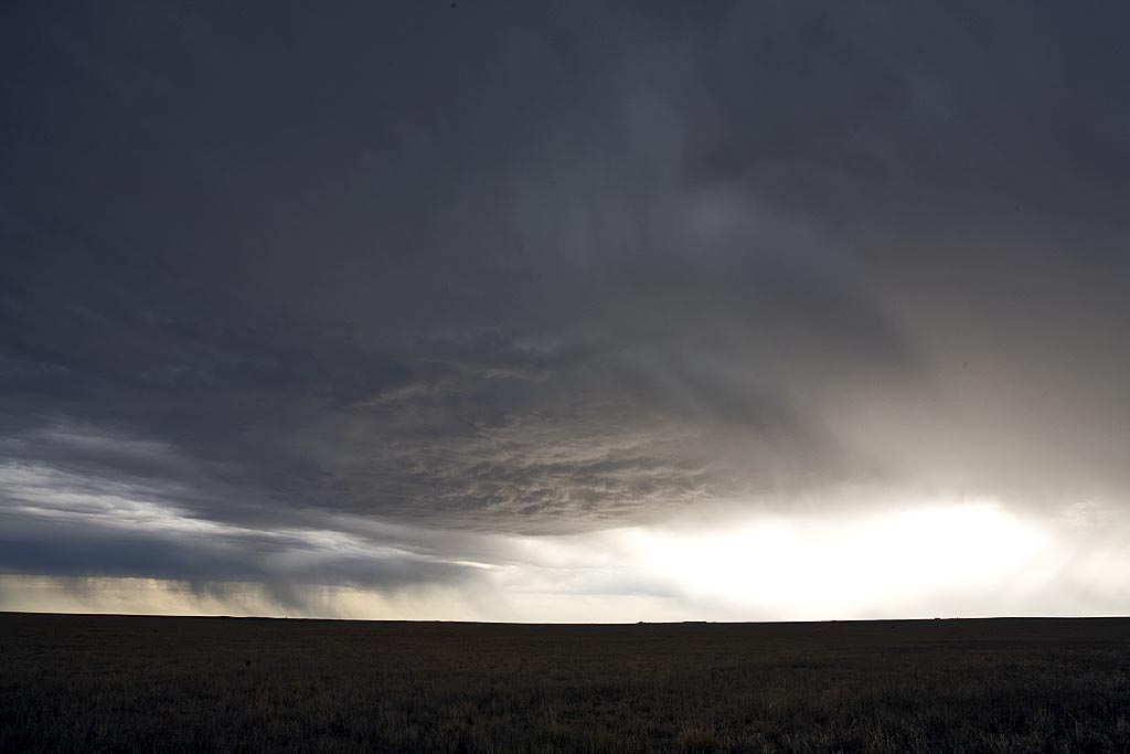
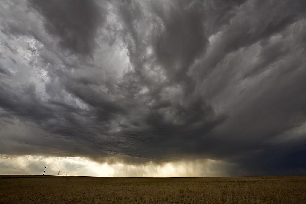
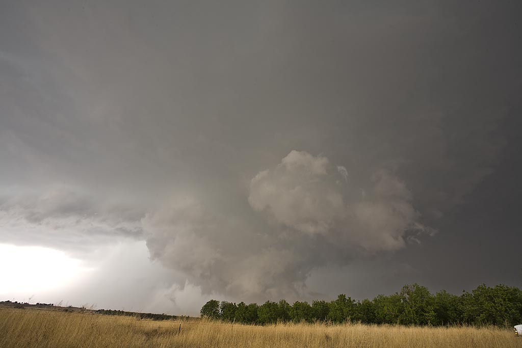
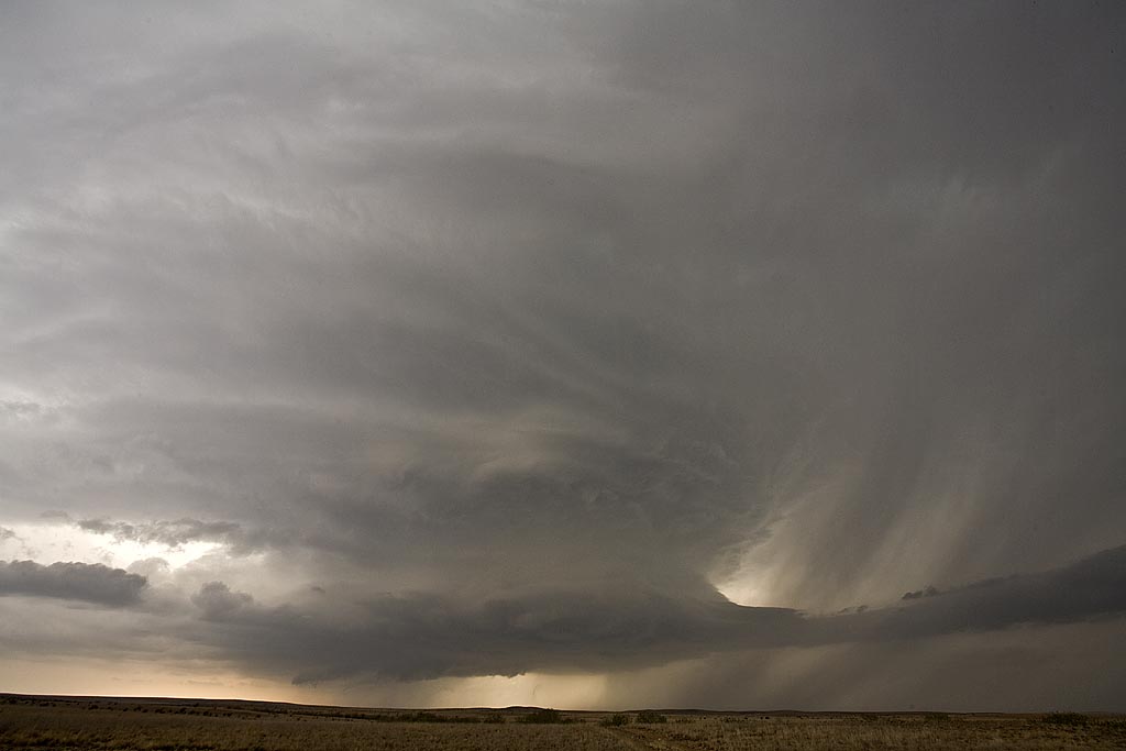
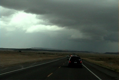
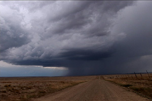
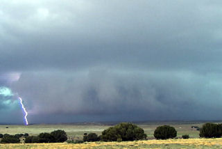
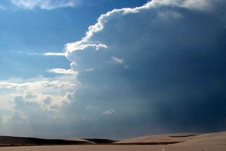
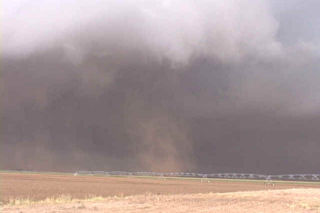
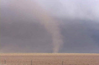
Tag Archives | New Mexico

June 12th New Mexico Supercell

June 12th featured good upslope flow into eastern New Mexico. Dewpoints in the 50s to near 60, CAPE to 3000 j/kg, good directional and speed shear, would set the stage for supercell development across that region. A cluster of supercells developed southwest of Hobbs, but we stayed put near Santa Rosa and were rewarded with a very pretty, nearly tornadic supercell. The storm was high based to begin, and then as evening approached and dew points also rose, the base came down and was tornado warned. The night time CG barrage was quite impressive as the updraft was lit up constantly.

July 18, 2009 Texas Panhandle Nicely Structured Supercell

July 18th was another day of good northwest flow, albeit the moisture and instability were a bit less than the 17th. We captured a beautiful LP/low end Classic supercell in the Texas panhandle north of Dalhart and stayed with it till it died south of I-40 in eastern New Mexico. Crazy chasing down here in July when you should be up north! But, this was a beautiful storm that also produced TONS of hail. Check out the time lapse and hail video below.

April 28, 2009 Carlsbad, New Mexico Supercell

April 28th took me to southwest Texas and southeast New Mexico to chase upslope storms. By late afternoon such a supercell developed near the Guadalupe mountains and tracked eastward along the Texas/New Mexico border towards Jal. The storm had pretty structure and was tornado warned for a long period of time. There may have been a brief tornado but we were too far away due to poor roads to confirm it. The storm produced large hail and tons of lightning.

June 17th, 2008 Northeast New Mexico Supercell

I didn’t have a lot of hope for this day. Upslope moisture was piling into northeast New Mexico, with fairly weak shear aloft. Decent instability developed and a series of supercells formed, moving southeast off the Raton Mesa area. As these storms moved southeast, they encountered drier air and weakened. However, early evening, stronger storms formed along a dryline and several became tornado warned. We had already blown off the day and headed north. Fortunately, no tornadoes occurred with these storms.

May 6th, 2008 Roswell, New Mexico Supercell

May 6th had good supercell potential, but the tornado threat was minimal with marginal low level shear. Upslope flow would develop into southeast and east central New Mexico and generate supercell thunderstorms of f the mountains west of Roswell. This beautiful supercell formed and gave us a spectacular show as it tracked eastward across all of east central New Mexico and was eventually tornado warned. It did not produce a tornado, but produced hail nearly softball size. The structure was text book classic, then morphed into a monstrous hp supercell.

June 25th, 2006 Northeast New Mexico Surprise Tornado

The first day of my North Land Lecture Tour resulted in a “south land” weak tornado! What a surprise! We headed south from Denver and crossed the Raton Mesa, only to see what looked like supercell structure near Mt Capulin volcano. East we blasted and caught up to this cell as it produced a distant weak tornado!! What a surprise!! Later on, a weak LP type supercell formed near Springer and had decent structure for awhile.

May 25 – 30th, 2005 New Mexico & Colorado Supercells

The last week in May was to prove unfruitful for tornadic supercell development. Very few tornadoes occurred, and even those that formed were weak. Due to upslope flow into New Mexico and Colorado, I would spend the entire week there. I captured numerous supercells, and a couple of weak tornadoes.

June 5th, 2003 New Mexico Gustnadofest

Not a great set up this day as storms formed north of an advancing cold front. These storms had embedded supercells in a line and they produced many photogenic gustnadoes. One such “spin up” actually had cloud base rotation and would be considered a weak tornado. Later, as the haboob formed, a large wall of red dirt was seen from many miles away.

June 4th, 2003 Quay County, NM Incredible Supercell!

June 4 was to be a day I would not soon forget. Northwest flow aloft would be the set up for this day. A nice highly striated supercell developed near Raton, NM and tracked due south along the foothills. This storm was very hard to stay with as the road network was not conducive to a successful intercept. However I was able to catch it and take some pretty video of this nearly 2 hour tornado warned storm. The next beast that I will not soon forget developed south of Tucumcari and tracked southward along an outflow boundary. This supercell, also tornado warned for several hours did not produce a significant tornado, however it did have INCREDIBLE structure, phenomenal 60 mph plus inflow and hail baseball size that destroyed my windshield. Check out the photos below of this beast. The first photos are of the first supercell.