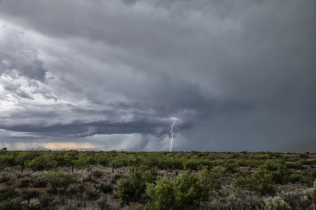
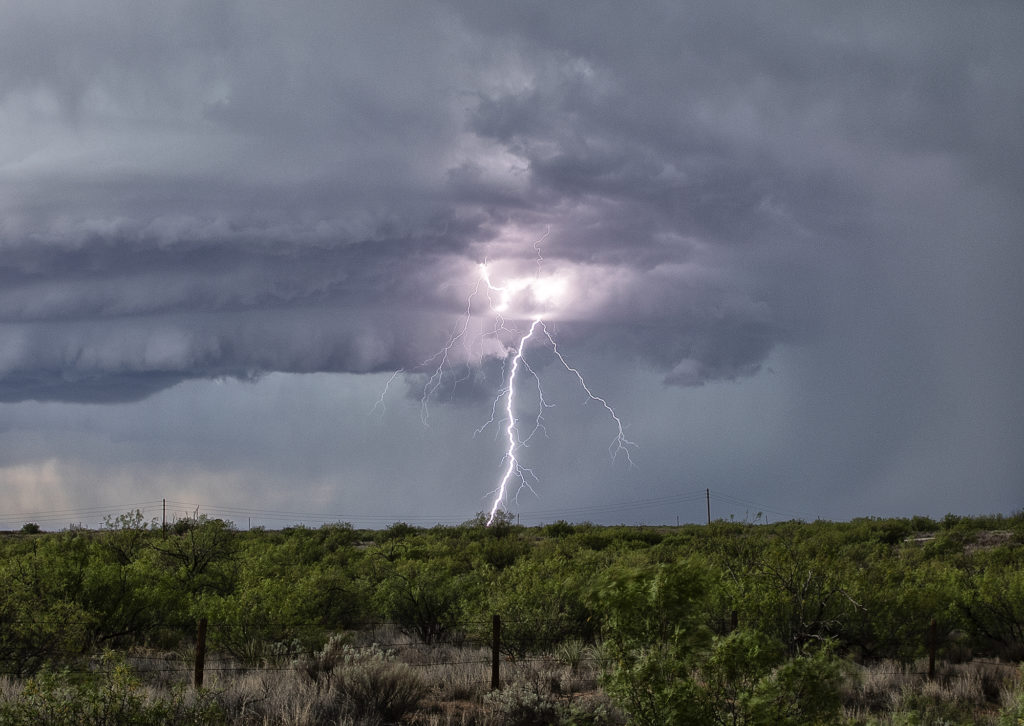
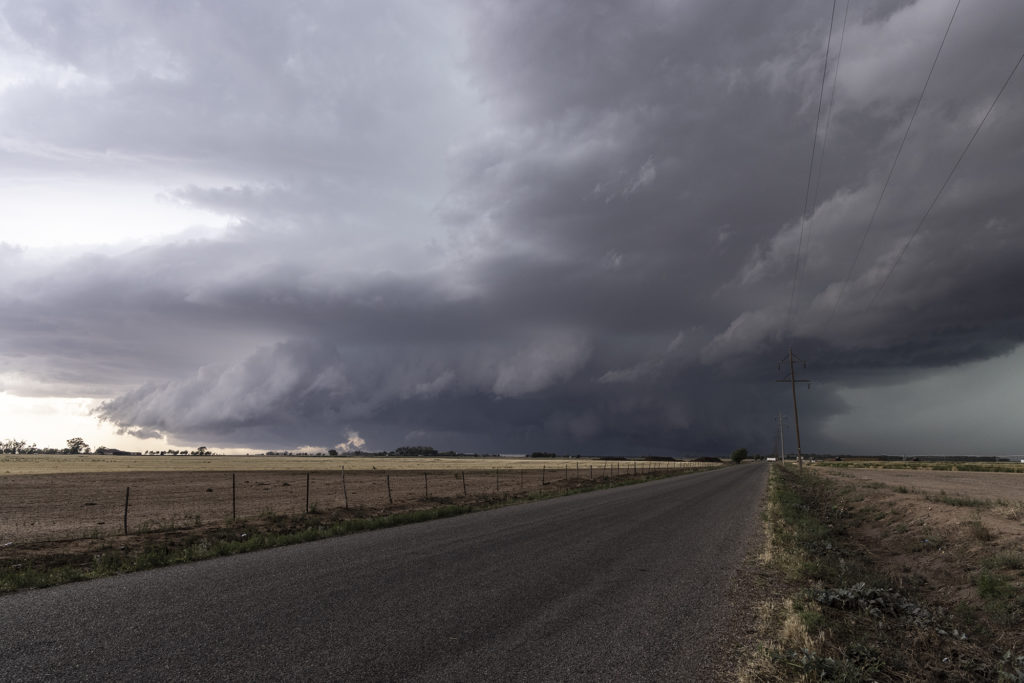
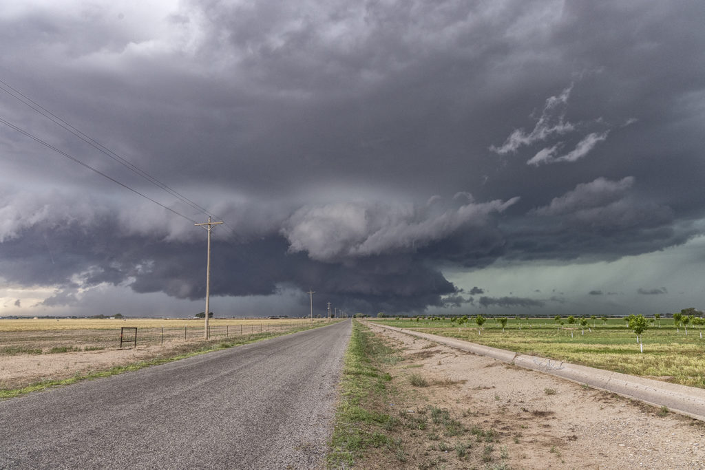
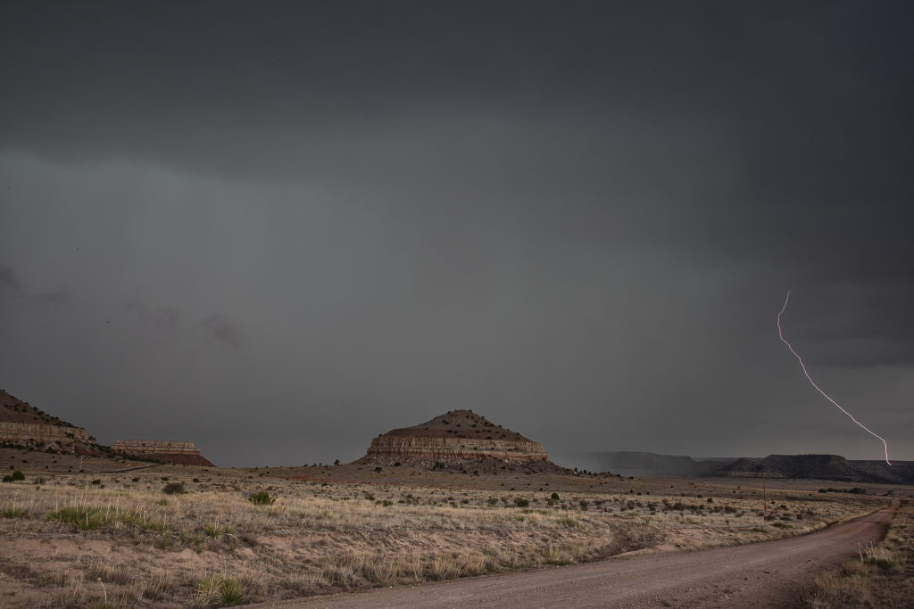
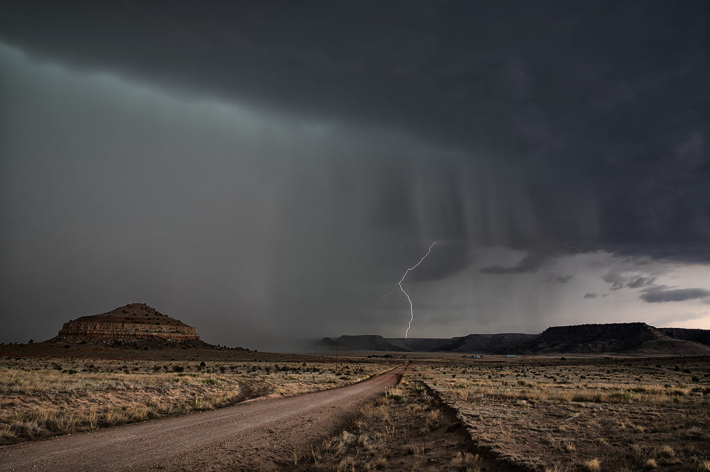
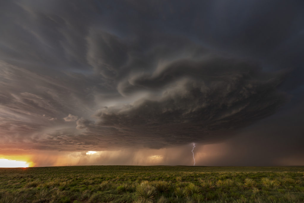
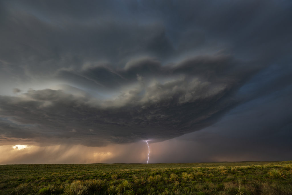
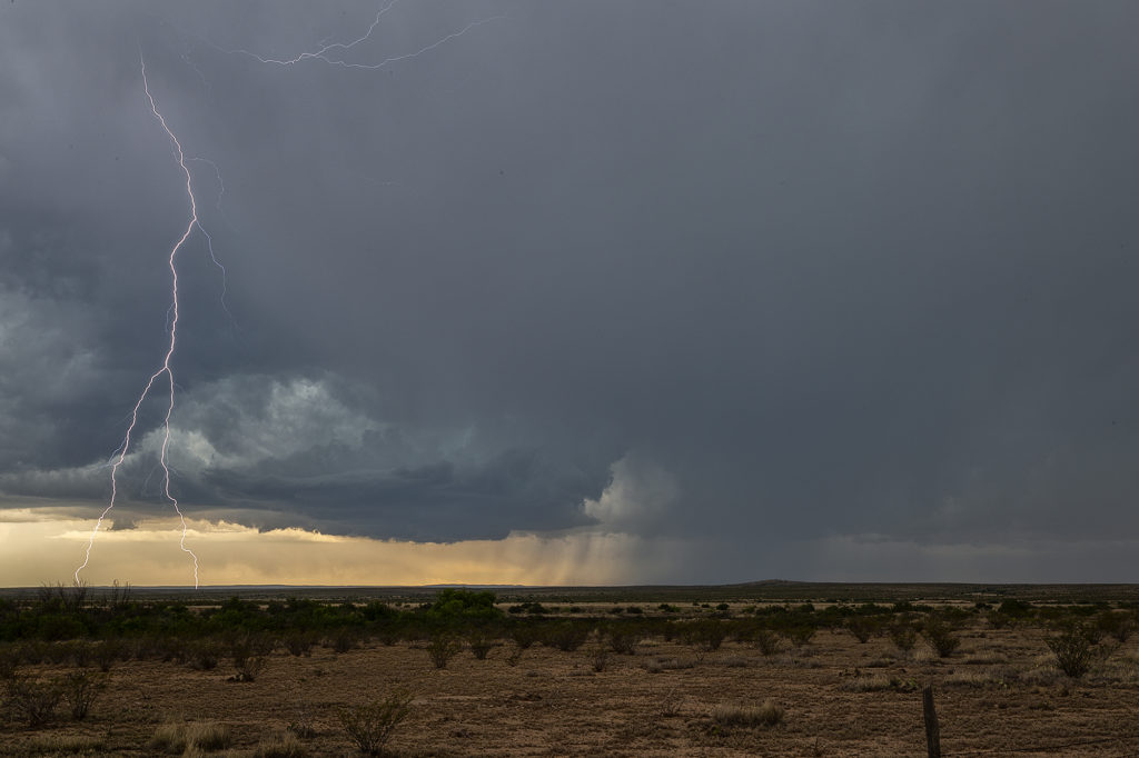
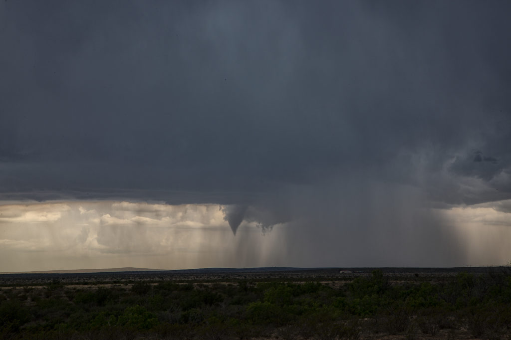
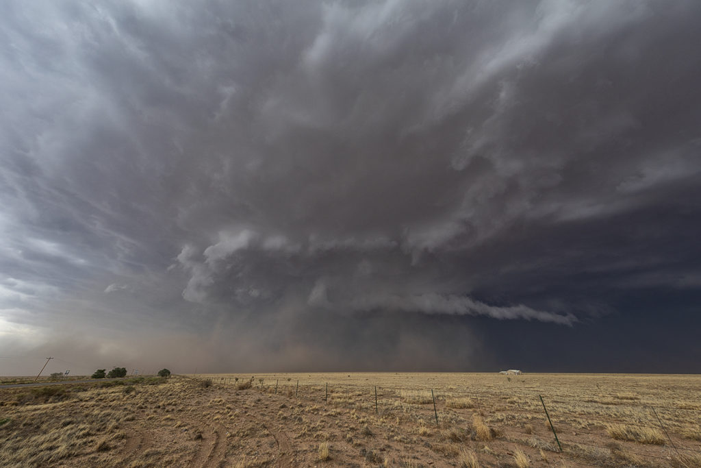
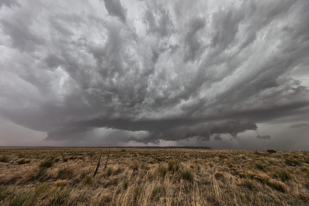
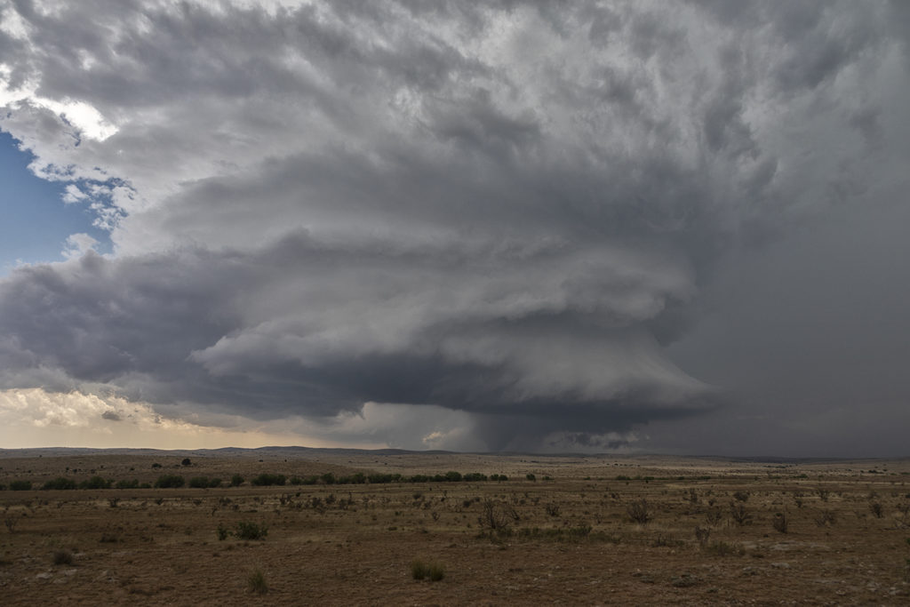
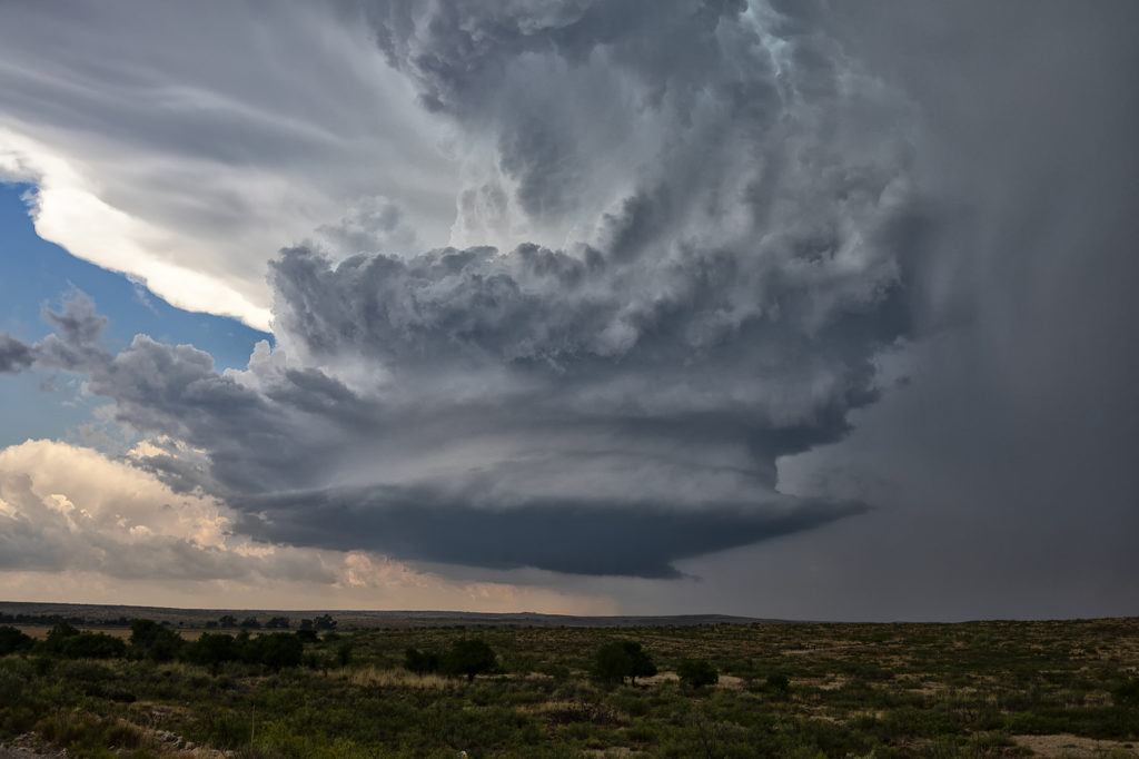
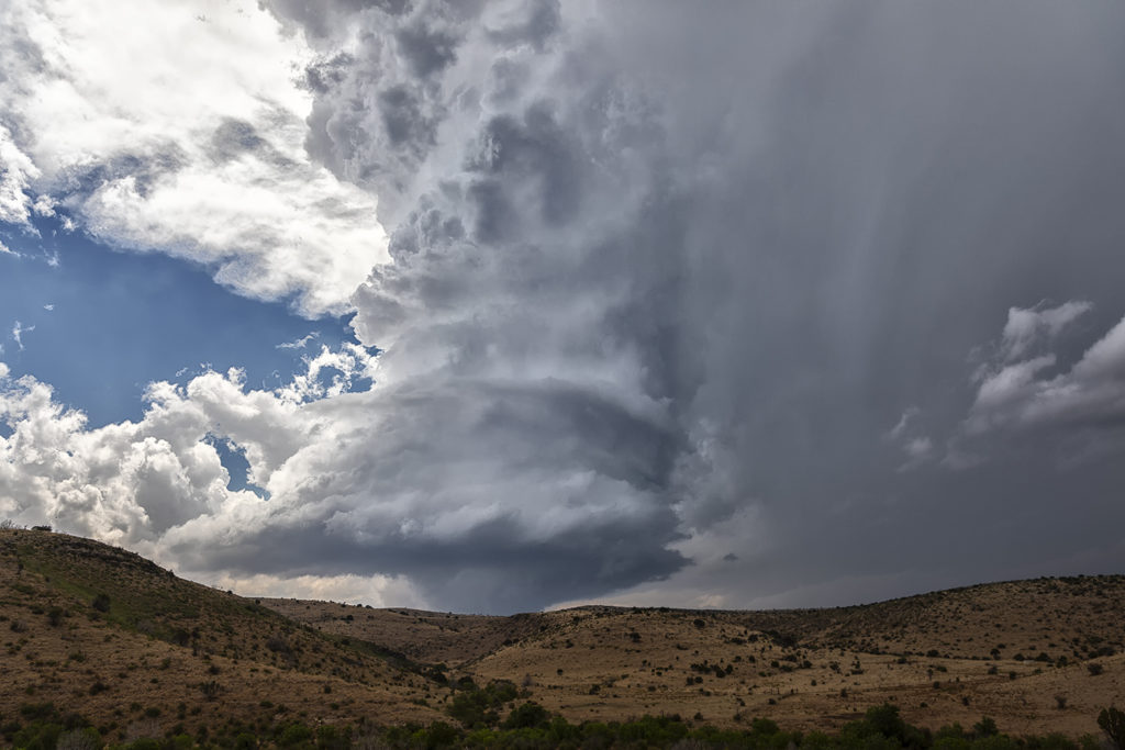
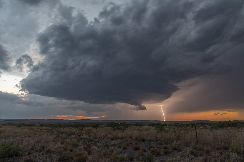
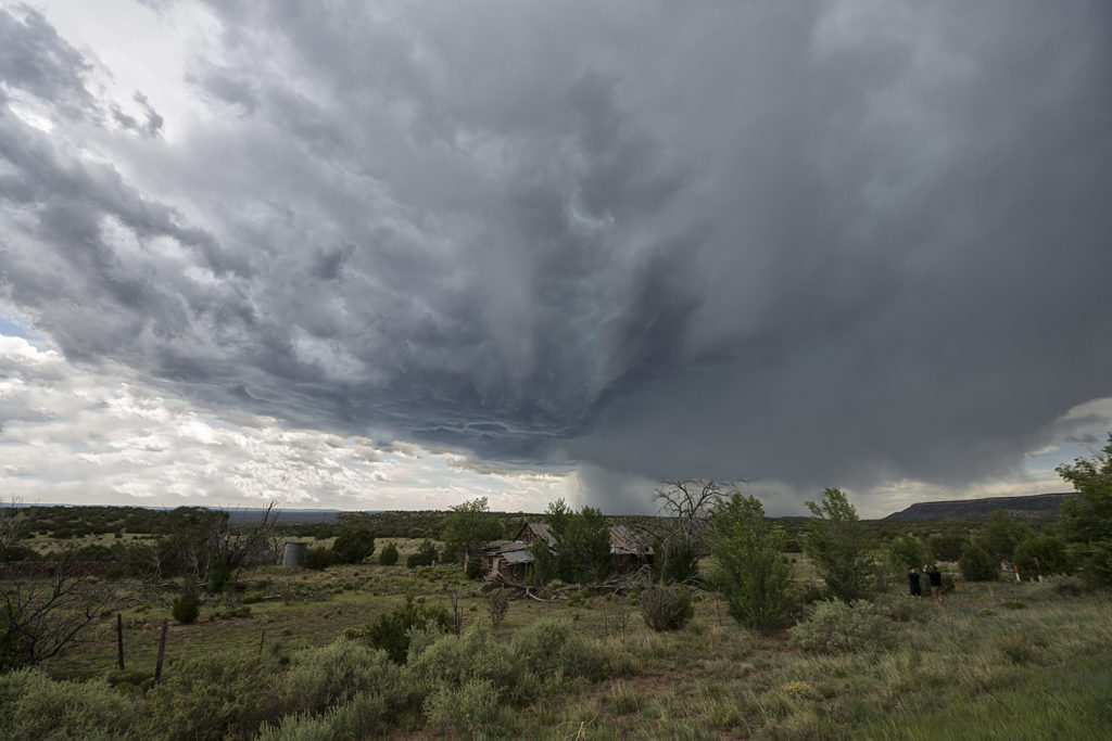
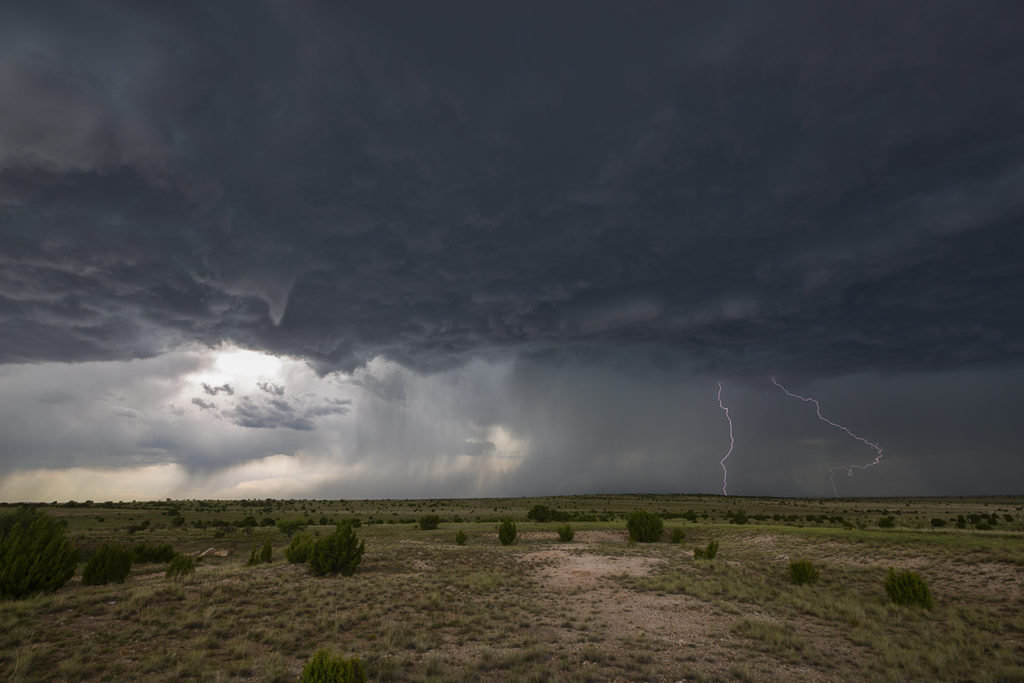
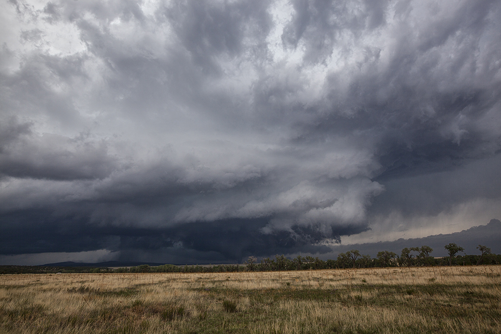
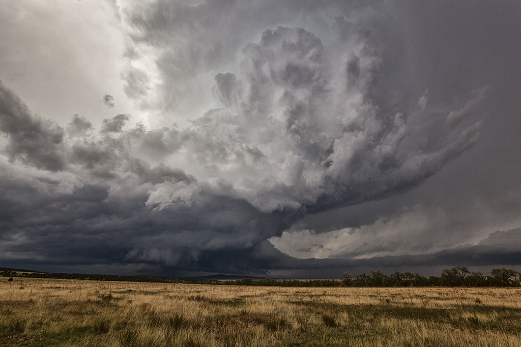
Tag Archives | New Mexico

June 19th Raton Mesa, New Mexico Supercell

June 19th was the last day of Tour 7.  The weather pattern kept us fairly close to home, with the set up over the Raton Mesa between Colorado and New Mexico. Upslope flow would push decent moisture into the region and thunderstorms would form by mid afternoon. Moderate CAPE and shear were also present as the storm intensified and moved eastward. The region is known for it’s lack of good roads, so we ended up on a few poorer gravel/dirt roads. We arrived as the storm was very intense, producing golfball to tennisball sized hail. Love the “hail core green” color to the clouds when they are suspending millions of hailstones in them. The region is very colorful with many red rock buttes and ridges in the area adding to the already pretty scene. The terrain has been very dry in 2020, so little vegetation was growing.  Eventually the storm moved out over the Black Mesa area of the Oklahoma panhandle and weakened as it moved further east. A fun last day was a pretty storm and countryside! Click on a pic for a larger image. Enjoy!

June 13th Nara Vista, New Mexico Tornado Warned Supercell

The set up for June 13th wasn’t great. Very limited moisture would result in fairly low CAPE values, however deep layer shear was strong. In the end, a cluster of storms would form over eastern New Mexico and slowly track east and south. The tail end cell became tornado warned for nearly 2 hours and was very strong, also producing hail golfball sized. We started the day near Clayton, and eventually dropped south to get on the tail end supercell. The structure was decent, but the main story of this storm was the lightning and amazing colors! Just before sunset, the storm spun hard and became incredibly electrified. As sun set, the storm weakened and gusted out as it moved southeast of Nara Vista. A fun day and on the photography side of things, it was quite spectacular! Enjoy the photos!

June 4th Artesia, New Mexico Tornado

What a surprise day this was! Upslope flow and terrain circulations can do magical things in the high plains and this day would be one of the best! Poor wind shear, marginal moisture, but decent CAPE would provide at least some threat for severe storms. We were in Roswell, New Mexico the night before and decided to stay around for the action on June 4th.  We dropped to west of Artesia as one LP supercell formed and produced copious amounts of hail. As it moved off the higher terrain it weakened and died. However, a group of storms formed and slowly intensified as they remained anchored on the foothills west of town.

As we positional ourselves on the eastern most storm, something strange happened. The storm started to get well organized and show signs of rotation. Soon a small wall cloud formed. From this wall cloud, a funnel dropped down and planted firmly on the ground for a few minutes. However due to the higher cloud bases and lack of appreciable moisture the funnel never fully condensed to the ground, but a debris cloud rose up from the ground to show it was connected. It persisted for several minutes before weakening and dissipating.  We then came back into town and dropped south to Carlsbad to watch the cell drift towards town. It maintained it’s supercell characteristics for a bit before gusting out and dying. A great day and a nice surprise tornado kept our streak of consecutive tours alive with all seeing at least one tornado!

June 3rd Central New Mexico Tornado Warned Supercells

June 3rd was a strange day. Never, in 33 years of chasing storms have we chased a set up in the New Mexico mountains and Rio Grande valley like this day looked like. Decent moisture, good instability and shear, as well as lift along the central mountain chains would set the stage for supercells. As one intense storm rolled off the mountains it started spinning wildly.  It had good structure and a strong gustnado on the leading edge of the RFD wrapping around the back of the storm.  It also produced hail nearly baseball sized as it moved east. As it weakened, it’s outflow produced another storm that became tornado warned. It had classic supercell features and a very low hanging wall cloud that was rotating rapidly. Soon, precip and hail wrapped around the lowering and due to poor road networks we couldn’t get into the notch to see if it was producing anything.  An hour later it lined out producing a nice shelf cloud. Quite a surprising day with 2 intense supercells in an area that is considered high desert and doesn’t get much rainfall each year.

May 23rd Roswell, New Mexico Large Tornado

It’s not often you wake up in Roswell, New Mexico with screaming southeast winds and 67 dewpoints.  Low stratus clouds were racing west towards the Sacramento mountains! Even though mid and upper level winds were not particularly strong this day, there was sufficient speed and directional shear to get a supercell to form. We weren’t expecting tornadoes, but with high dewpoints and strong instability we knew the potential existed. Funny thing was most chasers were racing north to play a system in the central plains, but we couldn’t pull ourselves away from Roswell.  In the end, we’re certainly glad we did! There wasn’t another chaser that witnessed what we did this day, with a quarter mile wide strong tornado under an amazing sculpted updraft! This cell produced huge hail as well and rolled across the countryside for hours all the way to Roswell. One of the most rewarding surprise days of 2018 for the tours!!!  Enjoy the pics!! Please don’t forget to check us out on Facebook as well as Twitter and Instagram!

May 22nd Roswell, New Mexico Supercellfest

May 22nd took us to New Mexico for what appeared to be a decent set up for severe storms, but not much tornado threat. Good mid level shear, decent surface moisture and instability would set the stage for storm formation off the mountains west of Roswell. By mid afternoon several supercells formed and kept forming over the same region as they moved east off the mountains. We intercepted a few storms that had good structure, big hail and a lot of lightning.  Storms persisted through the evening hours as they approached town with hail, high winds and plenty of electrical activity.  All in all a good day for Tour 4 and Photo Tour #1 as plenty of opportunities for photography/videography were available!

June 7th New Mexico Supercell

June 7th didn’t have a lot going for it. Limited moisture, instability and shear would cause Tour 6 to head for higher terrain. We arrived near Las Vegas, New Mexico as a supercell came off the mountains, headed for flatter lands.  This storm looked nice, albeit high based, and produced a lot of hail, lightning and wind. We followed it to Vaughn, New Mexico where it weakened and eventually dissipated. For a very marginal day, we had good results and a very nice supercell!

June 8, 2014 – New Mexico Tornadic Supercell

What a surprise it was this day!! A magnificent tornadic supercell formed over the higher mountain in northeast New Mexico west of the town of Watrous. This storm anchored for nearly 2 hours along the mountains and an old outflow boundary. Finally as the storm became a monster, it moved east of the mountains and tracked along the boundary producing at least one tornado we could confirm. A couple other chasers also confirmed the tornado near I-25 north of town. The structure on this storm was top notch as well! It also produced copious amounts of hail up to baseball sized.  As the storm moved well east of the mountains, it eventually merged in with a line of severe storms, still spinning wildly all the way to the Texas border.


May 23-25, 2014 New Mexico Supercells

We got the pleasure of spending 3 consecutive days in the upslope region of southeastern New Mexico between Carlsbad and Roswell. Good moisture, lift, instability and shear would fuel beautiful storms each day. The prairies of New Mexico provide a gorgeous setting to watch this daily round of severe weather. Storm motion was quite slow, allowing us to sit and photograph/video each storm. Lightning was great, as was storm structure. One storm pictured below with the pink/red background came VERY close to producing a tornado near Artesia. Each storm shown also produced very large hail to baseball size.  The guests had quite a treat during these 3 days!


May 6th East Central New Mexico Supercell

Wasn’t expecting much this day with low 50s dewpoints and modest shear, but ended up catching a decent supercell that lasted several hours. It had fairly good structure, produced a pretty gustnado and quite a bit of lightning near dark.