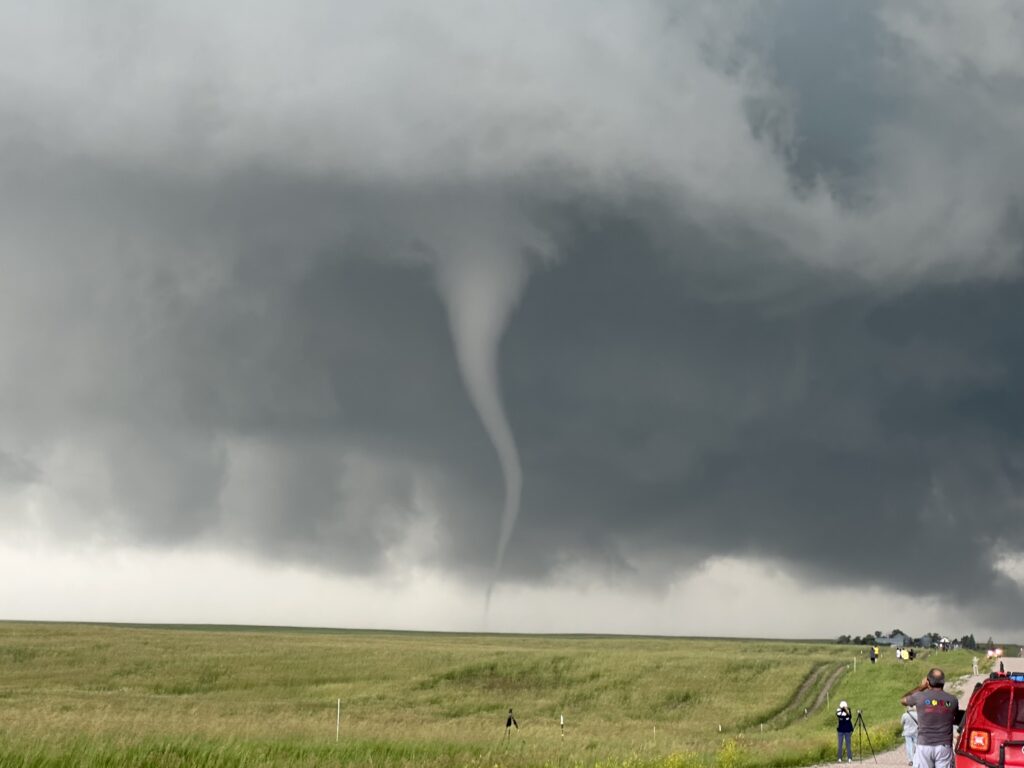
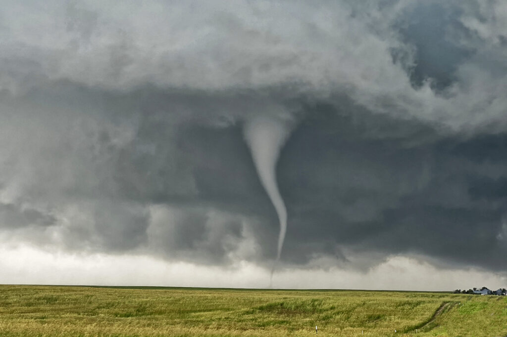
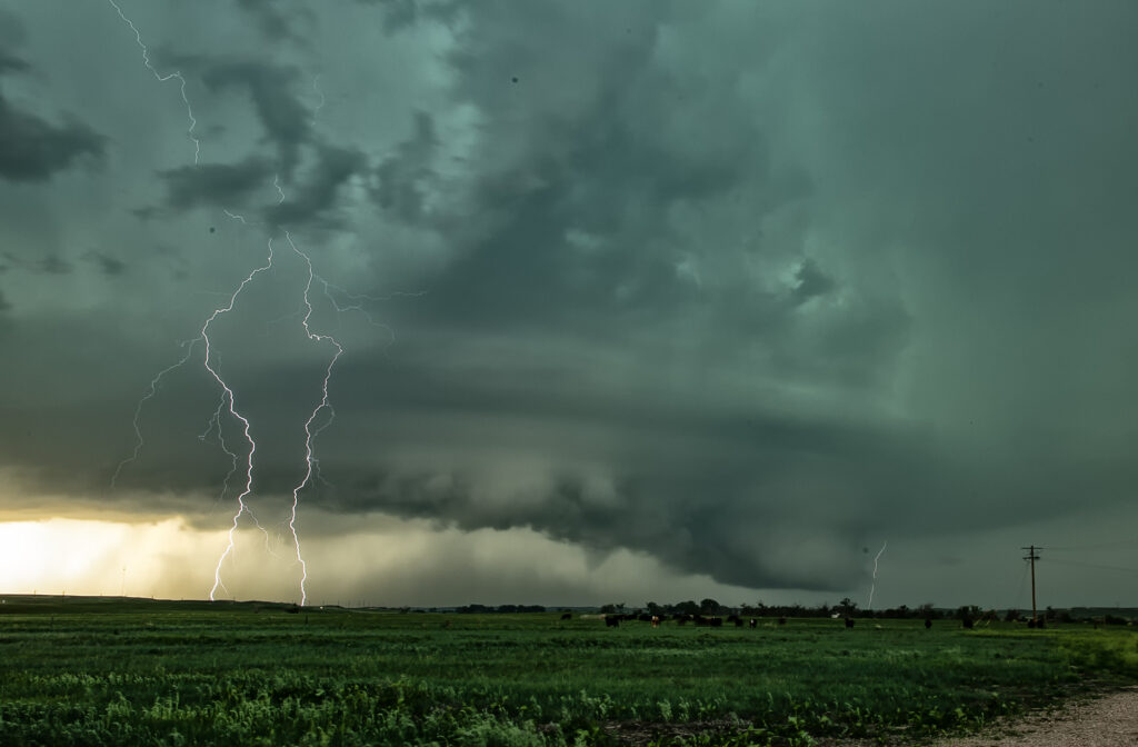
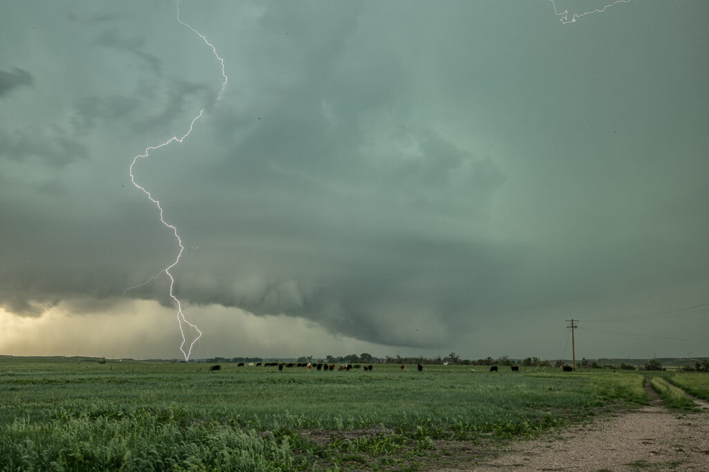
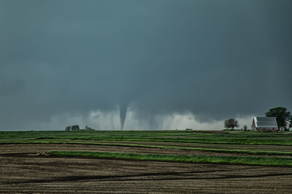
June 13th looked poor on paper. Modest shear, moisture and CAPE along the Cheyenne Ridge between Colorado and Nebraska. We started west towards Cheyenne where moisture was really quite meager. Much better and deeper moisture and instability existed further east, from near Sidney, Nebraska eastward. Strong easterly winds were pushing that moisture westward, but it didn’t look like it would make it in time before storms collapsed. Outflow surge from Cheyenne storms blew east and when it interacted with that deeper moisture, a line of storms, some supercells, exploded. Near Potter, NE on I-80 an updraft anchored and spun hard. It became incredibly electrified! It also produced a 5 minute multivortex tornado before it produced a tapered truncated cone tornado right near the interstate. Staying down wind a few miles allowed us to get out of the intense lightning threat, but also limited the view we had. But we were able to see the tornado and structure of the supercell together. It was very nice! Quite the surprise ending to a marginal day. Once in awhile nature gives you those surprises! Enjoy the pics!
May 21st Southwest Iowa Tornado Outbreak
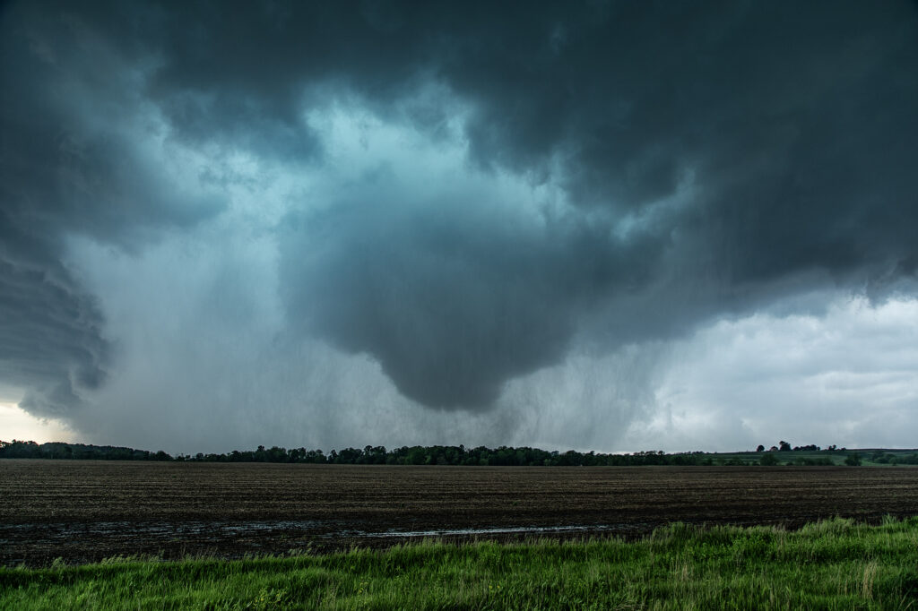
May 21st was a high potential set up in Iowa. A strong dry line, with fantastic shear, high CAPE and deep moisture would create a very dangerous environment in Iowa. By early afternoon storms exploded along the dry line and intensified as they moved east. Initial storms were not tornadic, but as the afternoon progressed, low level shear increased and tornadoes occurred with many storms! Our first tornado intercept was near Red Oak, Iowa as a supercell started spinning hard. The tornado went from a slender elephant trunk to a stovepipe and persisted for several minutes. The second tornado formed southwest of Carbon. It started as a big bowl, then vortices spun up and wrapping rain curtains were rotating violently around it. With motions of 60 mph we had to get out of its way as it approached us within a mile. The next tornado is now probably the most well-known. A strong multivortex tornado formed to our south near Corning and intensified as it moved northeast. It eventually turned into a raging F3 tornado that caused significant loss of property and life in the town of Greenfield. Our heartfelt sympathies go out to those who suffered losses there. Always the downside of significant tornadoes. Another tornado occurred to our southeast as a cell raced north towards Creston but we lost it due to storm motion and another core with huge hail causing us to have to slow down. Crazy, wild day that most will never forget.
June 23rd Chugwater, WY to Scottsbluff, NE Tornadofest
June 23rd had significant potential in southeast Wyoming as well as southeast Colorado. We chose to play the Wyoming target instead of Colorado. And both produced tornadoes!!! When you get upslope flow into the Laramie Range in southeast Wyoming with decent moisture and instability, you chase there, plain and simple. Good shear and lift into the mountains were also present and by midafternoon storms erupted west of Chugwater. It took a bit for storms to become organized, but one such supercell over the town of Chugwater became the primary supercell this day. It spun east all the way past Scottsbluff, NE and produced at least a half dozen tornadoes, a few of which we were close to and became pretty photogenic! A Tornado Emergency was issued for one large tornado near town and fortunately did not cause any serious injuries or fatalities. Storm structure was pretty as well and the supercell also produced softball sized hail at various locations in the lifetime. A great chase day and fortunately the results were good for the local residents. Enjoy the pics!