Last day of Tour 4, so we stayed close to home (OKC). Several storms formed as the environment continued to prime for the culmination on May 31st (which we couldn’t chase due to commitments to be back in Denver that day!). An active dryline spawned several supercells, of which most were tornado warned. From Chickasha all the way down to the Red River south of Ardmore, it was a treat even though no tornadoes actually occurred.
May 28th Bennington, Kansas Violent Tornado
May 28th had that “look” to it. All the ingredients were there for a few strong supercells and tornadoes. One issue had to be solved, and that was the cap. It took a lot of convergence on the triple point just north of Salina, but finally it broke late afternoon. A cluster of storms formed, and the Bennington tornadic supercell emerged and crushed everything around it. A violent EF4 tornado formed and was nearly anchored for almost an hour before dissipating. We were positioned about 3-4 miles east of the tornado, and assumed it would move east towards us, but instead stayed anchored nearly its entire lifecycle. Nonetheless we were treated with a vicious tornado that fortunately missed Bennington and other towns. I shutter to think what could have happened had it hit Salina or the small towns just north of there.
May 25th Western South Dakota Supercells
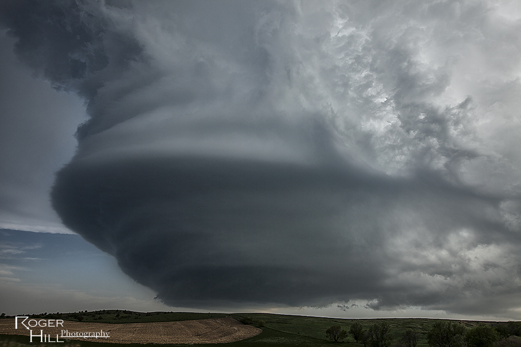
Decent upslope flow into the Black Hills, along with good moisture and moderate shear, would set the stage for several supercells to develop and move east from the Rapid City area. Structure was quite nice with each of these storms as they spun across the countryside north of I-90. One storm tried hard to become tornadic, while the rest were quite prolific hail producers.
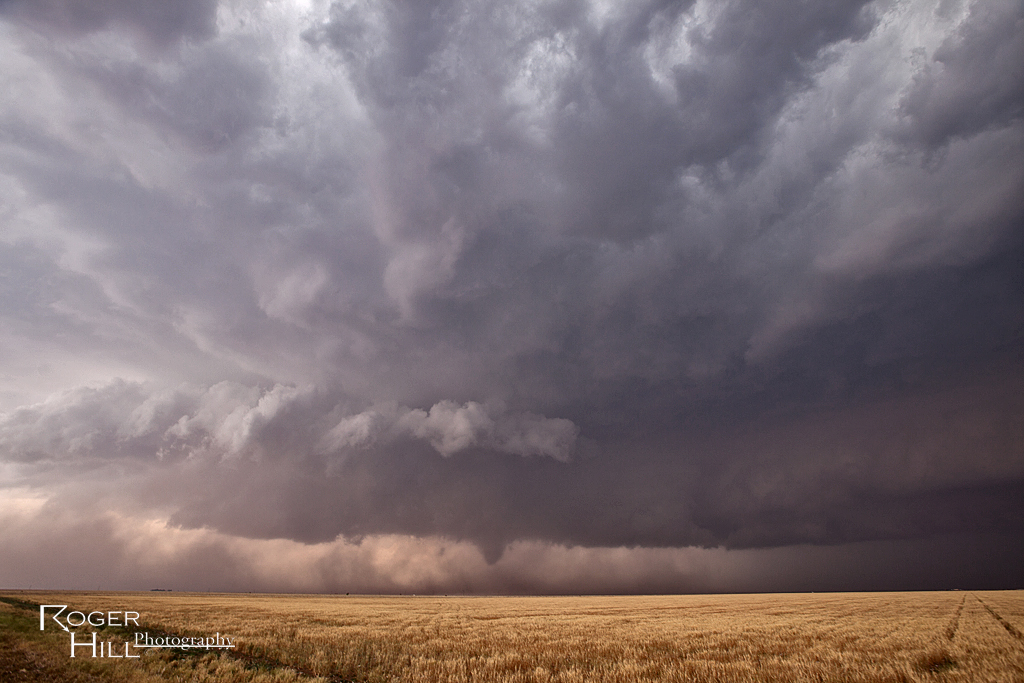
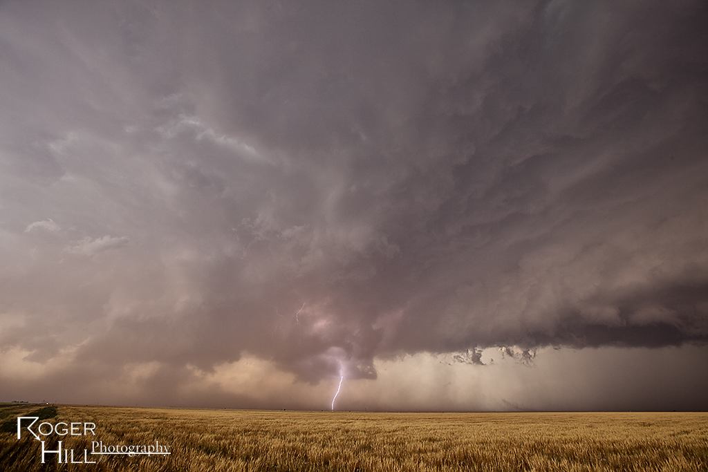
May 23rd Texas Panhandle Tornado Warned Supercell
May 23rd took me near Plainview, Texas and points southeast. A strong supercell developed near a boundary and produced a couple of landspouts. It was rotating quite strongly and between the inflow and RFD, became almost invisible at times due to blowing red dirt. The storm had pretty decent structure as it also produced tons of hail to baseball size. At one point early, a funnel extended halfway to the ground for a couple minutes as it rotated around the mesocyclone.
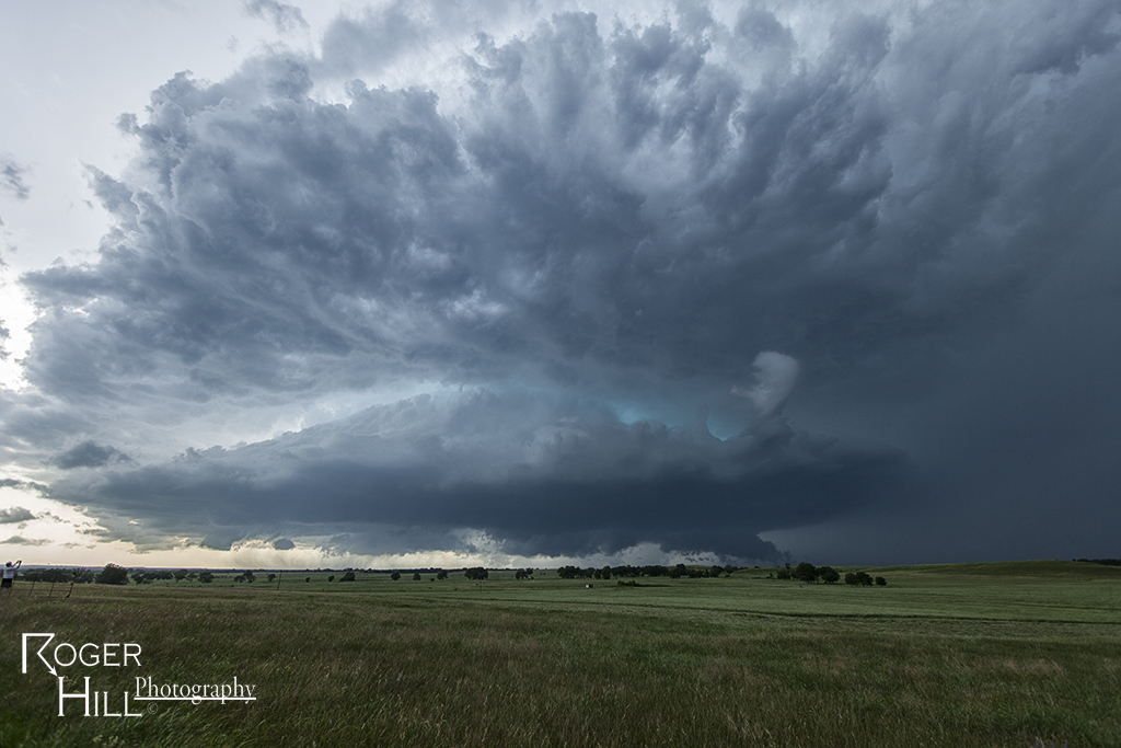
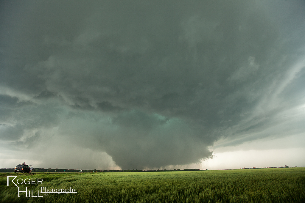
May 19th South Central Kansas Tornadoes
May 19th held high hopes for a significant severe weather outbreak. We felt south central Kansas would be the place to start. After positioning ourselves near the Kansas/Oklahoma border, several supercells formed, of few which produced tornadoes. Unfortunately for us, the storm of the day developed near Shawnee, Oklahoma and produced a large EF4 tornado. The photos below were taken all not far from South Haven, Kansas. We witnessed 3 tornadoes this day. This first two photos are of the initial supercell and developing tornado, and the bottom two photos were of the last supercell and pretty elephant trunk tornado.
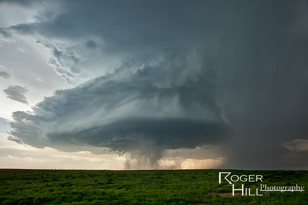
May 17th Hyannis, Nebraska Tornado Warned Supercell
What a surprise this day was! After a cluster of weakly organized storms formed over the sandhills early afternoon, another storm, a rotating supercell, developed near Hyannis. Shear increased as evening came and so did the structure! A very pretty tornado warned supercell that was quite photogenic and electrified continued until near midnight.
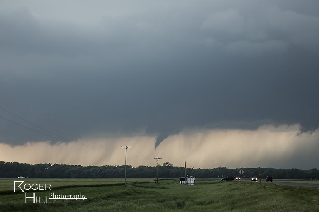
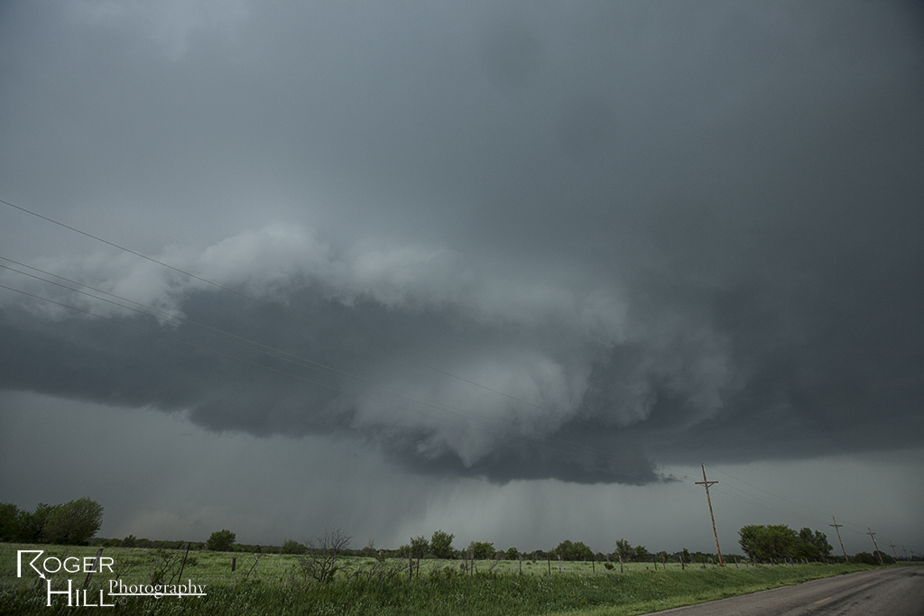
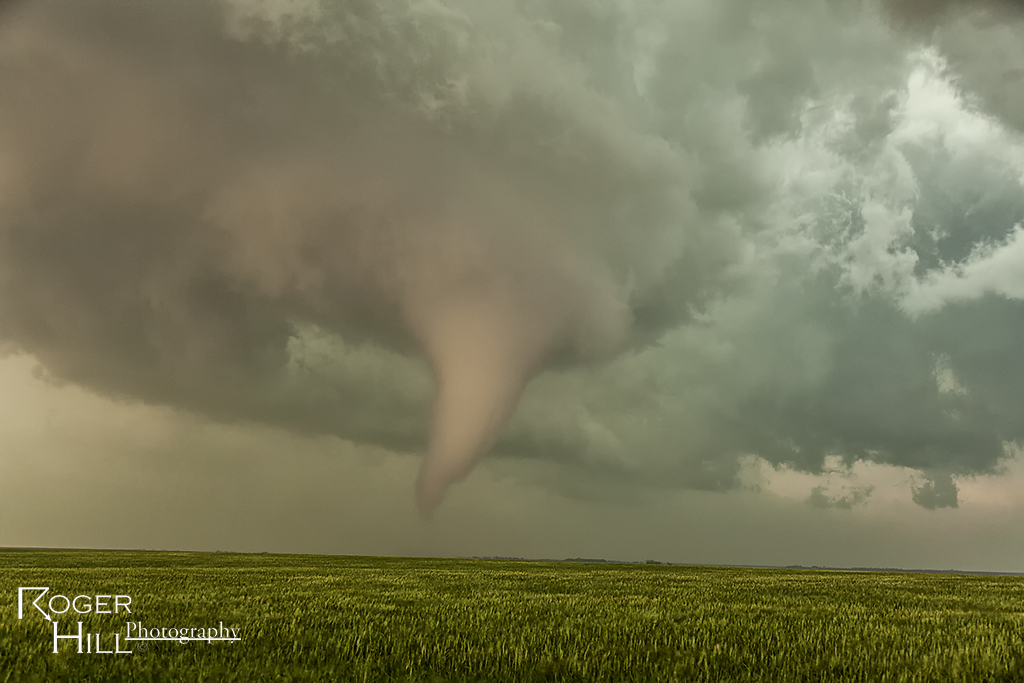
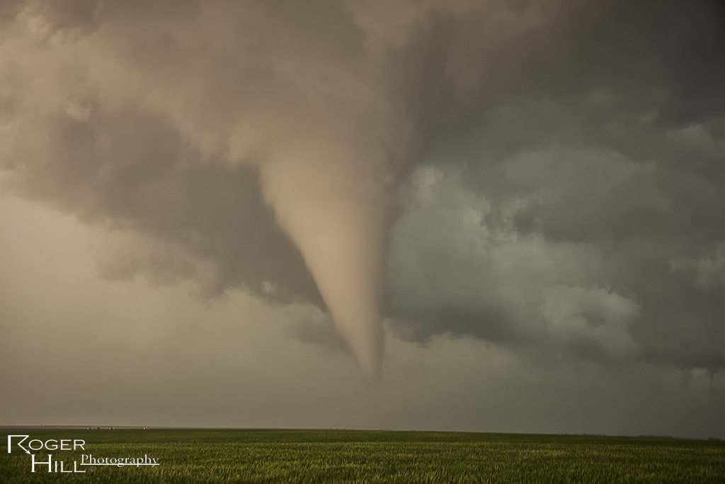
May 18th Central Kansas Tornadoes
May 18th took Caryn and I to south central Kansas. We staged in Greensburg with the dryline immediately to our west. Hot temps and fairly low dewpoints had me initially concerned that storms would be high based and outflow dominant quickly. However, good shear and strong flow aloft I hoped would push storms quickly into better moisture and allow the bases to come down. We targeted storms coming out of the Oklahoma panhandle and soon found out those would not develop into much more than a line of high based hailers. Another storm, just northwest of Greensburg, started spinning from its initiation and we decided to blast back north to catch it as it ingested mid 60s dews. Fortunately we caught the tail end of the Rozell tornado and the entire life of the Sanford tornado. The first photo is of the Rozell EF4 tornado and the rest are from the Sanford tornado.
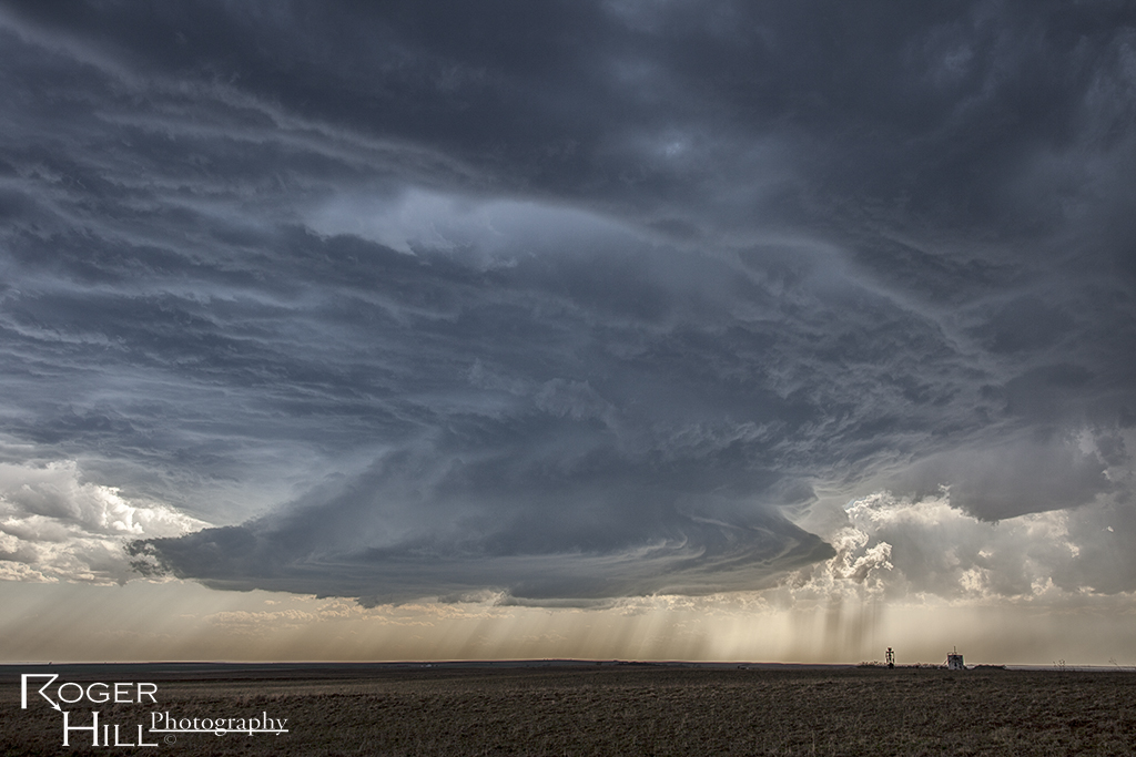
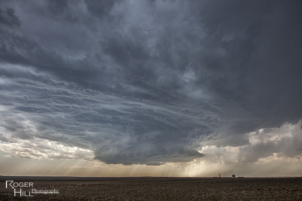
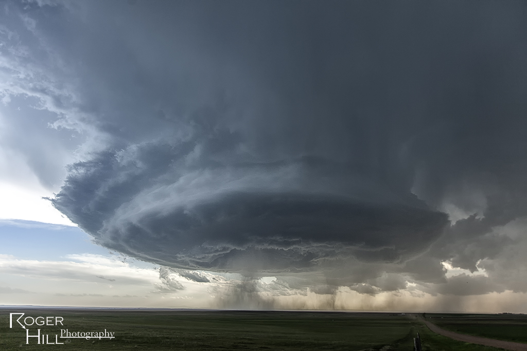
May 26th Central Nebraska Tornado Warned Supercell
Wasn’t really confident in a decent storm on May 26th. Nature sure changed that though in a hurry! An intense, highly striated supercell formed northeast of Broken Bow, Nebraska and became one of the best structured storms of 2013. It was tornado warned for hours as well. The storm produced baseball sized hail and was also quite electrified in its lifetime.
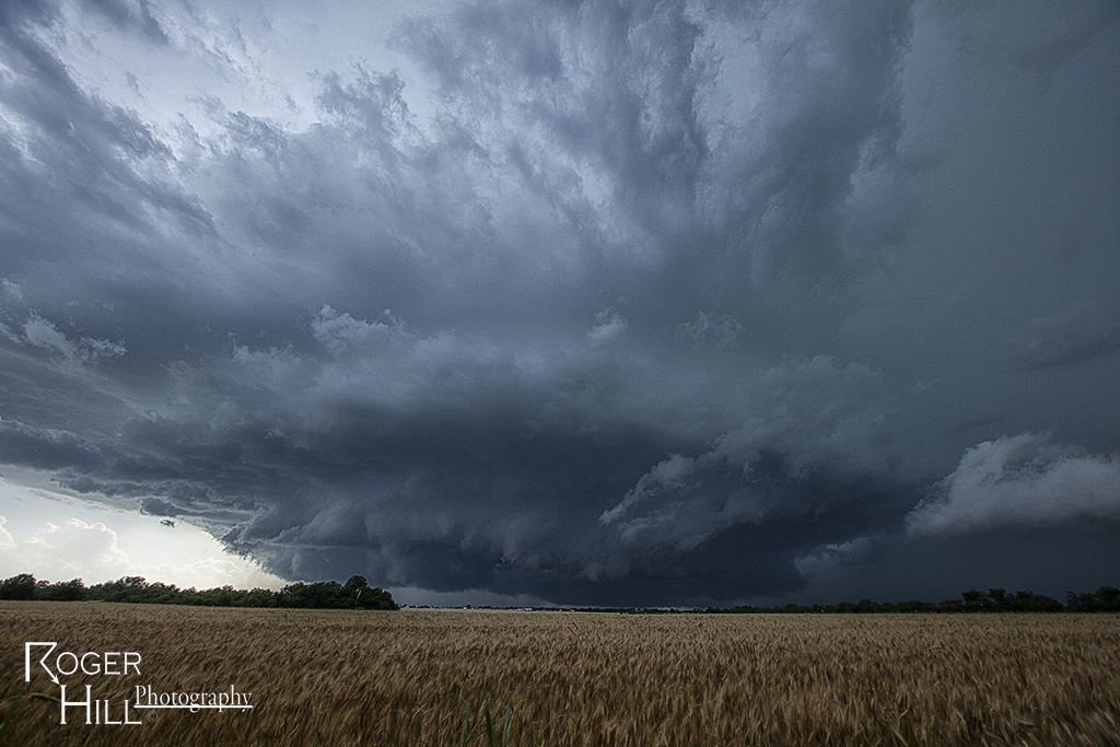
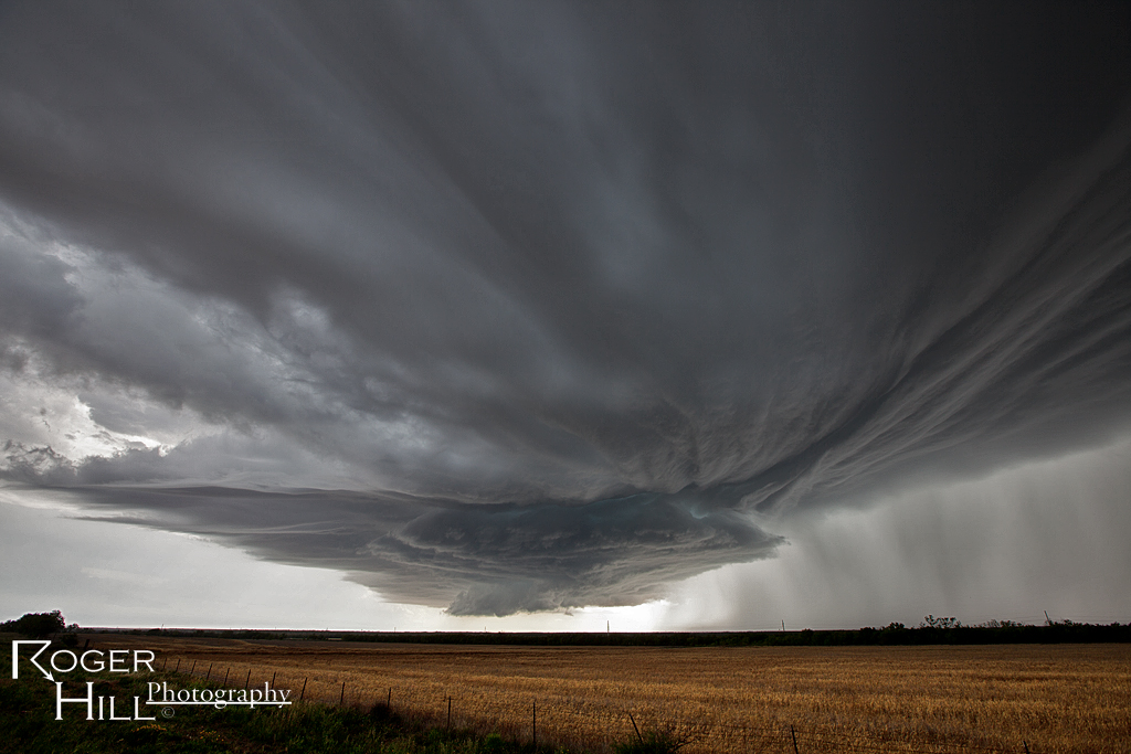
May 9th Abilene/Menard, Texas Tornado Warned Supercells
May 9th set up looked decent with good shear, decent moisture, instability, and a dryline for convergence and initiation. Mid afternoon a supercell formed near Abilene, which became tornado warned. Quickly 2 other supercells formed to the south of the first, with a very intense cell near Ballinger and the tail end storm between Eden and Menard. The tail end storm became very powerful and produced copious amounts of hail baseball sized and was tornado warned for hours (although, it did not produce).
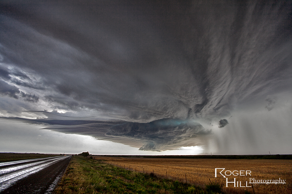
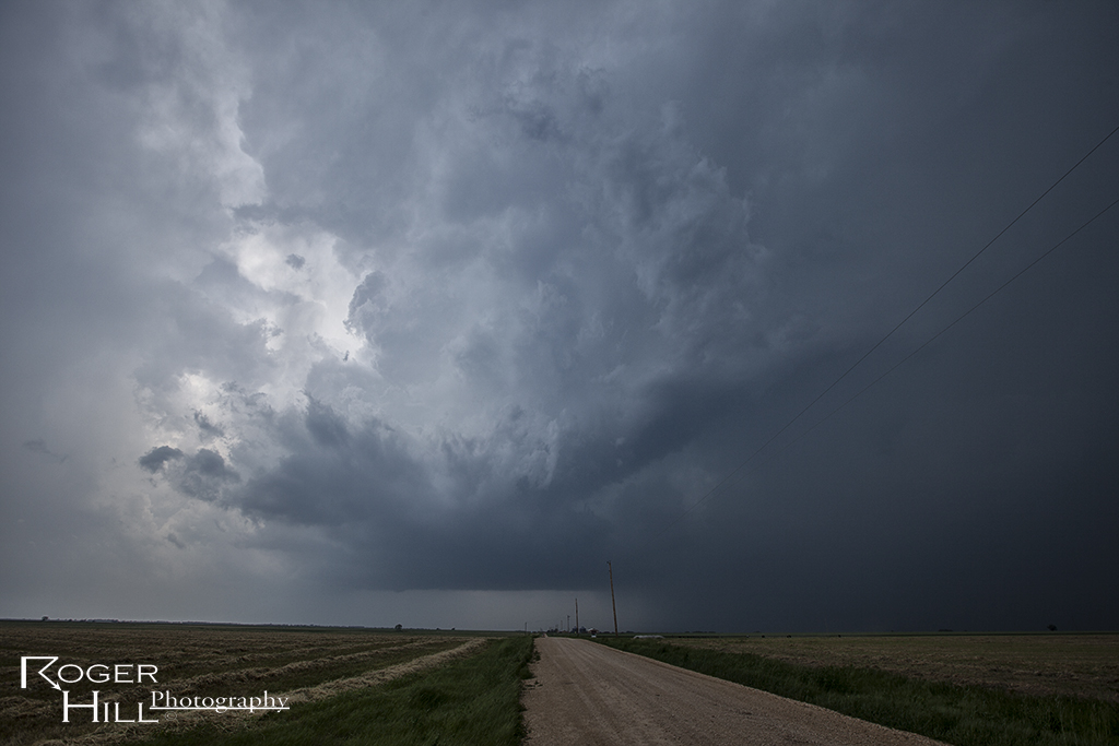
May 8th Protection, Kansas Supercell
May 8th featured a set up that was out of phase. Better moisture and instability was in Oklahoma, however better shear was in Kansas. We tried to find the best overlap of both, which looked like the Kansas/Oklahoma border area. A nice supercell formed late afternoon near Protection and tracked along a boundary until the cap strength increased, thus killing the storm.