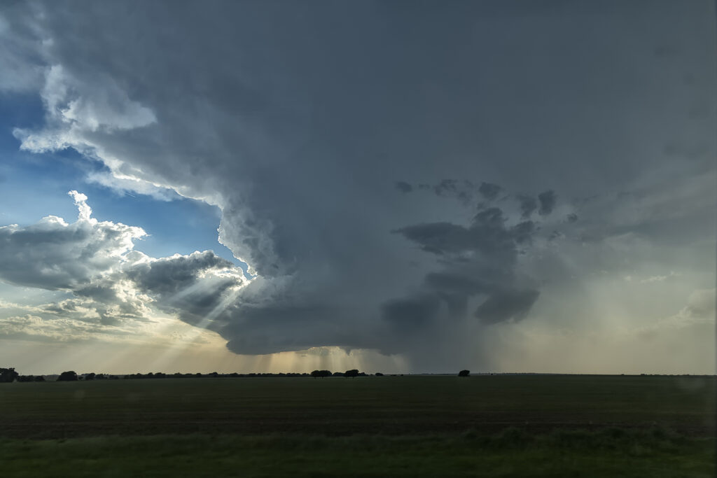
Good shear, but limited moisture would be the problem this day. Storms formed along a cold front in central Oklahoma by mid afternoon, but were high based. We were watching a cluster of towers west of Lawton and hoped something would form from them. Later in the afternoon, they did just that. A supercell emerged and produced baseball sized hail. Early evening it became tornado warned. It produced a couple of funnels but was moving into capped air and weakened. The setting sun made for a cool image as the updraft evaporated.
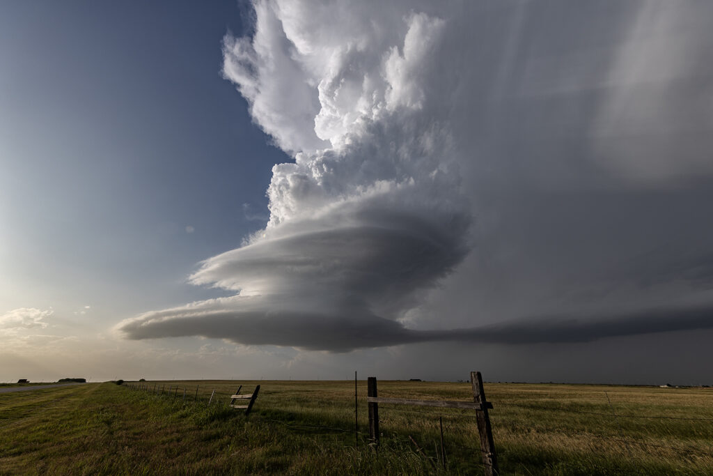
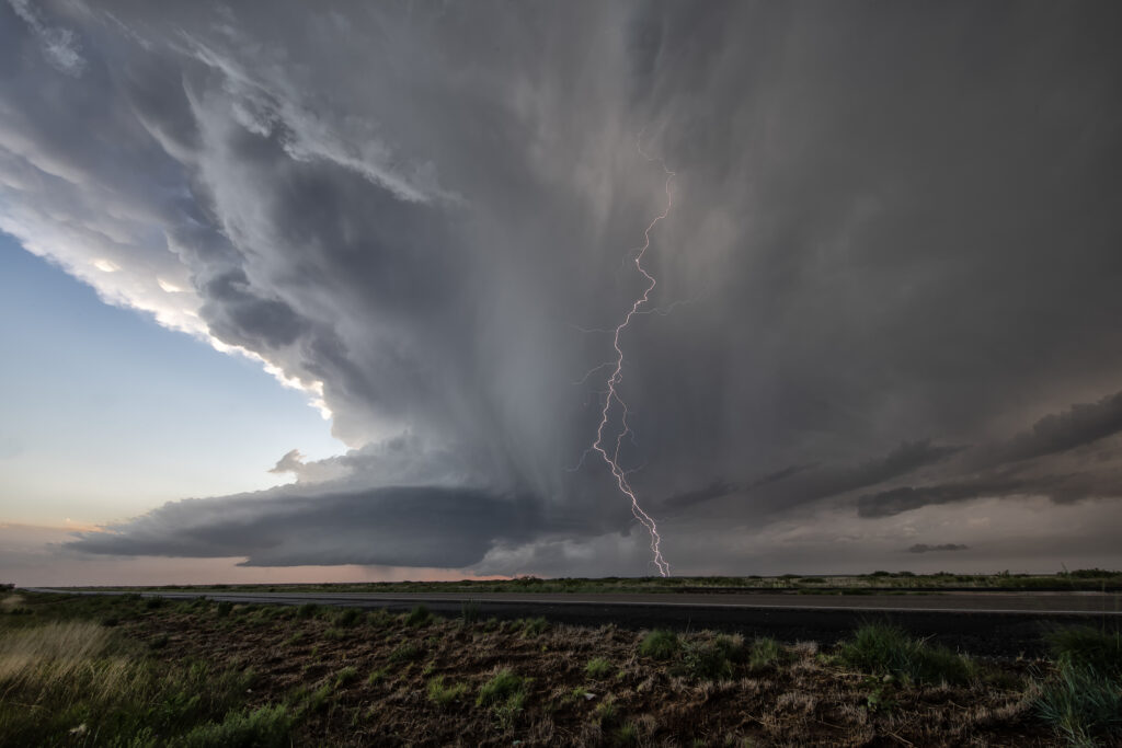
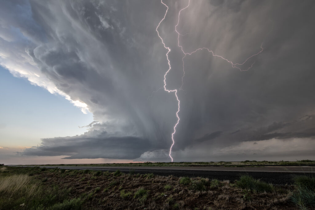
May 31st Roswell, New Mexico Incredible Supercell
May 31st had potential in the western Texas panhandle and southeastern New Mexico. Storms exploded in New Mexico, and a couple became tornado warned. Those clustered and moved into west Texas. A few hours later, more storms formed near Roswell. With good upslope flow, decent moisture and instability, they quickly became severe. One storm, on the southern end of a cluster, became a supercell. The structure was amazing and the electrification was phenomenal! We stayed with it till dark when it weakened and the lightning ceased. One of the prettiest LP supercells of the season to date! Enjoy the pics!