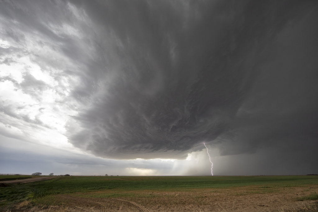
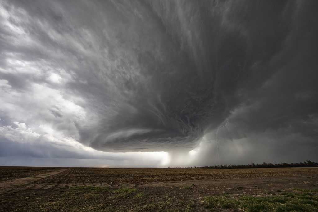
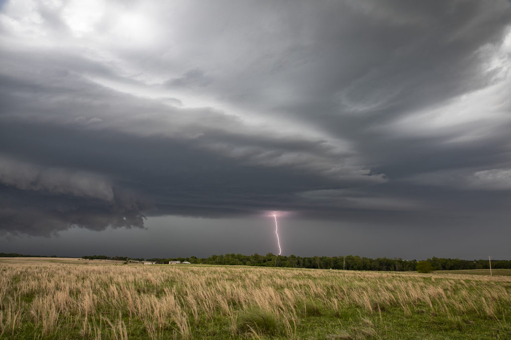
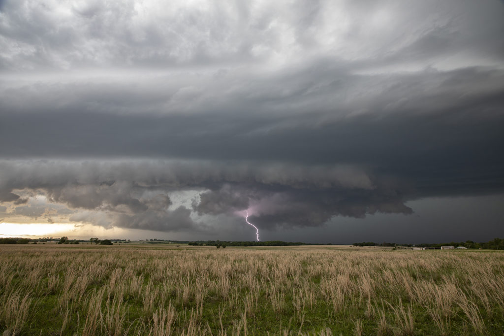
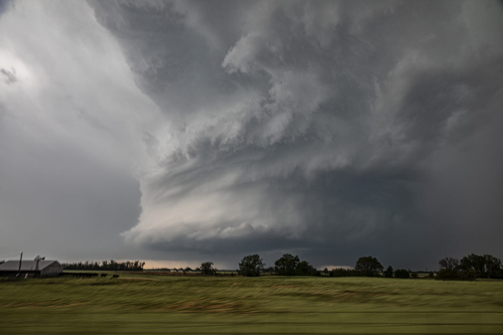
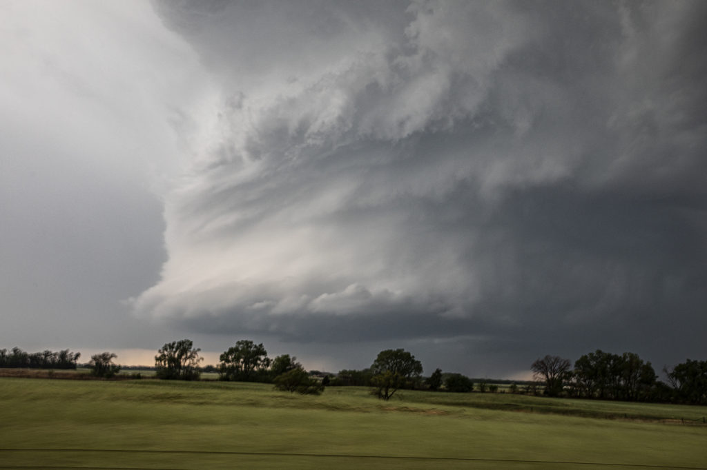
May 29th was the classic “day before the big day” type set up. Moisture and instability were rapidly increasing along a lifting warm front in Nebraska, and shear was quite strong. Models showed late afternoon and early evening supercells forming north of Broken Bow and that is exactly what occurred. It took awhile from the main supercell to root along the boundary and get organized, but once it did, it became a formidable storm! Eventually it became tornado warned as it moved to the northeast and stayed warned for a few hours. Due to storm motion and poor roads, it became virtually impossible to stay with it. Near O’Neill we had to let it go and head to Sioux Falls, SD for the night. The storm had good structure, and it had a well defined rotating wall cloud. It just couldn’t tighten enough to get a tornado to form. Enjoy the pics!
May 15th Eastern Oklahoma Supercells
Eastern Oklahoma was the target on May 15th. Extreme instability and moisture as well as a cold front would provide the ingredients for severe storms this day. A supercell developed along I-40 near Henrietta, OK and drifted south. More storms formed south of there and continued through the evening. Very high wind, huge hail and heavy rain would accompany them as the built south. We were on several different cells that gave us some good structure and great lightning. No tornadoes occurred, but the storms were quite pretty nonetheless! Enjoy the pics!
May 14th Southern Kansas/Northern Oklahoma Supercells
Lack of low level moisture was the theme this day. Good shear was present, however due to limited moisture, cloud bases were too high to produce tornadoes. Storms formed over south central Kansas and right turned into northwest Oklahoma as they became supercells. One storm even developed a clear slot and tried to produce a funnel. The intense lightning caused several grassland fires as well. Hail to the size of tennisballs also fell. They persisted through early evening before weakening due to loss of daytime heating. Very photogenic to say the least!
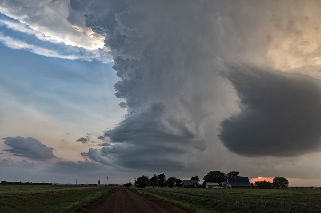
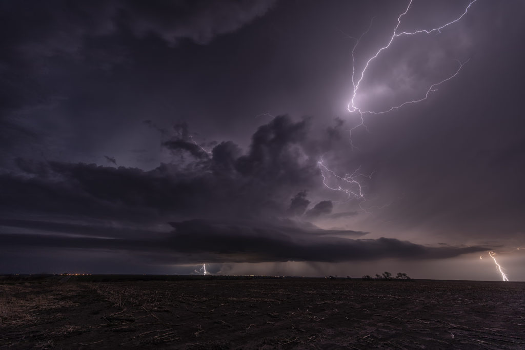
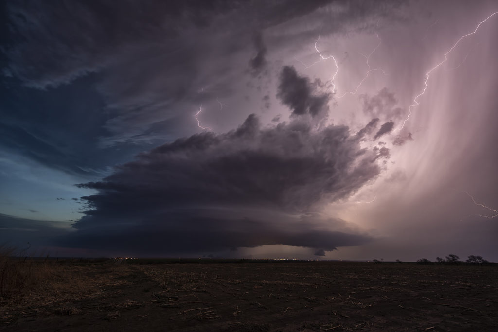
May 13th Northern Oklahoma Supercells
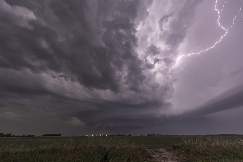
May 13th was a fairly marginal day as forecast. Some models tried to break out storms in southern Kansas and northern Oklahoma. We decided to chase down by the OK/KS border area and see if anything would form. Indeed it did! A couple of slow moving LP supercells developed and had decent structure and golfball hail. During the early evening hours, another supercell formed just southwest of the now decaying storms and became a formidable storm! Structure was of the classic supercell type and is spun like crazy in the dark. At one point we though it could even produce a tornado due to strong low level rotation. However it was not to be. A fun day, some good storms and great lightning in the night!
May 4th Northwest Texas Tornadoes
One of the most exciting days of 2022 so far occurred on May 4th. A dryline/triple point was located west of Paducah, Texas as moisture streamed northward. Great shear was also present. By mid afternoon a supercell formed and quickly became severe. It would be the storm of the day and produce several tornadoes. We tried to stay in front of it, but an error in the road map wreaked havoc for us. Maps showed a paved road that would have taken us right in front of the supercell towards Crowell and eventually Lockett, however it became dirt and was blocked off by a rancher with no trespassing signs, which of course we obeyed. This made us have to back track 20 miles on muddy and wet roads through huge hail and then blast east towards Crowell where we would have gone south to get right in front of the tornadic supercell. Due to losing 40 minutes on the map error, we could not go south as the storm was already crossing the road. Instead we went east then south but by that time the 5 minute tornado was gone. We continued east and then back north at Seymour to get in front of the supercell. It was now becoming dark as lightning constantly lit up the updraft. South of Vernon we stopped to watch the storm as a truncated cone tornado formed and crossed the road in the night directly in front of us. Then numerous power flashes were observed just northwest of us and lightning lit up a wedge tornado that hit the town of Lockett. We watched as this monster EF3 tornado roared across in the darkness, only lit by lightning and power flashes. It eventually dissipated as the storm weakened. Crazy day, and one stroke of bad luck due to a error in mapping software kept us from a pretty tornado. However, we still witnessed 4 others! Enjoy the pics!
May 2nd Central Oklahoma Tornadic Supercells
May 2nd offered a significant severe weather threat. An advancing cold front would be the focal point for severe storms, including supercells. Good moisture and instability would be present to fuel these storms. The question was what mode would storm take? As the front moved southeast, storms became linear. However a couple of storms formed along the dryline and would be the best storms to chase. A significant supercell formed near Dover, OK and produced a weak tornado. The structure on this storm was just gorgeous. Big spiraling soda can shape that spun like crazy. As the cold front overtook it, we blasted east and south towards Pauls Valley and caught another supercell that cycled several times before eventually producing a tornado near Seminole. The structure was spectacular with a mothership base to it and a very cumuliform updraft. Above it was a spectacular mammatus field that went on for many miles. A great chase day, very photogenic storms, and one of the best mammatus of the year!
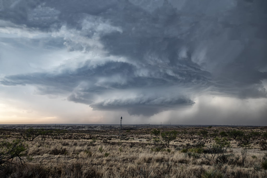
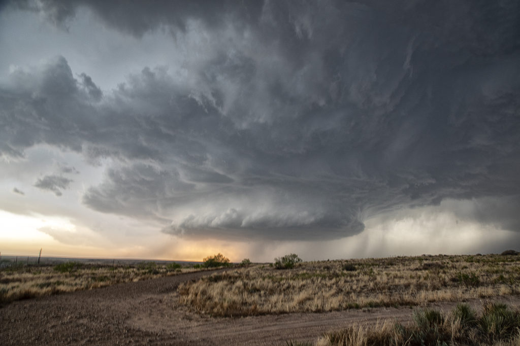
May 1st Texas Panhandle Supercell
May 1st had some potential in the Texas panhandle west of Amarillo. Moderate quality moisture was streaming north as a cold front drifted southeast. Great shear was also present. A cluster of storms developed west of Lubbock and raced northeast spewing outflow. I was certain it would ruin the rest of the day, however a supercell survived the blowing dirt and cold air from the now decaying storm cluster west of Channing. The cell slowly moved east and started getting a great classic supercell appearance. As the sun set, it just added to the beauty of the storm. We ended up losing it in the hills northwest of Amarilla due to a poor road network and other storms forming. But in the end it treated us to a nice show that we weren’t expecting. Enjoy the pics.
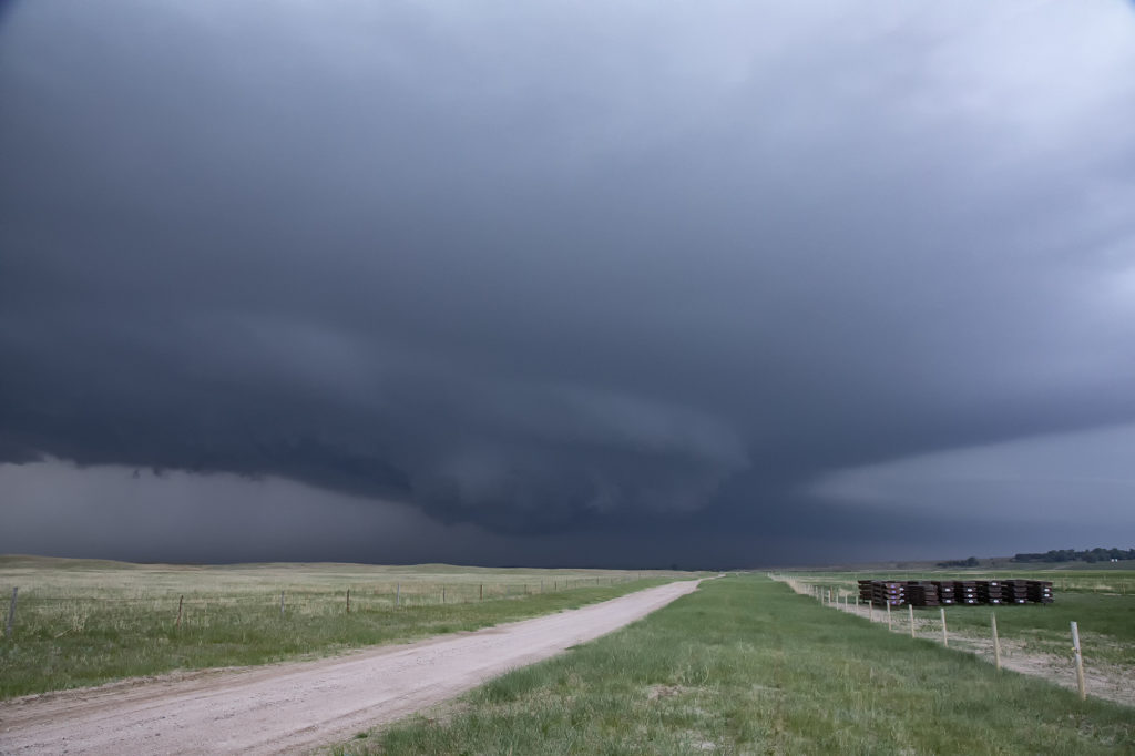
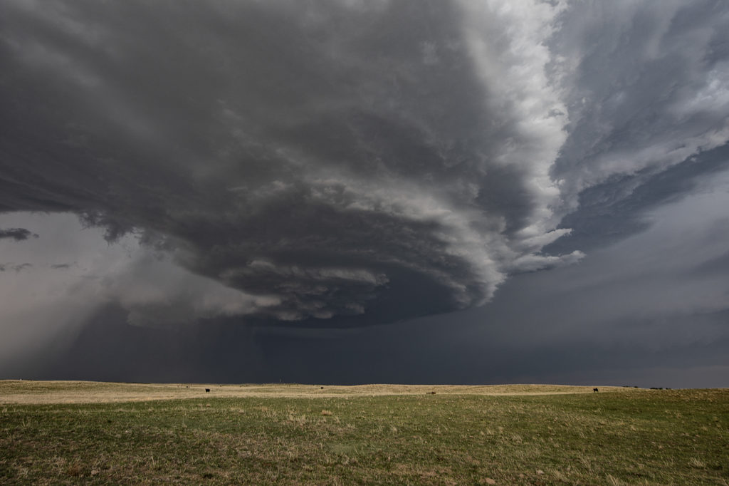
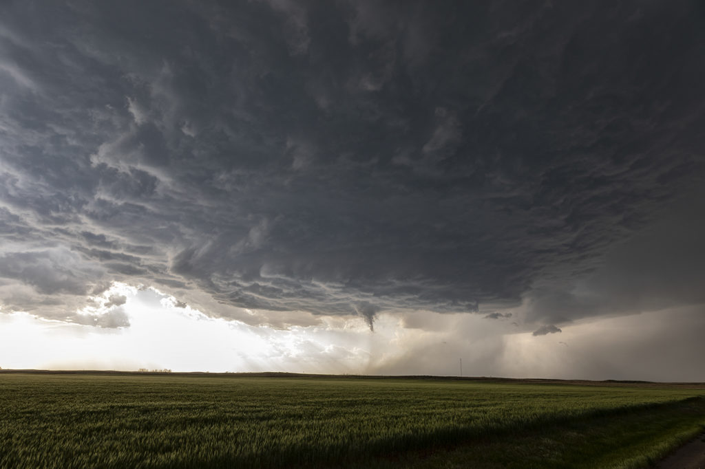
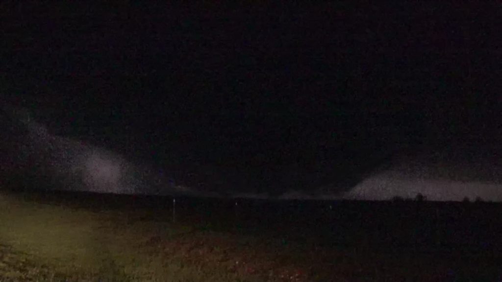
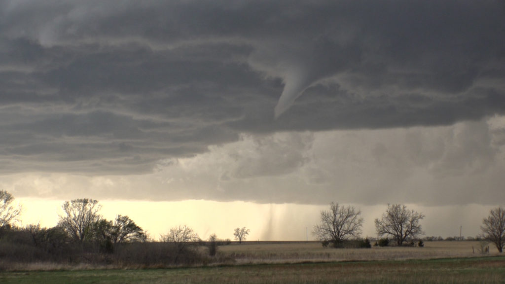
April 29th Central and Southern Kansas Tornadoes
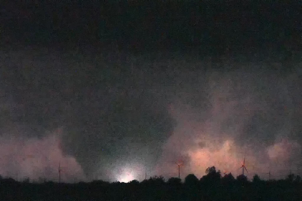
A big day was in store for Kansas. Supercells with tornadoes were possible as a combination of wind shear, moisture and instability were present with an approaching trough. By mid afternoon the dryline sharpened and soon cumulus towers formed. A cluster of storms had formed northeast of McPherson and the tail end storm started spinning. One small tornado formed as the cell moved north towards the warm front. As it approached it, other storms started forming on an advancing cold front and also became severe. We decided to leave the first storm as storm mergers made things too messy. As we blasted south towards Wichita, a landspout tornado formed underneath an updraft in the line and stayed on the ground for 12 minutes. When is dissipated, when then turned our attention to a supercell near Wichita. It had just spawned the Andover tornado and continued to cycle and become tornadic again near El Dorado. We blasted down to town, now in the dark and headed east towards the supercell’s updraft base. Quickly a tapered cone tornado formed and became visible through power flashes and lighting. It crossed the road in front of us and dissipated. Another one formed within a couple minutes and stabbed down to the ground and lifted. We continued to drift east with the storm and turned north at Rosalia. As we did a massive bowl formed and dropped to the ground! A wedge type tornado formed with multiple vortices. We got blasted with RFD winds wrapping around the tornado and had to vacate the area. As we continued east the tornado lifted as a line of storms merged with it ending the tornado threat. A crazy day with 5 tornadoes! Enjoy the pics!
April 28th North Central Kansas Supercells
April 28th looked good in terms of shear and a boundary for storms to form on. However, moisture was quite marginal. A supercell would form near Alma, Nebraska by mid afternoon and intensify while drifting southward along the residual boundary. It had decent structure and was also very electrified. The tornado threat was very small due to higher cloud bases, but by evening the bases would lower as low level moisture would increase. It never did produce a tornado, but certainly had everything else going for it. Late evening it was still active as it dropped up to a foot of rain and hail 6 inches deep. A fun day for Tour 2! Enjoy the pics!
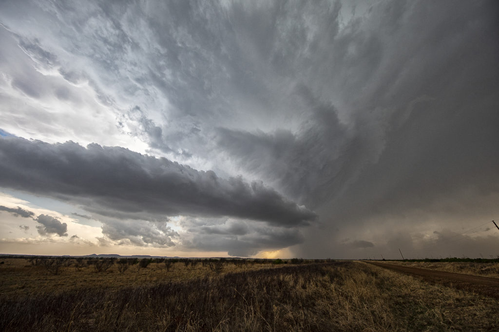
April 27th Southwest Kansas Surprise Beautiful Supercell
Certainly not expecting much this day as moisture was greatly lacking with dewpoints only near 50F. Shear was good and there was a boundary present as a weak cold front was drifting southeast through the area. Numerous high based storms formed and didn’t do a whole lot, but finally one formed southwest of Dodge City, Kansas and started getting organized. A severe thunderstorm warning was issued and soon the storm developed a nice circular rotating base and vault region with copious amounts of hail falling out of it to the size of tennisballs! The storm persisted for a few hours and was eventually overtaken by a line of storms that formed along the advancing front. The structure of this high based supercell was quite impressive and it was also a lightning machine! We hope you enjoy the pics!