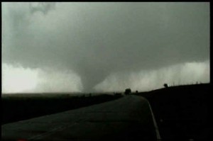
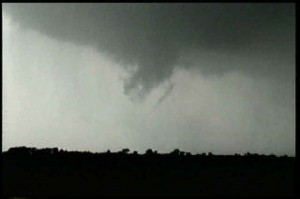
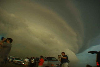
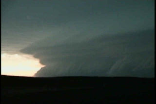
May 27 was a potentially violent day for the plains. A frontal boundary was draped across southern Kansas, and elevated severe storms developed north of this boundary. We decided to wait for any surface based convection to develop south of the front, and finally we were treated to a very violent, hail producing supercell that eventually went upscale into an incredible MCS that blasted Oklahoma that night. Pics of the supercell, weak tornado near Sitka, and incredible “outer space” shelf cloud are shown below.
June 3rd, 1999 Almena, Kansas Tornado
My encounter with a gorgeous F3 tornado and associated supercell near Almena, Kansas on June 3, 1999 was my favorite chase of the year. The setup was a simple forecast to nail. A dryline was evident based on surface obs in western Kansas. An east/west outflow boundary was in place from previous night’s convection. By noon the dryline was surging east as is typical with the dryline. About 3 PM a line of towering cu were seen on visible satellite and from my position. A dryline bulge formed across west central Kansas, so I decided to get into position to the northeast of the dryline bulge where it intersected the outflow boundary, and the results are shown below. A rather isolated supercell formed and produced a very photogenic slow moving F3 tornado!!!!! Beautiful storm. These pics first show the development of the supercell. Then there are a series of 12 photos that show the development, maturity and dissipation of the 1/4 mile tornado.